Home > Science > Space Exploration > Planets > Earth
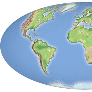
Global temperatures, May 2009

![]()
Wall Art and Photo Gifts from Science Photo Library
Global temperatures, May 2009
Global temperatures, May 2009. Infrared satellite map of average daytime air temperatures at 3000 metres elevation worldwide in May 2009. The colour-coded map shows temperatures in degrees Celsius, ranging from 40 degrees Celsius (dark orange) down to minus 30 degrees Celsius (purple). Features seen here include warm tropical areas, milder temperate regions (yellow and green), and cold polar regions. The data was obtained by the AIRS (Atmospheric Infrared Sounder) instrument as part of the EOS (Earth Observing System) mission, on NASAs Aqua satellite
Science Photo Library features Science and Medical images including photos and illustrations
Media ID 6299145
© NASA/JPL/SCIENCE PHOTO LIBRARY
2006 Aqua Atmosphere Climate Change Climatological Climatology Cold Continent Continental Continents Cool Earth Observing System Earth Science Environmental Environmental Science Equatorial Freezing From Space Frozen Global Global Warming Infra Red Land Latitude Meteorological Meteorology Planetary Polar Satellite Satellite Image Seas Spring Temperate Thermogram Thermography Tropic Tropics Warm Weather World Wide Airs Latitudes
FEATURES IN THESE COLLECTIONS
> Science
> Space Exploration
> Planets
> Earth
> Science
> Space Exploration
> Satellite Imagery
EDITORS COMMENTS
This print showcases a mesmerizing infrared satellite map of global temperatures in May 2009. The image, obtained by the AIRS instrument on NASA's Aqua satellite as part of the EOS mission, provides a comprehensive view of average daytime air temperatures at an elevation of 3000 meters worldwide. The colour-coded map vividly illustrates the temperature range in degrees Celsius, with dark orange representing scorching highs of 40 degrees Celsius and purple indicating freezing lows of minus 30 degrees Celsius. From this visual representation, one can observe various climatic features across the globe. Warm tropical regions are prominently displayed alongside milder temperate areas depicted in yellow and green hues. Additionally, cold polar regions stand out distinctly on this map. This remarkable snapshot not only highlights Earth's diverse climate zones but also emphasizes our planet's delicate balance between hot and cold environments. With its focus on environmental science and meteorology, this image offers valuable insights into global weather patterns and serves as a reminder of our planet's dynamic nature. As we navigate through the challenges posed by climate change and global warming in the 21st century, images like these provide us with crucial data to better understand Earth's complex systems.
MADE IN THE USA
Safe Shipping with 30 Day Money Back Guarantee
FREE PERSONALISATION*
We are proud to offer a range of customisation features including Personalised Captions, Color Filters and Picture Zoom Tools
SECURE PAYMENTS
We happily accept a wide range of payment options so you can pay for the things you need in the way that is most convenient for you
* Options may vary by product and licensing agreement. Zoomed Pictures can be adjusted in the Cart.