Fraud Blocker Skip to main content

Satellite Collection

"Exploring the World from Above: Captivating Satellite Images Unveil Earth's Wonders" Discovering the British Isles

Background imageSatellite Collection: British Isles, satellite image

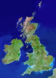
British Isles, satellite image
UK and Ireland. Satellite image of the UK and the Republic of Ireland (Eire). North is at top. Water is blue, vegetation is green, dry or barren areas are brown, and snow and ice are white

Background imageSatellite Collection: Whole Earth at night, satellite image

Whole Earth at night, satellite image
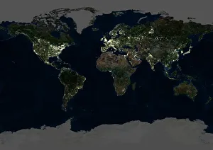
Whole Earth map at night, satellite image. Here, Africa is seen at centre. City lights (yellow) of increasing intensity show areas of increasing population

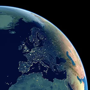
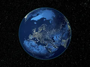
Background imageSatellite Collection: Europe at night

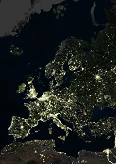
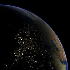
Europe at night, satellite image. North is at top. Yellow lights mark the major cities and population areas, showing a clearly delineated Mediterranean coast

Background imageSatellite Collection: Earth from space, satellite image

Earth from space, satellite image
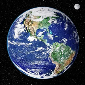
Earth from space. Satellite image showing North and South America as seen from 35, 000 kilometres above the Earths surface. North is at top and the Moon is at upper right

Background imageSatellite Collection: Europe at night, satellite image

Europe at night, satellite image. City lights (yellow) of increasing intensity show areas of increasing population, with areas of few lights being more sparsely populated

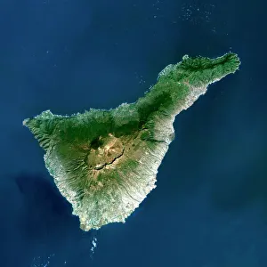
Background imageSatellite Collection: Tenerife, satellite image

Tenerife, satellite image. Satellite image of Tenerife showing Mount Teide (lower centre). Vegetation is green, and water is blue

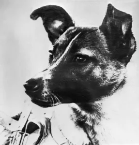
Background imageSatellite Collection: Space-Sputnik Ii-Laika

Space-Sputnik Ii-Laika
Picture from the Soviet daily Pravda dated 13 November 1957 of the dog Laika, the first living creature ever sent in space, onboard Sputnik II

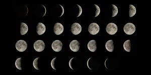
Background imageSatellite Collection: Phases of the Moon

Phases of the Moon. Composite image showing the Moon at each stage of its 28 day cycle (a lunar month). Along the top row, the Moon is a waxing (growing in apparent size) crescent

Background imageSatellite Collection: Ganges River delta, India

Ganges River delta, India
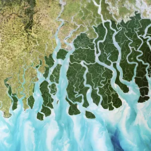
Ganges delta, India, satellite image. The Ganges is a river which flows for over 2400 kilometres from the Himalayas to the Indian Oceans Bay of Bengal

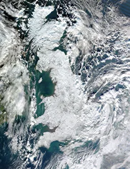
Background imageSatellite Collection: Snow-covered United Kingdom, January 2010

Snow-covered United Kingdom, January 2010. Satellite image of snow and ice (white) covering the UK during the cold spell in January 2010

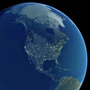
Background imageSatellite Collection: North America at night, satellite image

North America at night, satellite image
Africa at night. Satellite image of the Earth at night, set against a background of stars, centred on the continent of Africa. North is at top. City lights (yellow) show areas of dense population

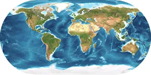
Background imageSatellite Collection: Earth, topographic and bathymetric map

Earth, topographic and bathymetric map. This whole Earth map is centred on the Greenwich meridian, at zero degrees latitude

Background imageSatellite Collection: Europe at night, satellite image

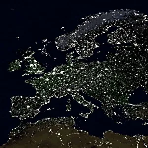
Europe at night, satellite image. City lights (yellow) show areas of dense population. There are few lights in North Africa (bottom) and the Arctic (top) since they are more sparsely populated

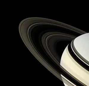
Background imageSatellite Collection: Saturns rings, Cassini image

Saturns rings, Cassini image. The rings consist of particles of nearly pure water ice and meteoric dust and span almost 300, 000 kilometres

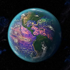
Background imageSatellite Collection: Ocean currents off the Americas

Ocean currents off the Americas. Satellite-based graphic showing ocean currents (swirling coloured lines) on an Earth globe centred on the Americas

Background imageSatellite Collection: Orange Harvest Moon

Orange Harvest Moon
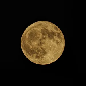
The Harvest Moon gets its name from folklore. The saying is the light of the moon helped farmers gather crops when days became shorter and nights longer following the Autumnal Equinox

Background imageSatellite Collection: North Sea at night, satellite image

North Sea at night, satellite image
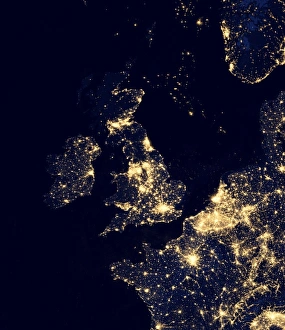
North Sea at night. Black marble satellite image of the North Sea at night. Lights from ships and flares from gas and oil platforms can be seen. On land, more densely populated areas are brighter

Background imageSatellite Collection: Aurora over Antarctica, satellite image

Aurora over Antarctica, satellite image
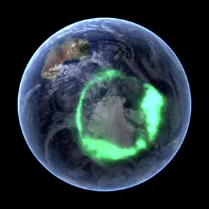
Aurora over Antarctica, ultraviolet satellite image. Australia is at upper left. This is the aurora australis (green ring), the southern lights display

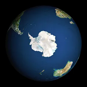
Background imageSatellite Collection: Earth

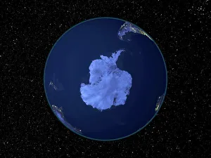
Earth. Satellite image of the Earth, centred on Antarctica. The South Pole is at centre. Water is blue, vegetation is green, arid areas are brown, and snow and ice are white

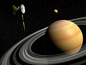
Background imageSatellite Collection: Cassini spacecraft orbiting Saturn and and its moon Titan

Cassini spacecraft orbiting Saturn and and its moon Titan

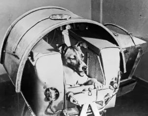
Background imageSatellite Collection: Space-Sputnik Ii-Laika

Space-Sputnik Ii-Laika
Picture from the Soviet daily Pravda dated 13 November 1957 of the dog Laika, the first living creature ever sent in space, onboard Sputnik II

Background imageSatellite Collection: Scotland, UK, satellite image

Scotland, UK, satellite image
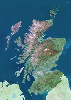
Scotland, UK. North is at top. Natural colour satellite image showing Scotland in the United Kingdom, with the surrounding territories shaded out

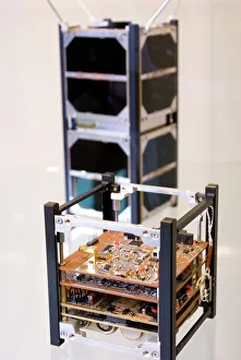
Background imageSatellite Collection: Cubesat satellite

Cubesat satellite
Cubesat microsatellite on display at the 2010 International Astronautical Congress exhibition in Prague

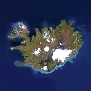
Background imageSatellite Collection: Iceland

Iceland, satellite image. Located in the Atlantic Ocean, just below the Arctic Circle, Iceland is a sparsely populated country of around 300, 000 people and an area of 100, 000 square kilometres

Background imageSatellite Collection: Space-Sputnik I

Space-Sputnik I
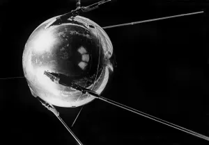
Picture of the worlds first artificial satellite Sputnik I, launched by the Soviet Union from the Baikonur cosmodrome in Kazakhstan, 04 October 1957. / AFP PHOTO / TASS / -

Background imageSatellite Collection: Sputnik 1 stamp

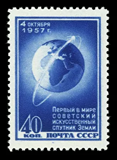
Sputnik 1 stamp. Artwork of Sputnik 1, the worlds first artificial satellite, on a stamp issued by the communist government of the former Soviet Union. Sputnik 1 was launched on October 4th, 1957

Background imageSatellite Collection: Firth of Forth, UK, satellite image

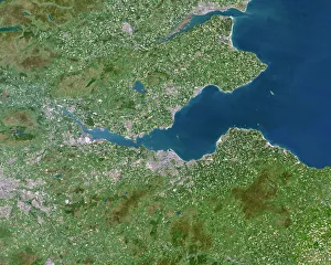
Firth of Forth, UK, satellite image. The Firth of Forth is the major estuary of the River Forth in Scotland. The grey area at centre is the city of Edinburgh

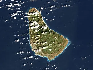
Background imageSatellite Collection: Barbados, satellite image

Barbados, satellite image
Barbados. Landsat image of the island of Barbados in the Caribbean sea. North is at top. Barbados has a total land area of about 430 square kilometres

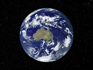
Background imageSatellite Collection: Australia, satellite image

Australia, satellite image
Australia. Satellite image of the Earth, set against a background of stars, centred on the island continent of Australia. North is at top. Clouds (white) are seen in the atmosphere

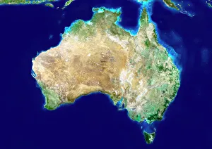
Background imageSatellite Collection: Australia, satellite image

Australia, satellite image. North is at top. Australia is the worlds smallest continent. It is located in the southern hemisphere, southeast of Asia

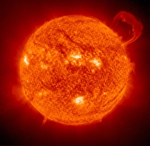
Background imageSatellite Collection: Solar prominence

Solar prominence, ultraviolet SOHO (Solar and Heliospheric Observatory) satellite image. The prominence (top right), is a dense cloud of plasma, or ionised gas

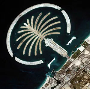
Background imageSatellite Collection: Palm Islands construction, Dubai

Palm Islands construction, Dubai
Luxury island construction, Dubai. Ikonos satellite image of an artificial palm tree-shaped island created in the Persian Gulf, off the coast of Dubai. This is the Jumeirah Palm resort

Background imageSatellite Collection: South America at night, satellite image

South America at night, satellite image
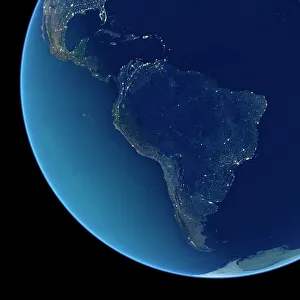
South America at night. Satellite image of the Earth at night, set against a background of stars, centred on the continent of South America. North is at top

Background imageSatellite Collection: India at night, satellite image

India at night, satellite image
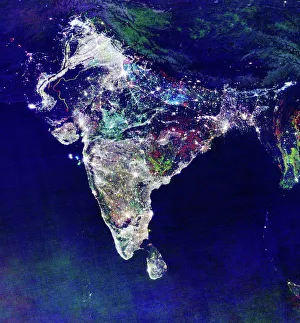
India at night, satellite view. This image is a composite showing the change in illumination over India from 1992-2003. Satellite data from 2003 is coloured red

Background imageSatellite Collection: Australia, topographic map

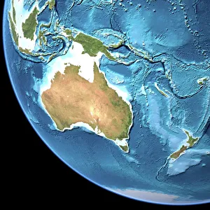
Australia, topographic map. Highlands and lowlands of the continents are shown as ridges and flat areas. Southeast Asia (top left), New Zealand (lower right) and Antarctica (bottom right)

Background imageSatellite Collection: South America at night, satellite image

South America at night, satellite image. City lights (yellow) show areas of dense population, particularly in North America (top left) and South Americas coasts

Background imageSatellite Collection: North America at night, satellite image

North America at night, satellite image. City lights (yellow) show areas of dense population, particularly in North America (upper centre)

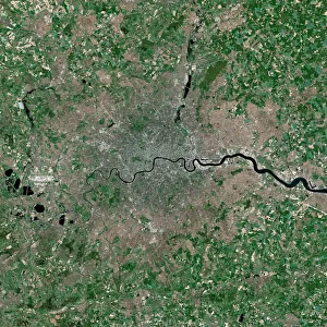
Background imageSatellite Collection: London, UK, satellite image

London, UK, satellite image
London, UK. Satellite image of the city of London (centre) and its surrounding area. North is at top. The River Thames is seen running through the city from left to right

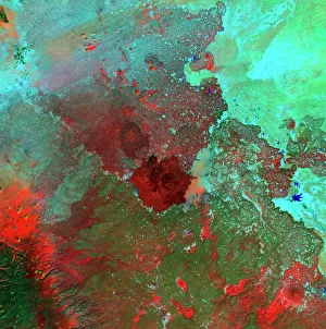
Background imageSatellite Collection: Syrian Desert, satellite image

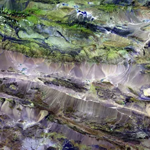
Syrian Desert, satellite image. North is at top. Vegetation is red and dark green, while arid areas of sand and rock are light green and light blue. Water is blue

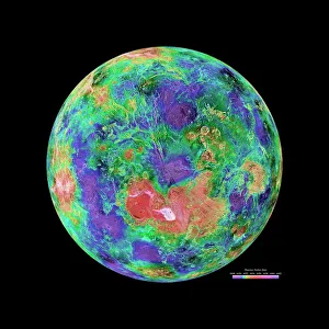
Background imageSatellite Collection: Venus radar map, North Pole

Venus radar map, North Pole
Venus radar map, centred on the Venusian North Pole. The map is colour-coded for altitude, going from low altitude (purple) through blue, green, yellow and orange to high altitude (red)

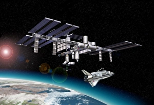
Background imageSatellite Collection: International space station and shuttle F008 / 3216

International space station and shuttle F008 / 3216
International space station and shuttle, artwork

Background imageSatellite Collection: Sputnik 1 postcard

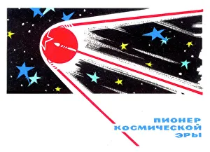
Sputnik 1 postcard. Artwork of Sputnik 1, the worlds first artificial satellite, on a postcard issued by the communist government of the former Soviet Union

Background imageSatellite Collection: Water vapour maps of Antarctica, 2004

Water vapour maps of Antarctica, 2004
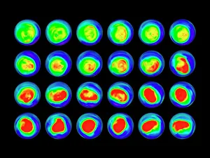
Water vapour maps of Antarctica. Satellite images of the increase in water vapour over Antarctica from 13 August to 14 October 2004 (the austral spring)

Background imageSatellite Collection: Model of Russian Molniya-1 satellite

Model of Russian Molniya-1 satellite
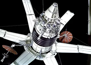
Molniya 1 communications satellite. Model of a Molniya-1 military communications satellite in its orbital configuration. Molniya-1 was the first attempt by the Soviet Union to provide satellite-based

Background imageSatellite Collection: VLA (Very Large Array) of the National Radio Astronomy Observatory, New Mexico

VLA (Very Large Array) of the National Radio Astronomy Observatory, New Mexico, United States of America, North America

Background imageSatellite Collection: VLA (Very Large Array) of the National Radio Astronomy Observatory, New Mexico

VLA (Very Large Array) of the National Radio Astronomy Observatory, New Mexico, United States of America, North America

Background imageSatellite Collection: Steppe-desert border, satellite image

Steppe-desert border, satellite image. North is at top. Arid areas of desert rock are brown, while grassy steppe areas are green. A small area of desert sands (yellow) is seen at far centre right

Background imageSatellite Collection: Europe at night

Europe at night, satellite image. North is towards top left. Yellow lights mark the major cities. The Mediterranean coast is densely populated, as is the mainland of Britain

Background imageSatellite Collection: Earth, topographic and bathymetric map

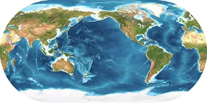
Earth, topographic and bathymetric map. This map is centred on the Pacific Ocean, at longitude 140 degrees west. Highlands and lowlands of the continents are shown as ridges and flat areas

Background imageSatellite Collection: Berlin, Germany, satellite image

Berlin, Germany, satellite image
Berlin, Germany. Satellite image of the city of Berlin (centre) and its surrounding area in northeastern Germany. North is at top

Background imageSatellite Collection: Whole Earth, satellite image

Whole Earth, satellite image. This map is centred on the Greenwich meridian, at zero degrees latitude. Arctic and Antarctic ice is white, oceans are blue and land is green and brown

Background imageSatellite Collection: North America at night, satellite image

North America at night, satellite image
North America at night. Black marble satellite image of North America at night. More densely populated areas are brighter

Background imageSatellite Collection: Africa, satellite image

Africa, satellite image
Africa. Satellite image of the Earth centred on Africa. Clouds are white, oceans are blue and land is green and brown. Also seen are Europe (top) Asia (upper right), the Indian Ocean (right)

Background imageSatellite Collection: Voyager 1 spacecraft entering interstellar space

Voyager 1 spacecraft entering interstellar space
This artists concept depicts NASAs Voyager 1 spacecraft entering interstellar space, or the space between stars. Interstellar space is dominated by the plasma, or ionized gas

Background imageSatellite Collection: Karbala, Iraq

Karbala, Iraq. Satellite image of Karbala, the capital city of the Al Karbala province, Iraq. Shi a Muslims consider it to be one of the holiest places in the world

Background imageSatellite Collection: Space-Sputnik I-Pravda

Space-Sputnik I-Pravda
(FILES) Picture dated 06 October 1957 shows the frontpage of the Sovietic newspaper Pravda after the launch of worlds first satellite Sputnik I

Background imageSatellite Collection: Illustration of Galileo Probe

Illustration of Galileo Probe

Background imageSatellite Collection: Hubble Space Telescope above earth

Hubble Space Telescope above earth

Background imageSatellite Collection: ISS and the Moon C013 / 5148

ISS and the Moon C013 / 5148
ISS and the Moon. The International Space Station (ISS, upper left) is orbiting the Earth here at an altitude of around 390 kilometres

Background imageSatellite Collection: 1974 Plymouth Satellite Custom

1974 Plymouth Satellite Custom 4 door

Background imageSatellite Collection: Sputnik 1 launch

Sputnik 1 launch. Sputnik 1, the worlds first artificial satellite, being launched by an R-7 Semyorka rocket from Tyuratam military range (now Baikonur Cosmodrome), Kazakhstan, on 4 October 1957

Background imageSatellite Collection: Artwork of Hubble Space Telescope over Earth

Artwork of Hubble Space Telescope over Earth
Hubble Space Telescope. Computer artwork of the Hubble Space Telescope (HST) in orbit over Earth, facing a collage of images that are typical of those it produces

Background imageSatellite Collection: Manned maneuvring unit space walk, 1984

Manned maneuvring unit space walk, 1984. Astronaut Bruce McCandless floats free above the Earth in his manned manoeuvring unit (MMU) on 7th February 1984

Background imageSatellite Collection: Brisbane, Australia, satellite image

Brisbane, Australia, satellite image. North is at top, water is blue, shallow coastal areas are light blue, urban areas are grey and vegetation is green

Background imageSatellite Collection: Richat Structure, satellite image

Richat Structure, satellite image. North is at top. Desert sands are pale yellow/white (top left and lower right), while less sandy, rocky areas are green, and volcanic rocks are blue

Background imageSatellite Collection: Southeast Asia at night, satellite image

Southeast Asia at night, satellite image
Southeast Asia at night. Satellite image of the Earth seen at 18:00 (6pm) GMT (UCT), centred on China. City lights (yellow) show areas of dense population, particularly in India (left)

Background imageSatellite Collection: Africa, night-day satellite image

Africa, night-day satellite image. This composite image of the Earth is set against a background of stars, and is centred on the continent of Africa. North is at top

Background imageSatellite Collection: Whole Earth at night, satellite image

Whole Earth at night, satellite image. This map is centred on the Greenwich meridian, at zero degrees latitude. City lights (yellow) show areas of dense population

Background imageSatellite Collection: Africa, topographic map

Africa, topographic map. Highlands and lowlands of the continents are shown as ridges and flat areas. Southern Europe and the Middle East are also seen at top and upper right respectively

Background imageSatellite Collection: The top of the British Telecom BT Tower, London

The top of the British Telecom BT Tower, London. Date: circa early 1980s

Background imageSatellite Collection: Sputnik I

Sputnik I
October 1957: Sputnik I, the first Russian satellite to enter space, displayed on a stand shortly before its launch on October 4, 1957. (Photo by Hulton Archive/Getty Images)

Background imageSatellite Collection: World Flat projection map from composite of satellite images. Credit NASA: Science

World Flat projection map from composite of satellite images. Credit NASA: Science Earth Geology Oceanography

Background imageSatellite Collection: World map, February 2004

World map, February 2004
World Map. Blue Marble: Next Generation cloud-free true-colour composite image of the Earth in February 2004. It is winter in the Northern Hemisphere and large areas of land are covered in snow

Background imageSatellite Collection: Times when Company I d Trade for Solitude

Times when Company I d Trade for Solitude
Duffey Lake in BC on the Duffey lake road highway 99 with Mt Rohr reflected in the emerald water

Background imageSatellite Collection: Middle East, satellite image

Middle East, satellite image
Middle East. North is at top. Satellite image of the Middle East, showing the borders (white lines) of the countries. The Middle East is a Eurocentric term used to describe a region that roughly

Background imageSatellite Collection: A model of Sputnik 1. Photograph, 1957

A model of Sputnik 1. Photograph, 1957
SPACE: SPUTNIK 1, 1957. A model of Sputnik 1. Photograph, 1957

Background imageSatellite Collection: Sputnik 1 rocket track

Sputnik 1 rocket track. Long exposure photograph of the night sky showing the track of the rocket that carried Sputnik 1, the worlds first artificial satellite

Background imageSatellite Collection: Earth and Moon with dwarf planets

Earth and Moon with dwarf planets. Scaled computer artwork of (from left) Earth, the Moon, Pluto and Ceres. The latter are two of the solar systems dwarf planets

Background imageSatellite Collection: Supernova remnant IC 443, composite image

Supernova remnant IC 443, composite image. This is a combination of X-ray (blue), radio (green) and optical (red) data. A supernova remnant (SNR)

Background imageSatellite Collection: Sergei Pavlovich Korolev, Soviet engineer

Sergei Pavlovich Korolev, Soviet engineer

Background imageSatellite Collection: Eastern Himalayas, satellite image

Eastern Himalayas, satellite image. North is at top. Snow is white, vegetation is red, barren areas are light blue and water is dark blue

Background imageSatellite Collection: Desert alluvial fan, satellite image

Desert alluvial fan, satellite image. North is at top. Desert areas can sometimes go for years without rain, and then intense storms will cause flooding that fills old dry river beds

Background imageSatellite Collection: Hubble Space Telescope in orbit, artwork

Hubble Space Telescope in orbit, artwork
Hubble Space Telescope (HST) in orbit over the Earth, artwork. The HST is an astronomical satellite in orbit around Earth

Background imageSatellite Collection: Europe, satellite image

Europe, satellite image
Europe. Satellite image centred on Europe. North converges towards top. Water is blue, vegetation is green, arid areas are brown, and snow and ice are white


All Professionally Made to Order for Quick Shipping

"Exploring the World from Above: Captivating Satellite Images Unveil Earth's Wonders" Discovering the British Isles: A mesmerizing satellite image showcases the stunning landscapes of the United Kingdom and Ireland, offering a bird's-eye view of their diverse beauty. Illuminating Europe at Night: Behold an enchanting satellite image capturing Europe in all its nocturnal glory, as cities sparkle like constellations against the darkened continent. Embracing Darkness: Witness Europe draped in darkness with another breathtaking satellite image, revealing a different perspective on our bustling continent during nighttime hours. The Whole Earth Shines Brightly: Prepare to be awestruck by an awe-inspiring satellite image showcasing our planet illuminated entirely at night, reminding us of humanity's collective presence across continents. Tenerife's Extraterrestrial Charm: Journey to Spain's Tenerife through a captivating satellite image that unveils this volcanic island's unique allure from space, where land and sea merge harmoniously. Earth Revealed from Space: Gaze upon an extraordinary satellite image that captures our magnificent blue planet suspended amidst endless cosmic wonders – a humbling reminder of our place in the universe. Scotland Unveiled from Above: Delight in a striking satellite image showcasing Scotland’s rugged terrain and picturesque lochs, inviting exploration into its untamed beauty from high above. Pioneering Space Exploration - Sputnik II & Laika: Commemorating history-making moments with a glimpse into space exploration’s early days – witness Sputnik II carrying Laika, paving the way for human endeavors beyond Earth’s atmosphere. Moonlit Phases Dance Across Skies: Marvel at nature’s celestial ballet as we present captivating images depicting various phases of the moon – each phase unveiling its own mystical charm against starry backdrops. Winter Wonderland Over United Kingdom 2010.

© Copyright Media Storehouse, All Rights Reserved 2003 - 2024
Facebook     Pinterest     Card Payments     Reviews IO