Premium Framed Print > North Wind Picture Archives > Maps
Premium Framed Print : EXPL2A-00227


![]()
Framed Photos from North Wind
EXPL2A-00227
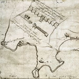
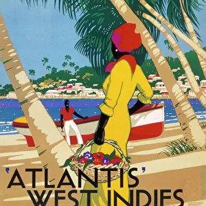
Map of Hispaniola in 1534, from cartography of Peter Martyr and Oviedo.
Hand-colored 19th-century woodcut reproduction of a 16th-century map
North Wind Picture Archives brings history to life with stock images and hand-colored illustrations
Media ID 5881793
© North Wind Picture Archives
1500s 16th Century Caribbean Cartography Colonial Colony Discover Dominican Republic Expedition Exploration Explore Haiti Hispaniola Island Navigation New Spain New World Santo Domingo Settlement Spanish West Indies 1534 Oviedo Peter Martyr
14"x18" Premium Frame
Contemporary style Premium Wooden Frame with 8"x12" Print. Complete with 2" White Mat and 1.25" thick MDF frame. Printed on 260 gsm premium paper. Glazed with shatter proof UV coated acrylic glass. Backing is paper covered backing with rubber bumpers. Supplied ready to hang with a pre-installed sawtooth/wire hanger. Care Instructions: Spot clean with a damp cloth. Securely packaged in a clear plastic bag and envelope in a reinforced cardboard shipper
FSC Real Wood Frame and Double Mounted with White Conservation Mountboard - Professionally Made and Ready to Hang
Estimated Image Size (if not cropped) is 30.4cm x 20.3cm (12" x 8")
Estimated Product Size is 45.8cm x 35.6cm (18" x 14")
These are individually made so all sizes are approximate
Artwork printed orientated as per the preview above, with landscape (horizontal) orientation to match the source image.
FEATURES IN THESE COLLECTIONS
> North Wind Picture Archives
> Latin America:Caribbean
> North Wind Picture Archives
> Maps
EDITORS COMMENTS
This vintage hand-colored woodcut reproduction captures the historic map of Hispaniola in 1534, a true treasure from the era of exploration and colonialism. Created by renowned cartographers Peter Martyr and Oviedo, this illustration provides a fascinating glimpse into the early navigation and discovery of the West Indies. The intricate details on this map showcase the Spanish settlement and colonies that were established during this time, including Santo Domingo in what is now known as the Dominican Republic. It offers a window into the rich history of Hispaniola, which played a significant role in shaping the New World. With its vibrant colors and meticulous craftsmanship, this print transports us back to an era when brave explorers embarked on expeditions to uncover new lands across uncharted seas. The map serves as both an artistic masterpiece and an invaluable historical artifact. As we admire this piece of cartography, we are reminded of how far our understanding of geography has come since those early days of discovery. This image invites us to explore not only the physical terrain but also delve deeper into the stories behind these remarkable journeys that forever changed our world.
MADE IN THE USA
Safe Shipping with 30 Day Money Back Guarantee
FREE PERSONALISATION*
We are proud to offer a range of customisation features including Personalised Captions, Color Filters and Picture Zoom Tools
SECURE PAYMENTS
We happily accept a wide range of payment options so you can pay for the things you need in the way that is most convenient for you
* Options may vary by product and licensing agreement. Zoomed Pictures can be adjusted in the Cart.