Fraud Blocker Skip to main content

Topography Collection (page 9)

"Exploring the World's Varied Topography

Background imageTopography Collection: Sketches of a Cruise to Alaska (engraving)

Sketches of a Cruise to Alaska (engraving)
1622966 Sketches of a Cruise to Alaska (engraving) by English School, (19th century); Private Collection; (add.info.: Sketches of a Cruise to Alaska)

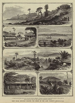
Background imageTopography Collection: Port Blair, Andaman Islands, the Scene of the Late Viceroys Assassination (engraving)

Port Blair, Andaman Islands, the Scene of the Late Viceroys Assassination (engraving)
1057746 Port Blair, Andaman Islands, the Scene of the Late Viceroys Assassination (engraving) by English School, (19th century); Private Collection; (add.info.: Port Blair, Andaman Islands)

Background imageTopography Collection: Agrarian Agitation in Ireland, Scene of the Attempted Assassination of Mr Smith

Agrarian Agitation in Ireland, Scene of the Attempted Assassination of Mr Smith, Lord Sligos Agent (engraving)
1054213 Agrarian Agitation in Ireland, Scene of the Attempted Assassination of Mr Smith, Lord Sligos Agent (engraving) by English School

Background imageTopography Collection: DDE-90021131

DDE-90021131
Aerial view of land below, Madagascar Date: 14/05/2008

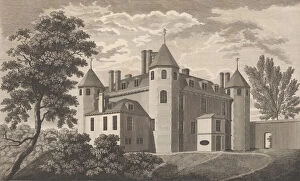
Background imageTopography Collection: Nash Court in Boughton, in the County of Kent, from Edward Hasted s, The History and To

Nash Court in Boughton, in the County of Kent, from Edward Hasted s, The History and To... 1777-90. Creator: Anon
Nash Court in Boughton, in the County of Kent, from Edward Hasted s, The History and Topographical Survey of the County of Kent, vols. 1-3, 1777-90

Background imageTopography Collection: Antiquities Dug up at Different Times in Crock-field near Newington, from Edward Hasted

Antiquities Dug up at Different Times in Crock-field near Newington, from Edward Hasted... 1777-90. Creator: Anon
Antiquities Dug up at Different Times in Crock-field near Newington, from Edward Hasted s, The History and Topographical Survey of the County of Kent, vols. 1-3, 1777-90

Background imageTopography Collection: Sutton Place, near Dartford, in the County of Kent, taken in the year 1766, before the... 1777-90

Sutton Place, near Dartford, in the County of Kent, taken in the year 1766, before the... 1777-90. Creator: Anon
Sutton Place, near Dartford, in the County of Kent, taken in the year 1766, before the alterations, from Edward Hasted s, The History and Topographical Survey of the County of Kent, vols. 1-3, 1777-90

Background imageTopography Collection: West Wickham Court in the County of Kent, from Edward Hasted s, The History and Topogra

West Wickham Court in the County of Kent, from Edward Hasted s, The History and Topogra... 1777-90. Creator: Anon
West Wickham Court in the County of Kent, from Edward Hasted s, The History and Topographical Survey of the County of Kent, vols. 1-3, 1777-90

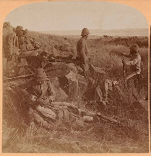
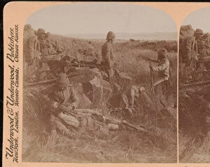
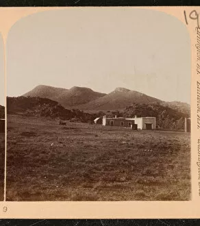
Background imageTopography Collection: Driefontein battlefield, South Africa, 1899 (b / w photo)

Driefontein battlefield, South Africa, 1899 (b / w photo)
5920858 Driefontein battlefield, South Africa, 1899 (b/w photo) by Underwood & Underwood (c.1881-1940); National Army Museum

Background imageTopography Collection: Some of the Palaces and Castles of the Late King Ludwig II, of Bavaria (litho)

Some of the Palaces and Castles of the Late King Ludwig II, of Bavaria (litho)
1046348 Some of the Palaces and Castles of the Late King Ludwig II, of Bavaria (litho) by Brewer, Henry Charles (1866-1950); Private Collection; (add.info)

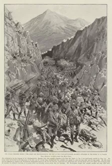
Background imageTopography Collection: The Indian Frontier Rising, the Saran Sar Reconnaissance, the Men of the Northamptonshire Regiment

The Indian Frontier Rising, the Saran Sar Reconnaissance, the Men of the Northamptonshire Regiment attacked by
1598230 The Indian Frontier Rising, the Saran Sar Reconnaissance, the Men of the Northamptonshire Regiment attacked by the Enemy in a Nullah (litho) by Begg

Background imageTopography Collection: The Indian Frontier Rising, with the Tirah Field Force at Shinowrie

The Indian Frontier Rising, with the Tirah Field Force at Shinowrie, Working Parties of the Gurkha Rifles engaged
1598048 The Indian Frontier Rising, with the Tirah Field Force at Shinowrie, Working Parties of the Gurkha Rifles engaged on the Camp Water Supply (litho) by Begg

Background imageTopography Collection: The Russo-Turkish War, the First Shot fired in Europe (engraving)

The Russo-Turkish War, the First Shot fired in Europe (engraving)
1059729 The Russo-Turkish War, the First Shot fired in Europe (engraving) by Durand, Godefroy (1832-1896); Private Collection; (add.info.: The Russo-Turkish War, the First Shot fired in Europe)

Background imageTopography Collection: The Church of St Michael, 1868 (w / c)

The Church of St Michael, 1868 (w / c)
5929548 The Church of St Michael, 1868 (w/c) by James, Francis (Frank) Cornelius (19th century); National Army Museum, London; (add.info.: The Church of St Michael, 1868)

Background imageTopography Collection: The Governors Cottage on the Rock of Gibraltar, March 1827. (w / c)

The Governors Cottage on the Rock of Gibraltar, March 1827. (w / c)
5926914 The Governors Cottage on the Rock of Gibraltar, March 1827. (w/c) by St Clair, Thomas Staunton (1785-1847); National Army Museum

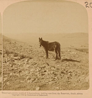
Background imageTopography Collection: Transvaal country south of Johannesburg, looking east from the Reservoir, South Africa (b / w photo)

Transvaal country south of Johannesburg, looking east from the Reservoir, South Africa (b / w photo)
5924783 Transvaal country south of Johannesburg, looking east from the Reservoir, South Africa (b/w photo) by Underwood & Underwood (c.1881-1940); National Army Museum

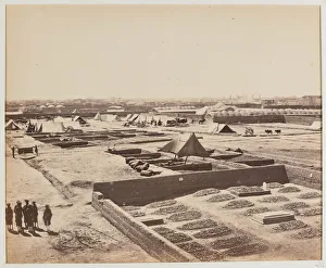
Background imageTopography Collection: British troops in a Sikh town, probably Allahabad, 1st Sikh War, 1845 circa (w / c)

British troops in a Sikh town, probably Allahabad, 1st Sikh War, 1845 circa (w / c)
5922947 British troops in a Sikh town, probably Allahabad, 1st Sikh War, 1845 circa (w/c) by Grant, Bethune Donald (fl.1840-46); National Army Museum

Background imageTopography Collection: View from General Outrams Head Quarters [Dr Fayrers House]. Looking Towards Palaces of Furrad Bux

View from General Outrams Head Quarters [Dr Fayrers House]. Looking Towards Palaces of Furrad Bux and Chuttur Munzil
5922376 View from General Outrams Head Quarters [Dr Fayrers House]. Looking Towards Palaces of Furrad Bux and Chuttur Munzil, 1858 circa (litho) by Dodgson, David Scott Lieutenant-Colonel (fl)

Background imageTopography Collection: Murcha Pass, from top of the Durrani gate, 1880 circa (b / w photo)

Murcha Pass, from top of the Durrani gate, 1880 circa (b / w photo)
5922154 Murcha Pass, from top of the Durrani gate, 1880 circa (b/w photo) by Simpson, Benjamin (1831-1923); National Army Museum, London; (add.info.: Murcha Pass, from top of the Durrani gate)

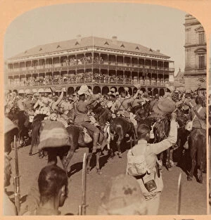
Background imageTopography Collection: Lord Roberts and Staff, Occupation of Pretoria, South Africa, 1899 (b / w photo)

Lord Roberts and Staff, Occupation of Pretoria, South Africa, 1899 (b / w photo)
5920869 Lord Roberts and Staff, Occupation of Pretoria, South Africa, 1899 (b/w photo) by Underwood & Underwood (c.1881-1940); National Army Museum

Background imageTopography Collection: View from the Redan looking towards the Vorontsov Ravine, 1855 (b / w photo)

View from the Redan looking towards the Vorontsov Ravine, 1855 (b / w photo)
5920272 View from the Redan looking towards the Vorontsov Ravine, 1855 (b/w photo) by Lefevre, George Shaw (1831-1928); National Army Museum

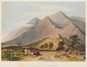
Background imageTopography Collection: Fortress of Bukkur from Roree, 1838 circa (coloured lithograph)

Fortress of Bukkur from Roree, 1838 circa (coloured lithograph)
5920141 Fortress of Bukkur from Roree, 1838 circa (coloured lithograph) by Jackson, Sir Keith A. (fl.1838); National Army Museum, London; (add.info.: Fortress of Bukkur from Roree, 1838 circa)

Background imageTopography Collection: Fortress of Ghuznee, 1839 circa (coloured lithograph)

Fortress of Ghuznee, 1839 circa (coloured lithograph)
5920133 Fortress of Ghuznee, 1839 circa (coloured lithograph) by Jackson, Sir Keith A. (fl.1838); National Army Museum, London; (add.info.: Fortress of Ghuznee, 1839 circa)

Background imageTopography Collection: 9th Hodsons Horse on the Western Front, 1916 circa (b / w photo)

9th Hodsons Horse on the Western Front, 1916 circa (b / w photo)
5920066 9th Hodsons Horse on the Western Front, 1916 circa (b/w photo) by Mullick Photo House (early 20th century); National Army Museum, London; (add.info.: 9th Hodsons Horse in France, 1916 circa)

Background imageTopography Collection: Cemetery at Kandahar, 1880 (b / w photo)

Cemetery at Kandahar, 1880 (b / w photo)
5919838 Cemetery at Kandahar, 1880 (b/w photo) by Simpson, Benjamin (1831-1923); National Army Museum, London; (add.info.: Cemetery at Kandahar, 1880)

Background imageTopography Collection: Driefontein battlefield, South Africa, 1899 (b / w photo)

Driefontein battlefield, South Africa, 1899 (b / w photo)
5924781 Driefontein battlefield, South Africa, 1899 (b/w photo) by Underwood & Underwood (c.1881-1940); National Army Museum

Background imageTopography Collection: Khoord Caubel Pass, 1842 (pencil and wash)

Khoord Caubel Pass, 1842 (pencil and wash)
5929769 Khoord Caubel Pass, 1842 (pencil and wash) by Croly, George Alfred (d.1845); National Army Museum, London; (add.info.: Khoord Caubel Pass, 1842)

Background imageTopography Collection: Senafe, Abyssinia, 1868 (w / c)

Senafe, Abyssinia, 1868 (w / c)
5929549 Senafe, Abyssinia, 1868 (w/c) by James, Francis (Frank) Cornelius (19th century); National Army Museum, London; (add.info.: Senafe, 1868)

Background imageTopography Collection: N Fort Taku from centre south cavalier, 30. 3. 62. (w / c)

N Fort Taku from centre south cavalier, 30. 3. 62. (w / c)
5929422 N Fort Taku from centre south cavalier, 30.3.62. (w/c) by Sanford, George E.L.S. (fl.1862); National Army Museum, London; (add.info.: N Fort Taku from centre south cavalier, 30.3.62)

Background imageTopography Collection: Cape Town, c. 1862 (w / c)

Cape Town, c. 1862 (w / c)
5929379 Cape Town, c.1862 (w/c) by Sanford, George E.L.S. (fl.1862); National Army Museum, London; (add.info.: Cape Town, 1862 (c)

Background imageTopography Collection: Caves of Bameean, 1842 (colour litho)

Caves of Bameean, 1842 (colour litho)
5929335 Caves of Bameean, 1842 (colour litho) by Eyre, Vincent (fl.c.1841) (after); National Army Museum, London; (add.info.: Caves of Bameean, 1842)

Background imageTopography Collection: Bhutan Campaign, 1864 circa (oil on canvas)

Bhutan Campaign, 1864 circa (oil on canvas)
5925097 Bhutan Campaign, 1864 circa (oil on canvas) by Adye, John Miller (1819-1900); National Army Museum, London; (add.info.: Bhutan Campaign, 1864 circa)

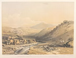
Background imageTopography Collection: Run with the 7th Dragoon foxhounds in Caffir Land, Cape of Good Hope

Run with the 7th Dragoon foxhounds in Caffir Land, Cape of Good Hope, 1843-1847 (coloured lithograph)
5925025 Run with the 7th Dragoon foxhounds in Caffir Land, Cape of Good Hope, 1843-1847 (coloured lithograph) by Darell, Harry Francis (1814-53); National Army Museum

Background imageTopography Collection: The 9th Foot (The Britannia Boys) entering Allahabad (on their way down country after the Sikh)

The 9th Foot (The Britannia Boys) entering Allahabad (on their way down country after the Sikh wars), 1st Sikh War
5922949 The 9th Foot (The Britannia Boys) entering Allahabad (on their way down country after the Sikh wars), 1st Sikh War, 1845 circa (w/c) by Grant

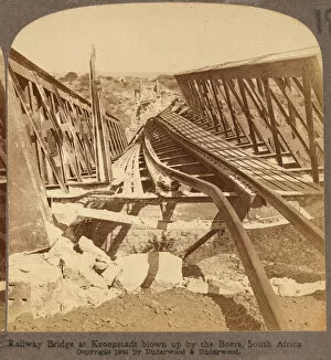
Background imageTopography Collection: Wrecked railway bridge across the Valsch River, Boer War, 1901 (b / w photo)

Wrecked railway bridge across the Valsch River, Boer War, 1901 (b / w photo)
5920887 Wrecked railway bridge across the Valsch River, Boer War, 1901 (b/w photo) by Underwood & Underwood (c.1881-1940); National Army Museum

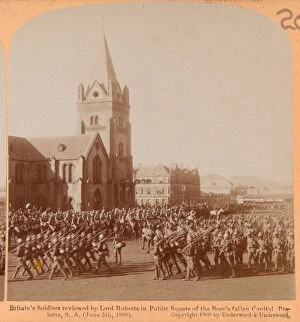
Background imageTopography Collection: Review, Pretoria, South Africa, 1900 (b / w photo)

Review, Pretoria, South Africa, 1900 (b / w photo)
5920871 Review, Pretoria, South Africa, 1900 (b/w photo) by Underwood & Underwood (c.1881-1940); National Army Museum, London; (add.info)

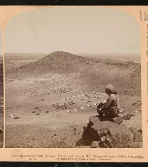
Background imageTopography Collection: Looking over the 12th Brigade Camp and Signal Hill, Slingersfontein, British Campaign, S. A

Looking over the 12th Brigade Camp and Signal Hill, Slingersfontein, British Campaign, S. A. 1900 circa (b / w photo)
5920849 Looking over the 12th Brigade Camp and Signal Hill, Slingersfontein, British Campaign, S.A. 1900 circa (b/w photo) by Underwood & Underwood (c.1881-1940); National Army Museum

Background imageTopography Collection: Boer Farm and New Zealand Hill, South Africa, 1900 (b / w photo)

Boer Farm and New Zealand Hill, South Africa, 1900 (b / w photo)
5920848 Boer Farm and New Zealand Hill, South Africa, 1900 (b/w photo) by Underwood & Underwood (c.1881-1940); National Army Museum, London; (add.info.: Boer Farm and New Zealand Hill, S.A)

Background imageTopography Collection: 9th Hodsons Horse march through Damascus, 2 October 1918 (b / w photo)

9th Hodsons Horse march through Damascus, 2 October 1918 (b / w photo)
5920454 9th Hodsons Horse march through Damascus, 2 October 1918 (b/w photo) by Mullick Photo House (early 20th century); National Army Museum

Background imageTopography Collection: View of City, from Signal Tower looking West, 1880 circa (b / w photo)

View of City, from Signal Tower looking West, 1880 circa (b / w photo)
5920190 View of City, from Signal Tower looking West, 1880 circa (b/w photo) by Simpson, Benjamin (1831-1923); National Army Museum, London; (add.info.: View of City, from Signal Tower looking West)

Background imageTopography Collection: Dadur, 1839 (coloured lithograph)

Dadur, 1839 (coloured lithograph)
5920140 Dadur, 1839 (coloured lithograph) by Jackson, Sir Keith A. (fl.1838); National Army Museum, London; (add.info.: Dadur, 1839)

Background imageTopography Collection: Kondye, Bolan Pass, 1839 circa (coloured lithograph)

Kondye, Bolan Pass, 1839 circa (coloured lithograph)
5920139 Kondye, Bolan Pass, 1839 circa (coloured lithograph) by Jackson, Sir Keith A. (fl.1838); National Army Museum, London; (add.info.: Kondye, Bolan Pass, 1839 circa)

Background imageTopography Collection: Kandahar Gate, Kelaat, 1839 circa (coloured lithograph)

Kandahar Gate, Kelaat, 1839 circa (coloured lithograph)
5920137 Kandahar Gate, Kelaat, 1839 circa (coloured lithograph) by Jackson, Sir Keith A. (fl.1838); National Army Museum, London; (add.info.: Kandahar Gate, Kelaat, 1839 circa)

Background imageTopography Collection: Ruined Tower at Maidaum Army Marching, 1839 (coloured lithograph)

Ruined Tower at Maidaum Army Marching, 1839 (coloured lithograph)
5920132 Ruined Tower at Maidaum Army Marching, 1839 (coloured lithograph) by Jackson, Sir Keith A. (fl.1838); National Army Museum, London; (add.info.: Ruined Tower at Maidaum Army Marching)

Background imageTopography Collection: Caubul, 1839 circa (coloured lithograph)

Caubul, 1839 circa (coloured lithograph)
5920129 Caubul, 1839 circa (coloured lithograph) by Jackson, Sir Keith A. (fl.1838); National Army Museum, London; (add.info.: Caubul, 1839 circa)

Background imageTopography Collection: No 2. Mountain Battery ascending the Springawi Pass, 1880 circa (b / w photo)

No 2. Mountain Battery ascending the Springawi Pass, 1880 circa (b / w photo)
5920051 No 2. Mountain Battery ascending the Springawi Pass, 1880 circa (b/w photo) by Bourne & Shepherd (19th-20th century); National Army Museum, London; (add.info.: No)

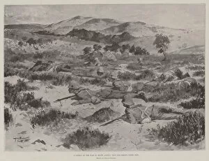
Background imageTopography Collection: A Lesson of the War in South Africa, how Our Troops fight now (litho)

A Lesson of the War in South Africa, how Our Troops fight now (litho)
1593372 A Lesson of the War in South Africa, how Our Troops fight now (litho) by Stewart, Allan (1865-1951); Private Collection; (add.info.: A Lesson of the War in South Africa)

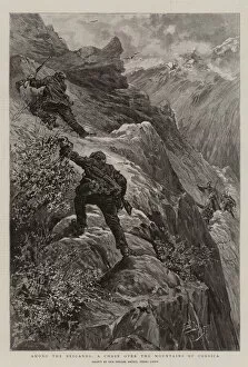
Background imageTopography Collection: Among the Brigands, a Chase over the Mountains of Corsica (engraving)

Among the Brigands, a Chase over the Mountains of Corsica (engraving)
1047633 Among the Brigands, a Chase over the Mountains of Corsica (engraving) by Lanos, Henri (1859-1929); Private Collection; (add.info.: Among the Brigands, a Chase over the Mountains of Corsica)


All Professionally Made to Order for Quick Shipping

"Exploring the World's Varied Topography: From Ancient Greece to Antarctica" Embark on a captivating journey through time and space as we delve into the fascinating realm of topography. This 150 caption takes you across continents, from Cyprus to Africa, Portugal to Wales, and beyond. Let's begin our expedition with a glimpse into history - an intriguing Map of Cyprus published in 1880. Its intricate details transport us back in time, unraveling the island's rich geographical tapestry. Next, we navigate towards Africa where a Political Map unveils the diverse nations that shape this vast continent. The contours and boundaries guide us through its majestic landscapes and vibrant cultures. Venturing westward, we encounter a Map of Portugal which showcases not only its cities but also reveals hidden gems nestled within its topographical wonders. It beckons explorers to uncover its secrets. As we traverse further northwards, three Welsh women dressed in traditional costumes capture our attention. Their attire reflects both their cultural heritage and the unique topography that surrounds them. Turning our gaze towards Scotland, James Craig's 1768 map presents Edinburgh's New Town for the first time. This pioneering plan intertwines urban development with meticulous attention to topographic features – shaping one of Europe's most enchanting cities. Across the Atlantic Ocean lies Plymouth, Massachusetts - Samuel de Champlain’s map from his 1605 expedition guides us through this historic settlement site. The rugged beauty of Plymouth is etched onto this map like a testament to human resilience against nature’s challenges. Our exploration now takes an icy turn as we discover Antarctica adorned with illustrations of sea gulls, penguins, elephant seals, and shrimp amidst towering ice formations. This juxtaposition between wildlife and man-made structures highlights how humanity has left imprints even on Earth’s harshest terrains. The turquoise waters surrounding Providenciales Island in Turks & Caicos come alive on a mural map depicting Grace Bay.