Fraud Blocker Skip to main content

Topography Collection (page 5)

"Exploring the World's Varied Topography

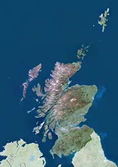
Background imageTopography Collection: Scotland with Shetland, United Kingdom, True Colour Satellite Image

Scotland with Shetland, United Kingdom, True Colour Satellite Image
Satellite view of Scotland including Shetland, United Kingdom. This image was compiled from data acquired by LANDSAT 5 & 7 satellites

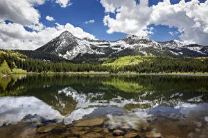
Background imageTopography Collection: Snowcapped East Beckwith Mountain In The Background Reflected In Lost Lake Slough; Colorado

Snowcapped East Beckwith Mountain In The Background Reflected In Lost Lake Slough; Colorado, United States Of America

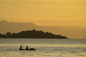
Background imageTopography Collection: Silhouette Of Fishermen In Dugout Canoe Leaving Cape Maclear In The Evening, Lake Malawi; Malawi

Silhouette Of Fishermen In Dugout Canoe Leaving Cape Maclear In The Evening, Lake Malawi; Malawi

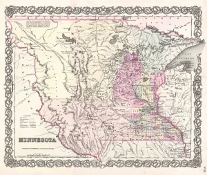
Background imageTopography Collection: 1855, Colton Map of Minnesota, topography, cartography, geography, land, illustration

1855, Colton Map of Minnesota, topography, cartography, geography, land, illustration
1855, Colton Map of Minnesota

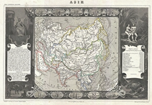
Background imageTopography Collection: 1852, Levasseur Map of Asia, topography, cartography, geography, land, illustration

1852, Levasseur Map of Asia, topography, cartography, geography, land, illustration
1852, Levasseur Map of Asia

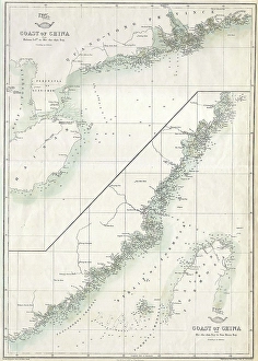
Background imageTopography Collection: 1863, Cassells Dispatch Atlas Map of Taiwan, Formosa and the Hainan Coast of China

1863, Cassells Dispatch Atlas Map of Taiwan, Formosa and the Hainan Coast of China

Background imageTopography Collection: 1835, S. D. U. K. City Map or Plan of Amsterdam, The Netherlands, topography, cartography

1835, S. D. U. K. City Map or Plan of Amsterdam, The Netherlands, topography, cartography
1835, S.D.U.K. City Map or Plan of Amsterdam, The Netherlands

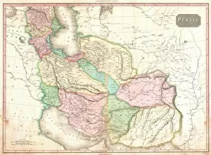
Background imageTopography Collection: 1818, Pinkerton Map of Persia, Iran, Afghanistan, John Pinkerton, 1758 - 1826, Scottish

1818, Pinkerton Map of Persia, Iran, Afghanistan, John Pinkerton, 1758 - 1826, Scottish antiquarian, cartographer, UK

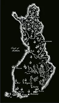
Background imageTopography Collection: Antique Finland Map

Antique Finland Map
Finland Map, - Antique style. Includes mountains and water bodies. High detail - vector illustration

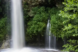
Background imageTopography Collection: Water Pours Over Natural Falls After A Heavy Rain; Oklahoma, United States Of America

Water Pours Over Natural Falls After A Heavy Rain; Oklahoma, United States Of America

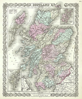
Background imageTopography Collection: 1855, Colton Map of Scotland, topography, cartography, geography, land, illustration

1855, Colton Map of Scotland, topography, cartography, geography, land, illustration
1855, Colton Map of Scotland

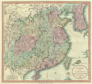
Background imageTopography Collection: 1801, Cary Map of China and Korea, John Cary, 1754 - 1835, English cartographer, topography

1801, Cary Map of China and Korea, John Cary, 1754 - 1835, English cartographer, topography
1801, Cary Map of China and Korea, John Cary, 1754 - 1835, English cartographer

Background imageTopography Collection: 1772, Bonne Map of Scotland, Rigobert Bonne 1727 - 1794, one of the most important

1772, Bonne Map of Scotland, Rigobert Bonne 1727 - 1794, one of the most important cartographers of the late 18th century

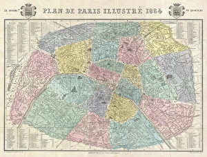
Background imageTopography Collection: 1864, Garnier Map of Pairs, France w-Monuments, topography, cartography, geography

1864, Garnier Map of Pairs, France w-Monuments, topography, cartography, geography
1864, Garnier Map of Pairs, France w-Monuments

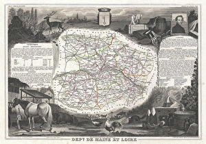
Background imageTopography Collection: 1852, Levasseur Map of the Department De Maine et Loire, France, topography, cartography

1852, Levasseur Map of the Department De Maine et Loire, France, topography, cartography
1852, Levasseur Map of the Department De Maine et Loire, France

Background imageTopography Collection: 1801, Cary Map of Scotland, 4 Sheets, John Cary, 1754 - 1835, English cartographer

1801, Cary Map of Scotland, 4 Sheets, John Cary, 1754 - 1835, English cartographer

Background imageTopography Collection: Topographic map of Sicily, Italy, lithograph, published in 1897

Topographic map of Sicily, Italy, lithograph, published in 1897
Topographic map of Sicily, Italy - largest island in the Mediterranean Sea. Lithograph, published in 1897

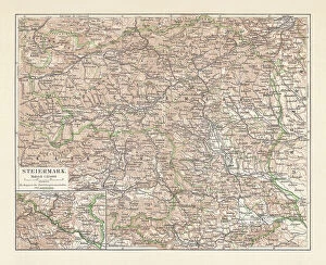
Background imageTopography Collection: Topographic map of Styria, Austria, lithograph, published in 1897

Topographic map of Styria, Austria, lithograph, published in 1897
Topographic map of Styria - state (Bundesland) located in the southeast of Austria. Lithograph, published in 1897

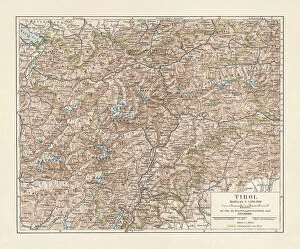
Background imageTopography Collection: Tyrol, historical region in Austria and Italy, lithograph, published 1897

Tyrol, historical region in Austria and Italy, lithograph, published 1897
Tyrol - historical region in the Alps; in northern Italy and western Austria. Lithograph, published in 1897

Background imageTopography Collection: Historical map of the Ottoman Empire (Turkey), European part, 1897

Historical map of the Ottoman Empire (Turkey), European part, 1897
Historical map of European part of the Ottoman Empire (Turkey) at the end of the 19th century. Lithograph, published in 1897
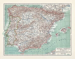
Background imageTopography Collection: Topographic map of Spain and Portugal, lithograph, published in 1897

Topographic map of Spain and Portugal, lithograph, published in 1897
Topographic map of Spain and Portugal. Lithograph, published in 1897
Background imageTopography Collection: The author and research traveler Sven Hedin, 1897. Creator: Unknown

The author and research traveler Sven Hedin, 1897. Creator: Unknown
The author and research traveler Sven Hedin, 1897

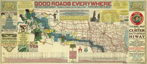
Background imageTopography Collection: Touring map of the Custer Battlefield Hiway: the scenic route to the west, 1925. Creators: John C

Touring map of the Custer Battlefield Hiway: the scenic route to the west, 1925. Creators: John C. Mulford, C. C
Touring map of the Custer Battlefield Hiway: the scenic route to the west, 1925. The Custer Battlefield Highway was created in 1925 as a scenic route between Iowa and Montana

Background imageTopography Collection: Topographical sketch of the gold & quicksilver district of California, 1848. Creator: Edward Ord

Topographical sketch of the gold & quicksilver district of California, 1848. Creator: Edward Ord
Topographical sketch of the gold & quicksilver district of California, 1848. Published in July 1848 after the first gold strikes at Sutter's Mill on the American River in northern California

Background imageTopography Collection: Map of the mining district of California, 1850. Creator: William A. Jackson

Map of the mining district of California, 1850. Creator: William A. Jackson
Map of the mining district of California, 1850. The California gold rush of 1849 began with the strikes at Sutter's Mill on the American River near Sacramento

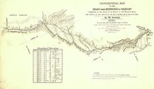
Background imageTopography Collection: Topographical map of the road from Missouri to Oregon, commencing at the mouth of

Topographical map of the road from Missouri to Oregon, commencing at the mouth of the Kansas...1846 Creators
Topographical map of the road from Missouri to Oregon, commencing at the mouth of the Kansas in the Missouri River and ending at the mouth of the Walla-Wallah in the Columbia, 1846

Background imageTopography Collection: China c. 1880s - White Stag temple near Amoy Xiamen

China c. 1880s - White Stag temple near Amoy Xiamen
Vintage 19th century photograph China c.1880s - White Stag temple near Amoy Xiamen

Background imageTopography Collection: City of London Road Map

City of London Road Map
Black and white illustration of geographical, road map of London, UK

Background imageTopography Collection: Green iguana (Iguana iguana) rear view of basking in sun, Banco Chinchorro Biosphere Reserve

Green iguana (Iguana iguana) rear view of basking in sun, Banco Chinchorro Biosphere Reserve, Caribbean region, Mexico, May

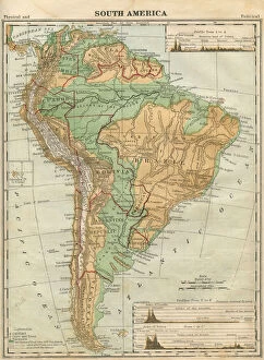
Background imageTopography Collection: South America Map Illustration, Travel, Exploration, Antique 1871 Illustration

South America Map Illustration, Travel, Exploration, Antique 1871 Illustration
Color stock photo of an antique South America map illustration. Salvaged from an 1871 geography book

Background imageTopography Collection: Eagle fern (Pteridium aquilinum) frond unfurling, Montseny Natural Park, a UNESCO National Park

Eagle fern (Pteridium aquilinum) frond unfurling, Montseny Natural Park, a UNESCO National Park and Biosphere Reserve, Barcelona, Catalonia, Spain, June 2016

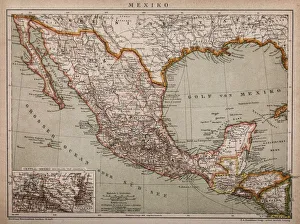
Background imageTopography Collection: Map of Mexico

Map of Mexico
Antique map of Mexico

Background imageTopography Collection: Aerial view of Slapton Sands, Devon, England

Aerial view of Slapton Sands, Devon, England

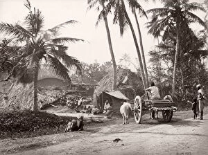
Background imageTopography Collection: 19th century vintage photograph India - village life in Bengal, Samuel Bourne, 1860s

19th century vintage photograph India - village life in Bengal, Samuel Bourne, 1860s

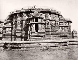
Background imageTopography Collection: 19th century vintage photograph India - Jain temples Halebidu

19th century vintage photograph India - Jain temples Halebidu

Background imageTopography Collection: China c. 1880s Jade Spring Hill Summer palace, Peking, Beijing

China c. 1880s Jade Spring Hill Summer palace, Peking, Beijing
Vintage 19th century photograph China c.1880s - pagoda, Jade Spring Hill, near the Summer palace, Peking, Beijing

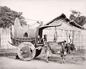
Background imageTopography Collection: India - bullock cart

India - bullock cart
19th century vintage photograph India - bullock cart

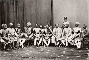
Background imageTopography Collection: India - Raja of Mahmudabad

India - Raja of Mahmudabad
19th century vintage photograph India - Raja of Mahmudabad

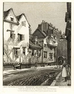
Background imageTopography Collection: View of part of Duke Street, West Smithfield, 1807

View of part of Duke Street, West Smithfield, 1807
View of part of Duke Street, formerly Duck Lane, West Smithfield, 1807. Tudor timber houses of oak, chestnut and plaster. Man on a ladder lighting a gas lantern

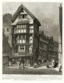
Background imageTopography Collection: Tudor houses on the corner of Chancery Lane

Tudor houses on the corner of Chancery Lane, Fleet Street, 1789. External specimen of the Grotesque Bracketed Front and Projecting Stories of the reign of Edward VI. Demolished 1799

Background imageTopography Collection: Yokohama and Tokyo

Yokohama and Tokyo
Old illustration map of Yokohama and Tokyo

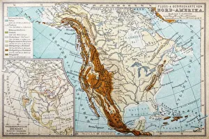
Background imageTopography Collection: River and mountains map of North America

River and mountains map of North America
Illustration of a River and mountains map of North America

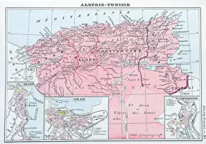
Background imageTopography Collection: Antique map of Algeria and Tunisia

Antique map of Algeria and Tunisia

Background imageTopography Collection: Markly, 1835. Creator: Charles Mottram

Markly, 1835. Creator: Charles Mottram
Markly, (1835). Markly House, Warbleton, Sussex, ancestral home of the Darby family. John Darby was said to have profited as a merchant from naval contracts in the Napoleonic wars

Background imageTopography Collection: Frant Church, 1835. Creator: Unknown

Frant Church, 1835. Creator: Unknown
Frant Church, 1835. St. Albans Church in the Parish of Frant, Sussex. From " The History, Antiquities, and Topography of the County of Sussex, Volume the First", by Thomas Walker Horsfield

Background imageTopography Collection: The Temple Grammar School, Brighton, 1835. Creator: Henry Alexander Ogg

The Temple Grammar School, Brighton, 1835. Creator: Henry Alexander Ogg
The Temple Grammar School, Brighton, 1835. View of the Temple built by Thomas Read Kemp on Montpelier Road. Steel engraving by Henry Alexander Ogg after George Earpe

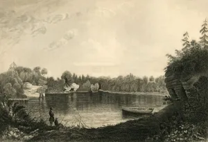
Background imageTopography Collection: Uckfield Lake, 1835. Creator: Henry Alexander Ogg

Uckfield Lake, 1835. Creator: Henry Alexander Ogg
Uckfield Lake, 1835. Antique line engraving by Henry Alexander Ogg after Thomas Henwood. From " The History, Antiquities, and Topography of the County of Sussex, Volume the First"

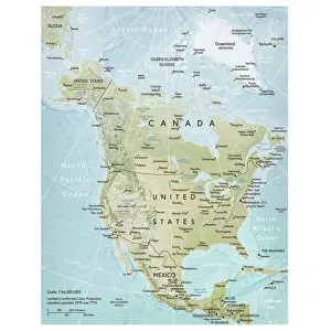
Background imageTopography Collection: North America map

North America map
Vector illustration of a detailed map of North America. Reference map was created by the US Central Intelligence Agency and is available as a public domain map at the University of Texas Libraries


All Professionally Made to Order for Quick Shipping

"Exploring the World's Varied Topography: From Ancient Greece to Antarctica" Embark on a captivating journey through time and space as we delve into the fascinating realm of topography. This 150 caption takes you across continents, from Cyprus to Africa, Portugal to Wales, and beyond. Let's begin our expedition with a glimpse into history - an intriguing Map of Cyprus published in 1880. Its intricate details transport us back in time, unraveling the island's rich geographical tapestry. Next, we navigate towards Africa where a Political Map unveils the diverse nations that shape this vast continent. The contours and boundaries guide us through its majestic landscapes and vibrant cultures. Venturing westward, we encounter a Map of Portugal which showcases not only its cities but also reveals hidden gems nestled within its topographical wonders. It beckons explorers to uncover its secrets. As we traverse further northwards, three Welsh women dressed in traditional costumes capture our attention. Their attire reflects both their cultural heritage and the unique topography that surrounds them. Turning our gaze towards Scotland, James Craig's 1768 map presents Edinburgh's New Town for the first time. This pioneering plan intertwines urban development with meticulous attention to topographic features – shaping one of Europe's most enchanting cities. Across the Atlantic Ocean lies Plymouth, Massachusetts - Samuel de Champlain’s map from his 1605 expedition guides us through this historic settlement site. The rugged beauty of Plymouth is etched onto this map like a testament to human resilience against nature’s challenges. Our exploration now takes an icy turn as we discover Antarctica adorned with illustrations of sea gulls, penguins, elephant seals, and shrimp amidst towering ice formations. This juxtaposition between wildlife and man-made structures highlights how humanity has left imprints even on Earth’s harshest terrains. The turquoise waters surrounding Providenciales Island in Turks & Caicos come alive on a mural map depicting Grace Bay.