Fraud Blocker Skip to main content

Old Map Collection (page 2)

"Unveiling the Rich Tapestry of History: Exploring Old Maps from Around the World" Step back in time to 1768 with the James Craig Map of New Town, Edinburgh

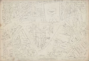
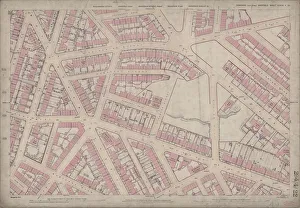
Background imageOld Map Collection: Ordnance Survey Map, City Centre, 1890 (sheet no. Yorkshire No. 294.8.16)

Ordnance Survey Map, City Centre, 1890 (sheet no. Yorkshire No. 294.8.16)
This map features Top left: Campo Lane, Church Street, St. James Row Bank, Trippet Lane, Pinfold Street, Bow Street, Canterbury Hall Public House, Orchard Street, Leopold Street, Sims Croft
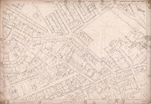
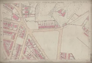
Background imageOld Map Collection: Ordnance Survey Map, Fitzalan Square area, 1889 (sheet no. Yorkshire No. 294.8.17)
Ordnance Survey Map, Fitzalan Square area, 1889 (sheet no. Yorkshire No. 294.8.17)
This map features: Top left: Watson's Walk [Watson Walk], Waterloo Turf Tavern, Commercial Street, Shude Hill, Shude Lane, Fish Market, [Marsh Brothers and Co.]

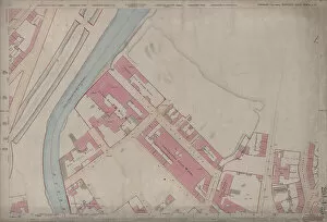
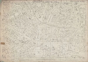
Background imageOld Map Collection: Ordnance Survey Map, Bernard Road area, 1890 (sheet no. Yorkshire No. 294.8.18)

Ordnance Survey Map, Bernard Road area, 1890 (sheet no. Yorkshire No. 294.8.18)
This map features Top left: Broad Street, Shrewsbury Works (metal) (in margin), Park Plate Works (in margin), Old Street, High Street Lane, Crown Alley Lane, Low Street, New Street Lane

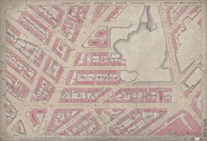
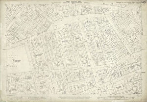
Background imageOld Map Collection: Ordnance Survey Map, Brookhill area, Sheffield, 1889 (sheet no. Yorkshire No. 294.7.19)

Ordnance Survey Map, Brookhill area, Sheffield, 1889 (sheet no. Yorkshire No. 294.7.19)
This map features Top left: Weston Street, Yardley Street, Sutton Street, Bolsover Street, Brightmore Street, Mitchell Street, Winter Street, Lodge on Winter Street, Reliance Place, West Grove Place

Background imageOld Map Collection: Cusco White

Cusco White
StudioSix

Background imageOld Map Collection: Ordnance Survey Map, Sheffield, Netherthorpe area, 1889 (Yorkshire sheet 294. 7. 9)

Ordnance Survey Map, Sheffield, Netherthorpe area, 1889 (Yorkshire sheet 294. 7. 9)
This map features: Top left: Abbey Street, Springvale Road, Crookesmoor Road, Burlington Street, Martin Street, Wentworth Street, Adelphi Street, Oxford Street, Martin Lane, Sunday School

Background imageOld Map Collection: Ordnance Survey Map, Sheffield, Cornish Street area, Netherthorpe, Sheffield

Ordnance Survey Map, Sheffield, Cornish Street area, Netherthorpe, Sheffield, 1889 (Yorkshire sheet 294. 7. 5)
This map features: Top left: Bedford Street, Burys and Co. Ltd. steel manufacturers, Regent Works, Penistone Road and Philadelphia Steel Works, Penistone Road / Bedford Street, Penistone Road

Background imageOld Map Collection: Ordnance Survey Map, Sheffield, Blake Street area, Netherthorpe, Sheffield

Ordnance Survey Map, Sheffield, Blake Street area, Netherthorpe, Sheffield, 1889 (Yorkshire sheet No. 294. 7. 3)
This map features: Top left: Daniel Hill Street, Elton Street, Harworth Street, Harworth Road, Walkley Street, Duncombe Street, Fulton Road, Blake Street Hotel Public House [Blake Hotel]

Background imageOld Map Collection: Ordnance Survey Map, Bessemer Road area, Attercliffe, Sheffield, 1889 (Yorkshire sheet No. 294. 4)

Ordnance Survey Map, Bessemer Road area, Attercliffe, Sheffield, 1889 (Yorkshire sheet No. 294. 4. 25)
This map features: Top left: River Don, Crown Steel and Wire Works, Bessemer Road [Arthur Lee and Sons Ltd. steel and wire manufacturers], Princess Street, Midland Railway, Savile Street East

Background imageOld Map Collection: Ordnance Survey Map, Gower Street area, Burngreave, Sheffield, 1889 (Yorkshire sheet No. 294. 4. 23)

Ordnance Survey Map, Gower Street area, Burngreave, Sheffield, 1889 (Yorkshire sheet No. 294. 4. 23)
This map features: Top left: Buckenham Road, Ditchingham Road, Catherine Road, Granville Street, Grimesthorpe Road, Bressinghham Road, Ellesmere Road, Clun Road, Petre Street, Buckenham Street

Background imageOld Map Collection: Ordnance Survey Map, Somerset Street area, Burngreave, Sheffield, 1889 (Yorkshire sheet no. 294)

Ordnance Survey Map, Somerset Street area, Burngreave, Sheffield, 1889 (Yorkshire sheet no. 294. 4. 22)
This map features: Top left: Rock Street, Nottingham Street, Brackley Street, Somerset Road, Catherine Street, Somerset Street, Leicester Villas, Fox Street, Cranworth Road, Brotherton Street

Background imageOld Map Collection: Ordnance Survey Map, Lyons Street / Carlisle Street area, Sheffield, 1889 (Yorkshire sheet no)

Ordnance Survey Map, Lyons Street / Carlisle Street area, Sheffield, 1889 (Yorkshire sheet no. 294. 4. 19)
This map features: Top left: Jamaica Street, Kingston Street, Petre Street, Edgar Street, Thorndon Road (marked in pencil), Earsham Street, Lyons Street, Carwood Lane Brick and Stone Works, Kiln

Background imageOld Map Collection: Ordnance Survey Map, Ellesmere Road / Lyons Road area of Sheffield

Ordnance Survey Map, Ellesmere Road / Lyons Road area of Sheffield, 1889 (Yorkshire sheet number 294. 4. 18)
This map features: Top left: Earldom Street, Grimesthorpe Road, Lyons Road, The Hills, Malton Street, Burngreave Cemetery, Hooton Street, Lucas Street, Normanton Street

Background imageOld Map Collection: Ordnance Survey Map, Burngreave area of Sheffield, 1889 (Yorkshire sheet number 294. 4. 17)

Ordnance Survey Map, Burngreave area of Sheffield, 1889 (Yorkshire sheet number 294. 4. 17)
This map features Top left: Minna Road, Burngreave Road, Melrose Road, Fox Street, Pilgrim Street, Melrose Villas, [Burngreave Road Wesleyan Chapel] Methodist Chapel

Background imageOld Map Collection: Ordnance Survey Map, West Bar area, Sheffield, 1889 (Yorkshire sheet 294. 8. 11)

Ordnance Survey Map, West Bar area, Sheffield, 1889 (Yorkshire sheet 294. 8. 11)
This map features: Top left: West Bar, tramway, Corporation Street, West Bar Green, Moseley's Arms Public House, Scotland Street, Crown Inn, Lambert Street, Steelhouse Lane, Furnace Hill

Background imageOld Map Collection: Ordnance Survey Map, Effingham Street area, Sheffield, 1889 (Yorkshire sheet 294. 8. 8)

Ordnance Survey Map, Effingham Street area, Sheffield, 1889 (Yorkshire sheet 294. 8. 8)
This map features: Top left: Goods shed, River Don, Effingham Street, Furnival Road, Wicker Brewery Hotel Public House, Savile Street, tramway, [George Turton, Platts and Co

Background imageOld Map Collection: Ordnance Survey Map, The Wicker / Spital Hill, Sheffield, 1889 (Yorkshire sheet 294. 8. 7)

Ordnance Survey Map, The Wicker / Spital Hill, Sheffield, 1889 (Yorkshire sheet 294. 8. 7)
This map features: Top left: Manchester, Sheffield and Lincolnshire Railway, Goods Shed, Brunswick Road, Andrew Street, [William Wright, mortar grinder]

Background imageOld Map Collection: Ordnance Survey Map, Alma Street / Netherthorpe area, Sheffield, 1889 (Yorkshire sheet 294. 8. 6)

Ordnance Survey Map, Alma Street / Netherthorpe area, Sheffield, 1889 (Yorkshire sheet 294. 8. 6)
This map features: Top left: Alma Street, River Don, [Taylor and Co. steam hammer manufacturers, ] Alma Street Works (Engineering), [Union Grinding Wheel Company] on Alma Street

Background imageOld Map Collection: Ordnance Survey Map, Attercliffe area, Sheffield, 1889 (Yorkshire sheet 294. 8. 4)

Ordnance Survey Map, Attercliffe area, Sheffield, 1889 (Yorkshire sheet 294. 8. 4)
This map features: Top left: [Charles Cammell and Co. Ltd. steel manufacturers], Cyclops Works (steel and iron), Sutherland Street / Saville Street East; [Spear and Jackson, Aetna Works]

Background imageOld Map Collection: Ordnance Survey Map, Sheffield, Eldon Street / West Street area, 1889 (Yorkshire sheet 294. 7. 25)

Ordnance Survey Map, Sheffield, Eldon Street / West Street area, 1889 (Yorkshire sheet 294. 7. 25)
This map features: Top left: West Street, Devonshire Street, Dawson Street, Eldon Brewery, Eldon Street, Eldon Lane, Broomhall Street, Eldon Street, Fitzwilliam Street, Reindeer Hotel Public House

Background imageOld Map Collection: Ordnance Survey Map, Broomhill area of Sheffield, 1889 (Yorkshire sheet 294. 7. 23)

Ordnance Survey Map, Broomhill area of Sheffield, 1889 (Yorkshire sheet 294. 7. 23)
This map features: Top left: Whitham Road, Wellesley Road, Damer Street, Claremont Crescent, Tree Root Walk, Northumberland Road, Durham House, Palmerston Road, Godfrey Dam Lodge, Westcliffe

Background imageOld Map Collection: Ordnance Survey Map, Sheffield, Portobello Street area (Yorkshire No. 294. 7. 20)

Ordnance Survey Map, Sheffield, Portobello Street area (Yorkshire No. 294. 7. 20)
This map features: Top left: Broad Lane, Boden Lane, Newcastle Street, Carr Lane, St. Thomas Street, West John Lane, West John Street, Firth College (Sheffield Technical School)

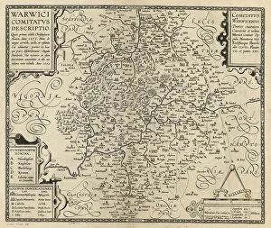
Background imageOld Map Collection: County of Warwick by William Smith, c. 1600 (after Saxton, c. 1574)

County of Warwick by William Smith, c. 1600 (after Saxton, c. 1574)
`WARWICI COMITATVS DESCRIPTIO. Quan primus aeditit Christophorus Saxton. Anno 1576. Nunc de integro correcta. aucta. et restituta. Cui adduntur (praeter 60)

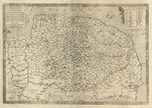
Background imageOld Map Collection: County of Norfolk by Christopher Saxton, c. 1574. Reprint of 1641

County of Norfolk by Christopher Saxton, c. 1574. Reprint of 1641
`NORFOLCIAE COMITATVS DESCRIPTIO CONTINENS in SE OPPIDA MERCATORIA XXVI. Pagos er Villas DCXXV. Vna cvm Singvlis Hundredis, et flvminibvs in eodem. Auctore Christophoro Saxton

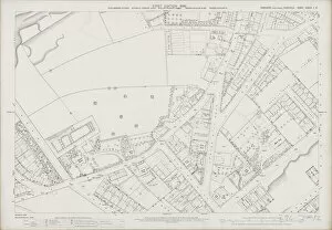
Background imageOld Map Collection: Ordnance Survey Map, Sheffield, School Road, Spring Hill Road area, 1889 (Yorkshire sheet 294. 7)

Ordnance Survey Map, Sheffield, School Road, Spring Hill Road area, 1889 (Yorkshire sheet 294. 7. 12)
This map features Top left: Old quarry, Hands Lane, Bowling Green on corner of Hands Lane and Townend Street, [Ramsey Road], [Leamington Street]

Background imageOld Map Collection: Ordnance Survey Map, Sheffield, Hoyle Street / Infirmary Road area, 1889 (Yorkshire sheet 294. 7)

Ordnance Survey Map, Sheffield, Hoyle Street / Infirmary Road area, 1889 (Yorkshire sheet 294. 7. 10)
This map features Top left: Watery Street, Henry Street, St. Phillips Road, Malinda Street, Sudbury Street, [Abram Brooksbank and Co.], Malinda Works, Malinda Street, steel and files; Progress Works

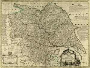
Background imageOld Map Collection: County Map of Yorkshire, c. 1777

County Map of Yorkshire, c. 1777
From The Large English Atlas: or, a new set of map of all the counties of England and Wales drawn from the several surveys which have been hitherto been published

Background imageOld Map Collection: County Map of Yorkshire North Riding, c. 1777

County Map of Yorkshire North Riding, c. 1777
From The Large English Atlas: or, a new set of map of all the counties of England and Wales drawn from the several surveys which have been hitherto been published

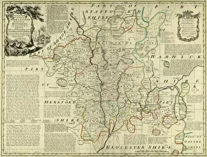
Background imageOld Map Collection: County Map of Worcestershire, c. 1777

County Map of Worcestershire, c. 1777
From The Large English Atlas: or, a new set of map of all the counties of England and Wales drawn from the several surveys which have been hitherto been published

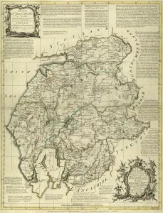
Background imageOld Map Collection: County Map of Westmoreland and Cumberland, c. 1777

County Map of Westmoreland and Cumberland, c. 1777
From The Large English Atlas: or, a new set of map of all the counties of England and Wales drawn from the several surveys which have been hitherto been published

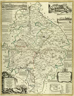
Background imageOld Map Collection: County Map of Warwickshire, c. 1777

County Map of Warwickshire, c. 1777
From The Large English Atlas: or, a new set of map of all the counties of England and Wales drawn from the several surveys which have been hitherto been published

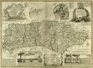
Background imageOld Map Collection: County Map of Sussex, c. 1777

County Map of Sussex, c. 1777
From The Large English Atlas: or, a new set of map of all the counties of England and Wales drawn from the several surveys which have been hitherto been published

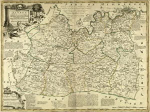
Background imageOld Map Collection: County Map of Surrey, c. 1777

County Map of Surrey, c. 1777
From The Large English Atlas: or, a new set of map of all the counties of England and Wales drawn from the several surveys which have been hitherto been published

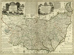
Background imageOld Map Collection: County Map of Suffolk, c. 1777

County Map of Suffolk, c. 1777
From The Large English Atlas: or, a new set of map of all the counties of England and Wales drawn from the several surveys which have been hitherto been published

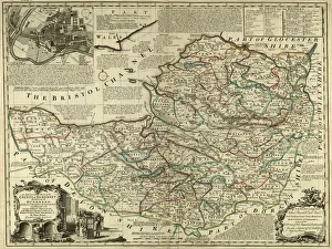
Background imageOld Map Collection: County Map of Somersetshire, c. 1777

County Map of Somersetshire, c. 1777
From The Large English Atlas: or, a new set of map of all the counties of England and Wales drawn from the several surveys which have been hitherto been published

Background imageOld Map Collection: County Map of Shropshire, c. 1777

County Map of Shropshire, c. 1777
From The Large English Atlas: or, a new set of map of all the counties of England and Wales drawn from the several surveys which have been hitherto been published

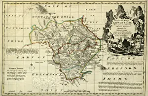
Background imageOld Map Collection: County Map of Radnorshire, Wales, c. 1777

County Map of Radnorshire, Wales, c. 1777
From The Large English Atlas: or, a new set of map of all the counties of England and Wales drawn from the several surveys which have been hitherto been published

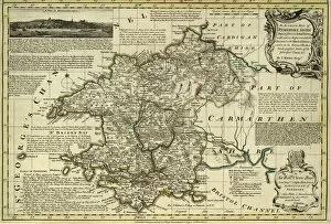
Background imageOld Map Collection: County Map of Pembrokeshire, Wales, c. 1777

County Map of Pembrokeshire, Wales, c. 1777
From The Large English Atlas: or, a new set of map of all the counties of England and Wales drawn from the several surveys which have been hitherto been published

Background imageOld Map Collection: County Map of Oxfordshire, c. 1777

County Map of Oxfordshire, c. 1777
From The Large English Atlas: or, a new set of map of all the counties of England and Wales drawn from the several surveys which have been hitherto been published

Background imageOld Map Collection: County Map of Nottinghamshire, c. 1777

County Map of Nottinghamshire, c. 1777
From The Large English Atlas: or, a new set of map of all the counties of England and Wales drawn from the several surveys which have been hitherto been published

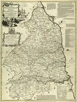
Background imageOld Map Collection: County Map of Northumberland, c. 1777

County Map of Northumberland, c. 1777
From The Large English Atlas: or, a new set of map of all the counties of England and Wales drawn from the several surveys which have been hitherto been published

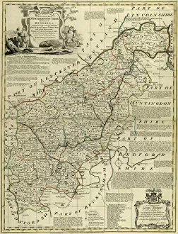
Background imageOld Map Collection: County Map of Northamptonshire, c. 1777

County Map of Northamptonshire, c. 1777
From The Large English Atlas: or, a new set of map of all the counties of England and Wales drawn from the several surveys which have been hitherto been published

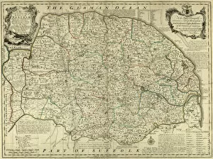
Background imageOld Map Collection: County Map of Norfolk, c. 1777

County Map of Norfolk, c. 1777
From The Large English Atlas: or, a new set of map of all the counties of England and Wales drawn from the several surveys which have been hitherto been published

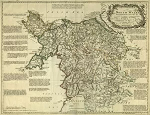
Background imageOld Map Collection: Map of North Wales, c. 1777

Map of North Wales, c. 1777
From The Large English Atlas: or, a new set of map of all the counties of England and Wales drawn from the several surveys which have been hitherto been published

Background imageOld Map Collection: County Map of Glamorganshire, Wales, c. 1777

County Map of Glamorganshire, Wales, c. 1777
From The Large English Atlas: or, a new set of map of all the counties of England and Wales drawn from the several surveys which have been hitherto been published

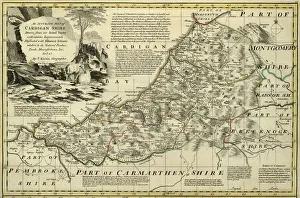
Background imageOld Map Collection: County Map of Cardiganshire, Wales, c. 1777

County Map of Cardiganshire, Wales, c. 1777
From The Large English Atlas: or, a new set of map of all the counties of England and Wales drawn from the several surveys which have been hitherto been published

Background imageOld Map Collection: County Map of Brecknockshire, Wales, c. 1777

County Map of Brecknockshire, Wales, c. 1777
From The Large English Atlas: or, a new set of map of all the counties of England and Wales drawn from the several surveys which have been hitherto been published

Background imageOld Map Collection: County Map of Huntingdonshire, c. 1777

County Map of Huntingdonshire, c. 1777
From The Large English Atlas: or, a new set of map of all the counties of England and Wales drawn from the several surveys which have been hitherto been published


All Professionally Made to Order for Quick Shipping

"Unveiling the Rich Tapestry of History: Exploring Old Maps from Around the World" Step back in time to 1768 with the James Craig Map of New Town, Edinburgh, Scotland - a fascinating glimpse into the birth of this iconic city's urban landscape. Delve into ancient Greece and its captivating islands through the intricate details of the 1794 Delisle Map - an invaluable resource for understanding Southern Ancient Greece and Crete's topography. Travel through County Durham circa 1777 as you unravel its hidden gems with a meticulously crafted County Map that showcases both its natural beauty and man-made landmarks. Embark on an astronomical journey with an 1886 Telescopic View and Map of the Moon - a stunning fusion of cartography, geography, and land exploration that unveils our celestial neighbor like never before. Uncover North America and South America's secrets through Visscher's remarkable 1658 map, which intricately captures their diverse topography while showcasing early advancements in cartographic techniques. Immerse yourself in Scandinavia's enchanting landscapes as depicted by Colton's exquisite 1855 map - an artistic marvel that brings Norway, Sweden, Finland to life while highlighting their unique topographical features. Trace ancient history across Greece, Macedonia, and Thrace prior to the Peloponnesian War using Spruner's detailed 1865 map - a treasure trove for historians seeking insights into this pivotal era’s topography. Navigate London’s bustling streets circa 1848 with Crutchley’s Pocket Map or Plan – a testament to England’s capital city’s ever-evolving nature captured through meticulous cartographic precision. Explore John Pinkerton’s renowned Pinkerton Map from1818 – your gateway to discovering Britain’s Isles' rich heritage encompassing England, Scotland & Ireland; it is truly a collector's delight.