Fine Art Print > Fine Art Storehouse > Map
Fine Art Print : Historical Map of Dutch Navigators Battle in Portugal Illustration


![]()
Fine Art Prints from Fine Art Storehouse
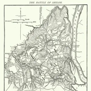
Historical Map of Dutch Navigators Battle in Portugal Illustration
Very Rare, Beautifully Illustrated Antique Engraved Victorian Illustration of Historical Map of Dutch Navigators Battle in Portugal Illustration. Copyright has expired on this artwork. Digitally restored
Unleash your creativity and transform your space into a visual masterpiece!
bauhaus1000
Media ID 13667021
© bauhaus1000
16th Century 16th Century Style 268399 78273 Armed Forces Business Finance And Industry Chart Commercial Dock Conflict Design Element Direction Discovery Dutch Culture European Culture Exploration Explorer Freight Transportation Guidance Harbor Image Created 16th Century Industrial Ship Industry Journey Military Ship Occupation Passenger Craft Passenger Ship Portugal Portuguese Culture Sailing Ship Sea Passage Ship Shipping Strategy Warship Victorian Style
20"x16" (+3" Border) Fine Art Print
Step back in time with our exquisite Historical Map of Dutch Navigators Battle in Portugal Illustration from the Media Storehouse Fine Art Prints collection. This rare and beautifully illustrated antique engraving, created by the talented bauhaus1000, transports you to the Victorian era. The intricate details and rich colors bring to life the historic battle between Dutch navigators and the Portuguese forces in Portugal. With the copyright on this artwork having expired, you can now proudly display this stunning piece in your home or office as a conversation starter and a testament to the past. Add a touch of history and elegance to your space with this unique and captivating Fine Art Print.
20x16 image printed on 26x22 Fine Art Rag Paper with 3" (76mm) white border. Our Fine Art Prints are printed on 300gsm 100% acid free, PH neutral paper with archival properties. This printing method is used by museums and art collections to exhibit photographs and art reproductions.
Our fine art prints are high-quality prints made using a paper called Photo Rag. This 100% cotton rag fibre paper is known for its exceptional image sharpness, rich colors, and high level of detail, making it a popular choice for professional photographers and artists. Photo rag paper is our clear recommendation for a fine art paper print. If you can afford to spend more on a higher quality paper, then Photo Rag is our clear recommendation for a fine art paper print.
Estimated Image Size (if not cropped) is 50.8cm x 36.5cm (20" x 14.4")
Estimated Product Size is 66cm x 55.9cm (26" x 22")
These are individually made so all sizes are approximate
Artwork printed orientated as per the preview above, with landscape (horizontal) orientation to match the source image.
FEATURES IN THESE COLLECTIONS
> Fine Art Storehouse
> History
> Battles & Wars
> Historcal Battle Maps and Plans
> Fine Art Storehouse
> Map
> Historical Maps
EDITORS COMMENTS
This beautifully illustrated antique print showcases a rare historical map of Dutch navigators battling in Portugal during the 16th century. The image, digitally restored and copyright expired, captures the essence of European culture and cartography from that era. The intricate engraving depicts a scene filled with passenger ships, sailing vessels, and military warships engaged in a strategic conflict at sea. It offers a glimpse into the rich history of exploration and discovery by Dutch explorers during this time. The black and white woodcut illustration exudes Victorian style while providing valuable guidance on sea passages, shipping routes, and port locations. It serves as an important design element for those interested in maritime history or studying the cultural exchange between nations. As we observe this print, we are transported back to an era when commercial docks were bustling with activity and industrial ships played a crucial role in freight transportation. The map reveals key details about Portuguese culture as well as Dutch occupation in Portugal during that period. Overall, this rare historical map is not only visually stunning but also holds immense value for anyone fascinated by 16th-century European history or seeking inspiration from past journeys of exploration.
MADE IN THE USA
Safe Shipping with 30 Day Money Back Guarantee
FREE PERSONALISATION*
We are proud to offer a range of customisation features including Personalised Captions, Color Filters and Picture Zoom Tools
SECURE PAYMENTS
We happily accept a wide range of payment options so you can pay for the things you need in the way that is most convenient for you
* Options may vary by product and licensing agreement. Zoomed Pictures can be adjusted in the Cart.