Fraud Blocker Skip to main content

Home > Europe > France > Canton > Landes

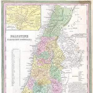
1836 Tanner Map Of Palestine Israel Holy Land

1836 Tanner Map Of Palestine Israel Holy Land
Sold 1
In Stock
We accept all major payment options so you can pay for the things you need in the way that is most convenient for you
Framed Photos
Buy from $79.99
Photo Prints
Buy from $9.99
Jigsaw Puzzles
Buy from $39.99
Poster Prints
Buy from $24.99
Canvas Prints
Buy from $99.99
Fine Art Prints
Buy from $60.90
Metal Prints
Buy from $169.99
Home Decor
Buy from $16.99
Image Downloads

Universal Images Group (UIG) Photo Prints and Wall Art

1836 Tanner Map Of Palestine Israel Holy Land

1836, Tanner Map of Palestine, Israel, Holy Land. Universal Images Group (UIG) manages distribution for many leading specialist agencies worldwide. © Artokoloro Quint Lox Limited

Media ID 38550826

1836 Holy Land Israel Antique Map Latitude Longitude Mappa Mundi Old Antique Plan Old Antique View Ols Antique Map Rare Old Maps Topo

FEATURES IN THESE COLLECTIONS

> Animals > Fishes > G > Grouper

> Asia > Israel > Maps

> Asia > Israel > Related Images

> Asia > Palestine > Maps

> Asia > Palestine > Related Images

> Europe > France > Canton > Landes

> Historic > Space exploration

> Maps and Charts > Early Maps

> Maps and Charts > Related Images

> Maps and Charts > World

> Universal Images Group (UIG) > History > Historical Maps

SECURE PAYMENTS
We accept all major payment options so you can pay for the things you need in the way that is most convenient for you

Made in USA
Safe Shipping, Easy Returns

FREE PERSONALISATION
We are proud to offer a range of customisation including Cropping, Captions, and Filters. Zoom Cropping can be adjusted in the basket


EDITORS COMMENTS

Step back in time to the 19th century with this stunning print of the Tanner Map of Palestine, Israel, and the Holy Land from 1836. This vintage map is a remarkable piece of cartography that showcases the region's topography and geography during a pivotal moment in history. Created by John Tanner, an American cartographer, this map is a testament to his skill and attention to detail. The intricate illustration features mountains, valleys, rivers, and cities, providing a comprehensive view of the region's landscape. From Jerusalem to Bethlehem, Nazareth to Gaza, every notable location is meticulously mapped out. This historic map not only serves as a fascinating piece of geographical art but also offers insight into the cultural and religious significance of the region during that era. It's a window into a bygone era when explorers like Tanner were charting new territories and documenting their findings for future generations. The aged paper has developed a beautiful patina over time, giving this print an air of nostalgia and character. Whether you're an historian, geographer or simply someone who appreciates vintage maps, this print is sure to captivate your imagination.


Framed Prints

Explore the rich history of the Holy Land with our stunning Framed Print from Media Storehouse. This exquisite reproduction features a rare 1836 Tanner Map of Palestine, Israel, and surrounding areas, expertly curated by Universal Images Group (UIG). With its intricate details and vintage charm, this print is a must-have for any history buff or collector. Perfect for framing in your home or office, it's a beautiful way to bring a piece of the past into your present.


Photo Prints

Step back in time with our stunning Photographic Prints from the Media Storehouse range! This historic map, '1836 Tanner Map of Palestine, Israel, Holy Land' from Universal Images Group (UIG), is a fascinating piece of cartography that showcases the region's rich history. Printed on high-quality paper, this archival-grade image is perfect for framing and display. Take a journey through the past and own a piece of history with this unique print.


Poster Prints

Explore the rich history of the Holy Land with our stunning poster print featuring the 1836 Tanner Map of Palestine, Israel. This beautifully detailed map, courtesy of Universal Images Group (UIG), offers a unique glimpse into the region's geography and topography during a pivotal moment in time. Perfect for historians, travelers, and anyone fascinated by ancient cultures, this vintage-style print is a must-have for any home or office decor.


Jigsaw Puzzles

Uncover the rich history of the Holy Land with our stunning jigsaw puzzle featuring a rare and fascinating 1836 Tanner Map of Palestine, Israel. This beautifully crafted piece is part of our Media Storehouse range, showcasing iconic images from Universal Images Group (UIG). As you assemble this challenging puzzle, you'll be transported to a bygone era and gain a deeper understanding of the region's significance. With intricate details and vivid colors, this unique puzzle is perfect for history buffs, geography enthusiasts, and anyone looking for a thought-provoking challenge. So why not take on the journey through time and space with our 1836 Tanner Map Of Palestine Jigsaw Puzzle?

You May Also Like


Avocet Recurvirostra avocetta feeding Titchwell RSPB Res Norfolk summerAvocet Recurvirostra avocetta feeding Titchwell RSPB Res Norfolk summer
Add to Basket
Sacred rock paintings on cliff depicting Dogon customs and stories in SongoSacred rock paintings on cliff depicting Dogon customs and stories in Songo
Add to Basket
1795 Wild Man of the woods - orangutan1795 Wild Man of the woods - orangutan
Add to Basket
Bubbling mud in a hot spring, view from aboveBubbling mud in a hot spring, view from above
Add to Basket
excision, medical equipment, surgical instrument, history of medicineexcision, medical equipment, surgical instrument, history of medicine
Add to Basket
Virgin Child Eight Angels Landscape 1511 WoodcutVirgin Child Eight Angels Landscape 1511 Woodcut
Add to Basket
Buzzards Bay, Dartmouth, Massachusetts. Millions of pogy fish swarm together next toBuzzards Bay, Dartmouth, Massachusetts. Millions of pogy fish swarm together next to
Add to Basket
Whitby lifeboat at the ALCWhitby lifeboat at the ALC
Add to Basket
Richard II's ships bringing provisions to the English forces in Ireland, 1300s. Printed LithographRichard II's ships bringing provisions to the English forces in Ireland, 1300s. Printed Lithograph
Add to Basket
The second Royal Exchange, London, built after Gresham's Exchange had been destroyed in the Fire of London 1666. 18th century (copperplate engraving)The second Royal Exchange, London, built after Gresham's Exchange had been destroyed in the Fire of London 1666. 18th century (copperplate engraving)
Add to Basket
Young French and German women in Empire style prom dress, 1802-1804 - French and German ladies in Empire style gowns, 1802-1804Young French and German women in Empire style prom dress, 1802-1804 - French and German ladies in Empire style gowns, 1802-1804
Add to Basket

Gallery Wall Inspiration

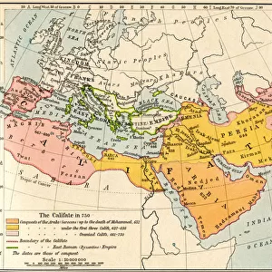
Map of the Muslim expansion and the Byzantine Empire at the end of the Umayyad Caliphate, in 750
1837 Dower Map Of Van Dieman's Land Or Tasmania
Map of England Britannia Antiqua From The Atlas of Ancient Geography by Samuel Butler published London circa 1829
Map of London
Nova et Accuratissima Totius Terrarum
Samuel Dunn Wall Map Of The World In Hemispheres
1836 Tanner Map Of Palestine Israel Holy Land
A Phrenological Map Of The Human Brain
First World Map in Whole 1508
Map of the world circa 1870 with possessions of the British Empire coloured red
Medieval Map of Europe
MAP OF EUROPE IN 1400
Cymbal Roman Period 30 B.C.-.D 364 Egypt Copper Alloy
1899 Bacon Pocket Plan Or Map Of London Topography
1899 View Map Of Boston Harbor From Boston To Cape Cod And Provincetown
1898 Brockhaus Map Of The Moon Topography Cartography
1895 U.S. Coast Survey Map Of The Chesapeake Bay Around Annapolis
1895 Meiji 28 Japanese Map Of Imperial Japan With Taiwan
1898 Walker Trolley Map And View Of New England Centered On Boston
1893 U.S. Coast Survey Nautical Chart Or Map Of The Chesapeake Bay And Delaware Bay
1897 Walker View Of Boston Harbor Topography
1892 Scientific American Map And View Of New York City
1894 Colton Map Of Maine Topography Cartography
1892 Colton Pocket Map Of Vermont And New Hampshire
1890 Hachette Map Of Antarctica Topography Cartography
1890 View Map Of Boston Habor From Boston To Cape Cod And Provincetown
1886 Telescopic View And Map Of The Moon Topography

Discover Our Collections


Early MapsEarly Maps
View Collection
GrouperGrouper
View Collection
Israel Related ImagesIsrael Related Images
View Collection
Palestine Related ImagesPalestine Related Images
View Collection
MapsMaps
View Collection
MapsMaps
View Collection
Maps and Charts Related ImagesMaps and Charts Related Images
View Collection
LandesLandes
View Collection
Historical MapsHistorical Maps
View Collection
WorldWorld
View Collection
Space explorationSpace exploration
View Collection


© Copyright Media Storehouse, All Rights Reserved 2003 - 2024
Facebook     Pinterest     100% Payment Secure     Reviews IO