
Maps Collection
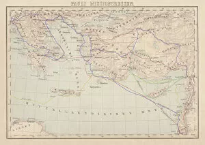
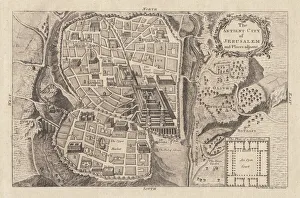
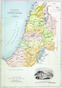
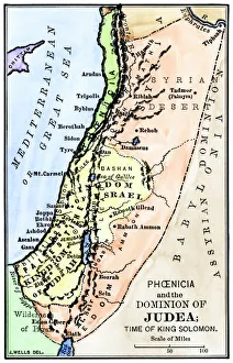
Maps of Israel Asia are maps that depict the geographical region of Israel and its surrounding countries in Asia
Choose a picture from our Maps Collection for your Wall Art and Photo Gifts
292 items


All Professionally Made to Order for Quick Shipping
-
Maps Collection
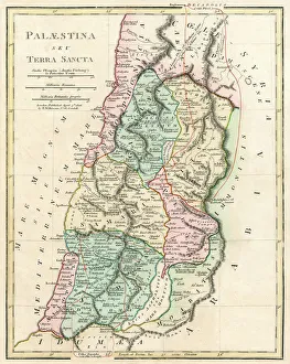
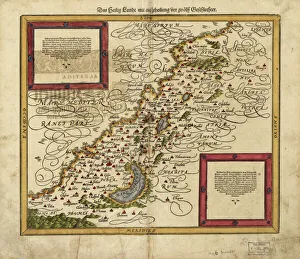
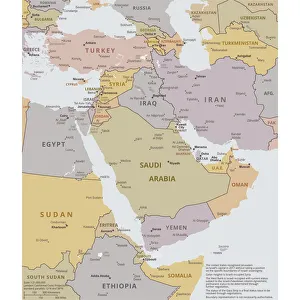
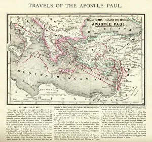
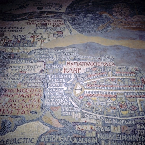
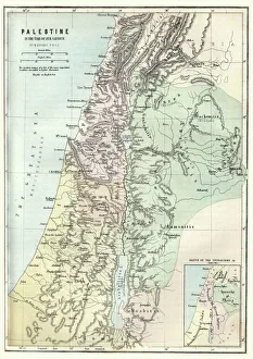
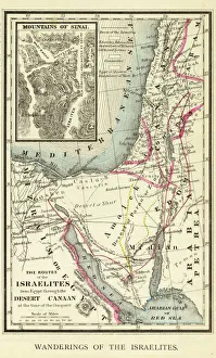
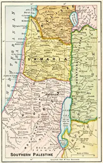
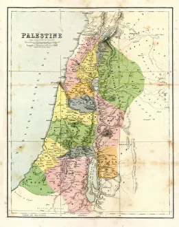
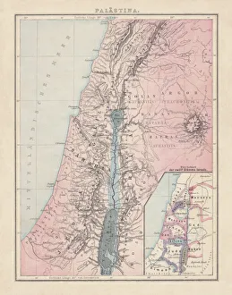
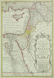
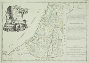
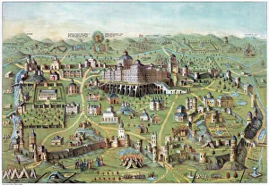
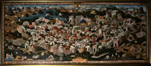
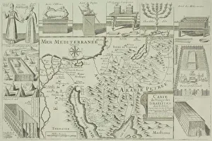
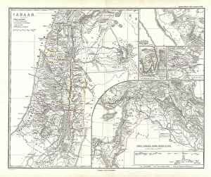
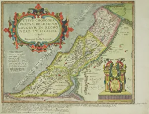
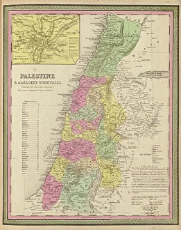
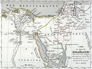
Maps of Israel Asia are maps that depict the geographical region of Israel and its surrounding countries in Asia. These maps provide an accurate representation of the region, including its physical features such as mountains, rivers, and deserts. They also show political boundaries between countries and their respective capitals. Additionally, these maps often include information about major cities, roads, airports, and other points of interest in the area. Maps of Israel Asia can be used to plan trips or to gain a better understanding of the region’s geography and are useful for studying history or conducting research on this part of the world.
+
Our beautiful pictures are available as Framed Prints, Photos, Wall Art and Photo Gifts
The Maps of Israel Asia collection from Media Storehouse is a stunning compilation of vintage and contemporary maps that showcase the intricate geography and history of Israel and its surrounding regions. Our collection features a diverse range of maps, including ancient biblical maps, Ottoman Empire maps, modern political boundary maps, and topographical relief maps. Each map is carefully curated to provide a unique perspective on the region's rich cultural heritage. These high-quality wall art prints are perfect for anyone interested in exploring the fascinating history and geography of Israel or looking to add an artistic touch to their home or office decor. The Maps of Israel Asia collection offers a wide variety of sizes and framing options to suit any taste or budget. Whether you're an avid collector or simply looking for a beautiful piece of artwork to adorn your walls, our collection has something for everyone. With its stunning visuals and historical significance, the Maps of Israel Asia collection is sure to be a conversation starter in any room it graces.
+
What are Maps of Israel Asia art prints?
Maps of Israel Asia art prints are high-quality reproductions of maps that depict the geography and topography of Israel and its surrounding regions in Asia. These prints showcase the intricate details, landmarks, cities, borders, and other important features that make up this part of the world. They are created using state-of-the-art printing technology to ensure that every detail is captured accurately. These art prints are perfect for anyone who has an interest in history or geography, as they provide a fascinating glimpse into the past and present of this region. They can be used to decorate homes, offices, schools or any other space where you want to add a touch of sophistication and elegance. Whether you're looking for a vintage map from centuries ago or a modern-day representation with all the latest updates included, Maps of Israel Asia art prints offer something for everyone. With their stunning visual appeal and educational value, these prints are sure to become treasured additions to your collection.
+
What Maps of Israel Asia art prints can I buy from Media Storehouse?
We offer a wide range of Maps of Israel Asia art prints that are perfect for those who love to explore and learn about the region. These prints showcase different maps from various periods in history, including antique maps, vintage maps, and modern-day cartography. Some of the popular Maps of Israel Asia art prints available at Media Storehouse include detailed topographical maps that highlight the natural features and landmarks of the area. Other options include political maps that show borders between countries and regions, as well as historical maps that depict ancient empires and civilizations. Whether you're looking for a unique piece to decorate your home or office or want to gift someone with an interest in geography or history, we have plenty of options to choose from. With high-quality printing techniques used on premium materials, these Maps of Israel Asia art prints are sure to impress any viewer.
+
How do I buy Maps of Israel Asia art prints?
To purchase Maps of Israel Asia art prints from Media Storehouse, you can browse our extensive collection of artwork online. Once you have found the print that you would like to purchase, simply add it to your cart and proceed to checkout. You will be prompted to enter your shipping and payment information before finalizing your order. We offer a variety of sizes for their prints, so be sure to select the size that best fits your needs. We also offer framing options for an additional fee if you prefer a ready-to-hang piece. If you have any questions about the ordering process or need assistance with selecting a print, we have customer service representatives available via phone or email who are happy to help. With our easy-to-use website and high-quality artwork selection, purchasing Maps of Israel Asia art prints from Media Storehouse is simple and convenient.
+
How much do Maps of Israel Asia art prints cost?
We offer a wide range of Maps of Israel Asia art prints at varying prices. Our collection includes high-quality reproductions of antique maps, contemporary designs, and everything in between. The cost of each print depends on several factors such as the size, material used for printing, and the complexity of the design. We understand that our customers have different preferences and budgets when it comes to purchasing art prints. Therefore, we strive to provide options that cater to everyone's needs without compromising on quality. Whether you're looking for a small poster or a large canvas print, we've got you covered. Our Maps of Israel Asia art prints are perfect for adding character and style to any room in your home or office. They also make great gifts for history buffs or anyone who loves exploring new cultures and places around the world.
+
How will my Maps of Israel Asia art prints be delivered to me?
Your Maps of Israel Asia art prints will be delivered to you through a reliable and secure shipping service. We take great care in ensuring that your artwork arrives at your doorstep in pristine condition, ready for display or framing. Our team works with trusted delivery partners who specialize in handling delicate items such as art prints. We use high-quality packaging materials to protect your artwork during transit, including sturdy cardboard tubes and protective sleeves. Your order will be dispatched promptly once it has been printed and quality checked by our team. We understand the importance of delivering your order on time and without any damage. That's why we work hard to ensure that every step of the delivery process is carefully managed and monitored. Once you receive your Maps of Israel Asia art prints, we hope they bring joy and inspiration into your home or office space for years to come.