Premium Framed Print > Europe > Netherlands > Maps
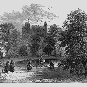
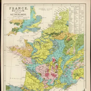
Premium Framed Print : Plan Of Amsterdam, Holland, At The Turn Of The 20Th Century. Map Is Edited In Spanish Language. From Enciclopedia Ilustrada Segu


![]()
Framed Photos From Design Pics
Plan Of Amsterdam, Holland, At The Turn Of The 20Th Century. Map Is Edited In Spanish Language. From Enciclopedia Ilustrada Segu
Design Pics offers Distinctively Different Imagery representing over 1,500 contributors
Media ID 18198163
© Ken Welsh / Design Pics
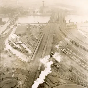
20th Amsterdam City Harbor Harbour Holland Layout Netherlands Plan Port Turn Twentieth Nineteenth
14"x18" Premium Frame
Contemporary style Premium Wooden Frame with 8"x12" Print. Complete with 2" White Mat and 1.25" thick MDF frame. Printed on 260 gsm premium paper. Glazed with shatter proof UV coated acrylic glass. Backing is paper covered backing with rubber bumpers. Supplied ready to hang with a pre-installed sawtooth/wire hanger. Care Instructions: Spot clean with a damp cloth. Securely packaged in a clear plastic bag and envelope in a reinforced cardboard shipper
FSC Real Wood Frame and Double Mounted with White Conservation Mountboard - Professionally Made and Ready to Hang
Estimated Image Size (if not cropped) is 30.4cm x 20.3cm (12" x 8")
Estimated Product Size is 45.8cm x 35.6cm (18" x 14")
These are individually made so all sizes are approximate
Artwork printed orientated as per the preview above, with landscape (horizontal) orientation to match the source image.
FEATURES IN THESE COLLECTIONS
> Europe
> Netherlands
> Amsterdam
> Europe
> Netherlands
> Maps
> Europe
> Netherlands
> Posters
> Europe
> Netherlands
> Related Images
> Maps and Charts
> Netherlands
> Maps and Charts
> Spain
EDITORS COMMENTS
This print showcases the "Plan of Amsterdam, Holland, at the turn of the 20th century". The map, edited in Spanish language, offers a unique perspective on this iconic city. From the renowned Enciclopedia Ilustrada Segu collection by Ken Welsh, this piece captures the essence of Amsterdam's rich history and urban layout. Amsterdam, known for its picturesque canals and charming architecture, is beautifully depicted in this vintage map. The intricate details highlight every street and landmark with precision. As we delve into this visual journey through time, we are transported to an era when horse-drawn carriages roamed these cobblestone streets. The bustling port and harbor come alive in vibrant hues as ships sail across the waters. This image serves as a reminder of Amsterdam's significance as a major trading hub during that period. It also reflects how much has changed since then – from technological advancements to architectural developments that have shaped today's modern cityscape. Ken Welsh's expertise shines through in capturing not only the physical layout but also the spirit of Amsterdam at that particular moment in history. This print is a testament to his dedication to preserving cultural heritage through visual storytelling. Whether you are an admirer of cartography or simply intrigued by historical cities like Amsterdam, this exquisite print will undoubtedly transport you back in time while igniting your imagination about what life was like at the end of the 19th century and beginning of the 20th century.
MADE IN THE USA
Safe Shipping with 30 Day Money Back Guarantee
FREE PERSONALISATION*
We are proud to offer a range of customisation features including Personalised Captions, Color Filters and Picture Zoom Tools
SECURE PAYMENTS
We happily accept a wide range of payment options so you can pay for the things you need in the way that is most convenient for you
* Options may vary by product and licensing agreement. Zoomed Pictures can be adjusted in the Basket.