Poster Print > North America > United States of America > New York > Related Images
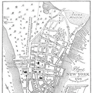
Poster Print : NEW YORK CITY MAP, 1755. Wood engraving, American, 19th century

![]()
Poster Prints From Granger
NEW YORK CITY MAP, 1755. Wood engraving, American, 19th century
Granger holds millions of images spanning more than 25,000 years of world history, from before the Stone Age to the dawn of the Space Age
Media ID 7524544
1755 Colony Lower Manhattan Manhattan Plan Topography
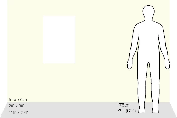
20x30 inch Poster Print
Step back in time with our vintage New York City Map print from The Granger Collection. This stunning 19th century wood engraving, originally from Granger Art on Demand, offers a captivating glimpse into the early history of America's most iconic city. Transport yourself to the colonial era as you explore the intricate details of this rare and authentic map, now available as a beautiful poster print from Media Storehouse. Perfect for history enthusiasts, map collectors, or anyone who appreciates the beauty of historical artwork. Bring a piece of the past into your home or office today.
Poster prints are budget friendly enlarged prints in standard poster paper sizes. Printed on 150 gsm Matte Paper for a natural feel and supplied rolled in a tube. Great for framing and should last many years. To clean wipe with a microfiber, non-abrasive cloth or napkin. Our Archival Quality Photo Prints and Fine Art Paper Prints are printed on higher quality paper and the choice of which largely depends on your budget.
Poster prints are budget friendly enlarged prints in standard poster paper sizes (A0, A1, A2, A3 etc). Whilst poster paper is sometimes thinner and less durable than our other paper types, they are still ok for framing and should last many years. Our Archival Quality Photo Prints and Fine Art Paper Prints are printed on higher quality paper and the choice of which largely depends on your budget.
Estimated Product Size is 51.4cm x 76.8cm (20.2" x 30.2")
These are individually made so all sizes are approximate
Artwork printed orientated as per the preview above, with landscape (horizontal) or portrait (vertical) orientation to match the source image.
FEATURES IN THESE COLLECTIONS
> North America
> Related Images
> North America
> United States of America
> New York
> Related Images
EDITORS COMMENTS
This print showcases a remarkable piece of history - the "New York City Map, 1755". Crafted through wood engraving in the 19th century by an American artist, this map offers a fascinating glimpse into the city's past. With its intricate details and exquisite craftsmanship, it serves as a testament to the rich cultural heritage that defines New York City. The map depicts Manhattan Island during its colonial era, providing valuable insights into the topography and layout of this bustling metropolis over two centuries ago. Every street and corner is meticulously etched onto the wooden surface, offering viewers a chance to explore how New York City evolved from its early beginnings. As one gazes upon this historic artifact, they are transported back in time to witness North America's largest city at that period. Lower Manhattan takes center stage with its narrow streets and iconic landmarks such as Trinity Church and Wall Street. The map also reveals lesser-known aspects like farmland surrounding urban areas – a stark contrast to today's concrete jungle. With great attention to detail, The Granger Collection has preserved this invaluable piece of art for us all to appreciate. It serves not only as an artistic masterpiece but also as a window into our collective past. Whether you're an avid historian or simply fascinated by New York City's evolution, this print is sure to captivate your imagination and transport you back in time.
MADE IN THE USA
Safe Shipping with 30 Day Money Back Guarantee
FREE PERSONALISATION*
We are proud to offer a range of customisation features including Personalised Captions, Color Filters and Picture Zoom Tools
SECURE PAYMENTS
We happily accept a wide range of payment options so you can pay for the things you need in the way that is most convenient for you
* Options may vary by product and licensing agreement. Zoomed Pictures can be adjusted in the Basket.