Poster Print > Europe > United Kingdom > Scotland > Maps
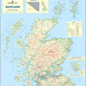
Poster Print : Map Of The British Isles, Circa. 1760. From "Atlas De Toutes Les Parties Connues Du Globe Terrestre "By Cartographer Rigobert Bonne. Published Geneva Circa. 1760


![]()
Poster Prints from Design Pics
Map Of The British Isles, Circa. 1760. From "Atlas De Toutes Les Parties Connues Du Globe Terrestre "By Cartographer Rigobert Bonne. Published Geneva Circa. 1760
Map Of The British Isles, Circa.1760. From " Atlas De Toutes Les Parties Connues Du Globe Terrestre " By Cartographer Rigobert Bonne. Published Geneva Circa. 1760
Design Pics offers Distinctively Different Imagery representing over 1,500 contributors
Media ID 18186469
© Ken Welsh / Design Pics
Cartography Geography Isles Mapmaking Plate Scotland Wales
18x24 inch Poster Print
Step back in time with our vintage Map of the British Isles, circa 1760. This beautifully detailed poster print is taken from the "Atlas De Toutes Les Parties Connues Du Globe Terrestre" by renowned cartographer Rigobert Bonne. Published in Geneva around 1760, this map offers a fascinating glimpse into the geographical knowledge of the time. With intricate borders and elegant cartography, this poster is a must-have for history enthusiasts, cartography collectors, or anyone who appreciates the beauty of historical maps. Bring a piece of the past into your home or office with our high-quality poster print.
Poster prints are budget friendly enlarged prints in standard poster paper sizes. Printed on 150 gsm Matte Paper for a natural feel and supplied rolled in a tube. Great for framing and should last many years. To clean wipe with a microfiber, non-abrasive cloth or napkin. Our Archival Quality Photo Prints and Fine Art Paper Prints are printed on higher quality paper and the choice of which largely depends on your budget.
Poster prints are budget friendly enlarged prints in standard poster paper sizes (A0, A1, A2, A3 etc). Whilst poster paper is sometimes thinner and less durable than our other paper types, they are still ok for framing and should last many years. Our Archival Quality Photo Prints and Fine Art Paper Prints are printed on higher quality paper and the choice of which largely depends on your budget.
Estimated Product Size is 46.3cm x 61.6cm (18.2" x 24.3")
These are individually made so all sizes are approximate
Artwork printed orientated as per the preview above, with portrait (vertical) orientation to match the source image.
FEATURES IN THESE COLLECTIONS
> Europe
> Republic of Ireland
> Maps
> Europe
> United Kingdom
> England
> Maps
> Europe
> United Kingdom
> Scotland
> Maps
> Europe
> United Kingdom
> Wales
> Maps
> Europe
> United Kingdom
> Wales
> Posters
> Europe
> United Kingdom
> Wales
> Related Images
> Maps and Charts
> Related Images
> Maps and Charts
> Wales
EDITORS COMMENTS
This stunning print showcases a historical treasure - the Map of the British Isles, circa 1760. Created by renowned cartographer Rigobert Bonne and published in Geneva during the same period, this map is a testament to the artistry and precision of early mapmaking. The intricate details and vibrant colors bring this piece to life, allowing viewers to explore the geography of England, Scotland, Wales, and Ireland from centuries ago. The carefully engraved lines depict coastlines, rivers, mountains, and cities with remarkable accuracy. As we gaze upon this vertical plate illustration, we are transported back in time to an era when exploration was at its peak. This map serves as a window into history - a snapshot of how people perceived their world over two centuries ago. Beyond its aesthetic appeal lies its educational value. Students of geography can delve into the past as they study changes in borders or discover forgotten towns that have since faded away. History enthusiasts can trace trade routes or imagine what life was like for those living on these lands long ago. Ken Welsh's expert photography captures every minute detail with clarity and precision. Whether displayed in homes or classrooms alike, this print is sure to captivate all who lay eyes upon it – reminding us of our connection to both our ancestors' journeys and the ever-changing landscapes that shape our present-day reality.
MADE IN THE USA
Safe Shipping with 30 Day Money Back Guarantee
FREE PERSONALISATION*
We are proud to offer a range of customisation features including Personalised Captions, Color Filters and Picture Zoom Tools
SECURE PAYMENTS
We happily accept a wide range of payment options so you can pay for the things you need in the way that is most convenient for you
* Options may vary by product and licensing agreement. Zoomed Pictures can be adjusted in the Cart.