Photo Mug > Maps and Charts > Abraham Ortelius
Photo Mug : Rimini, Italy. Theatrum Orbis Terrarum by Abraham Ortelis, 1


![]()
Home Decor from Mary Evans Picture Library
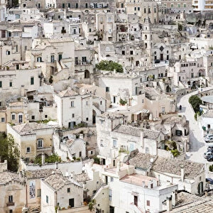
Rimini, Italy. Theatrum Orbis Terrarum by Abraham Ortelis, 1
Italy. Rimini city. Theatrum Orbis Terrarum by Abraham Ortelis, 1570. Library Estense. Modena. Italy
Mary Evans Picture Library makes available wonderful images created for people to enjoy over the centuries
Media ID 14337175
© Thaliastock / Mary Evans
1570 Abraham Adriatic Atlas Cartography Emilia Romagna Engraved Geographer Geography Orbis Ortelius Rimini Terrarum Theatrum
Large Photo Mug (15 oz)
Bring a piece of Italy's rich history into your daily routine with our Media Storehouse Photo Mug featuring the iconic Theatrum Orbis Terrarum map of Rimini by Abraham Ortelis. This beautiful, high-quality mug showcases intricate details of the ancient city, transporting you back in time with every sip. Perfect for coffee or tea, this unique mug makes a thoughtful gift for history enthusiasts or anyone who appreciates the beauty of old maps. Rights Managed by Mary Evans Prints Online.
Elevate your coffee or tea experience with our premium white ceramic mug. Its wide, comfortable handle makes drinking easy, and you can rely on it to be both microwave and dishwasher safe. Sold in single units, preview may show both sides of the same mug so you can see how the picture wraps around.
Elevate your coffee or tea experience with our premium white ceramic mug. Its wide, comfortable handle makes drinking easy, and you can rely on it to be both microwave and dishwasher safe. Sold in single units, preview may show both sides of the same mug so you can see how the picture wraps around.
These are individually made so all sizes are approximate
EDITORS COMMENTS
This image is a rare and exquisite glimpse into the past, showcasing the Italian city of Rimini as it appeared in the late 16th century, as depicted in the renowned atlas "Theatrum Orbis Terrarum" by the Flemish cartographer Abraham Ortelius. The engraving, created in 1570, is part of the vast collection housed in the Library Estense in Modena, Italy. The meticulously detailed illustration highlights the strategic location of Rimini along the Adriatic Sea, nestled between the Emilia-Romagna region and the Apennine Mountains. The city's port is clearly visible, with ships anchored in the harbor, signaling the importance of maritime trade during this era. The intricate line work and vibrant colors bring to life the city's architectural gems, including the ancient Arch of Augustus and the imposing Malatesta Temple. This historical map offers a fascinating window into the world of 16th-century geography and cartography, providing a valuable record of the past and a testament to the artistic mastery of Abraham Ortelius.
MADE IN THE USA
Safe Shipping with 30 Day Money Back Guarantee
FREE PERSONALISATION*
We are proud to offer a range of customisation features including Personalised Captions, Color Filters and Picture Zoom Tools
SECURE PAYMENTS
We happily accept a wide range of payment options so you can pay for the things you need in the way that is most convenient for you
* Options may vary by product and licensing agreement. Zoomed Pictures can be adjusted in the Cart.