Home > Animals > Birds > Passerines > Finches > Related Images
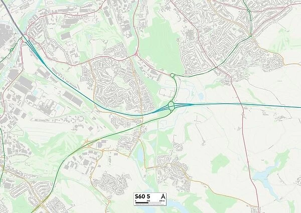
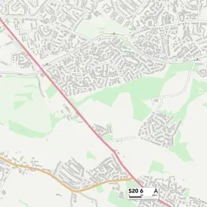
Rotherham S60 5 Map
![]()

Wall Art and Photo Gifts from Map Marketing
Rotherham S60 5 Map
Postcode Sector Map of Rotherham S60 5
Media ID 19979813
Ambleside Close Archers Way Arundel Avenue Arundel Road Arundel Street Atlas Street Balk Lane Bawtry Road Bradshaw Avenue Britannia Way Broadway Buckingham Way Bullfinch Close Carlton Way Carr Close Cherry Tree Close Church Lane Croft Road Derwent Crescent Dickens Close Duncan Street Ellis Street Falcon Drive Farm Close Field View Flatts Lane Frederick Street Front Street Graham Avenue Grange Farm Close Grange Lane Green Lane Gresham Avenue Hadrian Road Hill Top Close Homestead Drive Icknield Way Kirkstall Close Lodge Way Main Street Manor Crescent Manor Road Mill Lane Mill Road Montgomery Close Nelson Close New Street Nursery Drive Old School Lane Orchard Close Orchard Way Park Avenue Pear Tree Close Pike Road Pit Lane Poplar Drive Poplar Way Primrose Avenue Quarry Close Ridgeway Road Roman Crescent Rose Close Rotherham Rotherham Road South View Terrace St Andrews Walk St Davids Drive St Georges Drive St Helens Close St Marys Drive St Peters Close Station Road The Bungalows The Croft Thornhill Avenue Trentham Close Victoria Street Well Lane Whitehill Avenue Whitehill Drive Whitehill Lane Whitehill Road Willow Close Winchester Way Wood Lane Woodland Close
FEATURES IN THESE COLLECTIONS
> Animals
> Birds
> Passerines
> Finches
> Related Images
> Animals
> Birds
> Passerines
> Swallows And Martins
> Tree Swallow
> Animals
> Birds
> Passerines
> Tanagers
> Blue Finch
> Animals
> Birds
> Passerines
> Thrushes
> Related Images
> Animals
> Birds
> Passerines
> Thrushes
> Wood Thrush
> Animals
> Fishes
> S
> Swallower
> Animals
> Mammals
> Cricetidae
> California Mouse
> Animals
> Mammals
> Muridae
> Peters Mouse
> Arts
> Artists
> C
> Frederick Church
> Arts
> Artists
> D
> Frederick Duncan
> Map Marketing
> Postcode Sector Maps
> S - Sheffield
MADE IN THE USA
Safe Shipping with 30 Day Money Back Guarantee
FREE PERSONALISATION*
We are proud to offer a range of customisation features including Personalised Captions, Color Filters and Picture Zoom Tools
SECURE PAYMENTS
We happily accept a wide range of payment options so you can pay for the things you need in the way that is most convenient for you
* Options may vary by product and licensing agreement. Zoomed Pictures can be adjusted in the Cart.

