Home > Europe > United Kingdom > England > London > Boroughs > Enfield
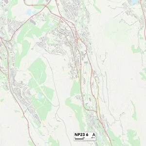
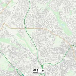
Bromsgrove B61 7 Map

![]()
Wall Art and Photo Gifts from Map Marketing
Bromsgrove B61 7 Map
Postcode Sector Map of Bromsgrove B61 7
Media ID 19965387
Albert Road Alderley Road Barnfield Road Bromsgrove Brook Road Buckfast Close Byland Close Carnoustie Close Dawson Road Deansway Dovecote Road Enfield Close Factory Lane Ford Road Fox Lane Grafton Lane Hanover Street High Meadows Highfield Road Highfields Kidderminster Road Martin Close Millfield Road Paget Close Parkstone Avenue Perry Lane Pipers Close Quarry Lane Rectory Lane Rock Hill Sanders Road School Lane Shrubbery Road St Andrews Way St Peters Close Sunningdale Road Swan Lane Swift Close Tintern Close Waltham Close Westbourne Close Westminster Close Woburn Close Worcester Road
FEATURES IN THESE COLLECTIONS
> Animals
> Mammals
> Dogs (Wild)
> Swift Fox
> Animals
> Mammals
> Muridae
> Peters Mouse
> Arts
> Portraits
> Pop art gallery
> Street art portraits
> Europe
> United Kingdom
> England
> London
> Boroughs
> Enfield
> Europe
> United Kingdom
> Scotland
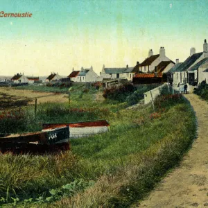
> Angus
> Carnoustie
> Europe
> United Kingdom
> Scotland
> Fife
> St Andrews
> Map Marketing
> Postcode Sector Maps
> B - Birmingham
> Maps and Charts
> Related Images
> North America
> Saint Martin
> Maps
MADE IN THE USA
Safe Shipping with 30 Day Money Back Guarantee
FREE PERSONALISATION*
We are proud to offer a range of customisation features including Personalised Captions, Color Filters and Picture Zoom Tools
SECURE PAYMENTS
We happily accept a wide range of payment options so you can pay for the things you need in the way that is most convenient for you
* Options may vary by product and licensing agreement. Zoomed Pictures can be adjusted in the Cart.