Fraud Blocker Skip to main content

Territory Collection (page 14)

"Exploring the Rich Tapestry of Territory

Background imageTerritory Collection: Up and down

Up and down
Zina Heg

Background imageTerritory Collection: WW2 - R. A. F. Photographic Observer

WW2 - R. A. F. Photographic Observer
A photograph of a British WW2 Royal Air Force photographic observer handing out his films, exposed over enemy territory. Date: circa 1940s

Background imageTerritory Collection: WW2 - Inside A Reconnaissance Plane

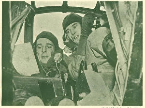
WW2 - Inside A Reconnaissance Plane
A photograph portraying a British WW2 Royal Air Force pilot consulting the sergeant observer while flying over enemy territory in a reconnaissance plane. Date: circa 1940s
Background imageTerritory Collection: Democratic Republic of the Congo - Kalemie

Democratic Republic of the Congo - Kalemie
Kalemie (formerly Albertville or Albertstad) - situated on the western shore of Lake Tanganyika in the Democratic Republic of the Congo Date: 1913

Background imageTerritory Collection: The Rock Hotel, Gibraltar

The Rock Hotel, Gibraltar - built by John Chrichton-Stuart, the Marquis of Bute in 1932 Date: circa late 1930s

Background imageTerritory Collection: Battle of Otumba (7th July 7, 1520)

Battle of Otumba (7th July 7, 1520). Confrontation between the army of the Aztecs against Spanish troops led by Hernan Cortes

Background imageTerritory Collection: Barcinonensium. Marca Hispanica sive limes hispanicus

Barcinonensium. Marca Hispanica sive limes hispanicus. Book written in Latin by Pierre de Marca (1594-1662). In 1656 he was commissioned to formalise the border treaty between the kingdoms of France

Background imageTerritory Collection: Blue Mountain Peak, Jamaica, West Indies

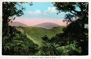
Blue Mountain Peak, Jamaica, West Indies
Blue Mountain Peak (the island's highest point), Jamaica, West Indies. The famed Jamaican Blue Mountain Coffee is grown in the region

Background imageTerritory Collection: Rio Cobre River, Jamaica, West Indies

Rio Cobre River, Jamaica, West Indies
Rio Cobre, Jamaica, West Indies. The river flows to meet the Caribbean Sea in the north west corner of Kingston Harbour. Date: circa 1920s

Background imageTerritory Collection: Doctor's Cave, Montego Bay, Jamaica

Doctor's Cave, Montego Bay, Jamaica. Date: circa 1920s

Background imageTerritory Collection: First Partition of Poland

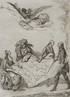
First Partition of Poland
Partitions of Poland. The First Partition of Poland. It was decided on August 5, 1772. The agreement was signed in Vienna in February 1772

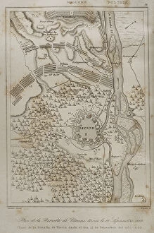
Background imageTerritory Collection: Plan of the Battle of Vienna, 12 September 1683

Plan of the Battle of Vienna, 12 September 1683
Holy Roman Empire. Plan of the Battle of Vienna, 12 September 1683. It took place at Kahlenberg Mountain, near Vienna, ather the city had been besieged by the Ottoman Empire during two months

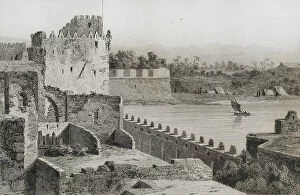
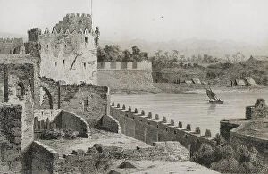
Background imageTerritory Collection: Ottoman domination. Acre. Walls of Saint Jean d'Acre

Ottoman domination. Acre. Walls of Saint Jean d'Acre
Ottoman domination. Acre (today Akko in northern territory of Israel). Walls of Saint Jean d'Acre. Engraving, 19th century. Engraving by Lemaitre

Background imageTerritory Collection: Ottoman period. Europe. Balkan Peninsula. Balkan Mountains

Ottoman period. Europe. Balkan Peninsula. Balkan Mountains
Period of domination of the Ottoman Empire. Europe. Balkan Peninsula. The Balkan Mountains. Engraving by Lemaitre, Danvin and Ch. Lalaisse

Background imageTerritory Collection: The Deserted Trench

The Deserted Trench
This painting, with use of angular lines, shows a deserted, flooded trench from the Battle of the Yser, which took place in October 1914, during the First World War, between Nieuwpoort and Diksmuide

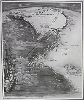
Background imageTerritory Collection: British and Norwegian bases in the South Pole

British and Norwegian bases in the South Pole. The routes taken by Captain Amunsden and Captain Scott. The Norwegian base was on the Bay of Whales, the British Base was at Roberston Bay

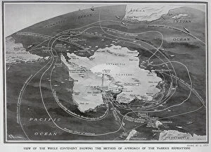
Background imageTerritory Collection: Route taken to the South Pole by different expeditions

Route taken to the South Pole by different expeditions
Route taken to the South Pole by Captain Roald Amunsden. He led the first expedition to traverse the Northwest Passage by sea, from 1903 to 1906, and the first expedition to the South Pole in 1911

Background imageTerritory Collection: A stone breakwater in Germany

A stone breakwater in Germany between the mainland and Hamburg Hallig. Claimed that these break waters increased territory for Germany. Date: circa 1900

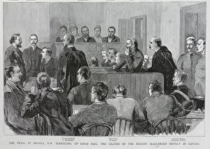
Background imageTerritory Collection: The Trial of Louis Riel, Regina, Canada

The Trial of Louis Riel, Regina, Canada
The Courtroom Trial of Louis Riel in Regina, North-Western Territory, Canada. He was on trial for his leadership of the North-West Rebellion of Spring 1885, in which the Metis people

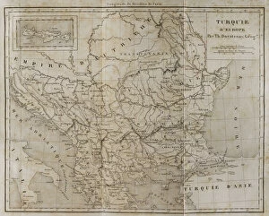
Background imageTerritory Collection: European Turkey map by Th. Duvotenay

European Turkey map by Th. Duvotenay
European Turkey map by Thunot Duvotenay. Historia de Turquia by Joseph Marie Jouannin (1783-1844) and Jules Van Gaver, 1840. Date: 2018

Background imageTerritory Collection: Ottoman domination. Acre (today Akko)

Ottoman domination. Acre (today Akko)
Ottoman domination. Acre (today Akko in northern territory of Israel). Walls of Saint Jean d'Acre. Engraving, 19th century. Engraving by Lemaitre

Background imageTerritory Collection: Official anti British First Boer War protest card

Official anti British First Boer War protest card
A conflict known also as the Transvaal Rebellion took place between the British and the Boers from 1880 to 1881 The south of Africa was overlaid with European powers competing for colonial territory

Background imageTerritory Collection: Support French Alsace - Lorraine

Support French Alsace - Lorraine
Alsace-Lorraine was the name given to territory that was ceded by France to Germany in 1871 after the Franco-German War.The loss of Alsace-Lorraine was a major cause of anti-German feeling in France

Background imageTerritory Collection: c. 1880s Victoria Bridge St Lawrence river, Montreal Canada

c. 1880s Victoria Bridge St Lawrence river, Montreal Canada
c. 1880s vintage photograph - North America - the Victoria Bridge over the St Lawrence river, near Montreal Canada

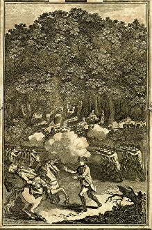
Background imageTerritory Collection: Defeat and death of General Braddock, North America

Defeat and death of General Braddock, North America
Defeat and death of General Edward Braddock in North America during the French and Indian War. 1755

Background imageTerritory Collection: Military Cemetery Gibraltar British Territory

Military Cemetery Gibraltar British Territory
military, cemetery, gibraltar, british, territory, death, burial, monument, cross, headstone, palm, tree, trees, sepia, grave, graves, graveyard, man, uniform, history, historical, 10825931

Background imageTerritory Collection: Spain. Civil War. Republican soldier, with his

Spain. Civil War. Republican soldier, with his son in arms, after leaving Spanish territory and going into exile in France (1939)

Background imageTerritory Collection: Guernica after bombing, Spanish Civil War, 1937

Guernica after bombing, Spanish Civil War, 1937
Photograph showing the Basque town of Guernica after the Nationalist air raids, 1937. Guernica was in Republican territory when Franco's Nationalist airforce combined with the German Condor

Background imageTerritory Collection: Map of the Boer Republics at the end of the 19th century, from South Africa and the Transvaal War

Map of the Boer Republics at the end of the 19th century, from South Africa and the Transvaal War: Vol
KW371000 Map of the Boer Republics at the end of the 19th century, from South Africa and the Transvaal War: Vol. 1 by Louis Creswicke, published 1900 (litho) by English School

Background imageTerritory Collection: Map showing the site of the Siege of Badajoz, Spain in 1812 (litho)

Map showing the site of the Siege of Badajoz, Spain in 1812 (litho)
KW361117 Map showing the site of the Siege of Badajoz, Spain in 1812 (litho) by English School, (19th century); Private Collection; (add.info.: from the book How England Saved Europe)

Background imageTerritory Collection: Map of Matabeleland in the late 19th century, from South Africa and the Transvaal War: Vol

Map of Matabeleland in the late 19th century, from South Africa and the Transvaal War: Vol
KW371011 Map of Matabeleland in the late 19th century, from South Africa and the Transvaal War: Vol. 1 by Louis Creswicke, published 1900 (litho) by English School, (20th century); Private Collection

Background imageTerritory Collection: Map of Zululand and adjoining portions of Natal at the end of the 19th century

Map of Zululand and adjoining portions of Natal at the end of the 19th century
KW371004 Map of Zululand and adjoining portions of Natal at the end of the 19th century, from South Africa and the Transvaal War: Vol

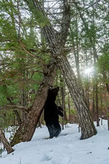
Background imageTerritory Collection: Asian black bear (Ursus thibetanus) scent marking tree by rubbing back on it

Asian black bear (Ursus thibetanus) scent marking tree by rubbing back on it, Land of the Leopard National Park, Russian Far East. Taken with remote camera. December

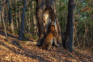
Background imageTerritory Collection: Siberian tiger (Panthera tigris altaica) sitting and scent marking tree in forest by rubbing body

Siberian tiger (Panthera tigris altaica) sitting and scent marking tree in forest by rubbing body against it, Land of the Leopard National Park, Russian Far East. Endangered

Background imageTerritory Collection: Lion (Panthera leo) male, scent marking its territory at dawn

Lion (Panthera leo) male, scent marking its territory at dawn, Ngorongoro Conservation Area / Serengeti National Park boundary, northern Tanzania

Background imageTerritory Collection: Northern parula (Parula americana) male singing from flowering crabapple (Malus sp)

Northern parula (Parula americana) male singing from flowering crabapple (Malus sp)
Northern parula (Parula americana) male singing from flowering crabapple (Malus sp.) tree in spring, near Salamanca, New York, USA, May 2022

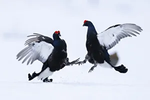
Background imageTerritory Collection: Two male Black grouse (Lyrurus tetrix) fighting and sparing over territory at a snow covered lek

Two male Black grouse (Lyrurus tetrix) fighting and sparing over territory at a snow covered lek, Vasterbotten, Sweden. April

Background imageTerritory Collection: DDE-90039455

DDE-90039455
Prothonotary Warbler (Prothonotaria citrea) male on breeding territory, Texas, USA. Date: 07/05/2013

Background imageTerritory Collection: DDE-90039454

DDE-90039454
Prothonotary Warbler (Prothonotaria citrea) male on breeding territory, Texas, USA. Date: 07/05/2013

Background imageTerritory Collection: DDE-90039376

DDE-90039376
Prothonotary Warbler (Prothonoteria citrea) adult male in spring, Texas Date: 20/05/2012

Background imageTerritory Collection: DDE-90039247

DDE-90039247
Western Meadowlark (Strunella neglecta) in grasslands of western Oklahoma, USA in nesting territory Date: 29/11/2010

Background imageTerritory Collection: DDE-90038646

DDE-90038646
Falkland Islands, West Falkland, West Point Island aka Albatross Island. Black-browed albatross (wild: Thalassarche melanophris) fuzzy molting fledgling. Date: 29/06/2010

Background imageTerritory Collection: DDE-90038645

DDE-90038645
Falkland Islands, West Falkland, Saunders Island. Coastal sunrise. Date: 29/06/2010

Background imageTerritory Collection: DDE-90037374

DDE-90037374
Deer walking through residential neighborhood Date: 04/08/2006

Background imageTerritory Collection: DDE-90035710

DDE-90035710
United Kingdom, Iberian Peninsula, Rock of Gibraltar (aka Jabal al Tariq). Monolithic limestone promontory off the tip of Spain. Date: 28/09/2006

Background imageTerritory Collection: DDE-90035709

DDE-90035709
United Kingdom, Iberian Peninsula, Rock of Gibraltar (aka Jabal al Tariq). Monolithic limestone promontory off the tip of Spain. Date: 28/09/2006

Background imageTerritory Collection: DDE-90035708

DDE-90035708
United Kingdom, Iberian Peninsula, Rock of Gibraltar (aka Jabal al Tariq). Monolithic limestone promontory off the tip of Spain. Date: 28/09/2006

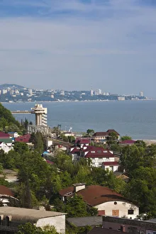
Background imageTerritory Collection: DDE-90035019

DDE-90035019
Russia, Black Sea Coast, Sochi-area, Dagomys, elevated town view Date: 27/10/2007


All Professionally Made to Order for Quick Shipping

"Exploring the Rich Tapestry of Territory: From Ancient Empires to Majestic Landscapes" Embark on a captivating journey through time and space as we delve into the concept of territory. Let us begin our expedition with a glance at Scotland in the 1870s, where an intricate map unravels tales of clans and their territorial disputes. Shifting our focus eastward, we encounter a mesmerizing Map of the Ancient Persian Empire. Marvel at its vast expanse, once ruled by mighty kings who sought to expand their dominion across ancient lands. Transporting ourselves to Britain in 597 AD, another map reveals how territories evolved over centuries. Witness the birth of kingdoms and empires that shaped this island nation's history. As dusk descends upon Uluru, Ayers Rock in Australia, soak in nature's splendor while contemplating indigenous peoples' connection to their ancestral territories. The sunset paints vibrant hues across this sacred land. Journeying back to Europe, let us explore Ireland through a map from the 1870s. Discover its lush landscapes and ponder upon historical struggles for control over this enchanting island. Expand your horizons further with the World Map Empire McVitie; marvel at how various nations carved out their territories during different eras – each stroke representing power dynamics and conquests. Venturing into antiquity, immerse yourself in Alexander the Great's empire through an awe-inspiring map. Uncover his audacious quest for dominance as he conquered vast stretches of land under his rule. Witnessing nature's wonders takes flight as we observe a majestic Red Kite soaring above its nest territory in Lower Saxony, Germany. A symbol of freedom within defined boundaries - it reminds us that even wildlife has territorial instincts ingrained within them. Turning towards spiritual realms brings us face-to-face with Palestine and Holy Land on an intricately detailed map. Contemplate millennia-old conflicts rooted deeply in territorial claims and religious significance.