Fraud Blocker Skip to main content

Territory Collection (page 11)

"Exploring the Rich Tapestry of Territory

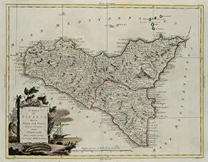
Background imageTerritory Collection: Island of Sicily, divided into its valleys, engraving by G. Zuliani taken from Tome II of

Island of Sicily, divided into its valleys, engraving by G. Zuliani taken from Tome II of the "Newest Atlas" published in Venice in 1782 by Antonio Zatta

Background imageTerritory Collection: Land of Otranto, engraving by G. Zuliani taken from Tome II of the 'Newest Atlas' published in

Land of Otranto, engraving by G. Zuliani taken from Tome II of the "Newest Atlas" published in Venice in 1783 by Antonio Zatta, Private Collection Florence Engraving Eighteenth Century

Background imageTerritory Collection: Capitanata, engraving by G. Zuliani taken from Tome II of the 'Newest Atlas' published in Venice

Capitanata, engraving by G. Zuliani taken from Tome II of the "Newest Atlas" published in Venice in 1783 by Antonio Zatta, Private Collection Florence Engraving Eighteenth Century

Background imageTerritory Collection: Farther and Hither Abruzzo, engraving by G. Zuliani taken from Tome II of the 'Newest Atlas'

Farther and Hither Abruzzo, engraving by G. Zuliani taken from Tome II of the "Newest Atlas" published in Venice in 1783 by Antonio Zatta

Background imageTerritory Collection: Territory of Pisa, engraving by G. Zuliani taken from Tome II of the 'Newest Atlas' published in

Territory of Pisa, engraving by G. Zuliani taken from Tome II of the "Newest Atlas" published in Venice in 1783 by Antonio Zatta, Private Collection Florence Engraving Eighteenth Century

Background imageTerritory Collection: Territory of Sienna, engraving by G. Zuliani taken from Tome II of the 'Newest Atlas' published in

Territory of Sienna, engraving by G. Zuliani taken from Tome II of the "Newest Atlas" published in Venice in 1783 by Antonio Zatta, Private Collection Florence Engraving Eighteenth Century

Background imageTerritory Collection: The Grand Duchy of Tuscany divided into its provinces, engraving by G

The Grand Duchy of Tuscany divided into its provinces, engraving by G. Zuliani taken from Tome II of the "Newest Atlas" published in Venice in 1783 by Antonio Zatta

Background imageTerritory Collection: The Island of Sardinia divided into its districts, engraving by G

The Island of Sardinia divided into its districts, engraving by G. Zuliani taken from Tome II of the "Newest Atlas" published in Venice in 1782 by Antonio Zatta

Background imageTerritory Collection: The part of Piedmont that contains the Duchy of Aosta, the Contado of Canavese

The part of Piedmont that contains the Duchy of Aosta, the Contado of Canavese, the province of Biella, Valle di Sesia, Signoria di Vercelli and the Upper and Lower Novarese, engraving by G

Background imageTerritory Collection: Duchy of Mantua, engraving by G. Zuliani taken from Tome II of the 'Newest Atlas' published in

Duchy of Mantua, engraving by G. Zuliani taken from Tome II of the "Newest Atlas" published in Venice in 1781 by Antonio Zatta, Private Collection Florence Engraving Eighteenth Century

Background imageTerritory Collection: Duchy of Milan, engraving by G. Zuliani taken from Tome II of the 'Newest Atlas' published in

Duchy of Milan, engraving by G. Zuliani taken from Tome II of the "Newest Atlas" published in Venice in 1784 by Antonio Zatta, Private Collection Florence Engraving Eighteenth Century

Background imageTerritory Collection: The part of Modena that includes the Duchies of Modena, Reggio and Mirandola

The part of Modena that includes the Duchies of Modena, Reggio and Mirandola, the Trinitary of Carpi and Correggio and the Province of Frignano, engraving by G

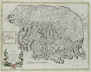
Background imageTerritory Collection: The Duchies of Parma, Piacenza and Guastalla, engraving by G

The Duchies of Parma, Piacenza and Guastalla, engraving by G. Zuliani taken from Tome II of the "Newest Atlas" published in Venice in 1782 by Antonio Zatta

Background imageTerritory Collection: The Patrimony of St. Peter and Sabine Territory, engraving by G

The Patrimony of St. Peter and Sabine Territory, engraving by G. Zuliani taken from Tome II of the "Newest Atlas" published in Venice in 1783 by Antonio Zatta

Background imageTerritory Collection: The Marca (Territory) of Ancona, engraving by G. Zuliani taken from Tome II of the 'Newest Atlas'

The Marca (Territory) of Ancona, engraving by G. Zuliani taken from Tome II of the "Newest Atlas" published in Venice in 1783 by Antonio Zatta

Background imageTerritory Collection: Land area of the State of the Veneto: Legation of Urbino, engraving by G

Land area of the State of the Veneto: Legation of Urbino, engraving by G. Zuliani taken from Tome II of the "Newest Atlas" published in Venice in 1783 by Antonio Zatta

Background imageTerritory Collection: Land area of the State of the Veneto: Legation of Romagna, engraving by G

Land area of the State of the Veneto: Legation of Romagna, engraving by G. Zuliani taken from Tome II of the "Newest Atlas" published in Venice in 1783 by Antonio Zatta

Background imageTerritory Collection: Sea area of the State of the Veneto: Venetian Dalmatia, engraving by G

Sea area of the State of the Veneto: Venetian Dalmatia, engraving by G. Zuliani taken from Tome II of the "Newest Atlas" published in Venice in 1784 by Antonio Zatta

Background imageTerritory Collection: Land area of the State of the Veneto: area of Padua, engraving by G

Land area of the State of the Veneto: area of Padua, engraving by G. Zuliani taken from Tome II of the "Newest Atlas" published in Venice in 1784 by Antonio Zatta

Background imageTerritory Collection: Land area of the State of the Veneto: area of Verona with the district of Cologna, engraving by G

Land area of the State of the Veneto: area of Verona with the district of Cologna, engraving by G. Zuliani taken from Tome II of the "Newest Atlas" published in Venice in 1783 by Antonio

Background imageTerritory Collection: Land area of the State of the Veneto: area of Belluna divided into its districts, engraving by G

Land area of the State of the Veneto: area of Belluna divided into its districts, engraving by G. Zuliani taken from Tome II of the "Newest Atlas" published in Venice in 1783 by Antonio

Background imageTerritory Collection: Land area of the State of the Veneto: area of Treviso divided into its territories and districts

Land area of the State of the Veneto: area of Treviso divided into its territories and districts, engraving by G. Zuliani taken from Tome II of the "Newest Atlas" published in Venice in

Background imageTerritory Collection: Land area of the State of the Veneto: Friuli, engraving by G

Land area of the State of the Veneto: Friuli, engraving by G. Zuliani taken from Tome II of the "Newest Atlas" published in Venice in 1783 by Antonio Zatta

Background imageTerritory Collection: Land area of the State of the Veneto, divided into its Provinces, engraving by G

Land area of the State of the Veneto, divided into its Provinces, engraving by G. Zuliani taken from Tome II of the "Newest Atlas" published in Venice in 1782 by Antonio Zatta

Background imageTerritory Collection: Provinces of Frisia, Groningen and Over-Yssel with a part of Holland proper, engraving by G

Provinces of Frisia, Groningen and Over-Yssel with a part of Holland proper, engraving by G. Zuliani taken from Tome I of the "Newest Atlas" published in Venice in 1778 by Antonio Zatta

Background imageTerritory Collection: English Louisiana with the western part of Florida, Georgia and South Carolina, engraving by G

English Louisiana with the western part of Florida, Georgia and South Carolina, engraving by G. Zuliani taken from Tome I of the "Newest Atlas" published in Venice in 1778 by Antonio Zatta

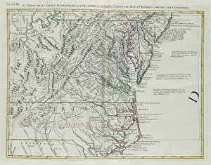
Background imageTerritory Collection: Maryland, southern New Jersey, Delaware and the eastern part of Virginia and North Carolina

Maryland, southern New Jersey, Delaware and the eastern part of Virginia and North Carolina, engraving by G. Zuliani taken from Tome I of the "Newest Atlas" published in Venice in 1778 by

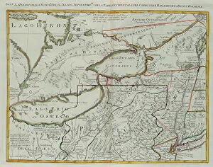
Background imageTerritory Collection: Pennsylvania, New York, southern New Jersey, with the western part of Connecticut

Pennsylvania, New York, southern New Jersey, with the western part of Connecticut, Massachusetts Bay and Land of the Iroquois, engraving by G

Background imageTerritory Collection: The western part of New France or Canada, engraving by G. Zuliani taken from Tome I of the 'Newest

The western part of New France or Canada, engraving by G. Zuliani taken from Tome I of the "Newest Atlas" published in Venice in 1778 by Antonio Zatta

Background imageTerritory Collection: The Islands of Bermuda and the frontispiece of the section dedicated to the United Colonies of

The Islands of Bermuda and the frontispiece of the section dedicated to the United Colonies of North America, engraving by G

Background imageTerritory Collection: Hudson Bay, Land of Labrador and Greenland with the adjacent islands, engraving by G

Hudson Bay, Land of Labrador and Greenland with the adjacent islands, engraving by G. Zuliani taken from Tome I of the "Newest Atlas" published in Venice in 1778 by Antonio Zatta

Background imageTerritory Collection: Canada, the English Colonies with Louisiana and Florida, engraving by G

Canada, the English Colonies with Louisiana and Florida, engraving by G. Zuliani taken from Tome I of the "Newest Atlas" published in Venice in 1778 by Antonio Zatta

Background imageTerritory Collection: Southern Scotland divided into its counties, engraving by G. Zuliani taken from Tome I of

Southern Scotland divided into its counties, engraving by G. Zuliani taken from Tome I of the "Newest Atlas" published in Venice in 1779 by Antonio Zatta

Background imageTerritory Collection: The Kingdom of Ireland that the provinces of Munster and Connaught, engraving by G

The Kingdom of Ireland that the provinces of Munster and Connaught, engraving by G. Zuliani is from Volume I of Atlas Novissimo "published in Venice in 1778 by Antonio Zatta

Background imageTerritory Collection: Island of Minorca and the plan of the port and the city of Mahon and its Forts, engraving by G

Island of Minorca and the plan of the port and the city of Mahon and its Forts, engraving by G. Zuliani taken from Tome I of the "Newest Atlas" published in Venice in 1778 by Antonio Zatta

Background imageTerritory Collection: Province of Essex, engraving by G. Zuliani taken from Tome I of the 'Newest Atlas' published in

Province of Essex, engraving by G. Zuliani taken from Tome I of the "Newest Atlas" published in Venice in 1779 by Antonio Zatta, Private Collection Florence Engraving Eighteenth Century

Background imageTerritory Collection: Province of Surrey, engraving by G. Zuliani taken from Tome I of the 'Newest Atlas' published in

Province of Surrey, engraving by G. Zuliani taken from Tome I of the "Newest Atlas" published in Venice in 1779 by Antonio Zatta, Private Collection Florence Engraving Eighteenth Century

Background imageTerritory Collection: Governances of Langedoc, Foix and Roussillon with Rouergue, engraving by G

Governances of Langedoc, Foix and Roussillon with Rouergue, engraving by G. Zuliani taken from Tome I of the "Newest Atlas" published in Venice in 1777 by Antonio Zatta

Background imageTerritory Collection: Governances of Bourgogne, Franca Contea and Lyons, engraving by G

Governances of Bourgogne, Franca Contea and Lyons, engraving by G. Zuliani taken from Tome I of the "Newest Atlas" published in Venice in 1777 by Antonio Zatta

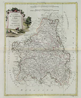
Background imageTerritory Collection: Governances of Champagne and Brie, engraving by G. Zuliani taken from Tome I of the 'Newest Atlas'

Governances of Champagne and Brie, engraving by G. Zuliani taken from Tome I of the "Newest Atlas" published in Venice in 1777 by Antonio Zatta

Background imageTerritory Collection: Governances of Anjou, Saumurois, Touraine and Poitou, Aunis and Saintonge with that of Anjoumois

Governances of Anjou, Saumurois, Touraine and Poitou, Aunis and Saintonge with that of Anjoumois, engraving by G. Zuliani taken from Tome I of the "Newest Atlas" published in Venice in 1777

Background imageTerritory Collection: Governances of French Flanders, Artois, Picardy and Boulonois, engraving by G

Governances of French Flanders, Artois, Picardy and Boulonois, engraving by G. Zuliani taken from Tome I of the "Newest Atlas" published in Venice in 1776 by Antonio Zatta

Background imageTerritory Collection: Governances of Guyenne and Guascogne with that of Bearn and Lower Navarre, engraving by G

Governances of Guyenne and Guascogne with that of Bearn and Lower Navarre, engraving by G. Zuliani taken from Tome I of the "Newest Atlas" published in Venice in 1776 by Antonio Zatta

Background imageTerritory Collection: Governances of Limosin, Quercy and Perigord, engraving by G. Zuliani taken from Tome I of

Governances of Limosin, Quercy and Perigord, engraving by G. Zuliani taken from Tome I of the "Newest Atlas" published in Venice in 1776 by Antonio Zatta

Background imageTerritory Collection: The Governances of the Ile de France and Orleans, engraving by G

The Governances of the Ile de France and Orleans, engraving by G. Zuliani taken from Tome I of the "Newest Atlas" published in Venice in 1776 by Antonio Zatta

Background imageTerritory Collection: The outline of Paris, The Governances of France and Orleans, engraving by G

The outline of Paris, The Governances of France and Orleans, engraving by G. Zuliani taken from Tome I of the "Newest Atlas" published in Venice in 1776 by Antonio Zatta

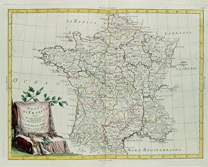
Background imageTerritory Collection: The Kingdom of France divided into its governances, engraving by G

The Kingdom of France divided into its governances, engraving by G. Zuliani taken from Tome I of the "Newest Atlas" published in Venice in 1776 by Antonio Zatta

Background imageTerritory Collection: Andalusia and Granada, engraving by G. Zuliani taken from Tome I of the 'Newest Atlas' published

Andalusia and Granada, engraving by G. Zuliani taken from Tome I of the "Newest Atlas" published in Venice in 1776 by Antonio Zatta


All Professionally Made to Order for Quick Shipping

"Exploring the Rich Tapestry of Territory: From Ancient Empires to Majestic Landscapes" Embark on a captivating journey through time and space as we delve into the concept of territory. Let us begin our expedition with a glance at Scotland in the 1870s, where an intricate map unravels tales of clans and their territorial disputes. Shifting our focus eastward, we encounter a mesmerizing Map of the Ancient Persian Empire. Marvel at its vast expanse, once ruled by mighty kings who sought to expand their dominion across ancient lands. Transporting ourselves to Britain in 597 AD, another map reveals how territories evolved over centuries. Witness the birth of kingdoms and empires that shaped this island nation's history. As dusk descends upon Uluru, Ayers Rock in Australia, soak in nature's splendor while contemplating indigenous peoples' connection to their ancestral territories. The sunset paints vibrant hues across this sacred land. Journeying back to Europe, let us explore Ireland through a map from the 1870s. Discover its lush landscapes and ponder upon historical struggles for control over this enchanting island. Expand your horizons further with the World Map Empire McVitie; marvel at how various nations carved out their territories during different eras – each stroke representing power dynamics and conquests. Venturing into antiquity, immerse yourself in Alexander the Great's empire through an awe-inspiring map. Uncover his audacious quest for dominance as he conquered vast stretches of land under his rule. Witnessing nature's wonders takes flight as we observe a majestic Red Kite soaring above its nest territory in Lower Saxony, Germany. A symbol of freedom within defined boundaries - it reminds us that even wildlife has territorial instincts ingrained within them. Turning towards spiritual realms brings us face-to-face with Palestine and Holy Land on an intricately detailed map. Contemplate millennia-old conflicts rooted deeply in territorial claims and religious significance.