Fraud Blocker Skip to main content

Territory Collection (page 13)

"Exploring the Rich Tapestry of Territory

Background imageTerritory Collection: Eupatoria - French Head-Quarters, 1854. Creator: Unknown

Eupatoria - French Head-Quarters, 1854. Creator: Unknown
Eupatoria - French Head-Quarters, 1854. Yevpatoria is a city in Western Crimea on the Black Sea. It was the first port landed at by the allies during the Crimean War

Background imageTerritory Collection: Eupatoria - The Promenade, 1854. Creator: Unknown

Eupatoria - The Promenade, 1854. Creator: Unknown
Eupatoria - The Promenade, 1854. Yevpatoria is a city in Western Crimea on the Black Sea. It was the first port landed at by the allies during the Crimean War

Background imageTerritory Collection: Eupatoria - Jews Synagogue and Schools, 1854. Creator: Unknown

Eupatoria - Jews Synagogue and Schools, 1854. Creator: Unknown
Eupatoria - Jews Synagogue and Schools, 1854. Yevpatoria is a city in Western Crimea on the Black Sea. It was the first port landed at by the allies during the Crimean War

Background imageTerritory Collection: Eupatoria - Residence of Captain Brock, 1854. Creator: Unknown

Eupatoria - Residence of Captain Brock, 1854. Creator: Unknown
Eupatoria - Residence of Captain Brock, 1854. Yevpatoria is a city in Western Crimea on the Black Sea. It was the first port landed at by the allies during the Crimean War

Background imageTerritory Collection: Plan of the Attack at 5.30pm, when these were almost exclusively the Ships engaged with

Plan of the Attack at 5.30pm, when these were almost exclusively the Ships engaged with the... 1854 Creator: Unknown
Plan of the Attack at 5.30pm, when these were almost exclusively the Ships engaged with the Forts, 1854. Crimean War. Map showing the besieged Black Sea port of Sebastopol

Background imageTerritory Collection: Stand up paddle along Seven Mile Beach at sunset, George Town, Grand Cayman

Stand up paddle along Seven Mile Beach at sunset, George Town, Grand Cayman, Cayman Islands

Background imageTerritory Collection: Traditional House, George Town, Grand Cayman, Cayman Islands

Traditional House, George Town, Grand Cayman, Cayman Islands

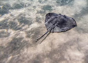
Background imageTerritory Collection: Southern stingray (Hypanus americanus), Stingray City, Grand Cayman, Cayman Islands

Southern stingray (Hypanus americanus), Stingray City, Grand Cayman, Cayman Islands

Background imageTerritory Collection: Boats at Stingray City, Grand Cayman, Cayman Islands

Boats at Stingray City, Grand Cayman, Cayman Islands

Background imageTerritory Collection: Governors Harbour, West Bay, Grand Cayman, Cayman Islands

Governors Harbour, West Bay, Grand Cayman, Cayman Islands

Background imageTerritory Collection: Sunset seen from Seven Mile Beach, West Bay, Grand Cayman, Cayman Islands

Sunset seen from Seven Mile Beach, West Bay, Grand Cayman, Cayman Islands

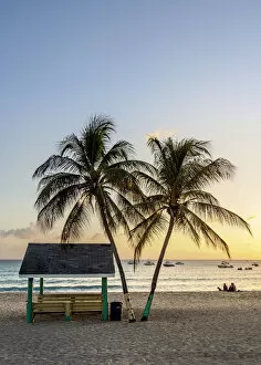
Background imageTerritory Collection: Seven Mile Beach at sunset, West Bay, Grand Cayman, Cayman Islands

Seven Mile Beach at sunset, West Bay, Grand Cayman, Cayman Islands

Background imageTerritory Collection: Heritage Kitchen Bar, Seven Mile Beach, West Bay, Grand Cayman, Cayman Islands

Heritage Kitchen Bar, Seven Mile Beach, West Bay, Grand Cayman, Cayman Islands

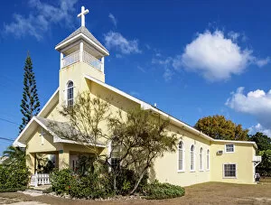
Background imageTerritory Collection: Ministry of Peace Church, West Bay, Grand Cayman, Cayman Islands

Ministry of Peace Church, West Bay, Grand Cayman, Cayman Islands

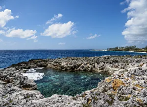
Background imageTerritory Collection: Coast of Pedro St. James National Historic Site, Savannah, Bodden Town District

Coast of Pedro St. James National Historic Site, Savannah, Bodden Town District, Grand Cayman, Cayman Islands

Background imageTerritory Collection: Pedro St. James National Historic Site, Savannah, Bodden Town District, Grand Cayman

Pedro St. James National Historic Site, Savannah, Bodden Town District, Grand Cayman, Cayman Islands

Background imageTerritory Collection: Gnome Figure at Queen Elizabeth II Botanic Park, North Side, Grand Cayman, Cayman Islands

Gnome Figure at Queen Elizabeth II Botanic Park, North Side, Grand Cayman, Cayman Islands

Background imageTerritory Collection: Rankine House, Heritage Garden, Queen Elizabeth II Botanic Park, North Side, Grand Cayman

Rankine House, Heritage Garden, Queen Elizabeth II Botanic Park, North Side, Grand Cayman, Cayman Islands

Background imageTerritory Collection: Queen Elizabeth II Botanic Park, North Side, Grand Cayman, Cayman Islands

Queen Elizabeth II Botanic Park, North Side, Grand Cayman, Cayman Islands

Background imageTerritory Collection: Hammock at North Side, Grand Cayman, Cayman Islands

Hammock at North Side, Grand Cayman, Cayman Islands

Background imageTerritory Collection: Starfish Point Beach, North Side, Grand Cayman, Cayman Islands

Starfish Point Beach, North Side, Grand Cayman, Cayman Islands

Background imageTerritory Collection: Sea star st Starfish Point, North Side, Grand Cayman, Cayman Islands

Sea star st Starfish Point, North Side, Grand Cayman, Cayman Islands

Background imageTerritory Collection: Architecture of North Side, Grand Cayman, Cayman Islands

Architecture of North Side, Grand Cayman, Cayman Islands

Background imageTerritory Collection: Catamaran at North Side, Grand Cayman, Cayman Islands

Catamaran at North Side, Grand Cayman, Cayman Islands

Background imageTerritory Collection: Rum Point, North Side, Grand Cayman, Cayman Islands

Rum Point, North Side, Grand Cayman, Cayman Islands

Background imageTerritory Collection: Sunset at the coast of George Town, Grand Cayman, Cayman Islands

Sunset at the coast of George Town, Grand Cayman, Cayman Islands

Background imageTerritory Collection: Cruise Ship by the coast of George Town, Grand Cayman, Cayman Islands

Cruise Ship by the coast of George Town, Grand Cayman, Cayman Islands

Background imageTerritory Collection: Cayman Islands National Museum, George Town, Grand Cayman, Cayman Islands

Cayman Islands National Museum, George Town, Grand Cayman, Cayman Islands

Background imageTerritory Collection: Coast of George Town, Grand Cayman, Cayman Islands

Coast of George Town, Grand Cayman, Cayman Islands

Background imageTerritory Collection: Crystal Caves, North Side, Grand Cayman, Cayman Islands

Crystal Caves, North Side, Grand Cayman, Cayman Islands

Background imageTerritory Collection: U. S. Virgin Islands, St. John, Cruz Bay, elevated town view with The Battery

U. S. Virgin Islands, St. John, Cruz Bay, elevated town view with The Battery
U.S. Virgin Islands, St. John, Cruz Bay, elevated town view with The Battery

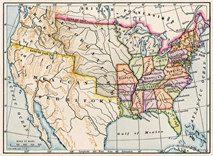
Background imageTerritory Collection: United States map in 1830

United States map in 1830
Territories of the United States in 1830. Printed color lithograph

Background imageTerritory Collection: Up and down

Up and down
Zina Heg

Background imageTerritory Collection: WW2 - R. A. F. Photographic Observer

WW2 - R. A. F. Photographic Observer
A photograph of a British WW2 Royal Air Force photographic observer handing out his films, exposed over enemy territory. Date: circa 1940s

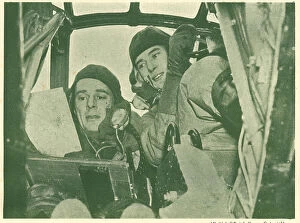
Background imageTerritory Collection: WW2 - Inside A Reconnaissance Plane

WW2 - Inside A Reconnaissance Plane
A photograph portraying a British WW2 Royal Air Force pilot consulting the sergeant observer while flying over enemy territory in a reconnaissance plane. Date: circa 1940s

Background imageTerritory Collection: Democratic Republic of the Congo - Kalemie

Democratic Republic of the Congo - Kalemie
Kalemie (formerly Albertville or Albertstad) - situated on the western shore of Lake Tanganyika in the Democratic Republic of the Congo Date: 1913

Background imageTerritory Collection: The Rock Hotel, Gibraltar

The Rock Hotel, Gibraltar - built by John Chrichton-Stuart, the Marquis of Bute in 1932 Date: circa late 1930s

Background imageTerritory Collection: Battle of Otumba (7th July 7, 1520)

Battle of Otumba (7th July 7, 1520). Confrontation between the army of the Aztecs against Spanish troops led by Hernan Cortes
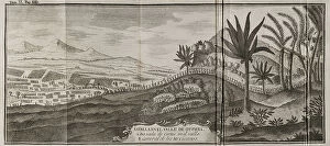
Background imageTerritory Collection: Barcinonensium. Marca Hispanica sive limes hispanicus

Barcinonensium. Marca Hispanica sive limes hispanicus. Book written in Latin by Pierre de Marca (1594-1662). In 1656 he was commissioned to formalise the border treaty between the kingdoms of France

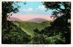
Background imageTerritory Collection: Blue Mountain Peak, Jamaica, West Indies

Blue Mountain Peak, Jamaica, West Indies
Blue Mountain Peak (the island's highest point), Jamaica, West Indies. The famed Jamaican Blue Mountain Coffee is grown in the region

Background imageTerritory Collection: Rio Cobre River, Jamaica, West Indies

Rio Cobre River, Jamaica, West Indies
Rio Cobre, Jamaica, West Indies. The river flows to meet the Caribbean Sea in the north west corner of Kingston Harbour. Date: circa 1920s

Background imageTerritory Collection: Doctor's Cave, Montego Bay, Jamaica

Doctor's Cave, Montego Bay, Jamaica. Date: circa 1920s

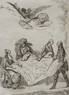
Background imageTerritory Collection: First Partition of Poland

First Partition of Poland
Partitions of Poland. The First Partition of Poland. It was decided on August 5, 1772. The agreement was signed in Vienna in February 1772

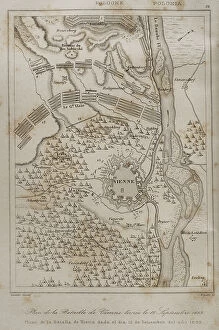
Background imageTerritory Collection: Plan of the Battle of Vienna, 12 September 1683

Plan of the Battle of Vienna, 12 September 1683
Holy Roman Empire. Plan of the Battle of Vienna, 12 September 1683. It took place at Kahlenberg Mountain, near Vienna, ather the city had been besieged by the Ottoman Empire during two months

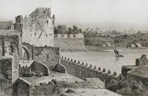
Background imageTerritory Collection: Ottoman domination. Acre. Walls of Saint Jean d'Acre

Ottoman domination. Acre. Walls of Saint Jean d'Acre
Ottoman domination. Acre (today Akko in northern territory of Israel). Walls of Saint Jean d'Acre. Engraving, 19th century. Engraving by Lemaitre

Background imageTerritory Collection: Ottoman period. Europe. Balkan Peninsula. Balkan Mountains

Ottoman period. Europe. Balkan Peninsula. Balkan Mountains
Period of domination of the Ottoman Empire. Europe. Balkan Peninsula. The Balkan Mountains. Engraving by Lemaitre, Danvin and Ch. Lalaisse

Background imageTerritory Collection: The Deserted Trench

The Deserted Trench
This painting, with use of angular lines, shows a deserted, flooded trench from the Battle of the Yser, which took place in October 1914, during the First World War, between Nieuwpoort and Diksmuide

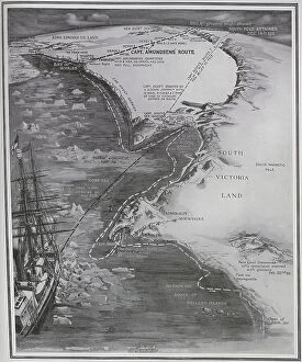
Background imageTerritory Collection: British and Norwegian bases in the South Pole

British and Norwegian bases in the South Pole. The routes taken by Captain Amunsden and Captain Scott. The Norwegian base was on the Bay of Whales, the British Base was at Roberston Bay


All Professionally Made to Order for Quick Shipping

"Exploring the Rich Tapestry of Territory: From Ancient Empires to Majestic Landscapes" Embark on a captivating journey through time and space as we delve into the concept of territory. Let us begin our expedition with a glance at Scotland in the 1870s, where an intricate map unravels tales of clans and their territorial disputes. Shifting our focus eastward, we encounter a mesmerizing Map of the Ancient Persian Empire. Marvel at its vast expanse, once ruled by mighty kings who sought to expand their dominion across ancient lands. Transporting ourselves to Britain in 597 AD, another map reveals how territories evolved over centuries. Witness the birth of kingdoms and empires that shaped this island nation's history. As dusk descends upon Uluru, Ayers Rock in Australia, soak in nature's splendor while contemplating indigenous peoples' connection to their ancestral territories. The sunset paints vibrant hues across this sacred land. Journeying back to Europe, let us explore Ireland through a map from the 1870s. Discover its lush landscapes and ponder upon historical struggles for control over this enchanting island. Expand your horizons further with the World Map Empire McVitie; marvel at how various nations carved out their territories during different eras – each stroke representing power dynamics and conquests. Venturing into antiquity, immerse yourself in Alexander the Great's empire through an awe-inspiring map. Uncover his audacious quest for dominance as he conquered vast stretches of land under his rule. Witnessing nature's wonders takes flight as we observe a majestic Red Kite soaring above its nest territory in Lower Saxony, Germany. A symbol of freedom within defined boundaries - it reminds us that even wildlife has territorial instincts ingrained within them. Turning towards spiritual realms brings us face-to-face with Palestine and Holy Land on an intricately detailed map. Contemplate millennia-old conflicts rooted deeply in territorial claims and religious significance.