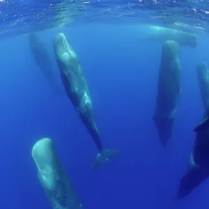
Home > Animals > Aquatic > Cetacea > Whale
Map of the English coast between the Isle of Wight and Dover, 1580-83 (engraving)
")
![]()
Wall Art and Photo Gifts from Fine Art Finder
Map of the English coast between the Isle of Wight and Dover, 1580-83 (engraving)
7415468 Map of the English coast between the Isle of Wight and Dover, 1580-83 (engraving) by Doetecum, Joannes van (1530-1605); 32.5 -- 51.0 cm; Rijksmuseum, Amsterdam, The Netherlands; (add.info.: By Joannes van Doetechum (I))
Media ID 32180794
© Bridgeman Images
Aquatic Mammal British Channel C16h Coast Line Compass Card Compass Rose Compass Star Dover English Channel Fishes Humpback Whale Isle Of Wight Kent Marine Mammal Marine Mammals Sail Boat Sail Boats Sailboat Sailboats Sailing Boat Sailing Ship Sailing Vessel Sea Mammal Seas Seawater Ships Sail Unpopulated Whale Wind Rose 16 16th Xvi Xvith Sixteenth Century Britisch Britisch Coast Scene Egnland Flemish Art Flemish Artist Means Of Conveyance Uk United Kingdom Without Anyone Without People
FEATURES IN THESE COLLECTIONS
> Animals
> Aquatic
> Cetacea
> Whale
> Animals
> Aquatic
> Related Images
> Animals
> Birds
> Columbiformes
> Doves
> Related Images
> Animals
> Fishes
> Related Images
> Animals
> Mammals
> Balaenopteridae
> Humpback Whale
> Animals
> Mammals
> Humpback Whale
> Europe
> Netherlands
> Amsterdam
> Europe
> Netherlands
> Maps
> Europe
> Netherlands
> Paintings
> Europe
> Netherlands
> Posters
> Fine Art Finder
> Artists
> Joannes van Doetecum
EDITORS COMMENTS
This engraving, titled "Map of the English coast between the Isle of Wight and Dover" takes us back to the late 16th century. Created by Flemish artist Joannes van Doetecum, this intricate piece showcases his exceptional talent in cartography and engraving. Measuring at 32.5 by 51.0 cm, this artwork is housed in the prestigious Rijksmuseum in Amsterdam, Netherlands. The map provides a detailed depiction of England's southern coastline, spanning from the picturesque Isle of Wight to the iconic white cliffs of Dover. Van Doetecum's masterful use of color brings life to this historical document. Each coastal feature is meticulously rendered with vibrant hues that highlight their unique characteristics. As we explore this map further, our eyes are drawn to a magnificent humpback whale gracefully swimming through these waters—a reminder of the rich marine life that once thrived along these shores. Beyond its artistic value, this engraving serves as an invaluable historical artifact. It offers insights into England's maritime history and reveals how navigators charted their course during a time when accurate maps were crucial for safe navigation. With its combination of artistry and scientific precision, Van Doetecum's "Map of the English coast between the Isle of Wight and Dover" stands as a testament to both his skill as an engraver and his contribution to cartography during one of Europe's most fascinating periods—the Renaissance.
MADE IN THE USA
Safe Shipping with 30 Day Money Back Guarantee
FREE PERSONALISATION*
We are proud to offer a range of customisation features including Personalised Captions, Color Filters and Picture Zoom Tools
SECURE PAYMENTS
We happily accept a wide range of payment options so you can pay for the things you need in the way that is most convenient for you
* Options may vary by product and licensing agreement. Zoomed Pictures can be adjusted in the Cart.