Home > Maps and Charts > World
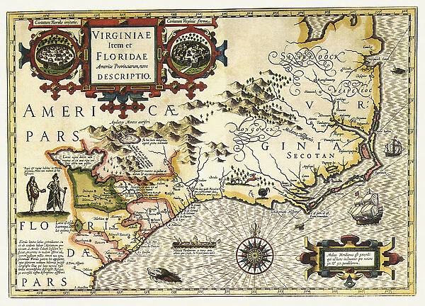
Virginiae Item et Floridae Americae Provinciarum nova Descri
![]()

Wall Art and Photo Gifts from Universal Images Group (UIG)
Virginiae Item et Floridae Americae Provinciarum nova Descri
Map of Virginia and Florida 1606
Universal Images Group (UIG) manages distribution for many leading specialist agencies worldwide
Media ID 20165205
1600s 17th Century Antiquarian Antiquarian Maps Florida Globe Travels Treks Trips Virginia Voyage
FEATURES IN THESE COLLECTIONS
> Maps and Charts
> Related Images
> Maps and Charts
> World
> Universal Images Group (UIG)
> History
> Historical Maps
EDITORS COMMENTS
This print takes us back in time to the 17th century, immersing us in the world of antiquarian maps. Titled "Virginiae Item et Floridae Americae Provinciarum nova Descri" this map from 1606 showcases Virginia and Florida, two significant regions of early America. The intricate details and delicate lines on this antique piece evoke a sense of wonder as we explore the uncharted territories of that era. As we gaze upon this historical artifact, our imagination transports us to a time when these lands were yet to be fully explored. It serves as a reminder of the brave voyages undertaken by early explorers who embarked on treks across vast oceans in search of new horizons. The faded colors and worn edges tell stories of countless journeys made by intrepid adventurers who sought to uncover the mysteries hidden within these unexplored lands. This map becomes a window into their world, offering glimpses into their triumphs and challenges along the way. In an age where digital navigation has become commonplace, this print reminds us of the beauty found in old-fashioned cartography. It invites us to appreciate how far we have come while honoring those who paved the way for our modern understanding of geography. Whether you are an avid traveler or simply fascinated by history, this stunning image is sure to captivate your senses and ignite your curiosity about past civilizations and their remarkable expeditions through unknown territories.
MADE IN THE USA
Safe Shipping with 30 Day Money Back Guarantee
FREE PERSONALISATION*
We are proud to offer a range of customisation features including Personalised Captions, Color Filters and Picture Zoom Tools
SECURE PAYMENTS
We happily accept a wide range of payment options so you can pay for the things you need in the way that is most convenient for you
* Options may vary by product and licensing agreement. Zoomed Pictures can be adjusted in the Cart.


