Home > Arts > Artists > H > Franz Hogenberg
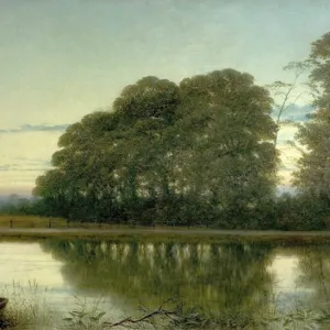
Map of Basel from Civitates Orbis Terrarum by Georg Braun, 1541-1622 and Franz Hogenberg, 1540-1590, engraving

![]()
Wall Art and Photo Gifts from Universal Images Group (UIG)
Map of Basel from Civitates Orbis Terrarum by Georg Braun, 1541-1622 and Franz Hogenberg, 1540-1590, engraving
Cartography, Switzerland, 16th century. Map of Basel. From Civitates Orbis Terrarum by Georg Braun (1541-1622) and Franz Hogenberg (1540-1590), Cologne. Engraving
Universal Images Group (UIG) manages distribution for many leading specialist agencies worldwide
Media ID 9504385
© DEA / R. MERLO
16th Century Basel Elevated View Hill Latin Script Manuscript River Switzerland Townscape
FEATURES IN THESE COLLECTIONS
> Arts
> Art Movements
> Landscapes
> Arts
> Artists
> H
> Franz Hogenberg
> Arts
> Contemporary art
> Landscapes
> Sculptures
> Arts
> Contemporary art
> Sculpture
> Landscape paintings
> Arts
> Landscape paintings
> Landscape art
> Landscape paintings
> Arts
> Landscape paintings
> Landscape art
> Arts
> Landscape paintings
> Waterfall and river artworks
> Landscape paintings
> Arts
> Landscape paintings
> Waterfall and river artworks
> River artworks
> Europe
> Switzerland
> Basel
> Universal Images Group (UIG)
> Art
> Painting, Sculpture & Prints
> Cartography
EDITORS COMMENTS
This print showcases a remarkable piece of cartographic history - the Map of Basel from Civitates Orbis Terrarum by Georg Braun and Franz Hogenberg. Created in the 16th century, this engraving offers us a glimpse into the intricate artistry and meticulous attention to detail that characterized mapmaking during this era. The image, captured in a studio setting, highlights the exquisite craftsmanship of the original manuscript. The townscape of Basel is beautifully depicted, with its winding river snaking through the landscape. The elevated view allows us to marvel at the physical geography of Switzerland's hilly terrain. As we delve into this historical artifact, it becomes evident that every stroke on this engraving was carefully executed. The Latin script adorning the map adds an air of authenticity and reminds us of its origins in a time long past. This photograph serves as both an illustration and painting, showcasing how art intertwined with cartography during this period. It transports us back in time to explore not only geographical landscapes but also cultural landscapes - offering insights into how people perceived their surroundings centuries ago. With no people present within the frame, our focus is solely on appreciating this masterpiece for what it truly is - a testament to human ingenuity and curiosity about our world. Let us cherish these glimpses into history that remind us how far we have come while honoring those who paved the way for modern mapping techniques.
MADE IN THE USA
Safe Shipping with 30 Day Money Back Guarantee
FREE PERSONALISATION*
We are proud to offer a range of customisation features including Personalised Captions, Color Filters and Picture Zoom Tools
SECURE PAYMENTS
We happily accept a wide range of payment options so you can pay for the things you need in the way that is most convenient for you
* Options may vary by product and licensing agreement. Zoomed Pictures can be adjusted in the Cart.