Premium Framed Print : View of the Valles Marineris canyon system, Mars


![]()
Framed Photos From Science Photo Library
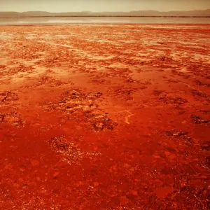
View of the Valles Marineris canyon system, Mars
Oblique view of the central region of the giant Valles Marineris canyon system on Mars, computer- processed from Viking spacecraft imagery & topographic maps of the planet. The Valles Marineris is over 3000 km long & up to 8 km deep, dwarfing the Grand Canyon of Arizona. The canyons were formed by a combination of geological faulting, landslides, and erosion by wind and ancient water flows. The central area shown here contains layered deposits which may have been deposited by ancient lakes. The view is looking east, from 30 degrees above the horizon. (Image processing by Alfred McEwen & topographic mapping by Sherman Wu, both at USGS, Flagstaff, Arizona)
Science Photo Library features Science and Medical images including photos and illustrations
Media ID 6426537
© NASA/SCIENCE PHOTO LIBRARY
Canyon Cosmology Erosion Mars Martian Surface On Mars Planetary Valles Marineris
14"x18" Premium Frame
Contemporary style Premium Wooden Frame with 8"x12" Print. Complete with 2" White Mat and 1.25" thick MDF frame. Printed on 260 gsm premium paper. Glazed with shatter proof UV coated acrylic glass. Backing is paper covered backing with rubber bumpers. Supplied ready to hang with a pre-installed sawtooth/wire hanger. Care Instructions: Spot clean with a damp cloth. Securely packaged in a clear plastic bag and envelope in a reinforced cardboard shipper
FSC Real Wood Frame and Double Mounted with White Conservation Mountboard - Professionally Made and Ready to Hang
Estimated Image Size (if not cropped) is 30.4cm x 20.3cm (12" x 8")
Estimated Product Size is 45.8cm x 35.6cm (18" x 14")
These are individually made so all sizes are approximate
Artwork printed orientated as per the preview above, with landscape (horizontal) orientation to match the source image.
EDITORS COMMENTS
This print showcases the awe-inspiring Valles Marineris canyon system on Mars, revealing its grandeur and complexity. With an oblique view of the central region, this computer-processed image combines data from Viking spacecraft imagery and topographic maps to provide a detailed representation of this Martian marvel. Stretching over 3000 km in length and plunging up to 8 km deep, Valles Marineris easily surpasses Arizona's Grand Canyon in scale. Its formation is attributed to a combination of geological faulting, landslides, and erosion caused by wind and ancient water flows. The central area depicted here exhibits intriguing layered deposits that may have originated from ancient lakes. The perspective captured in this photograph offers a unique vantage point looking eastward from 30 degrees above the horizon. It was meticulously processed by Alfred McEwen with topographic mapping assistance provided by Sherman Wu at USGS in Flagstaff, Arizona. As we explore the mysteries of our neighboring planet's surface, images like these not only ignite our curiosity but also deepen our understanding of planetary geology and cosmology. This remarkable visual testament serves as a reminder of the vastness and beauty that exists beyond Earth's boundaries – an enduring source of inspiration for scientists and dreamers alike.
MADE IN THE USA
Safe Shipping with 30 Day Money Back Guarantee
FREE PERSONALISATION*
We are proud to offer a range of customisation features including Personalised Captions, Color Filters and Picture Zoom Tools
SECURE PAYMENTS
We happily accept a wide range of payment options so you can pay for the things you need in the way that is most convenient for you
* Options may vary by product and licensing agreement. Zoomed Pictures can be adjusted in the Basket.