Premium Framed Print : 1850, Mitchell Map of Sweden and Norway, topography, cartography, geography, land


![]()
Framed Photos From Liszt Collection
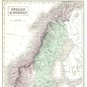
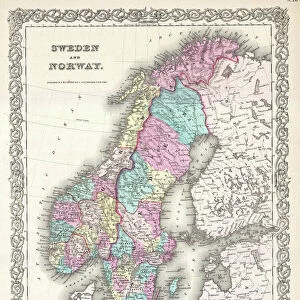
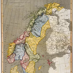
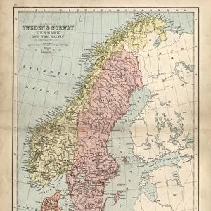
1850, Mitchell Map of Sweden and Norway, topography, cartography, geography, land
1850, Mitchell Map of Sweden and Norway
Liszt Collection of nineteenth-century engravings and images to browse and enjoy
Media ID 14007326
© Artokoloro Quint Lox Limited
1850 Antique Map Latitude Longitude Mappa Mundi Old Antique Plan Old Antique View Ols Antique Map Rare Old Maps Topo
14"x16" Premium Frame
Contemporary style Premium Wooden Frame with 8"x10" Print. Complete with 2" White Mat and 1.25" thick MDF frame. Printed on 260 gsm premium paper. Glazed with shatter proof UV coated acrylic glass. Backing is paper covered backing with rubber bumpers. Supplied ready to hang with a pre-installed sawtooth/wire hanger. Care Instructions: Spot clean with a damp cloth. Securely packaged in a clear plastic bag and envelope in a reinforced cardboard shipper
FSC Real Wood Frame and Double Mounted with White Conservation Mountboard - Professionally Made and Ready to Hang
Estimated Image Size (if not cropped) is 20.3cm x 25.4cm (8" x 10")
Estimated Product Size is 35.6cm x 40.6cm (14" x 16")
These are individually made so all sizes are approximate
Artwork printed orientated as per the preview above, with portrait (vertical) orientation to match the source image.
EDITORS COMMENTS
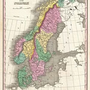
This print showcases the remarkable 1850 Mitchell Map of Sweden and Norway, a true masterpiece in the realms of topography, cartography, and geography. With its intricate details and precise land representations, this vintage map takes us on a journey through time to explore the ancient history of these Scandinavian lands. The illustration is a testament to the artistry involved in creating such historical maps. Its decorative elements add an aesthetic charm that transports us back to an era when navigation relied heavily on paper maps like this one. The aged appearance further enhances its allure, evoking a sense of nostalgia for bygone eras. As we gaze upon this rare old map, we are reminded of the importance placed on geographical knowledge during times when exploration was at its peak. This particular piece offers invaluable insights into the region's past and serves as a valuable resource for researchers and enthusiasts alike. With its grid lines denoting latitude and longitude, this Mitchell Map provides not only geographic accuracy but also serves as an educational tool for understanding Earth's diverse landscapes. It stands as a mappa mundi—a representation of our world—capturing both space and region within its meticulously crafted borders. This print from Liszt Collection invites us to appreciate the beauty found in historical cartography while igniting our curiosity about distant lands explored centuries ago.
MADE IN THE USA
Safe Shipping with 30 Day Money Back Guarantee
FREE PERSONALISATION*
We are proud to offer a range of customisation features including Personalised Captions, Color Filters and Picture Zoom Tools
SECURE PAYMENTS
We happily accept a wide range of payment options so you can pay for the things you need in the way that is most convenient for you
* Options may vary by product and licensing agreement. Zoomed Pictures can be adjusted in the Basket.