Poster Print > Arts > Art Movements > Landscapes
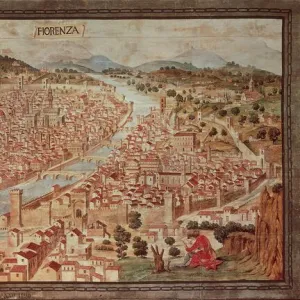
Poster Print : Map of Florence, 15th century


![]()
Poster Prints from Heritage Images
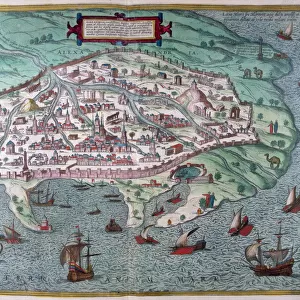
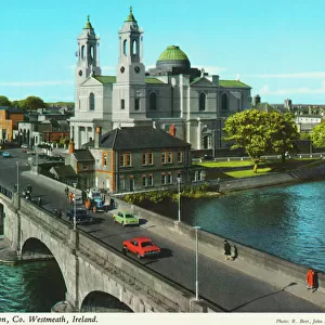
Map of Florence, 15th century
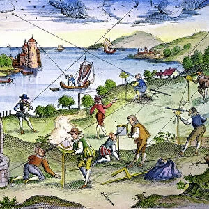
Map of Florence, 15th century. Pictorial Italian map showing the layout of the city. From the Gallery of Maps, Vatican Museum, Rome
Heritage Images features heritage image collections
Media ID 14866362
© Art Media / Heritage-Images
Cartography Community Distance Duomo Environment Florence Florentine High Angle Illustration And Painting Information Map Making Plan Tuscany
18x24 inch Poster Print
Poster prints are budget friendly enlarged prints in standard poster paper sizes. Printed on 150 gsm Matte Paper for a natural feel and supplied rolled in a tube. Great for framing and should last many years. To clean wipe with a microfiber, non-abrasive cloth or napkin. Our Archival Quality Photo Prints and Fine Art Paper Prints are printed on higher quality paper and the choice of which largely depends on your budget.
Poster prints are budget friendly enlarged prints in standard poster paper sizes (A0, A1, A2, A3 etc). Whilst poster paper is sometimes thinner and less durable than our other paper types, they are still ok for framing and should last many years. Our Archival Quality Photo Prints and Fine Art Paper Prints are printed on higher quality paper and the choice of which largely depends on your budget.
Estimated Product Size is 61.6cm x 46.3cm (24.3" x 18.2")
These are individually made so all sizes are approximate
Artwork printed orientated as per the preview above, with landscape (horizontal) orientation to match the source image.
FEATURES IN THESE COLLECTIONS
> Arts
> Art Movements
> Landscapes
> Arts
> Art Movements
> Medieval Art
> Arts
> Art Movements
> Renaissance Art
> Arts
> Landscape paintings
> Landscape art
> Landscape paintings
> Arts
> Landscape paintings
> Landscape art
> Arts
> Landscape paintings
> Rural countryside paintings
> Country landscapes
> Arts
> Landscape paintings
> Rural countryside paintings
> Landscape paintings
> Arts
> Landscape paintings
> Rural countryside paintings
> Arts
> Landscape paintings
> Waterfall and river artworks
> Landscape paintings
> Arts
> Landscape paintings
> Waterfall and river artworks
MADE IN THE USA
Safe Shipping with 30 Day Money Back Guarantee
FREE PERSONALISATION*
We are proud to offer a range of customisation features including Personalised Captions, Color Filters and Picture Zoom Tools
SECURE PAYMENTS
We happily accept a wide range of payment options so you can pay for the things you need in the way that is most convenient for you
* Options may vary by product and licensing agreement. Zoomed Pictures can be adjusted in the Cart.