Pillow > Maps and Charts > Early Maps
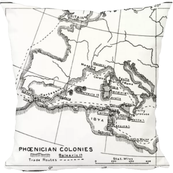
Pillow : Map of the Phoenincian colonies and its Mediterranean trade routes, 1500 -539 BC
![]()

Home Decor from Fine Art Finder
Map of the Phoenincian colonies and its Mediterranean trade routes, 1500 -539 BC
3614259 Map of the Phoenincian colonies and its Mediterranean trade routes, 1500 -539 BC, from Hutchinsons History of the Nations, pub.1915 by English School, (20th century); (add.info.: Map of the Phoenincian colonies and its Mediterranean trade routes, 1500 -539 BC. From Hutchinsons History of the Nations, published 1915.); English, out of copyright
Media ID 23006786
© Bridgeman Images
Archival Archive Civilizations Colonies Geographical Mediterranean Peoples Phoenicia Route Routes Semitic
18"x18" (46x46cm) Pillow
18"x18" (46x46cm) Faux Suede Pillow with a plush soft feel. Your choice of image fills the front, with a stone colored faux suede back. Flat sewn concealed white zip.
Accessorise your space with decorative, soft pillows
Estimated Product Size is 45.7cm x 45.7cm (18" x 18")
These are individually made so all sizes are approximate
Artwork printed orientated as per the preview above, with landscape (horizontal) or portrait (vertical) orientation to match the source image.
FEATURES IN THESE COLLECTIONS
> Fine Art Finder
> Artists
> English School
> Historic
> Ancient civilizations
> Maps and Charts
> Early Maps
> Maps and Charts
> Related Images
EDITORS COMMENTS
This print showcases a historical treasure - the Map of the Phoenician colonies and its Mediterranean trade routes, dating back to 1500-539 BC. Published in Hutchinson's History of the Nations in 1915, this English School engraving offers us a glimpse into the ancient world. The map reveals the extensive reach and influence of Phoenicia, an ancient civilization known for their seafaring prowess. It highlights their numerous colonies scattered across the Mediterranean region and depicts intricate trade routes that connected these settlements. Through this visual representation, we can appreciate how Phoenician traders navigated vast distances to establish prosperous commercial networks with various civilizations. The map also sheds light on their thalassocratic society, where maritime activities played a fundamental role in shaping their culture and history. As we explore this archival gem, it is fascinating to imagine bustling ports filled with ships carrying goods from distant lands. This illustration not only provides valuable geographical insights but also serves as a testament to human ingenuity and exploration during ancient times. Thanks to Ken Welsh's expertise in fine art finding, we are fortunate enough to admire this remarkable piece that encapsulates centuries of trade, civilization, and cultural exchange within its intricate lines.
MADE IN THE USA
Safe Shipping with 30 Day Money Back Guarantee
FREE PERSONALISATION*
We are proud to offer a range of customisation features including Personalised Captions, Color Filters and Picture Zoom Tools
SECURE PAYMENTS
We happily accept a wide range of payment options so you can pay for the things you need in the way that is most convenient for you
* Options may vary by product and licensing agreement. Zoomed Pictures can be adjusted in the Cart.


