Photographic Print > Fine Art Storehouse > Map
Photographic Print : Dominion of Canada map 1886


![]()
Photo Prints from Fine Art Storehouse
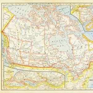
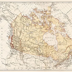
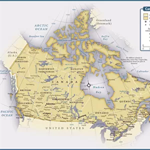
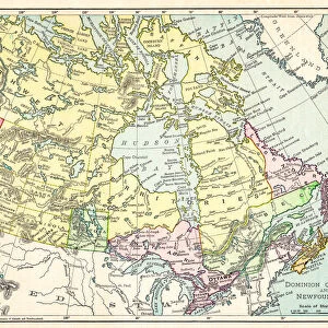
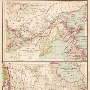
Dominion of Canada map 1886
Dominion of Canada map Maps Monteith Physical Geography 1886
Unleash your creativity and transform your space into a visual masterpiece!
THEPALMER
Media ID 14756960
© This content is subject to copyright
10"x8" Photo Print
Step back in time with our exquisite Dominion of Canada map print from ThePalmer's Fine Art Storehouse. This vintage map, originally published in 1886 by Monteith's Physical Geography, beautifully illustrates the political boundaries of Canada during the late 19th century. The intricate details and rich, antique hues bring history to life, making this print an exceptional addition to any home or office. Perfect for history enthusiasts, educators, or those who appreciate the art of cartography, this collectible print is sure to inspire curiosity and conversation. Order now and let the story of Canada's past unfold in your space.
Photo prints are produced on Kodak professional photo paper resulting in timeless and breath-taking prints which are also ideal for framing. The colors produced are rich and vivid, with accurate blacks and pristine whites, resulting in prints that are truly timeless and magnificent. Whether you're looking to display your prints in your home, office, or gallery, our range of photographic prints are sure to impress. Dimensions refers to the size of the paper in inches.
Our Photo Prints are in a large range of sizes and are printed on Archival Quality Paper for excellent colour reproduction and longevity. They are ideal for framing (our Framed Prints use these) at a reasonable cost. Alternatives include cheaper Poster Prints and higher quality Fine Art Paper, the choice of which is largely dependant on your budget.
Estimated Product Size is 25.4cm x 20.3cm (10" x 8")
These are individually made so all sizes are approximate
Artwork printed orientated as per the preview above, with landscape (horizontal) or portrait (vertical) orientation to match the source image.
FEATURES IN THESE COLLECTIONS
> Fine Art Storehouse
> Map
> Historical Maps
EDITORS COMMENTS
In this print titled "Dominion of Canada map 1886" we are transported back in time to the late 19th century. The image showcases a meticulously detailed map, created by Monteith Physical Geography in the year 1886. This historical artifact offers us a glimpse into the vast Dominion of Canada during its early years. The intricate lines and delicate shading on the map highlight the immense geographical expanse that constituted Canada at that time. From coast to coast, we witness an array of provinces and territories coming together under one unified nation. It is fascinating to observe how boundaries have evolved since then, as well as marvel at the sheer size and diversity of this great land. "ThePALMER" has skillfully captured this antique piece with utmost precision, allowing us to appreciate every fine detail preserved within it. The monochrome palette adds a timeless quality to the photograph, enhancing our connection with history. This print from Fine Art Storehouse serves as more than just an aesthetic piece; it acts as a portal through which we can explore our past. Whether you are a history enthusiast or simply intrigued by cartography, this artwork will undoubtedly spark curiosity about Canada's rich heritage and its journey towards becoming the nation we know today.
MADE IN THE USA
Safe Shipping with 30 Day Money Back Guarantee
FREE PERSONALISATION*
We are proud to offer a range of customisation features including Personalised Captions, Color Filters and Picture Zoom Tools
SECURE PAYMENTS
We happily accept a wide range of payment options so you can pay for the things you need in the way that is most convenient for you
* Options may vary by product and licensing agreement. Zoomed Pictures can be adjusted in the Cart.