Home > Europe > United Kingdom > England > London > Towns > Finsbury Park
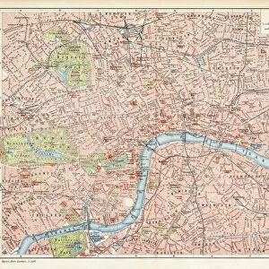
Map of London Underground railway, for Harrods

![]()
Wall Art and Photo Gifts from Mary Evans Picture Library
Map of London Underground railway, for Harrods
Map of the London Underground railway, How to Reach Harrods by Tube. Date: circa 1909
Mary Evans Picture Library makes available wonderful images created for people to enjoy over the centuries
Media ID 23270942
© Illustrated London News Ltd/Mary Evans
Brompton Finsbury Hammersmith Journey Kings Lines Maps Metropolitan Piccadilly Railways Route Routes Stations Underground Bakerloo
FEATURES IN THESE COLLECTIONS
> Animals
> Birds
> Gruiformes
> Rallidae
> King Rail
> Europe
> United Kingdom
> England
> London
> Boroughs
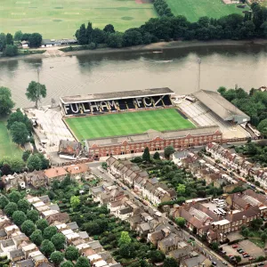
> Hammersmith and Fulham
> Europe
> United Kingdom
> England
> London
> Sights
> Harrods
> Europe
> United Kingdom
> England
> London
> Towns
> Finsbury Park
> Europe
> United Kingdom
> England
> London
> Towns
> Hammersmith
> Europe
> United Kingdom
> England
> London
> Transport
> Stations
> Europe
> United Kingdom
> England
> London
> Transport
> Underground
> Maps and Charts
> Related Images
> Mary Evans Prints Online
> New Images August 2021
EDITORS COMMENTS
Step into the bustling heart of London with this Edwardian map of the London Underground railway, showcasing the intricate web of routes and stations that crisscrossed the city over a century ago. Dating back to circa 1909, this vintage print offers a fascinating glimpse into the early days of the Underground network, which revolutionized urban transportation and connected the diverse neighborhoods of London like never before. Navigate your way through the labyrinthine system with ease, as key stations such as Hammersmith, Piccadilly, Kings Cross, Finsbury Park, Brompton, and Baker Street are clearly marked. The Metropolitan, District, Piccadilly, Brompton, Central, and Great Northern lines are all represented, providing multiple routes for your journey. As you explore this map, imagine the excitement of early travelers as they ventured beneath the streets of London for the first time, eager to discover the hidden gems and vibrant culture that the city had to offer. Whether you're a history buff, a London enthusiast, or simply someone who appreciates the beauty of vintage maps, this rare find is sure to transport you back in time and ignite your sense of adventure.
MADE IN THE USA
Safe Shipping with 30 Day Money Back Guarantee
FREE PERSONALISATION*
We are proud to offer a range of customisation features including Personalised Captions, Color Filters and Picture Zoom Tools
SECURE PAYMENTS
We happily accept a wide range of payment options so you can pay for the things you need in the way that is most convenient for you
* Options may vary by product and licensing agreement. Zoomed Pictures can be adjusted in the Cart.