Fraud Blocker Skip to main content

Home > Maps and Charts > Abraham Ortelius

Abraham Ortelius Collection

Ortelius Atlas Rediscovered: A Visual Journey Around the Globe

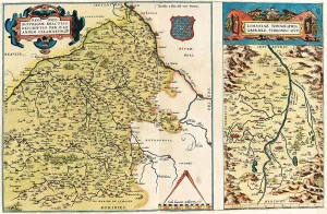
Choose a picture from our Abraham Ortelius Collection for your Wall Art and Photo Gifts

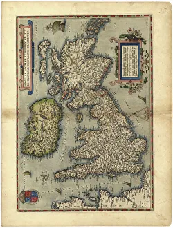
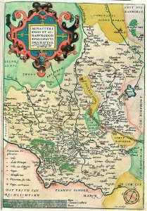
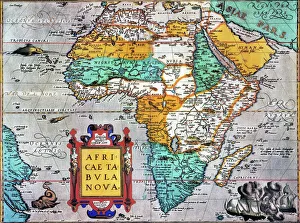
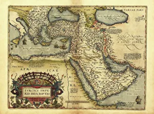
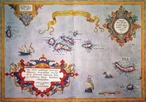
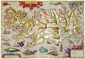
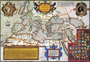
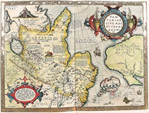
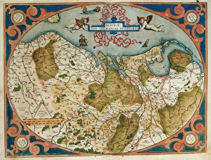
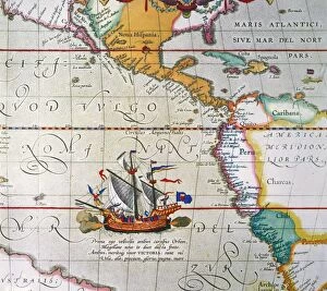
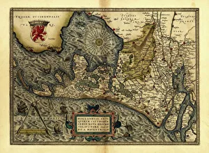
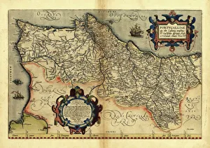
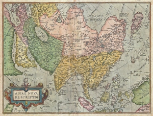
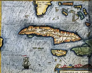
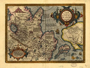
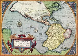
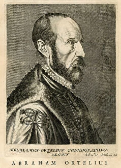
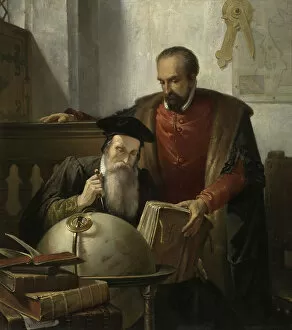
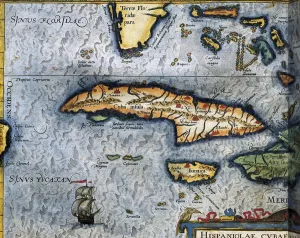
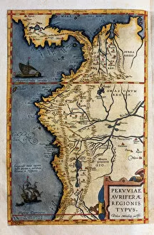
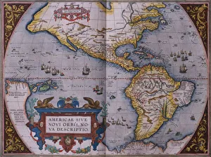
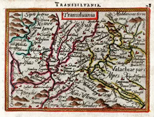
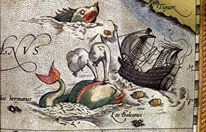
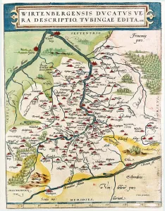
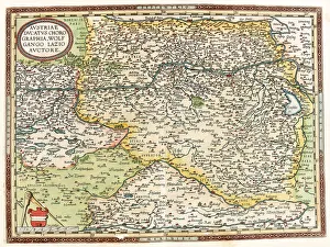
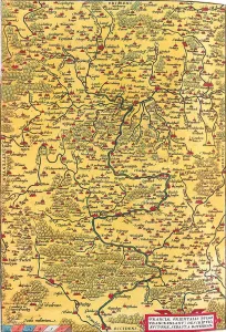
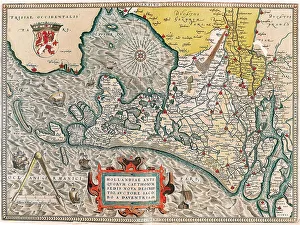
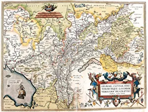
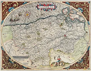
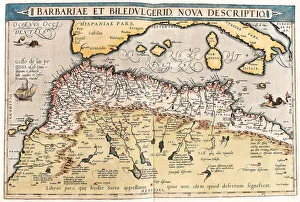
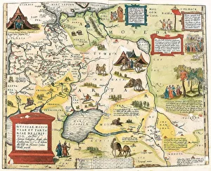
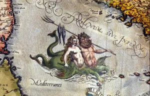
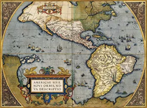
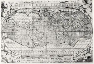
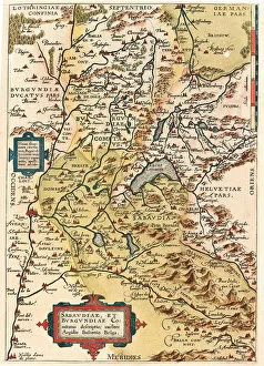
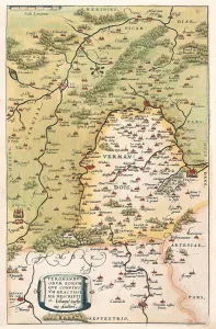
Abraham Ortelius, a renowned cartographer of the 16th century, left an indelible mark on the world of mapmaking with his pioneering work and innovative approach. Born in Antwerp, Belgium, in 1527, Ortelius initially pursued a career in engraving and bookbinding. However, his fascination with geography and exploration led him to delve into the art of mapmaking. In 1570, he published his magnum opus, the "Theatrum Orbis Terrarum" or "Theatre of the World," considered the first modern atlas. This groundbreaking atlas compiled maps from various sources, standardized their format, and included a list of sources—a practice uncommon at the time, ensuring its accuracy and reliability. Ortelius's meticulous attention to detail and commitment to cartographic excellence earned him widespread acclaim and established him as one of the most influential figures in the history of cartography.

374 items

Background imageAbraham Ortelius Collection: 16th century map of the British Isles

16th century map of the British Isles
Map of the British Isles, in the 1570 edition of Ortelius Atlas (Theatrum Orbis Terrarum). Abraham Ortelius (1527-1598) was a Flemish mapmaker who is considered to have produced the first true atlas

Background imageAbraham Ortelius Collection: Map of Franconia in Germany, 1570 (engraving)

Map of Franconia in Germany, 1570 (engraving)
LRI4704575 Map of Franconia in Germany, 1570 (engraving) by Ortelius, Abraham (1527-98); Museo Navale di Pegli, Genoa, Italy; (add.info.: Franciae Orientalis)

Background imageAbraham Ortelius Collection: MAP OF AFRICA from the 1595 edition of Abraham Ortelius atlas Theatrum Orbis Terrarum

MAP OF AFRICA from the 1595 edition of Abraham Ortelius atlas Theatrum Orbis Terrarum
MAP OF AFRICA from the 1595 edition of Abraham Ortelius atlas " Theatrum Orbis Terrarum."

Background imageAbraham Ortelius Collection: Orteliuss map of Ottoman Empire, 1570

Orteliuss map of Ottoman Empire, 1570
Orteliuss map of the Ottoman Empire. This map is from the 1570 first edition of Theatrum orbis terrarum ( Theatre of the World )

Background imageAbraham Ortelius Collection: AZORES MAP, c1584. Engraved map by Abraham Ortelius

AZORES MAP, c1584. Engraved map by Abraham Ortelius

Background imageAbraham Ortelius Collection: ICELAND: MAP, 1595. Map of Iceland from a 1595 edition of Abraham Ortelius atlas Theatrum

ICELAND: MAP, 1595. Map of Iceland from a 1595 edition of Abraham Ortelius atlas Theatrum Orbis Terrarum

Background imageAbraham Ortelius Collection: MAP OF THE ROMAN EMPIRE. From the 1595 atlas, Theatrum Orbis Terrarum

MAP OF THE ROMAN EMPIRE. From the 1595 atlas, Theatrum Orbis Terrarum, by Abraham Oertel, also known as Ortelius, featuring portraits of Roma, deity of ancient Rome, and Romulus

Background imageAbraham Ortelius Collection: Theatrum Orbis Terrarum (Theatre of the World) by Abraham Or

Theatrum Orbis Terrarum (Theatre of the World) by Abraham Or
Theatrum Orbis Terrarum (Theatre of the World). Is considered to be the first true modern atlas. Written by Abraham Ortelius and originally printed on May 20, 1570, in Antwerp. World Map

Background imageAbraham Ortelius Collection: Map of the Tartar territory, 1570 (engraving)

Map of the Tartar territory, 1570 (engraving)
LRI4704938 Map of the Tartar territory, 1570 (engraving) by Ortelius, Abraham (1527-98); Museo Navale di Pegli, Genoa, Italy; (add.info)

Background imageAbraham Ortelius Collection: Map of Germany and current Netherlands. Theatrum Orbis Terra

Map of Germany and current Netherlands. Theatrum Orbis Terrarum by Abraham Ortelius (1527-1598). First Edition. Antwerp, 1574. Library of Catalonia. Barcelona. Spain

Background imageAbraham Ortelius Collection: MAGELLAN: VICTORIA, 1590. Ferdinand Magellans ship Victoria under full sail

MAGELLAN: VICTORIA, 1590. Ferdinand Magellans ship Victoria under full sail. Detail from Abraham Ortelius map of the Pacific Ocean, 1590

Background imageAbraham Ortelius Collection: Orteliuss map of Holland, 1570

Orteliuss map of Holland, 1570
Orteliuss map of Holland. This map is from the 1570 first edition of Theatrum orbis terrarum ( Theatre of the World ). Drawn by the Flemish mapmaker Abraham Ortelius (1527-1598)

Background imageAbraham Ortelius Collection: Orteliuss map of Portugal, 1570

Orteliuss map of Portugal, 1570
Orteliuss map of Portugal. This map is from the 1570 first edition of Theatrum orbis terrarum ( Theatre of the World ). Drawn by the Flemish mapmaker Abraham Ortelius (1527-1598)

Background imageAbraham Ortelius Collection: 1570, Ortelius Map of Asia, first edition, Abraham Ortelius, also Orthellius, 1527 - 1598

1570, Ortelius Map of Asia, first edition, Abraham Ortelius, also Orthellius, 1527 - 1598, Flemish, Netherlandish cartographer and geographer

Background imageAbraham Ortelius Collection: ORTELIUS, Abraham (1527-1598). Theatrum Orbis

ORTELIUS, Abraham (1527-1598). Theatrum Orbis Terrarum. 1570. It is considered to be the first modern atlas. Map of the Caribbean Sea with Cuba, Cayman Islands, Jamaica and Florida. 1588

Background imageAbraham Ortelius Collection: Tartariae sive Magni Chami Regni ty¨pus, 1603. Creators: Abraham Ortelius, Jan Baptist Vrients

Tartariae sive Magni Chami Regni ty¨pus, 1603. Creators: Abraham Ortelius, Jan Baptist Vrients
Tartariae sive Magni Chami Regni ty¨pus, 1603. Covers northern Asia. Relief shown pictorially. From Abraham Ortelius's atlas: Theatrvm Orbis Terrarvm, 1603 ed. Hand col

Background imageAbraham Ortelius Collection: America, or the New World: From the Theatrum Orbis Terrarum by Abraham Ortelius, 1570, 1570

America, or the New World: From the Theatrum Orbis Terrarum by Abraham Ortelius, 1570, 1570
America, or the New World: From the Theatrum Orbis Terrarum by Abraham Ortelius, 1570, (1936). From The Connoisseur, Vol. 98, edited by H. Granville Fell. [International Studio, London, 1936]

Background imageAbraham Ortelius Collection: Abraham Ortelius

Abraham Ortelius

Background imageAbraham Ortelius Collection: Map of the Gulf of Mexico (Guastecan), from Hernando de Soto's expedition in 1570 (engraving)

Map of the Gulf of Mexico (Guastecan), from Hernando de Soto's expedition in 1570 (engraving)
AIS5365875 Map of the Gulf of Mexico (Guastecan), from Hernando de Soto's expedition in 1570 (engraving) by Ortelius, Abraham (1527-98); (add.info.: Strong water in colors, 1588)

Background imageAbraham Ortelius Collection: Mercator and Ortelius (oil on canvas)

Mercator and Ortelius (oil on canvas)
471368 Mercator and Ortelius (oil on canvas) by Bellemans, Jozef (Joseph) (1816-88); 175x144 cm; Koninklijk Museum voor Schone Kunsten, Antwerp

Background imageAbraham Ortelius Collection: Map of the Caribbean Sea by Christophe Plantin, 1588

Map of the Caribbean Sea by Christophe Plantin, 1588
AIS5350385 Map of the Caribbean Sea by Christophe Plantin, 1588 by Plantin, Christophe (1414 or 1420-1589); Biblioteca Universidad, Salamanca

Background imageAbraham Ortelius Collection: Map of Europe. 1588 (coloured etching)

Map of Europe. 1588 (coloured etching)
AIS5366571 Map of Europe. 1588 (coloured etching) by Plantin, Christophe (1414 or 1420-1589); Biblioteca Universidad, Salamanca, Spain; (add.info.: Map of Europe)

Background imageAbraham Ortelius Collection: Danseurs andalous. Detail de Grenade, in Volume I 'Civitatis Orbis Terrarum'

Danseurs andalous. Detail de Grenade, in Volume I "Civitatis Orbis Terrarum"(Thetraum orbis terrarum)
AIS5374100 Danseurs andalous. Detail de Grenade, in Volume I " Civitatis Orbis Terrarum" (Thetraum orbis terrarum)

Background imageAbraham Ortelius Collection: Map of Peru, from the records of Hernando de Sotos expedition in 1570, 1588

Map of Peru, from the records of Hernando de Sotos expedition in 1570, 1588
AIS5365871 Map of Peru, from the records of Hernando de Sotos expedition in 1570, 1588 by Plantin, Christophe (1414 or 1420-1589); Biblioteca Universidad, Salamanca, Spain; (add.info.: Map of Peru)

Background imageAbraham Ortelius Collection: Map of Pacific ocean with a Whale between the American continent and Japan - 1588

Map of Pacific ocean with a Whale between the American continent and Japan - 1588
AIS5350357 Map of Pacific ocean with a Whale between the American continent and Japan - 1588 by Plantin, Christophe (1414 or 1420-1589); Biblioteca Universidad, Salamanca

Background imageAbraham Ortelius Collection: Orteliuss map of The New World, 1603 (engraving)

Orteliuss map of The New World, 1603 (engraving)
7074479 Orteliuss map of The New World, 1603 (engraving) by Ortelius, Abraham (1527-98); Private Collection; (add.info.: This map of the Americas is from the 1603 edition of Theatrum orbis terrarum)

Background imageAbraham Ortelius Collection: Map of Transylvania 1590

Map of Transylvania 1590
7143247 Map of Transylvania 1590 by Ortelius, Abraham (1527-98); Private Collection; (add.info.: Geography. Romania. Map of Transylvania)

Background imageAbraham Ortelius Collection: A whale attacks a ship. Plate from an edition of 'Theatrum Orbis Terrarum'

A whale attacks a ship. Plate from an edition of "Theatrum Orbis Terrarum"
GIA4791792 A whale attacks a ship. Plate from an edition of " Theatrum Orbis Terrarum" by cartographer Abraham Ortelius (1527-1598), 1584 by Ortelius

Background imageAbraham Ortelius Collection: Map of Italy from Monaco in France to Genoa, through the provinces of Imperia de Savona

Map of Italy from Monaco in France to Genoa, through the provinces of Imperia de Savona
LRI4704752 Map of Italy from Monaco in France to Genoa, through the provinces of Imperia de Savona and Genoa, 1570 (engraving) by Ortelius, Abraham (1527-98); Museo Navale di Pegli, Genoa

Background imageAbraham Ortelius Collection: Map of Baden-Wuerttemberg, Germany, 1570 (engraving)

Map of Baden-Wuerttemberg, Germany, 1570 (engraving)
LRI4704682 Map of Baden-Wuerttemberg, Germany, 1570 (engraving) by Ortelius, Abraham (1527-98); Museo Navale di Pegli, Genoa, Italy; (add.info.: Wirtenbergensis Ducatus Vera descriptio)

Background imageAbraham Ortelius Collection: Map of Austria with the Danube River and the city of Vienna, 1570 (engraving)

Map of Austria with the Danube River and the city of Vienna, 1570 (engraving)
LRI4704621 Map of Austria with the Danube River and the city of Vienna, 1570 (engraving) by Ortelius, Abraham (1527-98); Museo Navale di Pegli, Genoa

Background imageAbraham Ortelius Collection: Map of Franconia in Germany with the city of Frankfurt, 1570 (engraving)

Map of Franconia in Germany with the city of Frankfurt, 1570 (engraving)
LRI4704559 Map of Franconia in Germany with the city of Frankfurt, 1570 (engraving) by Ortelius, Abraham (1527-98); Museo Navale di Pegli, Genoa

Background imageAbraham Ortelius Collection: Map of the Netherlands with the cities of Amsterdam and Haarlem, 1570 (engraving)

Map of the Netherlands with the cities of Amsterdam and Haarlem, 1570 (engraving)
LRI4704472 Map of the Netherlands with the cities of Amsterdam and Haarlem, 1570 (engraving) by Ortelius, Abraham (1527-98); Museo Navale di Pegli, Genoa

Background imageAbraham Ortelius Collection: Map of the German Netherlands, 1570 (engraving)

Map of the German Netherlands, 1570 (engraving)
LRI4704434 Map of the German Netherlands, 1570 (engraving) by Ortelius, Abraham (1527-98); Museo Navale di Pegli, Genoa, Italy; (add.info.: Gelriae, Cliviae)

Background imageAbraham Ortelius Collection: Map of Flanders, 1570 (engraving)

Map of Flanders, 1570 (engraving)
LRI4704433 Map of Flanders, 1570 (engraving) by Ortelius, Abraham (1527-98); Museo Navale di Pegli, Genoa, Italy; (add.info)

Background imageAbraham Ortelius Collection: Map of northern Africa, 1570 (engraving)

Map of northern Africa, 1570 (engraving)
LRI4705031 Map of northern Africa, 1570 (engraving) by Ortelius, Abraham (1527-98); Museo Navale di Pegli, Genoa, Italy; (add.info.: Barbariae and Biledulgerid, Nova Descriptio)

Background imageAbraham Ortelius Collection: Map of the territory of Russia, 1570 (engraving)

Map of the territory of Russia, 1570 (engraving)
LRI4704916 Map of the territory of Russia, 1570 (engraving) by Ortelius, Abraham (1527-98); Museo Navale di Pegli, Genoa, Italy; (add.info.: Russiae, Moscoviae and Tartariae descriptio)

Background imageAbraham Ortelius Collection: Map of Poland, 1570 (engraving)

Map of Poland, 1570 (engraving)
LRI4704888 Map of Poland, 1570 (engraving) by Ortelius, Abraham (1527-98); Museo Navale di Pegli, Genoa, Italy; (add.info.: Poloniae finitimarumque locorum descriptio)

Background imageAbraham Ortelius Collection: Triton and Sirene in the Mediterranean Sea. 'Theatrum Orbis Terrarum'

Triton and Sirene in the Mediterranean Sea. "Theatrum Orbis Terrarum"
GIA4777016 Triton and Sirene in the Mediterranean Sea. " Theatrum Orbis Terrarum" by Abrahm Ortelius, Antwerp 1584

Background imageAbraham Ortelius Collection: Map of Africa, Plate taken from 'Theatrum Orbis Terrarum'

Map of Africa, Plate taken from "Theatrum Orbis Terrarum"
AIS5370515 Map of Africa, Plate taken from " Theatrum Orbis Terrarum" by Abraham Ortelius (1527-1598) 1574 by Unknown Artist, (16th century); eIberfoto; out of copyright

Background imageAbraham Ortelius Collection: A Map of America, 1612 (hand-coloured engraving)

A Map of America, 1612 (hand-coloured engraving)
985976 A Map of America, 1612 (hand-coloured engraving) by Ortelius, Abraham (1527-98) (after); Private Collection; (add.info.: A Map of America. From Theatro d el Orbe de la Tierra)

Background imageAbraham Ortelius Collection: Abraham Ortelius, frontispiece to his Theatrum Orbis Terrarum, 1579 (engraving)

Abraham Ortelius, frontispiece to his Theatrum Orbis Terrarum, 1579 (engraving)
XJF394210 Abraham Ortelius, frontispiece to his Theatrum Orbis Terrarum, 1579 (engraving) by Flemish School, (16th century); Private Collection; (add.info)

Background imageAbraham Ortelius Collection: Typus Orbis Terrarum, world map, 1577 (engraving) (b&w photo)

Typus Orbis Terrarum, world map, 1577 (engraving) (b&w photo)
XJF100257 Typus Orbis Terrarum, world map, 1577 (engraving) (b&w photo) by Ortelius, Abraham (1527-98); Private Collection; Flemish, out of copyright

Background imageAbraham Ortelius Collection: Map showing the Island of Crete, c. 1570 (coloured engraving)

Map showing the Island of Crete, c. 1570 (coloured engraving)
BAL42826 Map showing the Island of Crete, c.1570 (coloured engraving) by Ortelius, Abraham (1527-98); O Shea Gallery, London, UK; Flemish, out of copyright

Background imageAbraham Ortelius Collection: Map of Granada, from Civitates Orbis Terrarum (coloured engraving)

Map of Granada, from Civitates Orbis Terrarum (coloured engraving)
AIS5366589 Map of Granada, from Civitates Orbis Terrarum (coloured engraving) by Braun, Georg (1541-1622) and Hogenberg, Franz (1535-90); Biblioteca Universidad, Salamanca

Background imageAbraham Ortelius Collection: Map of Burgundy and Savoy, 1570 (engraving)

Map of Burgundy and Savoy, 1570 (engraving)
LRI4704387 Map of Burgundy and Savoy, 1570 (engraving) by Ortelius, Abraham (1527-98); Museo Navale di Pegli, Genoa, Italy; (add.info)

Background imageAbraham Ortelius Collection: Map of Vermandois and Picardy in Gaul (France), 1570 (engraving)

Map of Vermandois and Picardy in Gaul (France), 1570 (engraving)
LRI4704350 Map of Vermandois and Picardy in Gaul (France), 1570 (engraving) by Ortelius, Abraham (1527-98); Museo Navale di Pegli, Genoa

Background imageAbraham Ortelius Collection: Map of Bourges and the region of the centre in Gaul (France), 1570 (engraving)

Map of Bourges and the region of the centre in Gaul (France), 1570 (engraving)
LRI4704305 Map of Bourges and the region of the centre in Gaul (France), 1570 (engraving) by Ortelius, Abraham (1527-98); Museo Navale di Pegli, Genoa


Embark on a visual odyssey through the lens of discovery, where each image tells a story of breathtaking landscapes, vibrant cultures, and timeless wonders waiting to be explored. Let these snapshots ignite your wanderlust and inspire you.

All Professionally Made to Order for Quick Shipping


-

Why Choose Us?

We are a leading provider of Art Prints and Photo Gifts since 2003, working in partnership with a range of Sporting Clubs, Charities, Museums and Picture Libraries. A large share of profits from any of their images will go directly towards supporting that charity or club. Our archive of images is carefully curated to bring you a wide range of subjects, including landscapes, wildlife, architecture, and more. We ship from our partner labs in the UK, USA, EU (Netherlands) and Australia.
+

How do I place an order?

Ordering is quick & easy - Just follow 5 Simple Steps:
  1. Find your image: Use our search box or browse our online photo Collections to find the image you want.

  2. Choose your print format: Select your desired product and add it to your cart.

  3. Enter your details: If you're a returning customer, simply enter your email address and password, and we'll fill in your billing and shipping address details. All personal details are held securely and are fully GDPR compliant. As standard, we remove all Personally Identifiable Information after 12 months.

  4. Pay for your purchase: We use state-of-the-art security for online shopping and do not have access to your card details.

  5. Sit back and relax: We'll email you confirmation of your order and when it's dispatched. Registered customers can also track orders in the 'My Account' area.

+

How do I pay for an order?

You can pay for your order with most of the major credit and debit cards, or PayPal. For added security, major financial institutions process payment details separately and securely on our behalf. We do not have access to your online payment card details. Online payments are preferred however we do take phone orders. For UK customers only we accept cheques issued against a UK bank.
+

Is my data safe?

We take data security very seriously. We do not have access to your full card details and all payments are requested over a fully secure connection. Additionally, we fully comply with current European and GDPR legislation, and automatically remove all personal data after at most 12 months (unless you have an account with us and have signed in recently). We also have a strict opt-in policy and would never sell your personal details. Your data is only used to fulfill your order promptly and efficiently.
+

Is wall art ready to hang?

For quick and easy installation all wall art, including framed prints, canvas prints and metal prints are supplied with a ready to hang solution on the back. Generally, saw tooth hangers are applied as they allow wall art to hang flush against the wall. The serrated edge of the hanger prevents the frame from shifting or tilting when hung.
+

Are the photo prints fade resistant?

Yes, we use archival quality photo paper photographic paper for vivid reproduction Prints are an accurate representations of the original artwork, which is preserved for artistic character and authenticity. We guarantee they match previews shown on our web site