Home > Arts > Artists > O > Abraham Ortelius
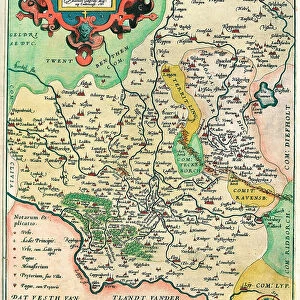
Map of Vermandois and Picardy in Gaul (France), 1570 (engraving)
![]()

Wall Art and Photo Gifts from Fine Art Finder
Map of Vermandois and Picardy in Gaul (France), 1570 (engraving)
LRI4704350 Map of Vermandois and Picardy in Gaul (France), 1570 (engraving) by Ortelius, Abraham (1527-98); Museo Navale di Pegli, Genoa, Italy; (add.info.: Veromanuorum Eorum que Confinium Accurssima Descript Geography map of the territory of Vermandois and Picardy in Gaul (France) from " Theatrum Orbis Terrarum" by Abraham Ortelius (Oertel, Ortell or Ortel, 1527-1598), 1570. Genova, Museo Navale); Luisa Ricciarini; Flemish, out of copyright
Media ID 23334202
© Luisa Ricciarini / Bridgeman Images
Atlas Book Geographical Map Picardy
FEATURES IN THESE COLLECTIONS
> Arts
> Artists
> O
> Abraham Ortelius
> Europe
> Italy
> Liguria
> Genoa
> Fine Art Finder
> Artists
> Abraham Ortelius
> Fine Art Finder
> Artists
> Unknown Artist
> Maps and Charts
> Abraham Ortelius
> Maps and Charts
> Italy
EDITORS COMMENTS
This print showcases a remarkable historical artifact - the "Map of Vermandois and Picardy in Gaul (France), 1570". Created by Abraham Ortelius, a renowned Flemish cartographer, this engraving offers an intricate depiction of the territories of Vermandois and Picardy during the 16th century. The map, part of Ortelius' famous atlas book "Theatrum Orbis Terrarum" provides a highly detailed geographical representation that was considered groundbreaking for its time. It highlights the accurate boundaries and features of these regions in Gaul (now France) with meticulous precision. Displayed at Museo Navale di Pegli in Genoa, Italy, this particular print captures every intricate line engraved by Ortelius himself. The craftsmanship is evident as one admires the delicate strokes that bring life to this historical document. Luisa Ricciarini's expert photography allows us to appreciate not only the beauty but also the significance of this ancient map. As we gaze upon it, we are transported back to a time when exploration and discovery were shaping our understanding of the world. With its rich history and attention to detail, this print serves as both an educational resource for geography enthusiasts and a stunning piece of art for those who appreciate fine craftsmanship. It reminds us how maps have always been powerful tools for understanding our surroundings while simultaneously capturing our imagination with their artistic allure.
MADE IN THE USA
Safe Shipping with 30 Day Money Back Guarantee
FREE PERSONALISATION*
We are proud to offer a range of customisation features including Personalised Captions, Color Filters and Picture Zoom Tools
SECURE PAYMENTS
We happily accept a wide range of payment options so you can pay for the things you need in the way that is most convenient for you
* Options may vary by product and licensing agreement. Zoomed Pictures can be adjusted in the Cart.


