Home > Europe > United Kingdom > Wales > Powys > Newtown
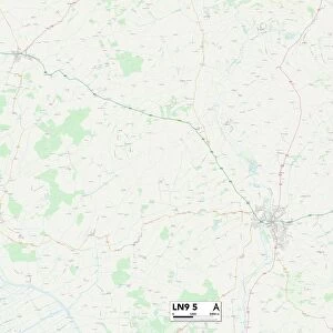
East Lindsey PE23 5 Map

![]()
Wall Art and Photo Gifts from Map Marketing
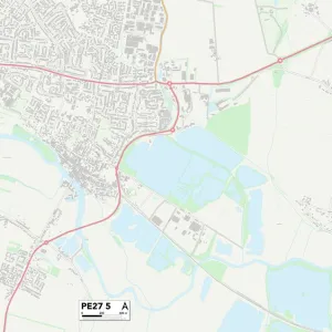
East Lindsey PE23 5 Map
Postcode Sector Map of East Lindsey PE23 5
Media ID 19978106
Ashby Road Back Lane Bakers Lane Beck Lane Blacksmiths Lane Blind Lane Boston Road Brickyard Lane Chapel Lane Church Lane Church Street Clough Lane Cooks Lane East Lindsey Eastfield Road Eastville Road Fen Lane Fen Road Foxglove Close Franklin Way Granary Close Halifax Road Halton Road Hardings Lane High Street Highfield Lane Hill Top Close Howe Lane Ings Lane Jacks Lane Lancaster Close Main Road Manor Drive Market Street Mill Lane Nelson Way New Lane Newtown Northfield Road Old Church Lane Old School Mews Park Avenue Pinfold Lane Post Office Lane Queen Street Raleigh Court Sand Lane Sandy Lane School Lane Simpson Street Spilsby Road Station Road Stones Lane Talbot Close Tennyson Way The Gables The Square The Terrace Vale Court Vale Road Wainfleet Road West End Willoughby Drive Winston Road Woodland View Woodlands Avenue Boothby Sparks Lane Spilsby
FEATURES IN THESE COLLECTIONS
> Animals
> Mammals
> Muridae
> Water Mouse
> Arts
> Artists
> H
> Harding Harding
> Arts
> Artists
> L
> Peter Lely
> Arts
> Portraits
> Pop art gallery
> Street art portraits
> Europe
> United Kingdom
> Wales
> Powys
> Newtown
> Map Marketing
> Postcode Sector Maps
> PE - Peterborough
> Maps and Charts
> Related Images
MADE IN THE USA
Safe Shipping with 30 Day Money Back Guarantee
FREE PERSONALISATION*
We are proud to offer a range of customisation features including Personalised Captions, Color Filters and Picture Zoom Tools
SECURE PAYMENTS
We happily accept a wide range of payment options so you can pay for the things you need in the way that is most convenient for you
* Options may vary by product and licensing agreement. Zoomed Pictures can be adjusted in the Cart.