Home > Europe > United Kingdom > Wales > Powys > Knighton
Leicester LE2 2 Map

![]()
Wall Art and Photo Gifts from Map Marketing
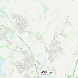
Leicester LE2 2 Map
Postcode Sector Map of Leicester LE2 2
Media ID 19973531
Albert Road Alexandra Road Barrington Road Church Lane Cornfields Dovedale Road Freemantle Road Glebe Close Glebe Road Grenfell Road Leicester Leicester Road Malvern Road Manor Close Manor Road Mere Road Morland Avenue Oaks Way Park Lane Sandown Road Shirley Avenue St Andrews Drive St Davids Crescent Sycamore Close The Broadway The Fairway Westminster Road Stoughton
FEATURES IN THESE COLLECTIONS
> Europe
> United Kingdom
> Scotland
> Fife
> St Andrews
> Europe
> United Kingdom
> Wales
> Pembrokeshire
> St Davids
> Europe
> United Kingdom
> Wales
> Powys
> Knighton
> Europe
> United Kingdom
> Wales
> Powys
> Related Images
> Map Marketing
> Postcode Sector Maps
> LE - Leicester
> Maps and Charts
> Related Images
MADE IN THE USA
Safe Shipping with 30 Day Money Back Guarantee
FREE PERSONALISATION*
We are proud to offer a range of customisation features including Personalised Captions, Color Filters and Picture Zoom Tools
SECURE PAYMENTS
We happily accept a wide range of payment options so you can pay for the things you need in the way that is most convenient for you
* Options may vary by product and licensing agreement. Zoomed Pictures can be adjusted in the Cart.