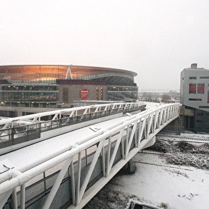
Home > Europe > United Kingdom > England > London > Boroughs > Waltham Forest
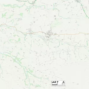
Lancaster LA2 6 Map

![]()
Wall Art and Photo Gifts from Map Marketing
Lancaster LA2 6 Map
Postcode Sector Map of Lancaster LA2 6
Media ID 19973478
Addington Road Arden Close Ascot Gardens Beech Grove Beech Road Chapel Close Church Brow Church Street Croft Avenue Dale Avenue Folly Lane Forge Lane Foundry Lane Goodwood Avenue Green Lane Greenacre Road Halton Hamilton Road Hazelbank High Road Highfield Drive Kirklands Lancaster Lancaster Road Lawson Place Lonsdale Road Low Road Main Road Manor Avenue Manor Close Manor Crescent Manor Drive Manor Lane Manor Road Marine Drive Meadowfield Mill Lane New Street Oak Drive Orchard Close Park Lane Peacock Lane Pine Close Prospect Avenue Prospect Drive Riverside Close Schoolhouse Lane Shady Lane Station Road Summerfield Drive Sunningdale Avenue The Crescent The Drive The Gardens The Knoll Townfield Lane Warren Close Warren Drive Williams Avenue Coastal Road
FEATURES IN THESE COLLECTIONS
> Animals
> Mammals
> Muridae
> House Mouse
> Arts
> Landscape paintings
> Forest and woodland scenes
> Forest artwork
> Arts
> Portraits
> Pop art gallery
> Street art portraits
> Europe
> United Kingdom
> England
> London
> Boroughs
> Waltham Forest
> Europe
> United Kingdom
> Scotland
> Strathclyde
> Hamilton
> Map Marketing
> Postcode Sector Maps
> LA - Lancaster
> Maps and Charts
> Related Images
> North America
> United States of America
> New York
> New York
> Brooklyn
> Marine Park
MADE IN THE USA
Safe Shipping with 30 Day Money Back Guarantee
FREE PERSONALISATION*
We are proud to offer a range of customisation features including Personalised Captions, Color Filters and Picture Zoom Tools
SECURE PAYMENTS
We happily accept a wide range of payment options so you can pay for the things you need in the way that is most convenient for you
* Options may vary by product and licensing agreement. Zoomed Pictures can be adjusted in the Cart.