Home > Europe > United Kingdom > England > London > Boroughs > Greenwich
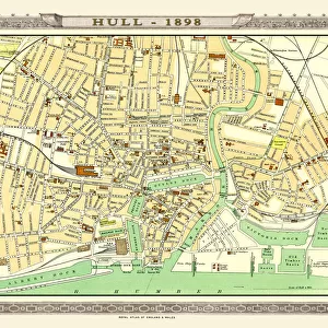
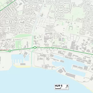
Kingston upon Hull HU9 4 Map

![]()
Wall Art and Photo Gifts from Map Marketing
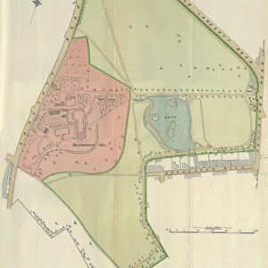
Kingston upon Hull HU9 4 Map
Postcode Sector Map of Kingston upon Hull HU9 4
Media ID 19971234
Annandale Road Anson Road Arran Close Barham Road Berkeley Court Broughton Close Carden Avenue Foxhill Close Garland Close Grange Road Griffin Road Hermes Close Kingston Upon Hull Leander Road Lingdale Road Mallard Road Martin Close Milne Road Shelley Avenue Sherwood Court St Georges Walk Stapleford Close Staveley Road Sutton Way Taylor Avenue Thanet Road The Dales The Orchard Twyford Close Wakefield Avenue Watson Avenue Winchester Avenue Winchester Close Wingfield Road Bainbridge Avenue Greenwich Avenue The Chilterns The Cotswolds
FEATURES IN THESE COLLECTIONS
> Animals
> Birds
> Waterfowl
> Ducks
> Mallard
> Animals
> Mammals
> Soricidae
> Leander
> Arts
> Portraits
> Pop art gallery
> Street art portraits
> Europe
> United Kingdom
> England
> London
> Boroughs
> Greenwich
> Europe
> United Kingdom
> Northern Ireland
> County Antrim
> Larne
> Europe
> United Kingdom
> Wales
> Flintshire
> Broughton
> Map Marketing
> Postcode Sector Maps
> HU - Hull
> Maps and Charts
> Related Images
> North America
> Saint Martin
> Maps
MADE IN THE USA
Safe Shipping with 30 Day Money Back Guarantee
FREE PERSONALISATION*
We are proud to offer a range of customisation features including Personalised Captions, Color Filters and Picture Zoom Tools
SECURE PAYMENTS
We happily accept a wide range of payment options so you can pay for the things you need in the way that is most convenient for you
* Options may vary by product and licensing agreement. Zoomed Pictures can be adjusted in the Cart.