Home > Europe > United Kingdom > England > Surrey > South Park
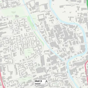
Kingston upon Hull HU4 7 Map

![]()
Wall Art and Photo Gifts from Map Marketing
Kingston upon Hull HU4 7 Map
Postcode Sector Map of Kingston upon Hull HU4 7
Media ID 19971196
Ashby Close Ashby Road Aspen Close Avondale Burnham Road Crispin Close Delius Close First Lane Glenwood Drive Gower Road Graham Avenue Harwood Drive Hickling Close Hull Road Inglewood Drive Kingston Upon Hull Lincoln Green Lulworth Avenue Lynton Avenue Mulberry Lane Netherton Road Newlyn Close Oak Drive Park Walk Pickering Road Poplar Close Rochester Avenue Rosewood Close Saltash Road Sherwood Drive Spring Gardens Springfield Way St Andrews Court St Nicholas Avenue Sullivan Road Taunton Road The Garth Tilbury Road Ulverston Road Valentine Close Vincent Close Westwood Drive
FEATURES IN THESE COLLECTIONS
> Europe
> United Kingdom
> England
> Surrey
> Related Images
> Europe
> United Kingdom
> England
> Surrey
> South Park
> Europe
> United Kingdom
> Scotland
> Fife
> St Andrews
> Map Marketing
> Postcode Sector Maps
> HU - Hull
> Maps and Charts
> Related Images
MADE IN THE USA
Safe Shipping with 30 Day Money Back Guarantee
FREE PERSONALISATION*
We are proud to offer a range of customisation features including Personalised Captions, Color Filters and Picture Zoom Tools
SECURE PAYMENTS
We happily accept a wide range of payment options so you can pay for the things you need in the way that is most convenient for you
* Options may vary by product and licensing agreement. Zoomed Pictures can be adjusted in the Cart.