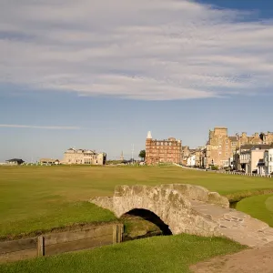
Home > Europe > United Kingdom > Scotland > Fife > St Andrews
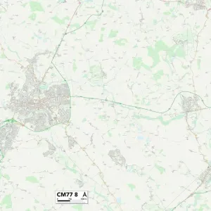
Uttlesford CM6 2 Map

![]()
Wall Art and Photo Gifts from Map Marketing
Uttlesford CM6 2 Map
Postcode Sector Map of Uttlesford CM6 2
Media ID 19966998
Abbey View Bell Lane Birch Road Bradley Close Brook View Burns Way Chapel End Church End Church Gardens Church Street Clare Court Coppice Close Duck Street Dunmow Road Elm Road Glebe Lane Green Lane Hawthorn Way Holly Close Manor Road Margaret Street Mill End Monk Street New Road Olivers Close Orange Street Orchard Close Park Road Park Street School Lane Stoney Lane The Broadway The Causeway The Chase The Drive The Lees The Maltings The Mead The Pightle The Poplars Town Street Uttlesford Vicarage Lane Walden Road Water Lane Watling Street Wells Court Woodside Way Emblems St Clements Thaxted
FEATURES IN THESE COLLECTIONS
> Animals
> Mammals
> Muridae
> Water Mouse
> Arts
> Artists
> C
> Oliver Clare
> Arts
> Portraits
> Pop art gallery
> Street art portraits
> Europe
> United Kingdom
> Scotland
> Fife
> St Andrews
> Map Marketing
> Postcode Sector Maps
> CM - Chelmsford
> Maps and Charts
> Related Images
> Maps and Charts
> Star Charts
> Popular Themes
> Dance
MADE IN THE USA
Safe Shipping with 30 Day Money Back Guarantee
FREE PERSONALISATION*
We are proud to offer a range of customisation features including Personalised Captions, Color Filters and Picture Zoom Tools
SECURE PAYMENTS
We happily accept a wide range of payment options so you can pay for the things you need in the way that is most convenient for you
* Options may vary by product and licensing agreement. Zoomed Pictures can be adjusted in the Cart.