Home > Maps and Charts > Geological Map
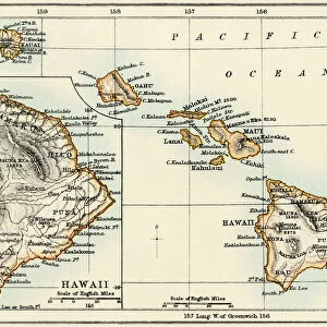
1919, U. S. Geological Survey Map of Nantucket, Massachusetts, topography, cartography

![]()
Wall Art and Photo Gifts from Liszt Collection
1919, U. S. Geological Survey Map of Nantucket, Massachusetts, topography, cartography
1919, U.S. Geological Survey Map of Nantucket, Massachusetts
Liszt Collection of nineteenth-century engravings and images to browse and enjoy
Media ID 14006509
© Artokoloro Quint Lox Limited
1919 Massachusetts Antique Map Atlas Chart Geographic Latitude Longitude Mappa Mundi Old Antique Plan Old Antique View Old Map Ols Antique Map Rare Old Maps Topo
FEATURES IN THESE COLLECTIONS
> Maps and Charts
> Early Maps
> Maps and Charts
> Geological Map
> Maps and Charts
> World
EDITORS COMMENTS
This print showcases a remarkable piece of history - the 1919 U. S. Geological Survey Map of Nantucket, Massachusetts. A true testament to the artistry and precision of cartography, this topographical map offers a glimpse into the geographic features and land formations that define this enchanting island. With its intricate grid lines denoting latitude and longitude, this vintage map serves as an invaluable tool for navigation and exploration. Its detailed illustrations beautifully capture the essence of Nantucket's terrain, providing a visual representation of its diverse regions. As we delve into this rare old map, we are transported back in time to an era when paper maps were essential companions for adventurous souls embarking on journeys across uncharted territories. The aged appearance adds a touch of nostalgia to this historical artifact, evoking feelings of wonderment and curiosity about past civilizations who relied on such maps for their own expeditions. Beyond its practical use, however, this decorative piece also holds artistic value. The carefully crafted lines and shapes create a mesmerizing geometric pattern that is both visually appealing and intellectually stimulating. Whether you are an avid collector or simply appreciate the beauty found in antique maps like these, this stunning print from Liszt Collection is sure to captivate your imagination with its rich history and timeless allure.
MADE IN THE USA
Safe Shipping with 30 Day Money Back Guarantee
FREE PERSONALISATION*
We are proud to offer a range of customisation features including Personalised Captions, Color Filters and Picture Zoom Tools
SECURE PAYMENTS
We happily accept a wide range of payment options so you can pay for the things you need in the way that is most convenient for you
* Options may vary by product and licensing agreement. Zoomed Pictures can be adjusted in the Cart.