Fraud Blocker Skip to main content

Jigsaw Puzzle > Fine Art Finder > Maps (celestial & Terrestrial)

Maps (celestial & Terrestrial) Jigsaw Puzzle Collection (#8)

1,541 Jigsaw Puzzles

Background imageMaps (celestial & Terrestrial) Jigsaw Puzzle Collection: Map of Belgium at the time of the Thirty Years War (1618-48)

Map of Belgium at the time of the Thirty Years War (1618-48)
CHT191865 Map of Belgium at the time of the Thirty Years War (1618-48), from the Theatre des guerres entre le roy d Espagne et les Estats de Hollande (known as the Atlas de Richelieu)

Background imageMaps (celestial & Terrestrial) Jigsaw Puzzle Collection: Canal du Midi, linking the Atlantic to the Mediterranean

Canal du Midi, linking the Atlantic to the Mediterranean
CHT199641 Canal du Midi, linking the Atlantic to the Mediterranean, beginning at Toulouse and ending, after Agde, at the Etang de Thau (b/w photo of 17th c)

Background imageMaps (celestial & Terrestrial) Jigsaw Puzzle Collection: The Carte du Tendre, a map of an imaginary country

The Carte du Tendre, a map of an imaginary country
CHT175289 The Carte du Tendre, a map of an imaginary country, from volume II of Clelie written by Mademoiselle de Scudery

Background imageMaps (celestial & Terrestrial) Jigsaw Puzzle Collection: Map of Lotharingia, from Atlas sive cosmographicae meditationes de fabrica mundi et

Map of Lotharingia, from Atlas sive cosmographicae meditationes de fabrica mundi et
MAE177372 Map of Lotharingia, from Atlas sive cosmographicae meditationes de fabrica mundi et fabricati figura, published by Hondius in c.1632 (coloured engraving) by Mercator

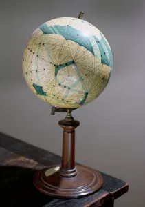
Background imageMaps (celestial & Terrestrial) Jigsaw Puzzle Collection: Globe of the planet Mars, made 1903-09

Globe of the planet Mars, made 1903-09
CHT176313 Globe of the planet Mars, made 1903-09 by Lowell, Percival (1855-1916) (after); Observatoire Camille Flammarion, Juvisy

Background imageMaps (celestial & Terrestrial) Jigsaw Puzzle Collection: Plan of proposed street running from Charing Cross to Portland Place, 1848 (colour litho)

Plan of proposed street running from Charing Cross to Portland Place, 1848 (colour litho)
GHL6094 Plan of proposed street running from Charing Cross to Portland Place, 1848 (colour litho) by English School, (19th century); London Metropolitan Archives

Background imageMaps (celestial & Terrestrial) Jigsaw Puzzle Collection: Venice, detail from the Galleria dell Carte Geografiche, 1580-83

Venice, detail from the Galleria dell Carte Geografiche, 1580-83
SAL55094 Venice, detail from the Galleria dell Carte Geografiche, 1580-83 by Danti, Egnazio (1536-86); Vatican Museums and Galleries

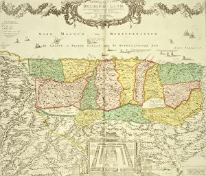
Background imageMaps (celestial & Terrestrial) Jigsaw Puzzle Collection: Map of the Holy Land, pub. by Jan Barend Elwe, Amsterdam, 1742 (engraving)

Map of the Holy Land, pub. by Jan Barend Elwe, Amsterdam, 1742 (engraving)
STC101844 Map of the Holy Land, pub. by Jan Barend Elwe, Amsterdam, 1742 (engraving) by Dutch School, (18th century); Private Collection; The Stapleton Collection; Dutch, out of copyright

Background imageMaps (celestial & Terrestrial) Jigsaw Puzzle Collection: Map of Florence, 1595 (engraving)

Map of Florence, 1595 (engraving)
BAT100306 Map of Florence, 1595 (engraving) by Florimi, Matteo (fl.1580-1603); Museo di Firenze Com era, Florence, Italy; Photo eNicol Orsi Battaglini; Italian, out of copyright

Background imageMaps (celestial & Terrestrial) Jigsaw Puzzle Collection: Map of Florence, 1584 (engraving)

Map of Florence, 1584 (engraving)
BAT100301 Map of Florence, 1584 (engraving) by Buonsignori, Stefano (d.1589); Museo di Firenze Com era, Florence, Italy; Photo eNicol Orsi Battaglini; Italian, out of copyright

Background imageMaps (celestial & Terrestrial) Jigsaw Puzzle Collection: Miniature Nautical Map of the Central Mediterranean, 1560 (parchment)

Miniature Nautical Map of the Central Mediterranean, 1560 (parchment)
FTB97043 Miniature Nautical Map of the Central Mediterranean, 1560 (parchment) by Prunes, Matteo (fl.1560); Museo Correr, Venice, Italy; Italian, out of copyright

Background imageMaps (celestial & Terrestrial) Jigsaw Puzzle Collection: Miniature Nautical Map of the Adriatic, 1624 (parchment)

Miniature Nautical Map of the Adriatic, 1624 (parchment)
FTB97042 Miniature Nautical Map of the Adriatic, 1624 (parchment) by Gramolin, Alvise (fl.1624); Museo Correr, Venice, Italy; Italian, out of copyright

Background imageMaps (celestial & Terrestrial) Jigsaw Puzzle Collection: Map of Sixteenth Century India, from the Sala del Mappamondo

Map of Sixteenth Century India, from the Sala del Mappamondo
BEN95817 Map of Sixteenth Century India, from the Sala del Mappamondo (Hall of the World Maps) c.1574-5 (fresco) by Vecchi, Giovanni de (1536-1615) (and workshop); Villa Farnese, Caprarola, Voterbo

Background imageMaps (celestial & Terrestrial) Jigsaw Puzzle Collection: Map of Mexico and Central America, from the Sala dell Carte Geografiche

Map of Mexico and Central America, from the Sala dell Carte Geografiche
BEN95492 Map of Mexico and Central America, from the Sala dell Carte Geografiche (Hall of Geographical Maps) c.1570 (oil on panel) by Danti

Background imageMaps (celestial & Terrestrial) Jigsaw Puzzle Collection: Map of Sixteenth Century Japan, from the Sala delle Carte Geografiche

Map of Sixteenth Century Japan, from the Sala delle Carte Geografiche
BEN90578 Map of Sixteenth Century Japan, from the Sala delle Carte Geografiche (Hall of Geographical Maps) 1575 (oil on panel) by Bonsignori, Stefano and Danti

Background imageMaps (celestial & Terrestrial) Jigsaw Puzzle Collection: MS CCC 2* f. 2v Map of Palestine (parchment)

MS CCC 2* f. 2v Map of Palestine (parchment)
CCC95535 MS CCC 2* f.2v Map of Palestine (parchment) by Paris, Matthew (c.1200-59); Corpus Christi College, Oxford, UK; English, out of copyright

Background imageMaps (celestial & Terrestrial) Jigsaw Puzzle Collection: Map of Southern Britain, coloured to show geological areas of interest

Map of Southern Britain, coloured to show geological areas of interest
ONH95278 Map of Southern Britain, coloured to show geological areas of interest, annotated by William Smith (1769-1839) (engraving) by Cary

Background imageMaps (celestial & Terrestrial) Jigsaw Puzzle Collection: RS / OS168, Frontispiece to Oxonia antiqua restaurata

RS / OS168, Frontispiece to Oxonia antiqua restaurata
NCO90870 RS/OS168, Frontispiece to Oxonia antiqua restaurata, a birds eye view of Oxford, reduced version of the original by Ralph or Radulph Agas (c.1540-1621) of 1578, by Joseph Skelton, Oxford

Background imageMaps (celestial & Terrestrial) Jigsaw Puzzle Collection: Map of the Turkish Empire, from the Mercator Atlas pub

Map of the Turkish Empire, from the Mercator Atlas pub
STC101840 Map of the Turkish Empire, from the Mercator Atlas pub. by Jodocus Hondius (1563-1612) Amsterdam, 1606 (engraving) by Dutch School

Background imageMaps (celestial & Terrestrial) Jigsaw Puzzle Collection: Map of Persia, from the Theatrum Orbis Terrarum, pub

Map of Persia, from the Theatrum Orbis Terrarum, pub
STC101839 Map of Persia, from the Theatrum Orbis Terrarum, pub. by Abraham Ortelius (1527-98) Antwerp, c.1590 (engraving) by Dutch School

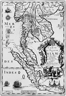
Background imageMaps (celestial & Terrestrial) Jigsaw Puzzle Collection: Map of the Kingdom of Siam, Paris, 1686 (engraving) (b / w photo)

Map of the Kingdom of Siam, Paris, 1686 (engraving) (b / w photo)
CHT286981 Map of the Kingdom of Siam, Paris, 1686 (engraving) (b/w photo) by French School, (17th century); Bibliotheque Nationale, Paris

Background imageMaps (celestial & Terrestrial) Jigsaw Puzzle Collection: World map of the different time zones, published by Blondel La Rougery in Paris c

World map of the different time zones, published by Blondel La Rougery in Paris c
CHT277803 World map of the different time zones, published by Blondel La Rougery in Paris c.1920 (colour litho) by French School

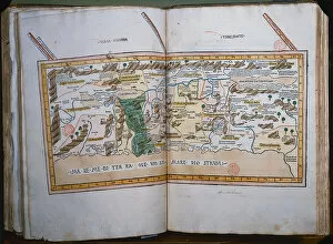
Background imageMaps (celestial & Terrestrial) Jigsaw Puzzle Collection: Inc. 425 Map of the Holy Land, based on descriptions and co-ordinates given in

Inc. 425 Map of the Holy Land, based on descriptions and co-ordinates given in
BMR221547 Inc. 425 Map of the Holy Land, based on descriptions and co-ordinates given in Cosmographica, by Ptolemy (Claudius Ptolemaeus of Alexandria) (c.90-168 AD) published in Ulm, Germany

Background imageMaps (celestial & Terrestrial) Jigsaw Puzzle Collection: A New and Correct Map of Hackney Marsh, 1745 (litho)

A New and Correct Map of Hackney Marsh, 1745 (litho)
STC222029 A New and Correct Map of Hackney Marsh, 1745 (litho) by Davies, Robert (fl.1745); Private Collection; (add.info.: New Cut surveyed and added 1799 by W.H)

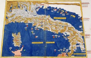
Background imageMaps (celestial & Terrestrial) Jigsaw Puzzle Collection: Ptolemaic Map of Italy, 1482 (coloured litho)

Ptolemaic Map of Italy, 1482 (coloured litho)
STC221897 Ptolemaic Map of Italy, 1482 (coloured litho) by Germanus, Nicolaus (fl.1464-71); Private Collection; (add.info)

Background imageMaps (celestial & Terrestrial) Jigsaw Puzzle Collection: Map of Fort Rosalie des Natchez, Louisiana (gouache on paper)

Map of Fort Rosalie des Natchez, Louisiana (gouache on paper)
CHT231125 Map of Fort Rosalie des Natchez, Louisiana (gouache on paper) by French School, (18th century); Bibliotheque Nationale de Cartes et Plans, Paris, France; eArchives Charmet; French

Background imageMaps (celestial & Terrestrial) Jigsaw Puzzle Collection: Map depicting plantations on the Mississippi River from Natchez to New Orleans

Map depicting plantations on the Mississippi River from Natchez to New Orleans
CHT231119 Map depicting plantations on the Mississippi River from Natchez to New Orleans, 1858 (colour litho) by American School, (19th century); Private Collection; eArchives Charmet; American

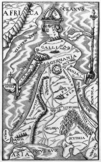
Background imageMaps (celestial & Terrestrial) Jigsaw Puzzle Collection: Map of Europe, illustration from Le Magasin Pittoresque

Map of Europe, illustration from Le Magasin Pittoresque
CHT230813 Map of Europe, illustration from Le Magasin Pittoresque, 1849 (engraving) (b/w photo) by French School, (19th century); Bibliotheque des Arts Decoratifs, Paris

Background imageMaps (celestial & Terrestrial) Jigsaw Puzzle Collection: The Ptolemaic System, from Description de l Univers

The Ptolemaic System, from Description de l Univers
CHT223717 The Ptolemaic System, from Description de l Univers by Alain Manesson Mallet (1630-1706) 1683 (engraving) (b/w photo) by French School, (17th century); Bibliotheque des Arts Decoratifs

Background imageMaps (celestial & Terrestrial) Jigsaw Puzzle Collection: The Copernican System, from Description de l Univers

The Copernican System, from Description de l Univers
CHT223715 The Copernican System, from Description de l Univers by Alain Manesson Mallet (1630-1706) 1683 (engraving) (b/w photo) by French School, (17th century); Bibliotheque des Arts Decoratifs

Background imageMaps (celestial & Terrestrial) Jigsaw Puzzle Collection: Bologna, detail from the Galleria delle Carte Geografiche, 1580-83

Bologna, detail from the Galleria delle Carte Geografiche, 1580-83
SAL205563 Bologna, detail from the Galleria delle Carte Geografiche, 1580-83 by Danti, Egnazio (1536-86); Vatican Museums and Galleries

Background imageMaps (celestial & Terrestrial) Jigsaw Puzzle Collection: The Great Empires in the Time of Charlemagne, c. 1850 (engraving)

The Great Empires in the Time of Charlemagne, c. 1850 (engraving)
KW206614 The Great Empires in the Time of Charlemagne, c.1850 (engraving) by Hughes, W (fl. c.1850); Private Collection; British, out of copyright

Background imageMaps (celestial & Terrestrial) Jigsaw Puzzle Collection: The Localities and Gradual Advance of the Barbarian Nations, c. 1850 (engraving)

The Localities and Gradual Advance of the Barbarian Nations, c. 1850 (engraving)
KW206613 The Localities and Gradual Advance of the Barbarian Nations, c.1850 (engraving) by Hughes, W (fl. c.1850); Private Collection; British, out of copyright

Background imageMaps (celestial & Terrestrial) Jigsaw Puzzle Collection: The Roman Empire, c. 1850 (engraving)

The Roman Empire, c. 1850 (engraving)
KW206610 The Roman Empire, c.1850 (engraving) by Hughes, W (fl. c.1850); Private Collection; British, out of copyright

Background imageMaps (celestial & Terrestrial) Jigsaw Puzzle Collection: Map of West African coastline, 1596 (hand coloured engraving)

Map of West African coastline, 1596 (hand coloured engraving)
STC239179 Map of West African coastline, 1596 (hand coloured engraving) by Langren, Arnold Florent van (1571-1644); 39x56 cm; Private Collection; (add.info)

Background imageMaps (celestial & Terrestrial) Jigsaw Puzzle Collection: The Travellers Pocket Map of Louisiana, published in 1830 (coloured engraving)

The Travellers Pocket Map of Louisiana, published in 1830 (coloured engraving)
NBY332324 The Travellers Pocket Map of Louisiana, published in 1830 (coloured engraving) by Brose, W. (fl.1830); 41x51 cm; Newberry Library, Chicago, Illinois, USA; eNewberry Library; American

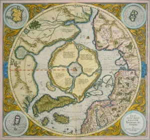
Background imageMaps (celestial & Terrestrial) Jigsaw Puzzle Collection: Septentrionalium Terrarum descriptio, 1595 (coloured engraving)

Septentrionalium Terrarum descriptio, 1595 (coloured engraving)
NBY332291 Septentrionalium Terrarum descriptio, 1595 (coloured engraving) by Mercator, Gerardus (1512-94); Newberry Library, Chicago, Illinois, USA; eNewberry Library; Flemish, out of copyright

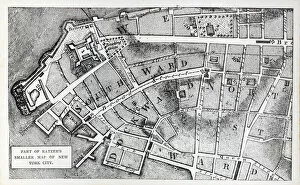
Background imageMaps (celestial & Terrestrial) Jigsaw Puzzle Collection: Part of Bernard Ratzers smaller map of New York City (litho)

Part of Bernard Ratzers smaller map of New York City (litho)
PNP329789 Part of Bernard Ratzers smaller map of New York City (litho) by American School, (18th century); Private Collection; Peter Newark American Pictures; American, out of copyright

Background imageMaps (celestial & Terrestrial) Jigsaw Puzzle Collection: Illustration of the differing measurements of the league in Germany, Brabant

Illustration of the differing measurements of the league in Germany, Brabant
CHT331721 Illustration of the differing measurements of the league in Germany, Brabant, France and Italy, from Theatre des guerres entre le roy d espagne et les Estats de Hollande

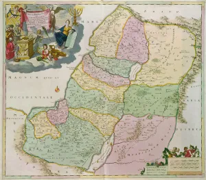
Background imageMaps (celestial & Terrestrial) Jigsaw Puzzle Collection: Map of the Holy Land (coloured engraving)

Map of the Holy Land (coloured engraving)
VNK249240 Map of the Holy Land (coloured engraving) by Danckerts, Theodorus (1663-1727); Vorontsov Palace, Crimea, Ukraine; (add.info.: carte de la Judee)

Background imageMaps (celestial & Terrestrial) Jigsaw Puzzle Collection: Map of the parish of St. Paul, Covent Garden, showing the site of Bedford House

Map of the parish of St. Paul, Covent Garden, showing the site of Bedford House
GHL254051 Map of the parish of St. Paul, Covent Garden, showing the site of Bedford House and grounds, published by W.P. Metchim, 1686 (litho) by Leybourn

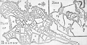
Background imageMaps (celestial & Terrestrial) Jigsaw Puzzle Collection: Map of Boston, printed in Bickerstaffs Albany Almanack, 1776 (print)

Map of Boston, printed in Bickerstaffs Albany Almanack, 1776 (print)
AQS256832 Map of Boston, printed in Bickerstaffs Albany Almanack, 1776 (print) by American School, (18th century); American Antiquarian Society, Worcester, Massachusetts, USA; eCourtesy

Background imageMaps (celestial & Terrestrial) Jigsaw Puzzle Collection: Street map of Dallas, Texas, 1872 (colour litho)

Street map of Dallas, Texas, 1872 (colour litho)
DHS212726 Street map of Dallas, Texas, 1872 (colour litho) by Brosius, Herman (1851-1917) (attr. to); Dallas Historical Society, Texas, USA; eDallas Historical Society; American, out of copyright

Background imageMaps (celestial & Terrestrial) Jigsaw Puzzle Collection: Map of Leeds, surveyed by John Tuke, 1781

Map of Leeds, surveyed by John Tuke, 1781
LMG209319 Map of Leeds, surveyed by John Tuke, 1781 by English School, (18th century); Leeds Museums and Galleries (Leeds Art Gallery) U.K.; eLeeds Museums and Galleries; English, out of copyright

Background imageMaps (celestial & Terrestrial) Jigsaw Puzzle Collection: Ms 25517 / 1 fol. 88 Map of the village of Belchamp St. Paul

Ms 25517 / 1 fol. 88 Map of the village of Belchamp St. Paul
SPC210579 Ms 25517/1 fol.88 Map of the village of Belchamp St. Paul, 1576 (pen & ink and w/c on paper) by Amyce, Israel (fl.1576); St. Pauls Cathedral Library, London, UK; eSt

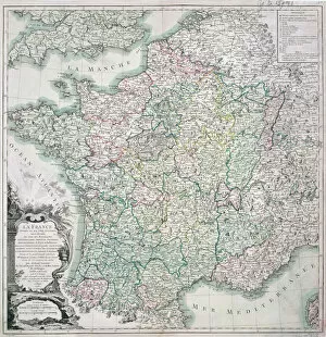
Background imageMaps (celestial & Terrestrial) Jigsaw Puzzle Collection: Map of France as Divided into 58 Provinces, 1765 (coloured engraving)

Map of France as Divided into 58 Provinces, 1765 (coloured engraving)
CHT170173 Map of France as Divided into 58 Provinces, 1765 (coloured engraving) by Desnos, Louis-Charles (c.1725-c.1800); Bibliotheque Nationale, Paris

Background imageMaps (celestial & Terrestrial) Jigsaw Puzzle Collection: Map representing the approximate tonnage of wines and spirits in circulation in France in

Map representing the approximate tonnage of wines and spirits in circulation in France in
CHT189341 Map representing the approximate tonnage of wines and spirits in circulation in France in 1857 by water and by railway, 1860 (colour litho) by Minard

Background imageMaps (celestial & Terrestrial) Jigsaw Puzzle Collection: The Lunar Globe, 1745-1806

The Lunar Globe, 1745-1806
BIR189293 The Lunar Globe, 1745-1806 by Russell, John (1745-1806); Birmingham Museums and Art Gallery; (add.info.: Russell made the first English lunar map; ); English, out of copyright


All Professionally Made to Order for Quick Shipping


-

Why Choose Us?

We are a leading provider of Art Prints and Photo Gifts since 2003, working in partnership with a range of Sporting Clubs, Charities, Museums and Picture Libraries. A large share of profits from any of their images will go directly towards supporting that charity or club. Our archive of images is carefully curated to bring you a wide range of subjects, including landscapes, wildlife, architecture, and more. We ship from our partner labs in the UK, USA, EU (Netherlands) and Australia.
+

How do I place an order?

Ordering is quick & easy - Just follow 5 Simple Steps:
  1. Find your image: Use our search box or browse our online photo Collections to find the image you want.

  2. Choose your print format: Select your desired product and add it to your cart.

  3. Enter your details: If you're a returning customer, simply enter your email address and password, and we'll fill in your billing and shipping address details. All personal details are held securely and are fully GDPR compliant. As standard, we remove all Personally Identifiable Information after 12 months.

  4. Pay for your purchase: We use state-of-the-art security for online shopping and do not have access to your card details.

  5. Sit back and relax: We'll email you confirmation of your order and when it's dispatched. Registered customers can also track orders in the 'My Account' area.

+

How do I pay for an order?

You can pay for your order with most of the major credit and debit cards, or PayPal. For added security, major financial institutions process payment details separately and securely on our behalf. We do not have access to your online payment card details. Online payments are preferred however we do take phone orders. For UK customers only we accept cheques issued against a UK bank.
+

Is my data safe?

We take data security very seriously. We do not have access to your full card details and all payments are requested over a fully secure connection. Additionally, we fully comply with current European and GDPR legislation, and automatically remove all personal data after at most 12 months (unless you have an account with us and have signed in recently). We also have a strict opt-in policy and would never sell your personal details. Your data is only used to fulfill your order promptly and efficiently.
+

Is wall art ready to hang?

For quick and easy installation all wall art, including framed prints, canvas prints and metal prints are supplied with a ready to hang solution on the back. Generally, saw tooth hangers are applied as they allow wall art to hang flush against the wall. The serrated edge of the hanger prevents the frame from shifting or tilting when hung.
+

Are the photo prints fade resistant?

Yes, we use archival quality photo paper photographic paper for vivid reproduction Prints are an accurate representations of the original artwork, which is preserved for artistic character and authenticity. We guarantee they match previews shown on our web site