Fraud Blocker Skip to main content

Home > Fine Art Finder > Maps (celestial & Terrestrial)

Maps (celestial & Terrestrial) Collection (page 7)

1,542 items

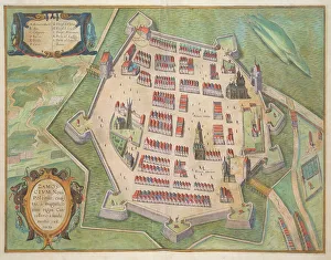
Background imageMaps (celestial & Terrestrial) Collection: Map of Zamosc, from Civitates Orbis Terrarum by Georg Braun (1541-1622

Map of Zamosc, from Civitates Orbis Terrarum by Georg Braun (1541-1622
STC138958 Map of Zamosc, from Civitates Orbis Terrarum by Georg Braun (1541-1622) and Frans Hogenberg (1535-90) c.1572-1617 (coloured engraving) by Hoefnagel

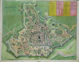
Background imageMaps (celestial & Terrestrial) Collection: Map of Padua, from Civitates Orbis Terrarum by Georg Braun (1541-1622

Map of Padua, from Civitates Orbis Terrarum by Georg Braun (1541-1622
STC138956 Map of Padua, from Civitates Orbis Terrarum by Georg Braun (1541-1622) and Frans Hogenberg (1535-90) c.1572-1617 (coloured engraving) by Hoefnagel

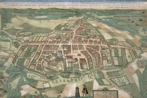
Background imageMaps (celestial & Terrestrial) Collection: Map of Odense, from Civitates Orbis Terrarum by Georg Braun (1541-1622

Map of Odense, from Civitates Orbis Terrarum by Georg Braun (1541-1622
STC138948 Map of Odense, from Civitates Orbis Terrarum by Georg Braun (1541-1622) and Frans Hogenberg (1535-90) 1597 (coloured engraving) by Hoefnagel

Background imageMaps (celestial & Terrestrial) Collection: Map of Chios, from Civitates Orbis Terrarum by Georg Braun (1541-1622

Map of Chios, from Civitates Orbis Terrarum by Georg Braun (1541-1622
STC138947 Map of Chios, from Civitates Orbis Terrarum by Georg Braun (1541-1622) and Frans Hogenberg (1535-90) c.1572-1617 (coloured engraving) by Hoefnagel

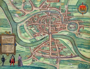
Background imageMaps (celestial & Terrestrial) Collection: Map of Bristol, from Civitates Orbis Terrarum by Georg Braun (1541-1622

Map of Bristol, from Civitates Orbis Terrarum by Georg Braun (1541-1622
STC138922 Map of Bristol, from Civitates Orbis Terrarum by Georg Braun (1541-1622) and Frans Hogenberg (1535-90) c.1572-1617 (coloured engraving) by Hoefnagel

Background imageMaps (celestial & Terrestrial) Collection: Map of the City and Portuguese Port of Goa, India, detail of port and merchant shipping

Map of the City and Portuguese Port of Goa, India, detail of port and merchant shipping
STC110751 Map of the City and Portuguese Port of Goa, India, detail of port and merchant shipping, 1595 (engraving) (detail of 110750) by Doetechum, Johannes Baptista van

Background imageMaps (celestial & Terrestrial) Collection: General map including Arabia, Japan, the Korean peninsula

General map including Arabia, Japan, the Korean peninsula
BON111061 General map including Arabia, Japan, the Korean peninsula and the greater part of the Indonesian archipelago, 1631 (colour engraving) by Hondius

Background imageMaps (celestial & Terrestrial) Collection: Monoceros, from A Celestial Atlas, pub. in 1822 (coloured engraving)

Monoceros, from A Celestial Atlas, pub. in 1822 (coloured engraving)
STC129815 Monoceros, from A Celestial Atlas, pub. in 1822 (coloured engraving) by Jamieson, Alexander (fl.1820); Private Collection; (add.info)

Background imageMaps (celestial & Terrestrial) Collection: Virgo, from A Celestial Atlas, pub. in 1822 (coloured engraving)

Virgo, from A Celestial Atlas, pub. in 1822 (coloured engraving)
STC129812 Virgo, from A Celestial Atlas, pub. in 1822 (coloured engraving) by Jamieson, Alexander (fl.1820); Private Collection; (add.info)

Background imageMaps (celestial & Terrestrial) Collection: Plate 27 from Atlas Coelestis, by John Flamsteed (1646-1719), pub

Plate 27 from Atlas Coelestis, by John Flamsteed (1646-1719), pub
STC128640 Plate 27 from Atlas Coelestis, by John Flamsteed (1646-1719), pub. in 1729 (hand coloured engraving) by Thornhill

Background imageMaps (celestial & Terrestrial) Collection: Plan of Lopburi, 1751 (litho)

Plan of Lopburi, 1751 (litho)
LIT389801 Plan of Lopburi, 1751 (litho) by French School, (18th century); (add.info.: made in Paris; Plan de la Ville de Louvo, demeure ordinaire des Rois de Siam; ); Photo eLuca Tettoni; French

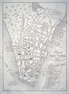
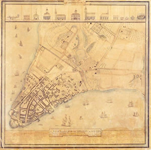
Background imageMaps (celestial & Terrestrial) Collection: Plan of New York in 1729 (litho)

Plan of New York in 1729 (litho)
PNP351119 Plan of New York in 1729 (litho) by English School; Private Collection; Peter Newark American Pictures; English, out of copyright

Background imageMaps (celestial & Terrestrial) Collection: Map of New York in 1766-67 (w / c on paper)

Map of New York in 1766-67 (w / c on paper)
PNP351108 Map of New York in 1766-67 (w/c on paper) by American School, (18th century); Private Collection; (add.info.: map surveyed by Lt)

Background imageMaps (celestial & Terrestrial) Collection: Map of Berlin, printed by C. L. Keller, Berlin, 1890 (colour litho)

Map of Berlin, printed by C. L. Keller, Berlin, 1890 (colour litho)
AGD355564 Map of Berlin, printed by C.L. Keller, Berlin, 1890 (colour litho) by Straube, Jul. (fl.1890); 51.1x65.2 cm; Private Collection; (add.info.: Illustrierter Plan von Berlin; ); German

Background imageMaps (celestial & Terrestrial) Collection: Map of Berlin, 1802 (coloured engraving)

Map of Berlin, 1802 (coloured engraving)
AGD355561 Map of Berlin, 1802 (coloured engraving) by Schneider, J.F. (fl.1802); Private Collection; (add.info.: Plan von Berlin nebst denen umliegenden Gegenden; ); German, out of copyright

Background imageMaps (celestial & Terrestrial) Collection: Map of Berlin and Coelln, 1688 (engraving)

Map of Berlin and Coelln, 1688 (engraving)
AGD355556 Map of Berlin and Coelln, 1688 (engraving) by Schultz, Joh. Bernhard (fl.1688); 47.5x142.7 cm; Private Collection; (add.info)

Background imageMaps (celestial & Terrestrial) Collection: Map of Berlin and Coelln, 1652 (engraving)

Map of Berlin and Coelln, 1652 (engraving)
AGD355554 Map of Berlin and Coelln, 1652 (engraving) by Memhardt, Johann Gregor (1607-78); 26.5x35.8 cm; Private Collection; (add.info)

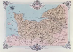
Background imageMaps (celestial & Terrestrial) Collection: Map of Normandy, from the 1st volume of La Normandie Illustree

Map of Normandy, from the 1st volume of La Normandie Illustree
CHT386009 Map of Normandy, from the 1st volume of La Normandie Illustree, engraved by Charpentier, published in Nantes 1852 (litho) by Benoist

Background imageMaps (celestial & Terrestrial) Collection: Map of the Coast of Malabar, East Indies, 1672 (engraving)

Map of the Coast of Malabar, East Indies, 1672 (engraving)
STC434932 Map of the Coast of Malabar, East Indies, 1672 (engraving) by Dutch School, (17th century); Private Collection; (add.info)

Background imageMaps (celestial & Terrestrial) Collection: Map of New Spain, New Galicia and Guatemala, 1625 (coloured engraving)

Map of New Spain, New Galicia and Guatemala, 1625 (coloured engraving)
REV397910 Map of New Spain, New Galicia and Guatemala, 1625 (coloured engraving) by Spanish School, (17th century); Biblioteca Nacional de Mexico, Mexico; Spanish, out of copyright

Background imageMaps (celestial & Terrestrial) Collection: Ms 1288 Chart of the Sea Coasts of England & Ireland and of the Bay of Biscay (engraving)

Ms 1288 Chart of the Sea Coasts of England & Ireland and of the Bay of Biscay (engraving)
BIF391161 Ms 1288 Chart of the Sea Coasts of England & Ireland and of the Bay of Biscay (engraving) by Seller, John (1632-97); Bibliotheque de l Institut de France, Paris, France; English

Background imageMaps (celestial & Terrestrial) Collection: Ms. 89 Higden fol. 13v Map of the World (ink on vellum)

Ms. 89 Higden fol. 13v Map of the World (ink on vellum)
CCC397776 Ms.89 Higden fol.13v Map of the World (ink on vellum) by Higden, Ranulf (d.1364); Corpus Christi College, Oxford

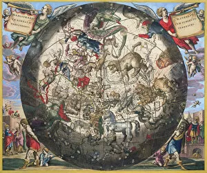
Background imageMaps (celestial & Terrestrial) Collection: Northern (Boreal) Hemisphere, from The Celestial Atlas

Northern (Boreal) Hemisphere, from The Celestial Atlas
OPT395357 Northern (Boreal) Hemisphere, from The Celestial Atlas, or the Harmony of the Universe, engraved by Pieter Schenk (1660-1719) and Gerard Valk (1651-1726) (hand-coloured engraving)

Background imageMaps (celestial & Terrestrial) Collection: Map of Manhattan, c. 1740 (colour litho)

Map of Manhattan, c. 1740 (colour litho)
NYH412353 Map of Manhattan, c.1740 (colour litho) by Grim, David (18th Century); Collection of the New-York Historical Society, USA; eNew York Historical Society; American, out of copyright

Background imageMaps (celestial & Terrestrial) Collection: Atlas of the United States, 1824 (litho)

Atlas of the United States, 1824 (litho)
497554 Atlas of the United States, 1824 (litho) by KlinckowstrAom, Axel Leonhard (1775-1837); 44x56 cm; Gilder Lehrman Collection, New York

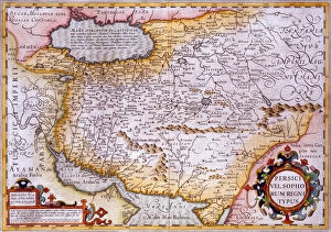
Background imageMaps (celestial & Terrestrial) Collection: Map of Persia, 1638 (hand-coloured engraving)

Map of Persia, 1638 (hand-coloured engraving)
619430 Map of Persia, 1638 (hand-coloured engraving) by Mercator, Gerard (1512-94) (after); Private Collection; The Stapleton Collection; Flemish, out of copyright

Background imageMaps (celestial & Terrestrial) Collection: Sketch showing defences and channels of Charleston Harbour, June 1864 (ink on oilcloth)

Sketch showing defences and channels of Charleston Harbour, June 1864 (ink on oilcloth)
696119 Sketch showing defences and channels of Charleston Harbour, June 1864 (ink on oilcloth) by Bartelle, Charles V. (fl.1864); 37.3x56 cm; Gilder Lehrman Collection, New York

Background imageMaps (celestial & Terrestrial) Collection: A new and general map of the middle dominion belonging to the United States

A new and general map of the middle dominion belonging to the United States
696116 A new and general map of the middle dominion belonging to the United States, 14th May 1794 (colour litho) by Whittle, James (1757-1818) and Laurie

Background imageMaps (celestial & Terrestrial) Collection: The Harbour of Charlestown [Charleston] in South Carolina, 1780 (colour litho)

The Harbour of Charlestown [Charleston] in South Carolina, 1780 (colour litho)
696112 The Harbour of Charlestown [Charleston] in South Carolina, 1780 (colour litho) by DesBarres, Joseph Frederick Wallet (1721-1824); Gilder Lehrman Collection, New York

Background imageMaps (celestial & Terrestrial) Collection: Map of Mexico and Cuzco, from Civitates Orbis Terrarum

Map of Mexico and Cuzco, from Civitates Orbis Terrarum
STC121080 Map of Mexico and Cuzco, from Civitates Orbis Terrarum by Georg Braun (1541-1622) and Frans Hogenberg (1535-90), c.1572 (coloured engraving) by Hoefnagel

Background imageMaps (celestial & Terrestrial) Collection: Map of Venice, from Civitates Orbis Terrarum by Georg Braun (1541-1622

Map of Venice, from Civitates Orbis Terrarum by Georg Braun (1541-1622
STC121071 Map of Venice, from Civitates Orbis Terrarum by Georg Braun (1541-1622) and Frans Hogenberg (1535-90), c.1572 (coloured engraving) by Hoefnagel

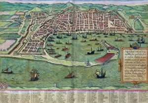
Background imageMaps (celestial & Terrestrial) Collection: Map of Messina, from Civitates Orbis Terrarum by Georg Braun (1541-1622

Map of Messina, from Civitates Orbis Terrarum by Georg Braun (1541-1622
STC121065 Map of Messina, from Civitates Orbis Terrarum by Georg Braun (1541-1622) and Frans Hogenberg (1535-90), c.1572 (coloured engraving) by Hoefnagel

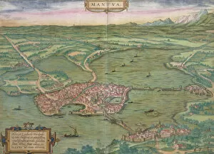
Background imageMaps (celestial & Terrestrial) Collection: Map of Mantua, from Civitates Orbis Terrarum by Georg Braun (1541-1622

Map of Mantua, from Civitates Orbis Terrarum by Georg Braun (1541-1622
STC121064 Map of Mantua, from Civitates Orbis Terrarum by Georg Braun (1541-1622) and Frans Hogenberg (1535-90), 1575 (coloured engraving) by Hoefnagel

Background imageMaps (celestial & Terrestrial) Collection: Map of Genoa and Florence, from Civitates Orbis Terrarum

Map of Genoa and Florence, from Civitates Orbis Terrarum
STC121063 Map of Genoa and Florence, from Civitates Orbis Terrarum by Georg Braun (1541-1622) and Frans Hogenberg (1535-90), c.1572 (coloured engraving) by Hoefnagel

Background imageMaps (celestial & Terrestrial) Collection: Map of Candia and Corfu, from Civitates Orbis Terrarum

Map of Candia and Corfu, from Civitates Orbis Terrarum
STC121057 Map of Candia and Corfu, from Civitates Orbis Terrarum by Georg Braun (1541-1622) and Frans Hogenberg (1535-90), c.1572 (coloured engraving) by Hoefnagel

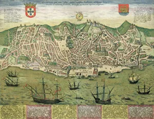
Background imageMaps (celestial & Terrestrial) Collection: Map of Lisbon, from Civitates Orbis Terrarum by Georg Braun (1541-1622

Map of Lisbon, from Civitates Orbis Terrarum by Georg Braun (1541-1622
STC121056 Map of Lisbon, from Civitates Orbis Terrarum by Georg Braun (1541-1622) and Frans Hogenberg (1535-90), c.1572 (coloured engraving) by Hoefnagel

Background imageMaps (celestial & Terrestrial) Collection: Map of Granada, from Civitates Orbis Terrarum by Georg Braun (1541-1622

Map of Granada, from Civitates Orbis Terrarum by Georg Braun (1541-1622
STC121048 Map of Granada, from Civitates Orbis Terrarum by Georg Braun (1541-1622) and Frans Hogenberg (1535-90), 1563 (coloured engraving) by Hoefnagel

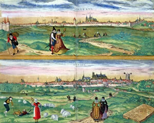
Background imageMaps (celestial & Terrestrial) Collection: Map of Orleans and Bourges, from Civitates Orbis Terrarum

Map of Orleans and Bourges, from Civitates Orbis Terrarum
STC121037 Map of Orleans and Bourges, from Civitates Orbis Terrarum by Georg Braun (1541-1622) and Frans Hogenberg (1535-90), c.1572 (coloured engraving) by Hoefnagel

Background imageMaps (celestial & Terrestrial) Collection: Map of Marseilles, from Civitates Orbis Terrarum

Map of Marseilles, from Civitates Orbis Terrarum
STC121036 Map of Marseilles, from Civitates Orbis Terrarum by Georg Braun (1541-1622) and Frans Hogenberg (1535-90), c.1572 (colour engraving) by Hoefnagel

Background imageMaps (celestial & Terrestrial) Collection: Map of Amsterdam, from Civitates Orbis Terrarum

Map of Amsterdam, from Civitates Orbis Terrarum
STC121004 Map of Amsterdam, from Civitates Orbis Terrarum by Georg Braun (1541-1622) and Frans Hogenburg (1535-90), c.1572 (coloured engraving) by Hoefnagel

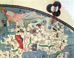
Background imageMaps (celestial & Terrestrial) Collection: Rc C 2487 Map of the World, designed by Sebastien Cabot (c. 1476-1557), 1544 (engraving)

Rc C 2487 Map of the World, designed by Sebastien Cabot (c. 1476-1557), 1544 (engraving)
REV131216 Rc C 2487 Map of the World, designed by Sebastien Cabot (c.1476-1557), 1544 (engraving) by French School, (16th century); 124x216 cm; Bibliotheque Nationale, Paris, France; French

Background imageMaps (celestial & Terrestrial) Collection: Typical Representations of Artificial Spheres (coloured engraving)

Typical Representations of Artificial Spheres (coloured engraving)
STC130625 Typical Representations of Artificial Spheres (coloured engraving) by German School, (18th century); Private Collection; The Stapleton Collection; German, out of copyright

Background imageMaps (celestial & Terrestrial) Collection: Map of Africa, after an original of 1447 (colour litho)

Map of Africa, after an original of 1447 (colour litho)
CHT169412 Map of Africa, after an original of 1447 (colour litho) by French School, (19th century); Bibliotheque des Arts Decoratifs, Paris

Background imageMaps (celestial & Terrestrial) Collection: Map of North Africa and West Africa, published in Strasbourg in 1522 (coloured engraving)

Map of North Africa and West Africa, published in Strasbourg in 1522 (coloured engraving)
CHT169411 Map of North Africa and West Africa, published in Strasbourg in 1522 (coloured engraving) by Ptolemy (Claudius Ptolemaeus of Alexandria)(c.90-168)(after); Bibliotheque des Arts Decoratifs

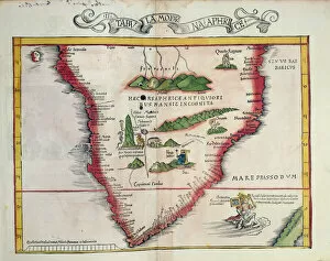
Background imageMaps (celestial & Terrestrial) Collection: Map of Southern Africa, published in Strasbourg in 1522 (coloured engraving)

Map of Southern Africa, published in Strasbourg in 1522 (coloured engraving)
CHT169410 Map of Southern Africa, published in Strasbourg in 1522 (coloured engraving) by Ptolemy (Claudius Ptolemaeus of Alexandria)(c.90-168)(after); Bibliotheque des Arts Decoratifs, Paris

Background imageMaps (celestial & Terrestrial) Collection: Ms 1288 f. 25 Map of Brazil, from Dutch Marine Maps, 1637 (engraving)

Ms 1288 f. 25 Map of Brazil, from Dutch Marine Maps, 1637 (engraving)
BIF159065 Ms 1288 f.25 Map of Brazil, from Dutch Marine Maps, 1637 (engraving) by Vingboons, Philip (1607/8-78); Bibliotheque de l Institut de France, Paris, France; Dutch, out of copyright

Background imageMaps (celestial & Terrestrial) Collection: Map of the Suez Canal accompanied by different views and portraits of Ferdinand de

Map of the Suez Canal accompanied by different views and portraits of Ferdinand de
CHT169365 Map of the Suez Canal accompanied by different views and portraits of Ferdinand de Lesseps (1805-94) and Ismail Pasha (1830-95) 1869 (litho) by French School

Background imageMaps (celestial & Terrestrial) Collection: Eastern Hemisphere, from a Series of World Maps published by John Tallis & Co

Eastern Hemisphere, from a Series of World Maps published by John Tallis & Co
STC190611 Eastern Hemisphere, from a Series of World Maps published by John Tallis & Co. New York & London, 1850s (engraving) by Rapkin


All Professionally Made to Order for Quick Shipping


-

Why Choose Us?

We are a leading provider of Art Prints and Photo Gifts since 2003, working in partnership with a range of Sporting Clubs, Charities, Museums and Picture Libraries. A large share of profits from any of their images will go directly towards supporting that charity or club. Our archive of images is carefully curated to bring you a wide range of subjects, including landscapes, wildlife, architecture, and more. We ship from our partner labs in the UK, USA, EU (Netherlands) and Australia.
+

How do I place an order?

Ordering is quick & easy - Just follow 5 Simple Steps:
  1. Find your image: Use our search box or browse our online photo Collections to find the image you want.

  2. Choose your print format: Select your desired product and add it to your cart.

  3. Enter your details: If you're a returning customer, simply enter your email address and password, and we'll fill in your billing and shipping address details. All personal details are held securely and are fully GDPR compliant. As standard, we remove all Personally Identifiable Information after 12 months.

  4. Pay for your purchase: We use state-of-the-art security for online shopping and do not have access to your card details.

  5. Sit back and relax: We'll email you confirmation of your order and when it's dispatched. Registered customers can also track orders in the 'My Account' area.

+

How do I pay for an order?

You can pay for your order with most of the major credit and debit cards, or PayPal. For added security, major financial institutions process payment details separately and securely on our behalf. We do not have access to your online payment card details. Online payments are preferred however we do take phone orders. For UK customers only we accept cheques issued against a UK bank.
+

Is my data safe?

We take data security very seriously. We do not have access to your full card details and all payments are requested over a fully secure connection. Additionally, we fully comply with current European and GDPR legislation, and automatically remove all personal data after at most 12 months (unless you have an account with us and have signed in recently). We also have a strict opt-in policy and would never sell your personal details. Your data is only used to fulfill your order promptly and efficiently.
+

Is wall art ready to hang?

For quick and easy installation all wall art, including framed prints, canvas prints and metal prints are supplied with a ready to hang solution on the back. Generally, saw tooth hangers are applied as they allow wall art to hang flush against the wall. The serrated edge of the hanger prevents the frame from shifting or tilting when hung.
+

Are the photo prints fade resistant?

Yes, we use archival quality photo paper photographic paper for vivid reproduction Prints are an accurate representations of the original artwork, which is preserved for artistic character and authenticity. We guarantee they match previews shown on our web site