Fraud Blocker Skip to main content

Latitude Collection (page 47)

"Exploring the World Through Latitude: A Journey of Maps and Topography" Step back in time to 1768 with James Craig's Map of New Town, Edinburgh, Scotland

Background imageLatitude Collection: 1801 Cary Map Of Upper Saxony Germany Berlin

1801 Cary Map Of Upper Saxony Germany Berlin
1801, Cary Map of Upper Saxony, Germany, Berlin, Dresden , John Cary, 1754 - 1835, English cartographer

Background imageLatitude Collection: 1801 Cary Map Of Turkey In Europe Greece And The Balkan

1801 Cary Map Of Turkey In Europe Greece And The Balkan
1801, Cary Map of Turkey in Europe, Greece, and the Balkan, John Cary, 1754 - 1835, English cartographer

Background imageLatitude Collection: 1801 Cary Map Of Turkey Iraq Armenia And Sryia

1801 Cary Map Of Turkey Iraq Armenia And Sryia
1801, Cary Map of Turkey, Iraq, Armenia and Sryia, John Cary, 1754 - 1835, English cartographer

Background imageLatitude Collection: 1801 Cary Map Of The East Indies And Southeast Asia

1801 Cary Map Of The East Indies And Southeast Asia
1801, Cary Map of the East Indies and Southeast Asia, Singapore, Borneo, Sumatra, Java, Philippines, John Cary, 1754 - 1835, English cartographer

Background imageLatitude Collection: 1801 Cary Map Of Scotland 4 Sheets John Cary

1801 Cary Map Of Scotland 4 Sheets John Cary
1801, Cary Map of Scotland, 4 Sheets, John Cary, 1754 - 1835, English cartographer

Background imageLatitude Collection: 1813 Pinkerton Map Of Western Africa Niger Valley

1813 Pinkerton Map Of Western Africa Niger Valley
1813, Pinkerton Map of Western Africa, Niger Valley, Mountains of Kong, John Pinkerton, 1758 - 1826, Scottish antiquarian, cartographer, UK

Background imageLatitude Collection: 1811 Cary Map Of Arabia Egypt And Abyssinia John Cary

1811 Cary Map Of Arabia Egypt And Abyssinia John Cary
1811, Cary Map of Arabia, Egypt and Abyssinia, John Cary, 1754 - 1835, English cartographer

Background imageLatitude Collection: 1807 Cary Map Of Nova Scotia And Newfoundland

1807 Cary Map Of Nova Scotia And Newfoundland
1807, Cary Map of Nova Scotia and Newfoundland, Canada, John Cary, 1754 - 1835, English cartographer

Background imageLatitude Collection: 1809 Pinkerton Map Of Northern Italy Tuscany

1809 Pinkerton Map Of Northern Italy Tuscany
1809, Pinkerton Map of Northern Italy, Tuscany, Florence, Venice, Milan , John Pinkerton, 1758 - 1826, Scottish antiquarian, cartographer, UK

Background imageLatitude Collection: 1809 Pinkerton Map Of Korea And Japan John Pinkerton

1809 Pinkerton Map Of Korea And Japan John Pinkerton
1809, Pinkerton Map of Korea and Japan, John Pinkerton, 1758 - 1826, Scottish antiquarian, cartographer, UK

Background imageLatitude Collection: 1807 Bridges Map Of New York City 1871 Reissue

1807 Bridges Map Of New York City 1871 Reissue
1807, Bridges Map of New York City, 1871 reissue

Background imageLatitude Collection: 1806 Mogg Pocket Or Case Map Of London England

1806 Mogg Pocket Or Case Map Of London England
1806, Mogg Pocket or Case Map of London, England

Background imageLatitude Collection: 1799 Clement Cruttwell Map Of Sweden Denmark And Norway

1799 Clement Cruttwell Map Of Sweden Denmark And Norway
1799, Clement Cruttwell Map of Sweden, Denmark and Norway

Background imageLatitude Collection: 1799 Cary Map Of Franconia Germany Nuremburg

1799 Cary Map Of Franconia Germany Nuremburg
1799, Cary Map of Franconia, Germany, Nuremburg, John Cary, 1754 - 1835, was an English cartographer, John Cary, 1754 - 1835, English cartographer

Background imageLatitude Collection: 1800 Bardi Map Of Genoa Genova Italy Topography

1800 Bardi Map Of Genoa Genova Italy Topography
1800, Bardi Map of Genoa, Genova, Italy

Background imageLatitude Collection: 1799 Cary Map Of Mantua Venice And Tyrol Italy

1799 Cary Map Of Mantua Venice And Tyrol Italy
1799, Cary Map of Mantua, Venice and Tyrol, Italy, John Cary, 1754 - 1835, was an English cartographer, John Cary, 1754 - 1835, English cartographer

Background imageLatitude Collection: 1798 Cassini Map Of Florida Louisiana Cuba And Central America

1798 Cassini Map Of Florida Louisiana Cuba And Central America
1798, Cassini Map of Florida, Louisiana, Cuba, and Central America

Background imageLatitude Collection: 1797 Tardieu Map Of Champagne France Topography

1797 Tardieu Map Of Champagne France Topography
1797, Tardieu Map of Champagne, France

Background imageLatitude Collection: 1796 Cary Folding Case Map Of England And Wales

1796 Cary Folding Case Map Of England And Wales
1796, Cary Folding Case Map of England and Wales, John Cary, 1754 - 1835, English cartographer

Background imageLatitude Collection: 1796 Benjamin Taylor Manuscript Survey Map Of Tribeca

1796 Benjamin Taylor Manuscript Survey Map Of Tribeca
1796, Benjamin Taylor Manuscript Survey Map of Tribeca, New York and Indenture

Background imageLatitude Collection: 1794 Jeffreys Map Of Corsica France Topography

1794 Jeffreys Map Of Corsica France Topography
1794, Jeffreys Map of Corsica, France

Background imageLatitude Collection: 1794 Laurie And Whittle Map Of Greece Turkey Andamp

1794 Laurie And Whittle Map Of Greece Turkey Andamp
1794, Laurie and Whittle Map of Greece, Turkey andamp, the Balkans

Background imageLatitude Collection: 1801 Cary Map Of Persia Iran Iraq Afghanistan

1801 Cary Map Of Persia Iran Iraq Afghanistan
1801, Cary Map of Persia, Iran, Iraq, Afghanistan , John Cary, 1754 - 1835, English cartographer

Background imageLatitude Collection: 1801 Cary Map Of Lower Saxony Holstein Lubeck

1801 Cary Map Of Lower Saxony Holstein Lubeck
1801, Cary Map of Lower Saxony, Holstein, Lubeck, Lunenburgzell, Bremen, Berlin, John Cary, 1754 - 1835, English cartographer

Background imageLatitude Collection: 1801 Cary Map Of Bohemia And Moravia Czech Republic

1801 Cary Map Of Bohemia And Moravia Czech Republic
1801, Cary Map of Bohemia and Moravia, Czech Republic , John Cary, 1754 - 1835, English cartographer

Background imageLatitude Collection: 1800 Stockdale Map Of Hispaniola Or Santo Domingo

1800 Stockdale Map Of Hispaniola Or Santo Domingo
1800, Stockdale Map of Hispaniola or Santo Domingo, West Indies, Haiti, Dominican Republic

Background imageLatitude Collection: 1799 Cruttwell Map Of The World On Mercator's Projection

1799 Cruttwell Map Of The World On Mercator's Projection
1799, Cruttwell Map of the World on Mercator's Projection

Background imageLatitude Collection: 1799 Clement Cruttwell Map Of China Korea And Taiwan

1799 Clement Cruttwell Map Of China Korea And Taiwan
1799, Clement Cruttwell Map of China, Korea, and Taiwan

Background imageLatitude Collection: 1799 Cary Map Of The Western Hemisphere America And Polynesia

1799 Cary Map Of The Western Hemisphere America And Polynesia
1799, Cary Map of the Western Hemisphere, America and Polynesia, John Cary, 1754 - 1835, was an English cartographer, John Cary, 1754 - 1835, English cartographer

Background imageLatitude Collection: 1799 Cary Map Of Swabia Germany John Cary 1754 – 1835

1799 Cary Map Of Swabia Germany John Cary 1754 – 1835
1799, Cary Map of Swabia, Germany, John Cary, 1754 - 1835, was an English cartographer, John Cary, 1754 - 1835, English cartographer

Background imageLatitude Collection: 1799 Cary Map Of Poland Prussia And Lithuania

1799 Cary Map Of Poland Prussia And Lithuania
1799, Cary Map of Poland, Prussia and Lithuania, John Cary, 1754 - 1835, was an English cartographer, John Cary, 1754 - 1835, English cartographer

Background imageLatitude Collection: 1799 Cary Map Of Piedmont Italy Milan Genoa John Cary

1799 Cary Map Of Piedmont Italy Milan Genoa John Cary
1799, Cary Map of Piedmont, Italy, Milan, Genoa , John Cary, 1754 - 1835, was an English cartographer, John Cary, 1754 - 1835, English cartographer

Background imageLatitude Collection: 1799 Cary Map Of Hungary Croatia And Transylvania

1799 Cary Map Of Hungary Croatia And Transylvania
1799, Cary Map of Hungary, Croatia and Transylvania, John Cary, 1754 - 1835, was an English cartographer, John Cary, 1754 - 1835, English cartographer

Background imageLatitude Collection: 1799 Cary Map Of Bavaria And Salzburg Germany

1799 Cary Map Of Bavaria And Salzburg Germany
1799, Cary Map of Bavaria and Salzburg, Germany, Munich, John Cary, 1754 - 1835, was an English cartographer, John Cary, 1754 - 1835, English cartographer

Background imageLatitude Collection: 1798 Payne Map Of The World Pre 1800 American Map

1798 Payne Map Of The World Pre 1800 American Map
1798, Payne Map of the World, pre 1800 American Map

Background imageLatitude Collection: 1797 Jean Map Of Paris And The Faubourgs France

1797 Jean Map Of Paris And The Faubourgs France
1797, Jean Map of Paris and the Faubourgs, France

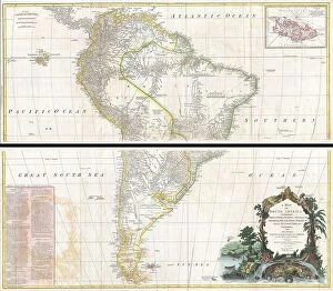
Background imageLatitude Collection: 1795 D'Anville Wall Map Of South America Topography

1795 D'Anville Wall Map Of South America Topography
1795, D'Anville Wall Map of South America

Background imageLatitude Collection: 1794 Laurie And Whittle Map Of Norway Sweden

1794 Laurie And Whittle Map Of Norway Sweden
1794, Laurie and Whittle Map of Norway, Sweden, Denmark and Finland, 1794 - 1812

Background imageLatitude Collection: 1785 Bocage Map Of Athens And Environs Including Piraeus

1785 Bocage Map Of Athens And Environs Including Piraeus
1785, Bocage Map of Athens and Environs, including Piraeus, in Ancient Greece

Background imageLatitude Collection: 1780 Raynal And Bonne Map Of Southern Brazil

1780 Raynal And Bonne Map Of Southern Brazil
1780, Raynal and Bonne Map of Southern Brazil, Northern Argentina, Uruguay and Paraguay, Rigobert Bonne 1727 - 1794, one of the most important cartographers of the late 18th century

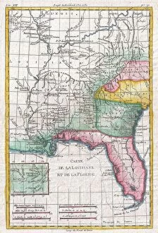
Background imageLatitude Collection: 1780 Raynal And Bonne Map Of Louisiana Florida And Carolina

1780 Raynal And Bonne Map Of Louisiana Florida And Carolina
1780, Raynal and Bonne Map of Louisiana, Florida and Carolina, Rigobert Bonne 1727 - 1794, one of the most important cartographers of the late 18th century

Background imageLatitude Collection: 1780 Raynal And Bonne Map Of Jamaica West Indies

1780 Raynal And Bonne Map Of Jamaica West Indies
1780, Raynal and Bonne Map of Jamaica, West Indies, Rigobert Bonne 1727 - 1794, one of the most important cartographers of the late 18th century

Background imageLatitude Collection: 1786 La Perouse Map Of Vancouver And British Columbia

1786 La Perouse Map Of Vancouver And British Columbia
1786, La Perouse Map of Vancouver and British Columbia, Canada

Background imageLatitude Collection: 1780 Raynal And Bonne Map Of The West Indies

1780 Raynal And Bonne Map Of The West Indies
1780, Raynal and Bonne Map of the West Indies, Caribbean, and Gulf of Mexico, Rigobert Bonne 1727 - 1794, one of the most important cartographers of the late 18th century

Background imageLatitude Collection: 1784 Bocage Map Of Athens Greece Topography Cartography

1784 Bocage Map Of Athens Greece Topography Cartography
1784, Bocage Map of Athens, Greece

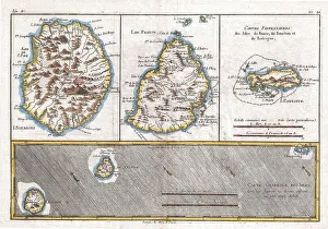
Background imageLatitude Collection: 1780 Raynal And Bonne Map Of Mascarene Islands

1780 Raynal And Bonne Map Of Mascarene Islands
1780, Raynal and Bonne Map of Mascarene Islands, Reunion, Mauritius, Bourbon, Rigobert Bonne 1727 - 1794, one of the most important cartographers of the late 18th century

Background imageLatitude Collection: 1780 Raynal And Bonne Map Of Martinique West Indies

1780 Raynal And Bonne Map Of Martinique West Indies
1780, Raynal and Bonne Map of Martinique, West Indies, Rigobert Bonne 1727 - 1794, one of the most important cartographers of the late 18th century

Background imageLatitude Collection: 1794 Delisle Map Of Northern Ancient Greece Balkans

1794 Delisle Map Of Northern Ancient Greece Balkans
1794, Delisle Map of Northern Ancient Greece, Balkans, Macedonia


All Professionally Made to Order for Quick Shipping

"Exploring the World Through Latitude: A Journey of Maps and Topography" Step back in time to 1768 with James Craig's Map of New Town, Edinburgh, Scotland. This intricate depiction showcases the birth of a new city, highlighting its topography and layout. Fast forward to 1794, where Delisle's Map takes us on an adventure through Southern Ancient Greece, Greek Isles, and Crete. Discover the stunning landscapes that shaped this ancient civilization. In 1886, a Telescopic View and Map of the Moon mesmerizes with its detailed cartography. Explore lunar topography as you delve into the mysteries of our celestial neighbor. Traveling to Costa Rica brings us a Vector Map that captures the beauty of this Central American gem. From lush rainforests to pristine beaches, uncover nature's wonders within its borders. An Antique map reveals Russia's rich history and vast territories. Marvel at how geography has shaped this mighty nation throughout centuries. Ptolemy's Map of the World from AD 150 transports us back in time when cartographers were pioneers in mapping our planet. Witness their early understanding of landmasses and geographical features. Witness mankind's triumphs as a spacecraft lands on the Moon accompanied by a lunar map. Explore uncharted territory through advanced technology while appreciating both artistry and science. Journey to 1658 with Visscher's Map showcasing North America and South America’s diverse topographies. Immerse yourself in these continents' varied landscapes from towering mountains to sprawling plains. The Colton Map from 1855 invites exploration across Scandinavia - Norway, Sweden, Finland - revealing their enchanting natural beauty through meticulous cartographic details. Spruner's Map takes us back even further – before Peloponnesian War – unveiling Greece’s captivating topography during ancient times. Trace historical paths etched upon rugged terrains that once witnessed great conflicts.