Fraud Blocker Skip to main content

Latitude Collection (page 41)

"Exploring the World Through Latitude: A Journey of Maps and Topography" Step back in time to 1768 with James Craig's Map of New Town, Edinburgh, Scotland

Background imageLatitude Collection: 1852 U.S.C.S. Map Or Chart Of Nantucket Massachusetts

1852 U.S.C.S. Map Or Chart Of Nantucket Massachusetts
1852, U.S.C.S. Map or Chart of Nantucket, Massachusetts

Background imageLatitude Collection: 1852 S.D.U.K. Pocket Map Of The Balkans Croatia

1852 S.D.U.K. Pocket Map Of The Balkans Croatia
1852, S.D.U.K. Pocket Map of the Balkans, Croatia, Dalmatia, Sclavonia

Background imageLatitude Collection: 1853 U.S.C.S. Coast Chart Or Map Of San Luis Pass

1853 U.S.C.S. Coast Chart Or Map Of San Luis Pass
1853, U.S.C.S. Coast Chart or Map of San Luis Pass, Texas

Background imageLatitude Collection: 1852 U.S. Coast Survey Map Of The North And South Edisto Rivers

1852 U.S. Coast Survey Map Of The North And South Edisto Rivers
1852, U.S. Coast Survey Map of the North and South Edisto Rivers, South Carolina, Charleston

Background imageLatitude Collection: 1852 Levassuer Map Of The Department Des Vosges

1852 Levassuer Map Of The Department Des Vosges
1852, Levassuer Map of the Department Des Vosges, France

Background imageLatitude Collection: 1852 Levassuer Map Of Senegal Senegambia And Madagascar

1852 Levassuer Map Of Senegal Senegambia And Madagascar
1852, Levassuer Map of Senegal, Senegambia, and Madagascar

Background imageLatitude Collection: 1852 Levasseur Map Of The Reunion Or The Ile. Bourbon

1852 Levasseur Map Of The Reunion Or The Ile. Bourbon
1852, Levasseur Map of the Reunion or the Ile. Bourbon, Indian Ocean

Background imageLatitude Collection: 1853 U.S.C.S. Map Of Cape Fear North Carolina

1853 U.S.C.S. Map Of Cape Fear North Carolina
1853, U.S.C.S. Map of Cape Fear, North Carolina

Background imageLatitude Collection: 1853 U.S.C.S. Map Of Cape Charles And Vicinity

1853 U.S.C.S. Map Of Cape Charles And Vicinity
1853, U.S.C.S. Map of Cape Charles and Vicinity, Virginia

Background imageLatitude Collection: 1853 U.S. Coast Survey Map Or Chart Of Bartaria Bay

1853 U.S. Coast Survey Map Or Chart Of Bartaria Bay
1853, U.S. Coast Survey Map or Chart of Bartaria Bay, Louisiana

Background imageLatitude Collection: 1853 U.S. Coast Survey Map Of The Romer And Flynn's Shoals Near Coney Island

1853 U.S. Coast Survey Map Of The Romer And Flynn's Shoals Near Coney Island
1853, U.S. Coast Survey Map of the Romer and Flynn's Shoals near Coney Island, New York

Background imageLatitude Collection: 1853 U.S. Coast Survey Map Of Lake Pontchartrain

1853 U.S. Coast Survey Map Of Lake Pontchartrain
1853, U.S. Coast Survey Map of Lake Pontchartrain, New Orleans, and the Mississippi Delta

Background imageLatitude Collection: 1853 Mitchell Map Of Southern Italy Naples Sicily

1853 Mitchell Map Of Southern Italy Naples Sicily
1853, Mitchell Map of Southern Italy, Naples, Sicily

Background imageLatitude Collection: 1853 Mitchell Map Of Northern Italy Tuscany Venice

1853 Mitchell Map Of Northern Italy Tuscany Venice
1853, Mitchell Map of Northern Italy, Tuscany, Venice

Background imageLatitude Collection: 1853 Mitchell Map Of California Oregon Washington

1853 Mitchell Map Of California Oregon Washington
1853, Mitchell Map of California, Oregon, Washington, Utah and New Mexico

Background imageLatitude Collection: 1853 Colton Map Of Washington And Oregon W- Montana

1853 Colton Map Of Washington And Oregon W- Montana
1853, Colton Map of Washington and Oregon, w- Montana, Idaho

Background imageLatitude Collection: 1852 Vuillemin Map Of The British Isles England

1852 Vuillemin Map Of The British Isles England
1852, Vuillemin Map of the British Isles, England, Ireland, Scotland

Background imageLatitude Collection: 1852 U.S. Coast Survey Map Of Key West Biscayne Bay

1852 U.S. Coast Survey Map Of Key West Biscayne Bay
1852, U.S. Coast Survey Map of Key West, Biscayne Bay, and the Cedar Keys

Background imageLatitude Collection: 1852 Stansbury Map Great Salt Lake To Fort Levenworth Route

1852 Stansbury Map Great Salt Lake To Fort Levenworth Route
1852, Stansbury Map, Great Salt Lake to Fort Levenworth Route, Colorado, Utah, Wyoming, Kansas

Background imageLatitude Collection: 1852 Levasseur Map Of The Department La Creuse

1852 Levasseur Map Of The Department La Creuse
1852, Levasseur Map of the Department La Creuse, France

Background imageLatitude Collection: 1852 Levasseur Map Of The Department L'Aisne

1852 Levasseur Map Of The Department L'Aisne
1852, Levasseur Map of the Department L'Aisne, France

Background imageLatitude Collection: 1852 Levasseur Map Of The Department Hautes Alpes

1852 Levasseur Map Of The Department Hautes Alpes
1852, Levasseur Map of the Department Hautes Alpes, France

Background imageLatitude Collection: 1852 Levasseur Map Of The Department Du Nord

1852 Levasseur Map Of The Department Du Nord
1852, Levasseur Map of the Department Du Nord, France

Background imageLatitude Collection: 1852 Levasseur Map Of The Department Du Lot France

1852 Levasseur Map Of The Department Du Lot France
1852, Levasseur Map of the Department Du Lot, France, Cahors Wine Region

Background imageLatitude Collection: 1852 Levasseur Map Of The Department Du Haut Rhin

1852 Levasseur Map Of The Department Du Haut Rhin
1852, Levasseur Map of the Department Du Haut Rhin, France, Alsace Wine Region

Background imageLatitude Collection: 1852 Levasseur Map Of The Department Du Gard

1852 Levasseur Map Of The Department Du Gard
1852, Levasseur Map of the Department du Gard, France

Background imageLatitude Collection: 1852 Levasseur Map Of The Department Du Doubs

1852 Levasseur Map Of The Department Du Doubs
1852, Levasseur Map of the Department du Doubs, France

Background imageLatitude Collection: 1852 Levasseur Map Of The Department Du Cantal

1852 Levasseur Map Of The Department Du Cantal
1852, Levasseur Map of the Department Du Cantal, France, Cantal Cheese Region

Background imageLatitude Collection: 1852 Levasseur Map Of The Department Du Bas Rhin

1852 Levasseur Map Of The Department Du Bas Rhin
1852, Levasseur Map of the Department Du Bas Rhin, France, Strasbourg, Alsace Wine Region

Background imageLatitude Collection: 1852 Levasseur Map Of The Department L'Ardeche

1852 Levasseur Map Of The Department L'Ardeche
1852, Levasseur Map of the Department L'Ardeche, France

Background imageLatitude Collection: 1852 Levasseur Map Of The Department La Charente

1852 Levasseur Map Of The Department La Charente
1852, Levasseur Map of the Department La Charente, France, Cognac and Pineau Wine Region

Background imageLatitude Collection: 1852 Levasseur Map Of The Department L'Aveyron

1852 Levasseur Map Of The Department L'Aveyron
1852, Levasseur Map of the Department L'Aveyron, France, Roquefort Cheese Region

Background imageLatitude Collection: 1852 Levasseur Map Of The Department L'Aube France

1852 Levasseur Map Of The Department L'Aube France
1852, Levasseur Map of the Department L'Aube, France, Chaource Cheese Region

Background imageLatitude Collection: 1852 Levasseur Map Of The Department L'Aude France

1852 Levasseur Map Of The Department L'Aude France
1852, Levasseur Map of the Department L'Aude, France

Background imageLatitude Collection: 1852 Levasseur Map Of The Department L'Allier

1852 Levasseur Map Of The Department L'Allier
1852, Levasseur Map of the Department L'Allier, France, Saint-Pourrcain Wine Region

Background imageLatitude Collection: 1852 Levasseur Map Of The Department L'Ain France

1852 Levasseur Map Of The Department L'Ain France
1852, Levasseur Map of the Department L'Ain, France, Bugey Wine Region

Background imageLatitude Collection: 1852 Levasseur Map Of The Department Du Var France

1852 Levasseur Map Of The Department Du Var France
1852, Levasseur Map of the Department Du Var, France, French Riviera, Cote d'Azur

Background imageLatitude Collection: 1852 Levasseur Map Of The Department Du Rhone

1852 Levasseur Map Of The Department Du Rhone
1852, Levasseur Map of the Department Du Rhone, France, Beaujolais Wine Region

Background imageLatitude Collection: 1852 Levasseur Map Of The Department Du Puy De Dome

1852 Levasseur Map Of The Department Du Puy De Dome
1852, Levasseur Map of the Department Du Puy de Dome, France

Background imageLatitude Collection: 1852 Levasseur Map Of The Department Du Morbihan

1852 Levasseur Map Of The Department Du Morbihan
1852, Levasseur Map of the Department Du Morbihan, France

Background imageLatitude Collection: 1852 Levasseur Map Of The Department Du Jura

1852 Levasseur Map Of The Department Du Jura
1852, Levasseur Map of the Department du Jura, France, France

Background imageLatitude Collection: 1852 Levasseur Map Of The Department Du Loiret

1852 Levasseur Map Of The Department Du Loiret
1852, Levasseur Map of the Department Du Loiret, France

Background imageLatitude Collection: 1852 Levasseur Map Of The Department Du Gers

1852 Levasseur Map Of The Department Du Gers
1852, Levasseur Map of the Department du Gers, France, Armagnac Region

Background imageLatitude Collection: 1852 Levasseur Map Of The Department Du Finistere

1852 Levasseur Map Of The Department Du Finistere
1852, Levasseur Map of the Department du Finistere, France

Background imageLatitude Collection: 1852 Levasseur Map Of The Department Du Cher

1852 Levasseur Map Of The Department Du Cher
1852, Levasseur Map of the Department Du Cher, France

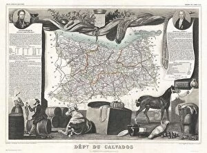
Background imageLatitude Collection: 1852 Levasseur Map Of The Department Du Calvados

1852 Levasseur Map Of The Department Du Calvados
1852, Levasseur Map of the Department Du Calvados, France

Background imageLatitude Collection: 1852 Levasseur Map Of The Department Des Basses Pyrenees

1852 Levasseur Map Of The Department Des Basses Pyrenees
1852, Levasseur Map of the Department Des Basses Pyrenees, France, Jurancon Wine Region

Background imageLatitude Collection: 1852 Levasseur Map Of The Department De Tarn

1852 Levasseur Map Of The Department De Tarn
1852, Levasseur Map of the Department De Tarn, France


All Professionally Made to Order for Quick Shipping

"Exploring the World Through Latitude: A Journey of Maps and Topography" Step back in time to 1768 with James Craig's Map of New Town, Edinburgh, Scotland. This intricate depiction showcases the birth of a new city, highlighting its topography and layout. Fast forward to 1794, where Delisle's Map takes us on an adventure through Southern Ancient Greece, Greek Isles, and Crete. Discover the stunning landscapes that shaped this ancient civilization. In 1886, a Telescopic View and Map of the Moon mesmerizes with its detailed cartography. Explore lunar topography as you delve into the mysteries of our celestial neighbor. Traveling to Costa Rica brings us a Vector Map that captures the beauty of this Central American gem. From lush rainforests to pristine beaches, uncover nature's wonders within its borders. An Antique map reveals Russia's rich history and vast territories. Marvel at how geography has shaped this mighty nation throughout centuries. Ptolemy's Map of the World from AD 150 transports us back in time when cartographers were pioneers in mapping our planet. Witness their early understanding of landmasses and geographical features. Witness mankind's triumphs as a spacecraft lands on the Moon accompanied by a lunar map. Explore uncharted territory through advanced technology while appreciating both artistry and science. Journey to 1658 with Visscher's Map showcasing North America and South America’s diverse topographies. Immerse yourself in these continents' varied landscapes from towering mountains to sprawling plains. The Colton Map from 1855 invites exploration across Scandinavia - Norway, Sweden, Finland - revealing their enchanting natural beauty through meticulous cartographic details. Spruner's Map takes us back even further – before Peloponnesian War – unveiling Greece’s captivating topography during ancient times. Trace historical paths etched upon rugged terrains that once witnessed great conflicts.