Fraud Blocker Skip to main content

Latitude Collection (page 44)

"Exploring the World Through Latitude: A Journey of Maps and Topography" Step back in time to 1768 with James Craig's Map of New Town, Edinburgh, Scotland

Background imageLatitude Collection: 1845 Mitchell Wall Map Of The United States Partial Republic Of Texas

1845 Mitchell Wall Map Of The United States Partial Republic Of Texas
1845, Mitchell Wall Map of the United States, partial Republic of Texas

Background imageLatitude Collection: 1846 U.S. Coast Survey Map Of Nantucket First U.S.C.S. Map Of The Davis Shoals

1846 U.S. Coast Survey Map Of Nantucket First U.S.C.S. Map Of The Davis Shoals
1846, U.S. Coast Survey Map of Nantucket, first U.S.C.S. Map of the Davis Shoals

Background imageLatitude Collection: 1844 Spruneri Map Of Asia In The 15th And 16th Centuries

1844 Spruneri Map Of Asia In The 15th And 16th Centuries
1844, Spruneri Map of Asia in the 15th and 16th Centuries, Ming China

Background imageLatitude Collection: 1846 Mitchell's Map Of Texas Oregon And California

1846 Mitchell's Map Of Texas Oregon And California
1846, Mitchell's Map of Texas Oregon and California

Background imageLatitude Collection: 1848 Phelps National Map Of The United States

1848 Phelps National Map Of The United States
1848, Phelps National Map of the United States, Pocket Map

Background imageLatitude Collection: 1848 Colton Map Of New York City And Vicinity

1848 Colton Map Of New York City And Vicinity
1848, Colton Map of New York City and Vicinity, 33 Miles Around

Background imageLatitude Collection: 1847 Molini Pocket Map Of Florence Frienze Italy

1847 Molini Pocket Map Of Florence Frienze Italy
1847, Molini Pocket Map of Florence, Frienze, Italy

Background imageLatitude Collection: 1847 Levasseur Map Of The Dept. De L'Ardeche

1847 Levasseur Map Of The Dept. De L'Ardeche
1847, Levasseur Map of the Dept. de L'Ardeche, France

Background imageLatitude Collection: 1847 Levasseur Map Of The Dept. De La Haute Garonne

1847 Levasseur Map Of The Dept. De La Haute Garonne
1847, Levasseur Map of the Dept. de la Haute Garonne, France

Background imageLatitude Collection: 1847 Levasseur Map Of Sarthe France Topography

1847 Levasseur Map Of Sarthe France Topography
1847, Levasseur Map of Sarthe, France

Background imageLatitude Collection: 1847 Levasseur Map Of Dept. Maine Et Loire France

1847 Levasseur Map Of Dept. Maine Et Loire France
1847, Levasseur Map of Dept. Maine et Loire, France

Background imageLatitude Collection: 1847 Japanese Edo Period Woodblock Map Of The Izu Islands

1847 Japanese Edo Period Woodblock Map Of The Izu Islands
1847, Japanese Edo Period Woodblock Map of the Izu Islands, Tokyo or Edo

Background imageLatitude Collection: 1846 Street Map Or Plan Of Philadelphia Pennsylvania

1846 Street Map Or Plan Of Philadelphia Pennsylvania
1846, Street Map or Plan of Philadelphia, Pennsylvania

Background imageLatitude Collection: 1846 Colton Map Of New York City And Vicinity

1846 Colton Map Of New York City And Vicinity
1846, Colton Map of New York City and Vicinity, 33 Miles Around

Background imageLatitude Collection: 1846 Homann Heirs Map Of North America And South America

1846 Homann Heirs Map Of North America And South America
1846, Homann Heirs Map of North America and South America

Background imageLatitude Collection: 1846 Burroughs Mitchell Map Of Argentina Uruguay

1846 Burroughs Mitchell Map Of Argentina Uruguay
1846, Burroughs, Mitchell Map of Argentina, Uruguay, Chili in South America

Background imageLatitude Collection: 1846 1879 Colton Map Of New York City And Vicinity

1846 1879 Colton Map Of New York City And Vicinity
1846, 1879 Colton Map of New York City and Vicinity, 33 Miles Around

Background imageLatitude Collection: 1843 Tienpo 14 Edo Period Map Of Mt. Fuji Tokyo

1843 Tienpo 14 Edo Period Map Of Mt. Fuji Tokyo
1843, Tienpo 14 Edo Period Map of Mt. Fuji, Tokyo, and Vicinity

Background imageLatitude Collection: 1843 Monaldini Case Map Of Rome Italy Topography

1843 Monaldini Case Map Of Rome Italy Topography
1843, Monaldini Case Map of Rome, Italy

Background imageLatitude Collection: 1848 Levasseur Map Of Senegal Gambia And Madagascar

1848 Levasseur Map Of Senegal Gambia And Madagascar
1848, Levasseur Map of Senegal, Gambia and Madagascar

Background imageLatitude Collection: 1848 Crutchley Pocket Map Or Plan Of London England

1848 Crutchley Pocket Map Or Plan Of London England
1848, Crutchley Pocket Map or Plan of London, England

Background imageLatitude Collection: 1847 U.S. Coast Survey Map Of Holmes' Hole Vineyard Haven

1847 U.S. Coast Survey Map Of Holmes' Hole Vineyard Haven
1847, U.S. Coast Survey Map of Holmes' Hole, Vineyard Haven, Martha's Vineyard, Massachusetts

Background imageLatitude Collection: 1847 Levasseur Map Of The Dept. Du Lot France

1847 Levasseur Map Of The Dept. Du Lot France
1847, Levasseur Map of the Dept. Du Lot, France

Background imageLatitude Collection: 1843 Blackwell Map Of Niagara Falls New York

1843 Blackwell Map Of Niagara Falls New York
1843, Blackwell Map of Niagara Falls, New York

Background imageLatitude Collection: 1842 Greenleaf Map Of The East Indies Borneo

1842 Greenleaf Map Of The East Indies Borneo
1842, Greenleaf Map of the East Indies, Borneo, Java, Sumatra, Thailand, Vietnam

Background imageLatitude Collection: 1840 S.D.U.K. Map Or City Plan Of Toulon France

1840 S.D.U.K. Map Or City Plan Of Toulon France
1840, S.D.U.K. Map or City Plan of Toulon, France

Background imageLatitude Collection: 1840 Manuscript Map Of The Collect Pond And Five Points

1840 Manuscript Map Of The Collect Pond And Five Points
1840, Manuscript Map of the Collect Pond and Five Points, New York City

Background imageLatitude Collection: 1840 Lizars Map Of Scandinavia Norway Sweden

1840 Lizars Map Of Scandinavia Norway Sweden
1840, Lizars Map of Scandinavia, Norway, Sweden, Finland, Denmark, Iceland

Background imageLatitude Collection: 1839 Burr Wall Map Of The United States Only Example Of Jedediah Smith's Map

1839 Burr Wall Map Of The United States Only Example Of Jedediah Smith's Map
1839, Burr Wall Map of the United States, only example of Jedediah Smith's map

Background imageLatitude Collection: 1838 Wyld Wall Map Of India Hindostan Or British India

1838 Wyld Wall Map Of India Hindostan Or British India
1838, Wyld Wall Map of India, Hindostan or British India

Background imageLatitude Collection: 1843 Malte Brun Map Of The Biblical Lands Of The Hebrews

1843 Malte Brun Map Of The Biblical Lands Of The Hebrews
1843, Malte Brun Map of the Biblical Lands of the Hebrews, Egypt, Arabia, Israel, Turkey

Background imageLatitude Collection: 1838 Monin Map Or Physical Tableau And Astronomy Chart

1838 Monin Map Or Physical Tableau And Astronomy Chart
1838, Monin Map or Physical Tableau and Astronomy Chart, Zodiac

Background imageLatitude Collection: 1837 S.D.U.K. City Map Or Plan Of Frankfort Germany

1837 S.D.U.K. City Map Or Plan Of Frankfort Germany
1837, S.D.U.K. City Map or Plan of Frankfort, Germany

Background imageLatitude Collection: 1837 Malte-Brun Map Of The British Isles England

1837 Malte-Brun Map Of The British Isles England
1837, Malte-Brun Map of the British Isles, England, Scotland, Ireland

Background imageLatitude Collection: 1837 Malte-Brun Map Of India Burma And Southeast Asia

1837 Malte-Brun Map Of India Burma And Southeast Asia
1837, Malte-Brun Map of India, Burma and Southeast Asia, Siam , Vietnam

Background imageLatitude Collection: 1837 Dower Map Of Van Dieman's Land Or Tasmania

1837 Dower Map Of Van Dieman's Land Or Tasmania
1837, Dower Map of Van Dieman's Land or Tasmania

Background imageLatitude Collection: 1835 S.D.U.K. City Map Or Plan Of Amsterdam The Netherlands

1835 S.D.U.K. City Map Or Plan Of Amsterdam The Netherlands
1835, S.D.U.K. City Map or Plan of Amsterdam, The Netherlands

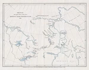
Background imageLatitude Collection: 1835 Murray Map Of The Arctic Land Expedition

1835 Murray Map Of The Arctic Land Expedition
1835, Murray Map of the Arctic Land Expedition, Hudson Bay, Canada

Background imageLatitude Collection: 1834 S.D.U.K. Map Of Bombay Presidency And Goa

1834 S.D.U.K. Map Of Bombay Presidency And Goa
1834, S.D.U.K. Map of Bombay Presidency and Goa, India

Background imageLatitude Collection: 1834 S.D.U.K. Comparative Map Or Chart Of The World's Great Rivers

1834 S.D.U.K. Comparative Map Or Chart Of The World's Great Rivers
1834, S.D.U.K. Comparative Map or Chart of the World's Great Rivers

Background imageLatitude Collection: 1833 Charle Map Of The Dept. Of Morbihan Bretagne

1833 Charle Map Of The Dept. Of Morbihan Bretagne
1833, Charle Map of the Dept. of Morbihan, Bretagne, France

Background imageLatitude Collection: 1832 S.D.U.K. Map Of Bordeaux France Topography

1832 S.D.U.K. Map Of Bordeaux France Topography
1832, S.D.U.K. Map of Bordeaux, France

Background imageLatitude Collection: 1832 Mitchell's Pocket Map Of The United States

1832 Mitchell's Pocket Map Of The United States
1832, Mitchell's Pocket Map of the United States

Background imageLatitude Collection: 1843 Malte-Brun Map Of Prussia Germany Topography

1843 Malte-Brun Map Of Prussia Germany Topography
1843, Malte-Brun Map of Prussia, Germany

Background imageLatitude Collection: 1842 S.D.U.K. Map Of The City Of Calcutta India

1842 S.D.U.K. Map Of The City Of Calcutta India
1842, S.D.U.K. Map of the City of Calcutta, India

Background imageLatitude Collection: 1842 Mather Map Of Long Island New York Topography

1842 Mather Map Of Long Island New York Topography
1842, Mather Map of Long Island, New York

Background imageLatitude Collection: 1840 S.D.U.K. Map Of Constantinople Istanbul

1840 S.D.U.K. Map Of Constantinople Istanbul
1840, S.D.U.K. Map of Constantinople, Istanbul, Turkey

Background imageLatitude Collection: 1839 Woodblock Ino Tadataka Atlas Of Japan Or Kokugun Zenzu

1839 Woodblock Ino Tadataka Atlas Of Japan Or Kokugun Zenzu
1839, Woodblock Ino Tadataka Atlas of Japan or Kokugun Zenzu, 2 volumes


All Professionally Made to Order for Quick Shipping

"Exploring the World Through Latitude: A Journey of Maps and Topography" Step back in time to 1768 with James Craig's Map of New Town, Edinburgh, Scotland. This intricate depiction showcases the birth of a new city, highlighting its topography and layout. Fast forward to 1794, where Delisle's Map takes us on an adventure through Southern Ancient Greece, Greek Isles, and Crete. Discover the stunning landscapes that shaped this ancient civilization. In 1886, a Telescopic View and Map of the Moon mesmerizes with its detailed cartography. Explore lunar topography as you delve into the mysteries of our celestial neighbor. Traveling to Costa Rica brings us a Vector Map that captures the beauty of this Central American gem. From lush rainforests to pristine beaches, uncover nature's wonders within its borders. An Antique map reveals Russia's rich history and vast territories. Marvel at how geography has shaped this mighty nation throughout centuries. Ptolemy's Map of the World from AD 150 transports us back in time when cartographers were pioneers in mapping our planet. Witness their early understanding of landmasses and geographical features. Witness mankind's triumphs as a spacecraft lands on the Moon accompanied by a lunar map. Explore uncharted territory through advanced technology while appreciating both artistry and science. Journey to 1658 with Visscher's Map showcasing North America and South America’s diverse topographies. Immerse yourself in these continents' varied landscapes from towering mountains to sprawling plains. The Colton Map from 1855 invites exploration across Scandinavia - Norway, Sweden, Finland - revealing their enchanting natural beauty through meticulous cartographic details. Spruner's Map takes us back even further – before Peloponnesian War – unveiling Greece’s captivating topography during ancient times. Trace historical paths etched upon rugged terrains that once witnessed great conflicts.