Fraud Blocker Skip to main content

Geographical Collection (page 7)

"Journey through Time and Space: Exploring the Geographical Evolution" Al-Idrisi's World Map, 1154: Unveiling ancient cartographic wisdom

Background imageGeographical Collection: Cambodia, Ratanakiri region, surroundings of Banlung, Yeak Loam lake, landscape

Cambodia, Ratanakiri region, surroundings of Banlung, Yeak Loam lake, landscape

Background imageGeographical Collection: Cambodia, Phnom Penh, Royal Palace

Cambodia, Phnom Penh, Royal Palace

Background imageGeographical Collection: Vietnam, Chua Vinh Trang temple

Vietnam, Chua Vinh Trang temple

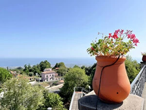
Background imageGeographical Collection: Italy, Sicily, Catania, Milo, view from Milo square

Italy, Sicily, Catania, Milo, view from Milo square

Background imageGeographical Collection: Madagascar, Isalo, waterfall and natural pool

Madagascar, Isalo, waterfall and natural pool

Background imageGeographical Collection: Madagascar, Isalo, waterfall and natural pool

Madagascar, Isalo, waterfall and natural pool

Background imageGeographical Collection: Italy, Sicily, Santo Stefano Quisquina, Andromeda Theater

Italy, Sicily, Santo Stefano Quisquina, Andromeda Theater

Background imageGeographical Collection: Italy, Sicily, Santo Stefano Quisquina, Andromeda Theater

Italy, Sicily, Santo Stefano Quisquina, Andromeda Theater

Background imageGeographical Collection: Italy, Sicily, Santo Stefano Quisquina, Andromeda Theater

Italy, Sicily, Santo Stefano Quisquina, Andromeda Theater

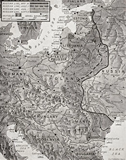
Background imageGeographical Collection: Map Advance Russian Army Red Army Wipe Out Enemy

Map Advance Russian Army Red Army Wipe Out Enemy
Map showing the advance of the Russian Army in their effort to wipe out the enemy, August 1944. From The War in Pictures, Fifth Year

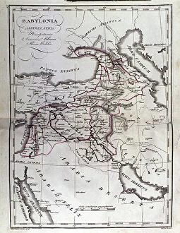
Background imageGeographical Collection: Map of Mesopotamia

Map of Mesopotamia
3779671 Map of Mesopotamia; (add.info.: Map of Mesopotamia, Babylon, Syria and Assyria from late 18th century.); Lebrecht History

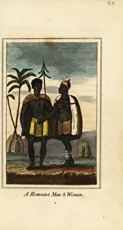
Background imageGeographical Collection: Khoikhoi man and woman, South Africa, 1818

Khoikhoi man and woman, South Africa, 1818. They wear animal skins and woven skirts and stand in front of huts covered in animal hides

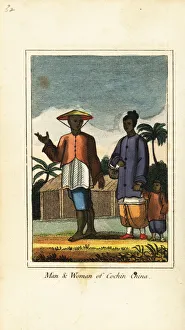
Background imageGeographical Collection: Man and woman of Cochin China (Vietnam) 1818

Man and woman of Cochin China (Vietnam) 1818. Handcoloured copperplate engraving from Mary Anne Vennings A Geographical Present being Descriptions of the Principal Countries of the World, Darton

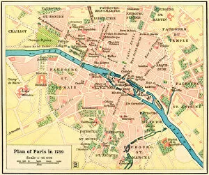
Background imageGeographical Collection: Plan of Paris, France in 1789

Plan of Paris, France in 1789. From Historical Atlas, published 1923

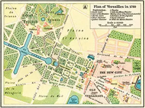
Background imageGeographical Collection: Plan of Versailles, France in 1789

Plan of Versailles, France in 1789. From Historical Atlas, published 1923

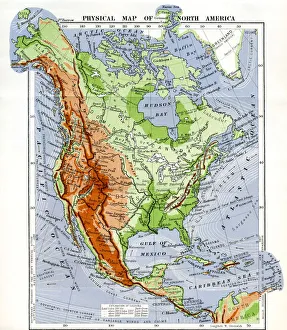
Background imageGeographical Collection: Physical Map Of North America In The Late 19Th Century

Physical Map Of North America In The Late 19Th Century

Background imageGeographical Collection: Map Italy Italian Frederik De Wit 18th Century

Map Italy Italian Frederik De Wit 18th Century
Map of Italy, by Frederik de Wit. 18th century

Background imageGeographical Collection: Western Australia - Route of The Dettlers Expedition ?

Western Australia - Route of The Dettlers Expedition ?
Western Australia - Route of The Dettlers Expedition Under Mr Ac Gregory From Perth To Gascoyne River 1848 and Govenor Fitz Gerald's Route From Champion Bay To Murchison River 1848 and 1849

Background imageGeographical Collection: Western Australia - Route of Expedition Under ?

Western Australia - Route of Expedition Under ?
Western Australia - Route of Expedition Under Surveyor General Roe From Perth To Russell Range 1848 and 1849

Background imageGeographical Collection: List of Names (Fragment)

List of Names (Fragment)
Parchment leaf. A namenregister comprising a list of names in two columns, mostly men but including a few women. It has been suggested that it is perhaps a list of those who have subscribed to a

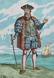
Background imageGeographical Collection: Vasco da Gama (1460-1524). Portuguese explorer

Vasco da Gama (1460-1524). Portuguese explorer
Vasco da Gama, 1st Count of Vidigueira (1460-1524). Portuguese explorer. He was the first European to reach India by sea. Engraving. Museo Militar, 1883. Later colouration. Date: 2019

Background imageGeographical Collection: SPAIN. Belchite. Ruins of the old town destroyed

SPAIN. Belchite. Ruins of the old town destroyed after the Battle of Belchite (1937)

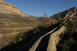
Background imageGeographical Collection: Spain Lleida Pallars Jussa Conca De Tremp Trenches

Spain Lleida Pallars Jussa Conca De Tremp Trenches
spain, lleida, pallars, jussa, conca, de, tremp, trenches, of, the, civil, war, in, area, vilanoveta, horizontal, colour, color, outdoor, daylight, exterior, outside, daytime, sunlight, europe

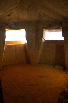
Background imageGeographical Collection: Spain Lleida Pallars Jussa Conca De Tremp Bunker

Spain Lleida Pallars Jussa Conca De Tremp Bunker
spain, lleida, pallars, jussa, conca, de, tremp, bunker, of, the, civil, war, in, conques, area, vertical, upright, colour, color, interior, interiors, inner, inside, insides, europe, european

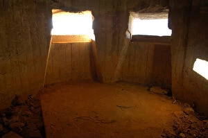
Background imageGeographical Collection: SPAIN. LLEIDA. Pallars Jussa. Conca de Tremp

SPAIN. LLEIDA. Pallars Jussa. Conca de Tremp. Bunker of the Civil War in Conques area
Background imageGeographical Collection: Spanish Civil War Map Of Catalonia Regions And

Spanish Civil War Map Of Catalonia Regions And
spanish, civil, war, map, of, catalonia, regions, and, counties, october, poster, edited, by, the, regional, ministry, ecocomy, generalitat, spain, barcelona, biblioteca, de, catalunya, national

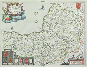
Background imageGeographical Collection: Map of Somerset, England

Map of Somerset, England
1662, antique, archival, cartography, coat of arms, england, europe, geographical, geography, historic, map, nobody, peerage, somerset, text, uk, vintage, Somerset, 87626075

Background imageGeographical Collection: City map of Rome from 1880, Italy, digitally restored reproduction of an original 19th century

City map of Rome from 1880, Italy, digitally restored reproduction of an original 19th century template
1900s, 19th-century, accurate, archive, atlas, atlases, attraction, attractions, black, black-and-white, black-white, central italy, character, city maps, concept, concept image, contemporary, copy

Background imageGeographical Collection: City map of Strasbourg in 1885, France, Historic, digitally restored reproduction of a 19th

City map of Strasbourg in 1885, France, Historic, digitally restored reproduction of a 19th century original
1900s, 19th-century, accurate, alsace-champagne-ardenne-lorraine, archive, atlas, atlases, black, black-and-white, black-white, character, city maps, concept, concept image, contemporary, copy

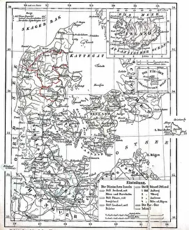
Background imageGeographical Collection: Map of Denmark and Prussian Province of Schleswig-Holstein circa 1890, Germany, Historical

Map of Denmark and Prussian Province of Schleswig-Holstein circa 1890, Germany, Historical
1900s, 19th-century, accurate, archive, atlas, atlases, black, black-and-white, black-white, character, concept, concept image, contemporary, copy, danish, depiction, depictions, deserted, digital

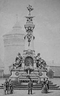
Background imageGeographical Collection: The traditional art fountain at the Plaerrer in Nuremberg, Bavaria, Germany, Historic

The traditional art fountain at the Plaerrer in Nuremberg, Bavaria, Germany, Historic
1900s, 19th-century, art fountain, art work, arts, artwork, artworks, attraction, attractions, bayern, black, black-and-white, black-white, characteristic, cities, countries, country, culture

Background imageGeographical Collection: Street Map of Paris, 1890, France, Historic, digitally restored reproduction of an original 19th

Street Map of Paris, 1890, France, Historic, digitally restored reproduction of an original 19th century original
1900s, 19th-century, art work, arts, artwork, artworks, black, black-and-white, black-white, card, cards, depiction, depictions, deserted, digital, digitally, drawing, drawings, drawn, early

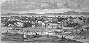
Background imageGeographical Collection: Dunqula, Dongola, Dungula, Dongla, Town in Nubia, Sudan, in 1880, Historic

Dunqula, Dongola, Dungula, Dongla, Town in Nubia, Sudan, in 1880, Historic
1900s, 19th-century, african, black, black-and-white, black-white, cities, contemporary, countries, country, depiction, depictions, deserted, digital, digitally, drawing, drawings, drawn, dunqula

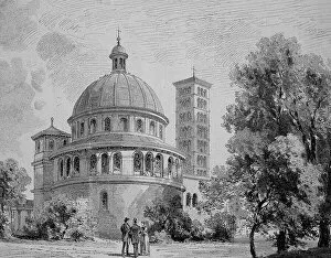
Background imageGeographical Collection: The Mausoleum of Potsdam in 1880, Germany, Historic, digital reproduction of an original

The Mausoleum of Potsdam in 1880, Germany, Historic, digital reproduction of an original 19th-century painting
1900s, 19th-century, art work, arts, artwork, artworks, attraction, attractions, black, black-and-white, black-white, brandenburg, burial ground, burial site, burial sites, cities, commemorating

Background imageGeographical Collection: Market Square and Porta Nigra in Trier, Germany, 19th century, Historic

Market Square and Porta Nigra in Trier, Germany, 19th century, Historic, digitally improved reproduction of an original
1900s, 19th-century, art work, arts, artwork, artworks, attraction, attractions, black, black-and-white, black-white, centuries, century, cities, city center, city centre, city square, civic center

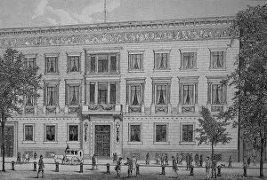
Background imageGeographical Collection: Ministry of Culture in Berlin, 1890, Germany, Historical, digital reproduction of an original

Ministry of Culture in Berlin, 1890, Germany, Historical, digital reproduction of an original from the 19th century
1900s, 19th-century, administration, administrations, art work, arts, artwork, artworks, attraction, attractions, authorities, black, black-and-white, black-white, cities, countries, country

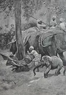
Background imageGeographical Collection: A working elephant is tied to a palm tree, India, Historic, digital reproduction of an original

A working elephant is tied to a palm tree, India, Historic, digital reproduction of an original 19th century painting
1900s, 19th-century, afrotheria, animals, art print, art prints, arts and crafts, asian, asian elephants, asiatic, asiatic elephant, bat, bats, captive, captive animal, captivity, chiroptera

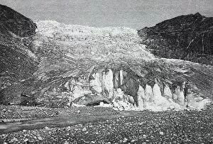
Background imageGeographical Collection: Rhone Glacier, Rottengletscher, a glacier in the Swiss Alps and the source of the Rhone, 1888

Rhone Glacier, Rottengletscher, a glacier in the Swiss Alps and the source of the Rhone, 1888, Switzerland, History
1900s, 19th-century, acreage, acreages, african, alpine landscape, alps, arable land, art work, arts, artwork, artworks, body of water, canton of valais, canton valais, cap, caps, cold, countries

Background imageGeographical Collection: Division of Brittany into Six Departments, c. 1789-90 (colour litho)
Division of Brittany into Six Departments, c. 1789-90 (colour litho)
ARH207437 Division of Brittany into Six Departments, c.1789-90 (colour litho) by French School, (18th century); Centre Historique des Archives Nationales, Paris, France; © Archives Charmet

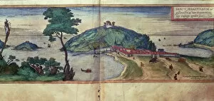
Background imageGeographical Collection: View of San Sebastian, from the work Civites Orbis Terrarum edited by Georg Braun

View of San Sebastian, from the work Civites Orbis Terrarum edited by Georg Braun and engraved by Franz Hogenberg
IND388255 View of San Sebastian, from the work Civites Orbis Terrarum edited by Georg Braun and engraved by Franz Hogenberg, 1576 (coloured engraving) by German School

Background imageGeographical Collection: The taking of ten British ships in Marbella in 1563 by the Alvaro de Bazans fleet

The taking of ten British ships in Marbella in 1563 by the Alvaro de Bazans fleet
IND388258 The taking of ten British ships in Marbella in 1563 by the Alvaro de Bazans fleet, during the reign of Philip II of Spain (fresco) by Spanish School

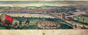
Background imageGeographical Collection: View of the city of Ecija and the Genil River, from the work Civites Orbis Terrarum edited by

View of the city of Ecija and the Genil River, from the work Civites Orbis Terrarum edited by Georg Braun
IND388256 View of the city of Ecija and the Genil River, from the work Civites Orbis Terrarum edited by Georg Braun and engraved by Franz Hogenberg, 1576 (coloured engraving) by German School

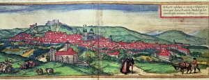
Background imageGeographical Collection: View of the city of Burgos, from the work Civites Orbis Terrarum edited by Georg Braun

View of the city of Burgos, from the work Civites Orbis Terrarum edited by Georg Braun and engraved by Franz Hogenberg
IND388257 View of the city of Burgos, from the work Civites Orbis Terrarum edited by Georg Braun and engraved by Franz Hogenberg, 1576 (coloured engraving) by German School

Background imageGeographical Collection: The entry of the fleet into Lisbon, a scene from the maritime campaign against Portugal conducted

The entry of the fleet into Lisbon, a scene from the maritime campaign against Portugal conducted by Alvaro de Bazan
IND388259 The entry of the fleet into Lisbon, a scene from the maritime campaign against Portugal conducted by Alvaro de Bazan, during the reign of Philip II of Spain (fresco) by Spanish School

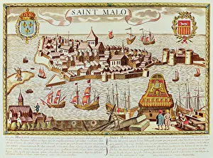
Background imageGeographical Collection: View of the port and fortified city of Saint Malo, located on the coast of Brittany

View of the port and fortified city of Saint Malo, located on the coast of Brittany
IND388249 View of the port and fortified city of Saint Malo, located on the coast of Brittany by French School; Private Collection; (add.info.: Vista del puerto y la ciudad fortificada de Saint Malo)

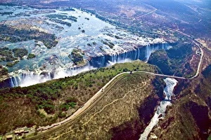
Background imageGeographical Collection: DDE-90023052

DDE-90023052
Aerial view of Victoria Falls, Waterfall, and the Zambesi River, Zimbabwe, Africa. On the Zambia-Zimbabwe Border Date: 14/08/2008

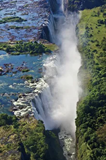
Background imageGeographical Collection: DDE-90023051

DDE-90023051
Aerial view of Victoria Falls, Waterfall, and the Zambesi River, Zimbabwe, Africa. On the Zambia-Zimbabwe Border Date: 14/08/2008

Background imageGeographical Collection: Map of the Island of Jamaica, divided into its Principal Parishes c. 1760 (hand-coloured engraving)

Map of the Island of Jamaica, divided into its Principal Parishes c. 1760 (hand-coloured engraving)
BAL42817 Map of the Island of Jamaica, divided into its Principal Parishes c.1760 (hand-coloured engraving) by Bowen, Emanuel (c.1694-1767); O Shea Gallery, London, UK


All Professionally Made to Order for Quick Shipping

"Journey through Time and Space: Exploring the Geographical Evolution" Al-Idrisi's World Map, 1154: Unveiling ancient cartographic wisdom, this map showcases the Islamic scholar's remarkable understanding of global geography. Continental Drift after 250 Million Years: Witnessing Earth's transformative power, this concept reveals how tectonic plates shaped our continents over millions of years. Malham Cove, Yorkshire Dales: A geological marvel standing tall in the picturesque Yorkshire Dales, showcasing nature's artistic prowess carved by ice and water. British Empire World Map, 19th Century: Tracing the vast expanse of an empire on which the sun never set; a testament to Britain's once-global dominance. James Craig Map of New Town, Edinburgh, Scotland (1768): The birth of urban planning captured in ink; explore Edinburgh’s meticulously designed New Town with its unique topography. Anglo-Saxon 10th Century World Map: Delving into medieval perceptions of our planet; discover how early societies envisioned their place within a world still shrouded in mystery. Catalan Atlas, 14th Century: Marvel at one of history’s most exquisite maps as it unveils Europe’s expanding knowledge during the Middle Ages – a true masterpiece. UK at Night from Space: Behold Britain illuminated like never before. This awe-inspiring view from space captures the vibrant tapestry that is modern-day United Kingdom after sundown. Orteliuss Map of Ottoman Empire (1570): Step back into time and witness one man’s meticulous depiction of an empire that spanned three continents - revealing cultural diversity and grandeur. Europe at Night - Satellite Image & Europe at Night - Illuminating Boundaries : Gaze upon two contrasting images capturing Europe under different lights – highlighting both unity and division across nations 17th Century World Map.