Fraud Blocker Skip to main content

Geographical Collection (page 5)

"Journey through Time and Space: Exploring the Geographical Evolution" Al-Idrisi's World Map, 1154: Unveiling ancient cartographic wisdom

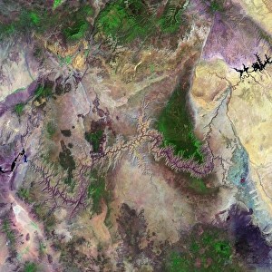
Background imageGeographical Collection: Grand Canyon

Grand Canyon. Coloured optical and infrared, Landsat satellite image of the Grand Canyon, Arizona, USA. North is at top. Arid areas are brown and purple, forests are green and water is black

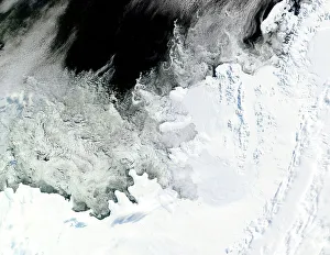
Background imageGeographical Collection: Wilkins Ice Shelf, Antarctica

Wilkins Ice Shelf, Antarctica
Wilkins Ice Shelf. Satellite image showing the location of the Wilkins Ice Shelf (just above and right of centre) on the Antarctic Peninsula

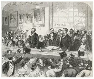
Background imageGeographical Collection: Speke & Grant. Lecture

Speke & Grant. Lecture
The explorers deliver a lecture at the Royal Geographical Society

Background imageGeographical Collection: Map of Europe according to the Peace Treaties 1918 - 1924. From The Evolution of Modern Europe

Map of Europe according to the Peace Treaties 1918 - 1924. From The Evolution of Modern Europe, 1453 - 1932, published 1933

Background imageGeographical Collection: Map of Europe in 1815. From The Evolution of Modern Europe, 1453 - 1932, published 1933

Map of Europe in 1815. From The Evolution of Modern Europe, 1453 - 1932, published 1933

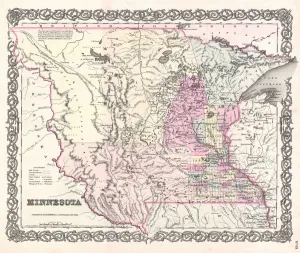
Background imageGeographical Collection: 1855, Colton Map of Minnesota, topography, cartography, geography, land, illustration

1855, Colton Map of Minnesota, topography, cartography, geography, land, illustration
1855, Colton Map of Minnesota

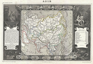
Background imageGeographical Collection: 1852, Levasseur Map of Asia, topography, cartography, geography, land, illustration

1852, Levasseur Map of Asia, topography, cartography, geography, land, illustration
1852, Levasseur Map of Asia

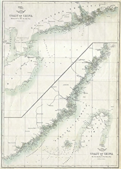
Background imageGeographical Collection: 1863, Cassells Dispatch Atlas Map of Taiwan, Formosa and the Hainan Coast of China

1863, Cassells Dispatch Atlas Map of Taiwan, Formosa and the Hainan Coast of China

Background imageGeographical Collection: 1835, S. D. U. K. City Map or Plan of Amsterdam, The Netherlands, topography, cartography

1835, S. D. U. K. City Map or Plan of Amsterdam, The Netherlands, topography, cartography
1835, S.D.U.K. City Map or Plan of Amsterdam, The Netherlands

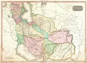
Background imageGeographical Collection: 1818, Pinkerton Map of Persia, Iran, Afghanistan, John Pinkerton, 1758 - 1826, Scottish

1818, Pinkerton Map of Persia, Iran, Afghanistan, John Pinkerton, 1758 - 1826, Scottish antiquarian, cartographer, UK

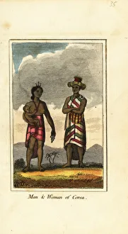
Background imageGeographical Collection: Man, woman and baby of Corea, Korea, 1818

Man, woman and baby of Corea, Korea, 1818. Handcoloured copperplate engraving from Mary Anne Vennings A Geographical Present being Descriptions of the Principal Countries of the World, Darton

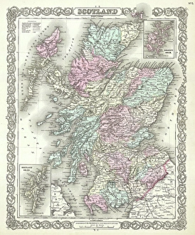
Background imageGeographical Collection: 1855, Colton Map of Scotland, topography, cartography, geography, land, illustration

1855, Colton Map of Scotland, topography, cartography, geography, land, illustration
1855, Colton Map of Scotland

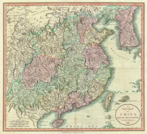
Background imageGeographical Collection: 1801, Cary Map of China and Korea, John Cary, 1754 - 1835, English cartographer, topography

1801, Cary Map of China and Korea, John Cary, 1754 - 1835, English cartographer, topography
1801, Cary Map of China and Korea, John Cary, 1754 - 1835, English cartographer

Background imageGeographical Collection: 1772, Bonne Map of Scotland, Rigobert Bonne 1727 - 1794, one of the most important

1772, Bonne Map of Scotland, Rigobert Bonne 1727 - 1794, one of the most important cartographers of the late 18th century

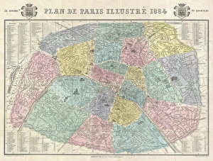
Background imageGeographical Collection: 1864, Garnier Map of Pairs, France w-Monuments, topography, cartography, geography

1864, Garnier Map of Pairs, France w-Monuments, topography, cartography, geography
1864, Garnier Map of Pairs, France w-Monuments

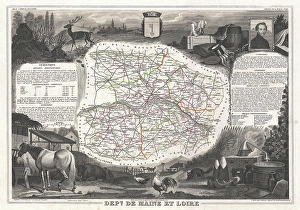
Background imageGeographical Collection: 1852, Levasseur Map of the Department De Maine et Loire, France, topography, cartography

1852, Levasseur Map of the Department De Maine et Loire, France, topography, cartography
1852, Levasseur Map of the Department De Maine et Loire, France

Background imageGeographical Collection: 1801, Cary Map of Scotland, 4 Sheets, John Cary, 1754 - 1835, English cartographer

1801, Cary Map of Scotland, 4 Sheets, John Cary, 1754 - 1835, English cartographer

Background imageGeographical Collection: A Map of the Kingdom of Kabul (colour litho)

A Map of the Kingdom of Kabul (colour litho)
XCF275023 A Map of the Kingdom of Kabul (colour litho) by English School, (19th century); Private Collection; English, out of copyright

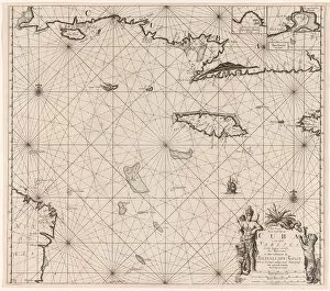
Background imageGeographical Collection: Sea chart of the south coast of Cuba and Jamaica, Jan Luyken, Claes Jansz Voogt

Sea chart of the south coast of Cuba and Jamaica, Jan Luyken, Claes Jansz Voogt, Johannes van Keulen (I), 1684 - 1799

Background imageGeographical Collection: 18th century map, Central America and Gulf of Mexico

18th century map, Central America and Gulf of Mexico
5322624 18th century map, Central America and Gulf of Mexico.; (add.info.: 18th century map of Central America and the Gulf of Mexico engraved by Balthasar Ruyter.).

Background imageGeographical Collection: Map of Abyssinia (Ethiopia), 19th century (map)

Map of Abyssinia (Ethiopia), 19th century (map)
6317642 Map of Abyssinia (Ethiopia), 19th century (map); (add.info.: Map of Abyssinia and the Adjacent Districts. From observations taken by British traveller and artist Henry Salt in 1809 and 1810)

Background imageGeographical Collection: Map of Athens and Piraeus, Greece, mid 19th century. From The Imperial Bible Dictionary

Map of Athens and Piraeus, Greece, mid 19th century. From The Imperial Bible Dictionary, published 1889
955359 Map of Athens and Piraeus, Greece, mid 19th century. From The Imperial Bible Dictionary, published 1889.; Private Collection.

Background imageGeographical Collection: Plan of Versailles, France in 1789. From Historical Atlas, published 1923 (print)

Plan of Versailles, France in 1789. From Historical Atlas, published 1923 (print)
2603518 Plan of Versailles, France in 1789. From Historical Atlas, published 1923 (print).

Background imageGeographical Collection: Map showing the Gulf of Paria or De La Ballena as Christopher Columbus named it on his third

Map showing the Gulf of Paria or De La Ballena as Christopher Columbus named it on his third voyage, 1892 (print)
2915323 Map showing the Gulf of Paria or De La Ballena as Christopher Columbus named it on his third voyage, 1892 (print); (add.info.: From the book Life of Christopher Columbus by Clements R)

Background imageGeographical Collection: 18th century map of Scotland

18th century map of Scotland
5322612 18th century map of Scotland; (add.info.: Map of Scotland dating from the early 18th century decorated with 14 small drawings or plans of important cities. Anonymous engraver.).

Background imageGeographical Collection: Map of Madrid late 17th or early 18th century (map)

Map of Madrid late 17th or early 18th century (map)
6117613 Map of Madrid late 17th or early 18th century (map); (add.info.: Anonymous map of Madrid dating from late 17th or early 18th century.); Photo © Ken Welsh. All rights reserved 2024.

Background imageGeographical Collection: Western part of the map of Juan de la Cosa from 1500. Juan de la Cosa sailed with Christopher

Western part of the map of Juan de la Cosa from 1500. Juan de la Cosa sailed with Christopher Columbus on his first
2915327 Western part of the map of Juan de la Cosa from 1500. Juan de la Cosa sailed with Christopher Columbus on his first three voyages. From the book Life of Christopher Columbus by Clements R

Background imageGeographical Collection: Map of Guanahani or San Salvador showing Watling Island where Christopher Columbus made landfall

Map of Guanahani or San Salvador showing Watling Island where Christopher Columbus made landfall in 1492
2915316 Map of Guanahani or San Salvador showing Watling Island where Christopher Columbus made landfall in 1492. From the book Life of Christopher Columbus by Clements R

Background imageGeographical Collection: Map of Fra Mauro, 1457 - 1459. From the book Life of Christopher Columbus by Clements R

Map of Fra Mauro, 1457 - 1459. From the book Life of Christopher Columbus by Clements R. Markham published 1892
2915315 Map of Fra Mauro, 1457 - 1459. From the book Life of Christopher Columbus by Clements R. Markham published 1892.; Photo © Hilary Morgan.

Background imageGeographical Collection: Map of Veragua showing coastline explored by Christopher Columbus on his fourth voyage, in 1502

Map of Veragua showing coastline explored by Christopher Columbus on his fourth voyage, in 1502
2915330 Map of Veragua showing coastline explored by Christopher Columbus on his fourth voyage, in 1502. From the book Life of Christopher Columbus by Clements R

Background imageGeographical Collection: Antonio de Herrera y Tordesillas map of the Bahamas, 1601. From the book Life of Christopher

Antonio de Herrera y Tordesillas map of the Bahamas, 1601. From the book Life of Christopher Columbus by Clements R
2915318 Antonio de Herrera y Tordesillas map of the Bahamas, 1601. From the book Life of Christopher Columbus by Clements R. Markham published 1892.; Photo © Hilary Morgan.

Background imageGeographical Collection: Map of the Klondike Gold Diggings and vicinity, Alaska, North America, 1898 - 1899

Map of the Klondike Gold Diggings and vicinity, Alaska, North America, 1898 - 1899
2967863 Map of the Klondike Gold Diggings and vicinity, Alaska, North America, 1898 - 1899. From The History of Our Country, published 1900; Private Collection.

Background imageGeographical Collection: Plan of London, England c. 1300. From Historical Atlas, published 1923

Plan of London, England c. 1300. From Historical Atlas, published 1923
2603529 Plan of London, England c. 1300. From Historical Atlas, published 1923..

Background imageGeographical Collection: Map showing the Roman roads in Britain. Illustrated Easy Stories from English History

Map showing the Roman roads in Britain. Illustrated Easy Stories from English History
1000964 Map showing the Roman roads in Britain. Illustrated Easy Stories from English History.; Private Collection.

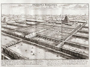
Background imageGeographical Collection: Plan of Babylon

Plan of Babylon
6117877 Plan of Babylon; (add.info.: Imaginary plan of Babylon, Mesopotamia. Modern day Iraq. 18th century engraving by Johann Adam Delsenbach, 1687-1765 from Entwurff einer historischen Architectur)

Background imageGeographical Collection: Map of South Africa at the time of the Transvaal War in 1901

Map of South Africa at the time of the Transvaal War in 1901. From The Story of England, published 1930
3058426 Map of South Africa at the time of the Transvaal War in 1901. From The Story of England, published 1930.; Photo © Hilary Morgan.

Background imageGeographical Collection: Map of Napoleon's Empire in 1812. From The Story of England, published 1930

Map of Napoleon's Empire in 1812. From The Story of England, published 1930
3058424 Map of Napoleon's Empire in 1812. From The Story of England, published 1930.; Photo © Hilary Morgan.

Background imageGeographical Collection: Map of the British Empire in 1901. From A First Book of British History published 1925

Map of the British Empire in 1901. From A First Book of British History published 1925
3058527 Map of the British Empire in 1901. From A First Book of British History published 1925.; Photo © Hilary Morgan.

Background imageGeographical Collection: Map of Espanola with the Columbine Forts and settlements. From the book Life of Christopher

Map of Espanola with the Columbine Forts and settlements. From the book Life of Christopher Columbus by Clements R
2915321 Map of Espanola with the Columbine Forts and settlements. From the book Life of Christopher Columbus by Clements R. Markham published 1892.; Photo © Hilary Morgan.

Background imageGeographical Collection: Map of the Spanish coast from Huelva to Cadiz. From the book Life of Christopher Columbus by

Map of the Spanish coast from Huelva to Cadiz. From the book Life of Christopher Columbus by Clements R
2915320 Map of the Spanish coast from Huelva to Cadiz. From the book Life of Christopher Columbus by Clements R. Markham published 1892.; Photo © Hilary Morgan.

Background imageGeographical Collection: Western part of the Catalan map of the world, 1275. From the book Life of Christopher Columbus by

Western part of the Catalan map of the world, 1275. From the book Life of Christopher Columbus by Clements R
2915313 Western part of the Catalan map of the world, 1275. From the book Life of Christopher Columbus by Clements R. Markham published 1892.; Photo © Hilary Morgan.

Background imageGeographical Collection: Map of Rome and Carthage at the beginning of the Second Punic War, 218 BC, publ. 1923 (colour litho)

Map of Rome and Carthage at the beginning of the Second Punic War, 218 BC, publ. 1923 (colour litho)
2603515 Map of Rome and Carthage at the beginning of the Second Punic War, 218 BC, publ. 1923 (colour litho) by American School, (20th century); (add.info.: From Historical Atlas, published 1923.).

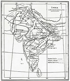
Background imageGeographical Collection: Map of India in the second century AD. From Hutchinson's History of the Nations, published 1915

Map of India in the second century AD. From Hutchinson's History of the Nations, published 1915
3033767 Map of India in the second century AD. From Hutchinson's History of the Nations, published 1915.; Private Collection.

Background imageGeographical Collection: Plan of Athens, Greece c.200 AD. From Historical Atlas, published 1923

Plan of Athens, Greece c.200 AD. From Historical Atlas, published 1923
2603507 Plan of Athens, Greece c.200 AD. From Historical Atlas, published 1923..

Background imageGeographical Collection: Map of the Athenian Empire at its height, c.450 B.C. From Historical Atlas

Map of the Athenian Empire at its height, c.450 B.C. From Historical Atlas, published 1923 (colour litho)
2603503 Map of the Athenian Empire at its height, c.450 B.C. From Historical Atlas, published 1923 (colour litho) by American School, (20th century).

Background imageGeographical Collection: Map showing the French dominions of Henry II King of england (print)

Map showing the French dominions of Henry II King of england (print)
1000965 Map showing the French dominions of Henry II King of england (print); Private Collection; (add.info.: From Illustrated Easy Stories from English History.).

Background imageGeographical Collection: Map of the Twelve Tribes of Israel, Canaan, or Palestine, as it was divided between the twelve

Map of the Twelve Tribes of Israel, Canaan, or Palestine, as it was divided between the twelve tribes of Israel
6117853 Map of the Twelve Tribes of Israel, Canaan, or Palestine, as it was divided between the twelve tribes of Israel. After a map published in 1750 (map); Photo © Ken Welsh

Background imageGeographical Collection: Map of Ireland, 17th century (map)

Map of Ireland, 17th century (map)
6117291 Map of Ireland, 17th century (map); (add.info.: Map of Ireland circa 1650-1675 by Dutch engraver, cartographer and publisher Nicolaes Visscher 1); Photo © Ken Welsh


All Professionally Made to Order for Quick Shipping

"Journey through Time and Space: Exploring the Geographical Evolution" Al-Idrisi's World Map, 1154: Unveiling ancient cartographic wisdom, this map showcases the Islamic scholar's remarkable understanding of global geography. Continental Drift after 250 Million Years: Witnessing Earth's transformative power, this concept reveals how tectonic plates shaped our continents over millions of years. Malham Cove, Yorkshire Dales: A geological marvel standing tall in the picturesque Yorkshire Dales, showcasing nature's artistic prowess carved by ice and water. British Empire World Map, 19th Century: Tracing the vast expanse of an empire on which the sun never set; a testament to Britain's once-global dominance. James Craig Map of New Town, Edinburgh, Scotland (1768): The birth of urban planning captured in ink; explore Edinburgh’s meticulously designed New Town with its unique topography. Anglo-Saxon 10th Century World Map: Delving into medieval perceptions of our planet; discover how early societies envisioned their place within a world still shrouded in mystery. Catalan Atlas, 14th Century: Marvel at one of history’s most exquisite maps as it unveils Europe’s expanding knowledge during the Middle Ages – a true masterpiece. UK at Night from Space: Behold Britain illuminated like never before. This awe-inspiring view from space captures the vibrant tapestry that is modern-day United Kingdom after sundown. Orteliuss Map of Ottoman Empire (1570): Step back into time and witness one man’s meticulous depiction of an empire that spanned three continents - revealing cultural diversity and grandeur. Europe at Night - Satellite Image & Europe at Night - Illuminating Boundaries : Gaze upon two contrasting images capturing Europe under different lights – highlighting both unity and division across nations 17th Century World Map.