Fraud Blocker Skip to main content

Geographical Collection (page 100)

"Journey through Time and Space: Exploring the Geographical Evolution" Al-Idrisi's World Map, 1154: Unveiling ancient cartographic wisdom

Background imageGeographical Collection: 1862, Johnson Map of Ontario and Quebec, Canada, topography, cartography, geography

1862, Johnson Map of Ontario and Quebec, Canada, topography, cartography, geography
1862, Johnson Map of Ontario and Quebec, Canada

Background imageGeographical Collection: 1862, Mitchells Map of Vermont and New Hampshire, topography, cartography, geography

1862, Mitchells Map of Vermont and New Hampshire, topography, cartography, geography
1862, Mitchells Map of Vermont and New Hampshire

Background imageGeographical Collection: 1862, Johnson Map of Northern Germany, Holstein and Hanover, topography, cartography

1862, Johnson Map of Northern Germany, Holstein and Hanover, topography, cartography
1862, Johnson Map of Northern Germany, Holstein and Hanover

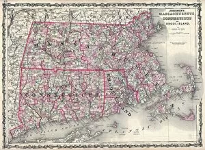
Background imageGeographical Collection: 1862, Johnson Map of Massachusetts, Connecticut and Rhode Island, topography, cartography

1862, Johnson Map of Massachusetts, Connecticut and Rhode Island, topography, cartography
1862, Johnson Map of Massachusetts, Connecticut and Rhode Island

Background imageGeographical Collection: 1862, Johnson Map of New Brunswick, Nova Scotia and Newfoundland, Canada, topography

1862, Johnson Map of New Brunswick, Nova Scotia and Newfoundland, Canada, topography
1862, Johnson Map of New Brunswick, Nova Scotia and Newfoundland, Canada

Background imageGeographical Collection: 1862, Johnson Map of Louisiana, Mississippi and Arkansas, topography, cartography

1862, Johnson Map of Louisiana, Mississippi and Arkansas, topography, cartography
1862, Johnson Map of Louisiana, Mississippi and Arkansas

Background imageGeographical Collection: 1862, Johnson Map of Kansas, Nebraska and Dakota, topography, cartography, geography

1862, Johnson Map of Kansas, Nebraska and Dakota, topography, cartography, geography
1862, Johnson Map of Kansas, Nebraska and Dakota

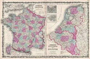
Background imageGeographical Collection: 1862, Johnson Map of France, Holland and Belgium, topography, cartography, geography

1862, Johnson Map of France, Holland and Belgium, topography, cartography, geography
1862, Johnson Map of France, Holland and Belgium

Background imageGeographical Collection: 1862, Johnson Map of Italy, Naples and Sicily, topography, cartography, geography

1862, Johnson Map of Italy, Naples and Sicily, topography, cartography, geography
1862, Johnson Map of Italy, Naples and Sicily

Background imageGeographical Collection: 1862, Johnson Map of California, Nevada, Utah, Colorado, New Mexico and Arizona, topography

1862, Johnson Map of California, Nevada, Utah, Colorado, New Mexico and Arizona, topography
1862, Johnson Map of California, Nevada, Utah, Colorado, New Mexico and Arizona

Background imageGeographical Collection: 1862, Johnson and Ward Map or Chart of the Worlds Mountains and Rivers, topography

1862, Johnson and Ward Map or Chart of the Worlds Mountains and Rivers, topography
1862, Johnson and Ward Map or Chart of the Worlds Mountains and Rivers

Background imageGeographical Collection: 1862, Johnsons Map of The Vicinity Of Richmond and Peninsular Campaign in Virginia

1862, Johnsons Map of The Vicinity Of Richmond and Peninsular Campaign in Virginia

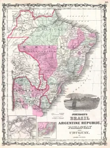
Background imageGeographical Collection: 1862, Johnson Map of Brazil, Paraguay, Uruguay and Argentina, topography, cartography

1862, Johnson Map of Brazil, Paraguay, Uruguay and Argentina, topography, cartography
1862, Johnson Map of Brazil, Paraguay, Uruguay and Argentina

Background imageGeographical Collection: 1862, Johnson Map of Arabia, Persia and Turkey in Asia, topography, cartography, geography

1862, Johnson Map of Arabia, Persia and Turkey in Asia, topography, cartography, geography
1862, Johnson Map of Arabia, Persia and Turkey in Asia

Background imageGeographical Collection: 1862, Colton Pocket Map of the United States, Civil War, topography, cartography

1862, Colton Pocket Map of the United States, Civil War, topography, cartography
1862, Colton Pocket Map of the United States, Civil War

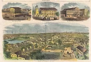
Background imageGeographical Collection: 1862, Harpers Weekly Civil War View of Richmond, Virginia, topography, cartography

1862, Harpers Weekly Civil War View of Richmond, Virginia, topography, cartography
1862, Harpers Weekly Civil War View of Richmond, Virginia

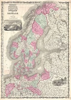
Background imageGeographical Collection: 1862, Johnsons Map of Scandinavia, Norway, Sweden, Finland and Denmark, topography

1862, Johnsons Map of Scandinavia, Norway, Sweden, Finland and Denmark, topography
1862, Johnsons Map of Scandinavia, Norway, Sweden, Finland and Denmark

Background imageGeographical Collection: 1861, Schaus Birds Eye View Map of Virginia, Delaware, and North Carolina, Seat of War

1861, Schaus Birds Eye View Map of Virginia, Delaware, and North Carolina, Seat of War

Background imageGeographical Collection: 1862, Johnsons Map of New York State, topography, cartography, geography, land

1862, Johnsons Map of New York State, topography, cartography, geography, land
1862, Johnsons Map of New York State

Background imageGeographical Collection: 1861, Mitchells Map of Illinois w- Chicago Inset, topography, cartography, geography

1861, Mitchells Map of Illinois w- Chicago Inset, topography, cartography, geography
1861, Mitchells Map of Illinois w- Chicago Inset

Background imageGeographical Collection: 1861, Levasseur Map of the Department de la Gironde, Bordeaux Wine Region, topography

1861, Levasseur Map of the Department de la Gironde, Bordeaux Wine Region, topography
1861, Levasseur Map of the Department de la Gironde, Bordeaux Wine Region

Background imageGeographical Collection: 1861, Johnson Map of Massachusetts, Connecticut and Rhode Island, topography, cartography

1861, Johnson Map of Massachusetts, Connecticut and Rhode Island, topography, cartography
1861, Johnson Map of Massachusetts, Connecticut and Rhode Island

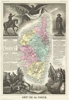
Background imageGeographical Collection: 1861, Levasseur Map of Corsica, La Corse, France, topography, cartography, geography

1861, Levasseur Map of Corsica, La Corse, France, topography, cartography, geography
1861, Levasseur Map of Corsica, La Corse, France

Background imageGeographical Collection: 1861, Johnson Map of Mississippi, Louisiana and Arkansas, topography, cartography

1861, Johnson Map of Mississippi, Louisiana and Arkansas, topography, cartography
1861, Johnson Map of Mississippi, Louisiana and Arkansas

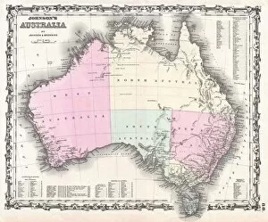
Background imageGeographical Collection: 1861, Johnson and Browning Map of Australia, First Edition, topography, cartography

1861, Johnson and Browning Map of Australia, First Edition, topography, cartography
1861, Johnson and Browning Map of Australia, First Edition

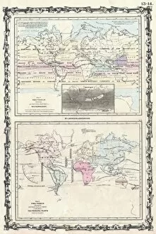
Background imageGeographical Collection: 1861, Johnson Climate Map of the World w- Meteorology, Rainfall, and Plants, topography

1861, Johnson Climate Map of the World w- Meteorology, Rainfall, and Plants, topography
1861, Johnson Climate Map of the World w- Meteorology, Rainfall, and Plants

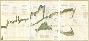
Background imageGeographical Collection: 1860, U. S. Coast Survey Map of Block Island, Buzzard Bay, Nantucket and Marthas Vineyard

1860, U. S. Coast Survey Map of Block Island, Buzzard Bay, Nantucket and Marthas Vineyard
1860, U.S. Coast Survey Map of Block Island, Buzzard Bay, Nantucket and Marthas Vineyard

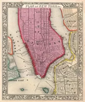
Background imageGeographical Collection: 1861, Colton Map of New York City w- Brooklyn, Manhattan, and Hoboken, topography

1861, Colton Map of New York City w- Brooklyn, Manhattan, and Hoboken, topography
1861, Colton Map of New York City w- Brooklyn, Manhattan, and Hoboken

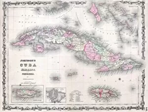
Background imageGeographical Collection: 1861, Johnsons Map of Cuba, Jamaica and Porto Rico, topography, cartography

1861, Johnsons Map of Cuba, Jamaica and Porto Rico, topography, cartography
1861, Johnsons Map of Cuba, Jamaica and Porto Rico

Background imageGeographical Collection: 1861, Appletons Map of the Seat of the Civil War, Pennsylvania, Virginia, Maryland

1861, Appletons Map of the Seat of the Civil War, Pennsylvania, Virginia, Maryland, North Carolina

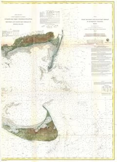
Background imageGeographical Collection: 1860, U. S. Coast Survey Chart or Map of Nantucket Island, Massachusetts, topography

1860, U. S. Coast Survey Chart or Map of Nantucket Island, Massachusetts, topography
1860, U.S. Coast Survey Chart or Map of Nantucket Island, Massachusetts

Background imageGeographical Collection: 1860, Pocket Map of Central Park, New York City, topography, cartography, geography

1860, Pocket Map of Central Park, New York City, topography, cartography, geography
1860, Pocket Map of Central Park, New York City

Background imageGeographical Collection: 1860, Mitchell Map of New York City, New York, first edition, topography, cartography

1860, Mitchell Map of New York City, New York, first edition, topography, cartography
1860, Mitchell Map of New York City, New York, first edition

Background imageGeographical Collection: 1860, Mitchell Map of Virginia, undivided and North Carolina, topography, cartography

1860, Mitchell Map of Virginia, undivided and North Carolina, topography, cartography
1860, Mitchell Map of Virginia, undivided and North Carolina

Background imageGeographical Collection: 1860, Mitchell Map of Iowa, Missouri, Illinois, Nebraska and Kansas, topography, cartography

1860, Mitchell Map of Iowa, Missouri, Illinois, Nebraska and Kansas, topography, cartography
1860, Mitchell Map of Iowa, Missouri, Illinois, Nebraska and Kansas

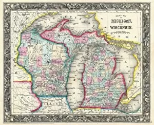
Background imageGeographical Collection: 1860, Mitchell Map of Michigan and Wisconsin, first edition, topography, cartography

1860, Mitchell Map of Michigan and Wisconsin, first edition, topography, cartography
1860, Mitchell Map of Michigan and Wisconsin, first edition

Background imageGeographical Collection: 1860, Mitchells Street Map of Philadelphia, topography, cartography, geography

1860, Mitchells Street Map of Philadelphia, topography, cartography, geography
1860, Mitchells Street Map of Philadelphia

Background imageGeographical Collection: 1860, Mitchells Map of the West Indies, Mexico and Central America, topography

1860, Mitchells Map of the West Indies, Mexico and Central America, topography
1860, Mitchells Map of the West Indies, Mexico and Central America

Background imageGeographical Collection: 1860, Andriveau Goujon Folding Wall Map of Paris, France, topography, cartography

1860, Andriveau Goujon Folding Wall Map of Paris, France, topography, cartography
1860, Andriveau Goujon Folding Wall Map of Paris, France

Background imageGeographical Collection: 1860, Andriveau Goujon Case Map of Paris, France, topography, cartography, geography

1860, Andriveau Goujon Case Map of Paris, France, topography, cartography, geography
1860, Andriveau Goujon Case Map of Paris, France

Background imageGeographical Collection: 1860, Mitchells Map of California, topography, cartography, geography, land

1860, Mitchells Map of California, topography, cartography, geography, land
1860, Mitchells Map of California

Background imageGeographical Collection: 1860, Mitchells Map of Peru, Ecuador, Venezuela, Columbia and Argentina, topography

1860, Mitchells Map of Peru, Ecuador, Venezuela, Columbia and Argentina, topography
1860, Mitchells Map of Peru, Ecuador, Venezuela, Columbia and Argentina

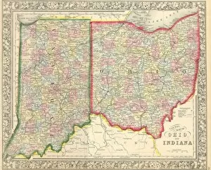
Background imageGeographical Collection: 1860, Mitchells Map of Ohio and Indiana, topography, cartography, geography

1860, Mitchells Map of Ohio and Indiana, topography, cartography, geography
1860, Mitchells Map of Ohio and Indiana

Background imageGeographical Collection: 1859, U. S. Coast Survey Map of Lynn Harbor, Massachusetts, topography, cartography

1859, U. S. Coast Survey Map of Lynn Harbor, Massachusetts, topography, cartography
1859, U.S. Coast Survey Map of Lynn Harbor, Massachusetts

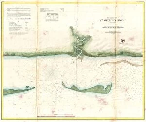
Background imageGeographical Collection: 1859, U. S. Coast Survey Map of St. George Sound, Florida Panhandle, topography, cartography

1859, U. S. Coast Survey Map of St. George Sound, Florida Panhandle, topography, cartography
1859, U.S. Coast Survey Map of St. George Sound, Florida Panhandle

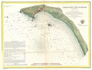
Background imageGeographical Collection: 1859, U. S. Coast Survey Map or Nautical Chart of Crescent City, California, topography

1859, U. S. Coast Survey Map or Nautical Chart of Crescent City, California, topography
1859, U.S. Coast Survey Map or Nautical Chart of Crescent City, California

Background imageGeographical Collection: 1859, Map of Marthas Vineyard, Marthas Vineyard, Massachusetts, topography, cartography

1859, Map of Marthas Vineyard, Marthas Vineyard, Massachusetts, topography, cartography
1859, Map of Marthas Vineyard, Marthas Vineyard, Massachusetts

Background imageGeographical Collection: 1859, Colton Pocket Map of Arkansas, Railroads, topography, cartography, geography

1859, Colton Pocket Map of Arkansas, Railroads, topography, cartography, geography
1859, Colton Pocket Map of Arkansas, Railroads


All Professionally Made to Order for Quick Shipping

"Journey through Time and Space: Exploring the Geographical Evolution" Al-Idrisi's World Map, 1154: Unveiling ancient cartographic wisdom, this map showcases the Islamic scholar's remarkable understanding of global geography. Continental Drift after 250 Million Years: Witnessing Earth's transformative power, this concept reveals how tectonic plates shaped our continents over millions of years. Malham Cove, Yorkshire Dales: A geological marvel standing tall in the picturesque Yorkshire Dales, showcasing nature's artistic prowess carved by ice and water. British Empire World Map, 19th Century: Tracing the vast expanse of an empire on which the sun never set; a testament to Britain's once-global dominance. James Craig Map of New Town, Edinburgh, Scotland (1768): The birth of urban planning captured in ink; explore Edinburgh’s meticulously designed New Town with its unique topography. Anglo-Saxon 10th Century World Map: Delving into medieval perceptions of our planet; discover how early societies envisioned their place within a world still shrouded in mystery. Catalan Atlas, 14th Century: Marvel at one of history’s most exquisite maps as it unveils Europe’s expanding knowledge during the Middle Ages – a true masterpiece. UK at Night from Space: Behold Britain illuminated like never before. This awe-inspiring view from space captures the vibrant tapestry that is modern-day United Kingdom after sundown. Orteliuss Map of Ottoman Empire (1570): Step back into time and witness one man’s meticulous depiction of an empire that spanned three continents - revealing cultural diversity and grandeur. Europe at Night - Satellite Image & Europe at Night - Illuminating Boundaries : Gaze upon two contrasting images capturing Europe under different lights – highlighting both unity and division across nations 17th Century World Map.