Fraud Blocker Skip to main content

Cartographic Collection (page 9)

"Unveiling the World Through Cartographic Masterpieces" Step back in time and embark on a journey through history with these captivating cartographic treasures

Background imageCartographic Collection: Europe, 1871 (colour litho)

Europe, 1871 (colour litho)
955446 Europe, 1871 (colour litho) by American School, (19th century); length: 46 cm; New York Public Library, USA; (add.info.: Published by Asher & Adams.); American, out of copyright

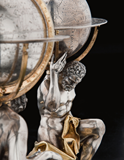
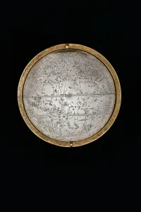
Background imageCartographic Collection: Two exceptional terrestrial and celestial globes, supported by Hercules and Atlas

Two exceptional terrestrial and celestial globes, supported by Hercules and Atlas
3482920 Two exceptional terrestrial and celestial globes, supported by Hercules and Atlas, Augsburg, 1697-99 (silver & silver-gilt) by Drentwett

Background imageCartographic Collection: Two exceptional terrestrial and celestial globes, supported by Hercules and Atlas

Two exceptional terrestrial and celestial globes, supported by Hercules and Atlas
3482919 Two exceptional terrestrial and celestial globes, supported by Hercules and Atlas, Augsburg, 1697-99 (silver & silver-gilt) by Drentwett

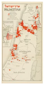
Background imageCartographic Collection: Map of Palestine, 1926 (colour litho)

Map of Palestine, 1926 (colour litho)
3482908 Map of Palestine, 1926 (colour litho) by Trietsch, Davis (1870-1935); Private Collection; (add.info.: PalAastina-Wirtschafts-Atlas. Berlin: Orient-Verlag, [1926])
Background imageCartographic Collection: Two exceptional terrestrial and celestial globes, supported by Hercules and Atlas

Two exceptional terrestrial and celestial globes, supported by Hercules and Atlas
3482893 Two exceptional terrestrial and celestial globes, supported by Hercules and Atlas, Augsburg, 1697-99 (silver & silver-gilt) by Drentwett

Background imageCartographic Collection: Large pair of library globes, the terrestrial 1645 / 48, the celestial after c

Large pair of library globes, the terrestrial 1645 / 48, the celestial after c
3482882 Large pair of library globes, the terrestrial 1645/48, the celestial after c.1630 (plaster, wood & engraved paper) by Blaeu

Background imageCartographic Collection: Large pair of library globes, the terrestrial 1645 / 48, the celestial after c

Large pair of library globes, the terrestrial 1645 / 48, the celestial after c
3482888 Large pair of library globes, the terrestrial 1645/48, the celestial after c.1630 (plaster, wood & engraved paper) by Blaeu

Background imageCartographic Collection: The Ottoman Corsair Khayr al-Din Barbarossa against Charles Vs Army

The Ottoman Corsair Khayr al-Din Barbarossa against Charles Vs Army
2901855 The Ottoman Corsair Khayr al-Din Barbarossa against Charles Vs Army, by Franz Hogenberg, 1535, engraving by Hogenberg

Background imageCartographic Collection: Map of Africa (hand-coloured engraving)

Map of Africa (hand-coloured engraving)
619429 Map of Africa (hand-coloured engraving) by Speed, John (1552-1629); Private Collection; The Stapleton Collection; English, out of copyright

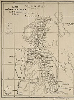
Background imageCartographic Collection: Map of Laos and the Mekong river showing the route of the voyage of Henri Mouhot

Map of Laos and the Mekong river showing the route of the voyage of Henri Mouhot
423692 Map of Laos and the Mekong river showing the route of the voyage of Henri Mouhot, illustration from Travels in the Central Parts of Indo-China (Siam), Cambodia, and Laos During the Years 1858

Background imageCartographic Collection: Map of the travels of Alexander the Great (356-323 BC) from Le Theatre du Monde

Map of the travels of Alexander the Great (356-323 BC) from Le Theatre du Monde
BMR165845 Map of the travels of Alexander the Great (356-323 BC) from Le Theatre du Monde or Nouvel Atlas, 1645 (coloured engraving) by Blaeu

Background imageCartographic Collection: Page 37b Map of Charlestown and state of the Kings troops, March 11 1780 (pencil

Page 37b Map of Charlestown and state of the Kings troops, March 11 1780 (pencil
5670303 Page 37b Map of Charlestown and state of the Kings troops, March 11 1780 (pencil, pen & ink) by Hodges, William (1744-97); Mitchell Library

Background imageCartographic Collection: ia. A Plan of the Harbour of St Johns in Newfoundland, 1760s (pen & ink and wash)

ia. A Plan of the Harbour of St Johns in Newfoundland, 1760s (pen & ink and wash)
5670245 ia. A Plan of the Harbour of St Johns in Newfoundland, 1760s (pen & ink and wash) by Cook, James (1728-79); Mitchell Library, State Library of New South Wales; (add.info.: Original Sketches)

Background imageCartographic Collection: Page 38b The Track of His Majestys ship Perseverance between Rutland

Page 38b The Track of His Majestys ship Perseverance between Rutland
5670306 Page 38b The Track of His Majestys ship Perseverance between Rutland and the Cinque Islands (pen & ink) by Unknown artist, (18th century); Mitchell Library

Background imageCartographic Collection: A Nautical Map, detail of the Gran Turco, 1564 (colour litho)

A Nautical Map, detail of the Gran Turco, 1564 (colour litho)
955466 A Nautical Map, detail of the Gran Turco, 1564 (colour litho) by Maggiolo, Giacomo (16th Century); Biblioteca Civica Bertoliana, Vicenza, Italy; Alinari

Background imageCartographic Collection: Europe, 1814 (litho)

Europe, 1814 (litho)
955444 Europe, 1814 (litho) by Bower, John (fl.1810-19); New York Public Library, USA; (add.info.: Published by Mathew Carey (1760-1839)); American, out of copyright

Background imageCartographic Collection: Plan of London looking towards Southwark (hand-coloured engraving)

Plan of London looking towards Southwark (hand-coloured engraving)
495414 Plan of London looking towards Southwark (hand-coloured engraving) by English School, (19th century); Private Collection; English, out of copyright

Background imageCartographic Collection: Map of the Cittie of London, 1633 (hand-coloured engraving)

Map of the Cittie of London, 1633 (hand-coloured engraving)
495412 Map of the Cittie of London, 1633 (hand-coloured engraving) by Ryther, Augustus (fl.1572-92) (atrr. to); Private Collection; (add.info.: This plan was produced to satisfy a European market)

Background imageCartographic Collection: Discovering the legacy of Lewis and Clark : bicentennial commemoration 2003-2006

Discovering the legacy of Lewis and Clark : bicentennial commemoration 2003-2006
preparation, recruitment, exploration and homecoming, Indian reservations, Louisiana Purchase boundary, and Lewis and Clark National Historic Trail

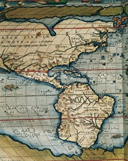
Background imageCartographic Collection: Map of Central and South America. Theatrum Orbis Terrarum by

Map of Central and South America. Theatrum Orbis Terrarum by Abraham Ortelius (1527-1598). First Edition. Antwerp, 1574

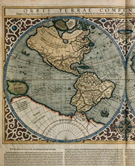
Background imageCartographic Collection: World Map by Rumold Mercator (1512-1594)

World Map by Rumold Mercator (1512-1594)
Orbis Terrae Compendiosa Descriptio. World map, 1587. Detail of America. By Rumold Mercator (1545-1599)

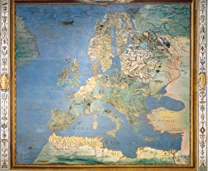
Background imageCartographic Collection: ITALY. Caprarola. Villa Farnese. Map of Europe

ITALY. Caprarola. Villa Farnese. Map of Europe. 1574 painting by Giovanni Antonio da Varese Vanosino. Stanza del Mappamondo (Geographic room or Room of the World Map). Renaissance art. Cinquecento

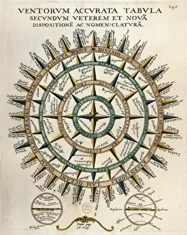
Background imageCartographic Collection: Tabula secundum accurata Ventorum veterem et nova

Tabula secundum accurata Ventorum veterem et nova [m] dispositione [m] ac nomenclature [m] (Table of the winds according to the old and new layout and nomenclature)

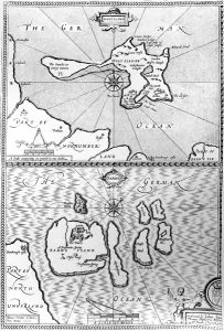
Background imageCartographic Collection: Maps of Holy Island and Farne Island, Northumberland, from The Theatre of the

Maps of Holy Island and Farne Island, Northumberland, from The Theatre of the
XJF448282 Maps of Holy Island and Farne Island, Northumberland, from The Theatre of the Empire of Great Britaine by John Speed, 1676 (engraving) by Speed

Background imageCartographic Collection: Ptolemys map of Britain, 16th century

Ptolemys map of Britain, 16th century
Ptolemys map of Britain. This map of the British Isles is from an edition of Ptolemys Geographia that was published in 1513 by German cartographer Martin Waldseemuller (c.1470-1520)

Background imageCartographic Collection: Theatrum Orbis Terrarum by Abraham Ortelius (1527-1598)

Theatrum Orbis Terrarum by Abraham Ortelius (1527-1598)
Map of America. Theatrum Orbis Terrarum by Abraham Ortelius (1527-1598). First Edition. Antwerp, 1574

Background imageCartographic Collection: The Invincible Armada. Map of Robert Adams. Engraving
The Invincible Armada. Map of Robert Adams. Engraving
" The Invincible Armada. Map of Robert Adams. Engraving by Augustine Ryther in " Expeditions in Anglian, Vera Descriptio" (1588). SPAIN. San Lorenzo de El Escorial

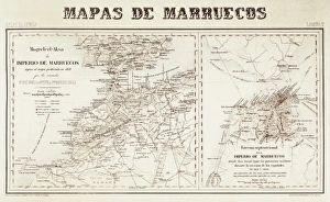
Background imageCartographic Collection: Spain. War of Africa (1859-1860). Maps of Morocco

Spain. War of Africa (1859-1860). Maps of Morocco

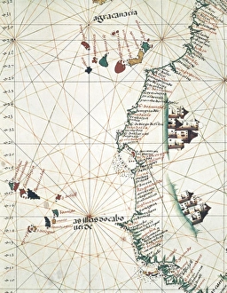
Background imageCartographic Collection: Map of the West of African coast with the Islands

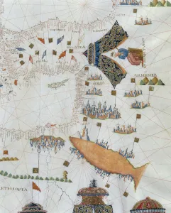
Map of the West of African coast with the Islands of Macaronesia, the Canary Isles and Cape Verde. 1514. Miniature Painting. PORTUGAL. Lisbon. Maritime Museum

Background imageCartographic Collection: Spain. First Carlist War (1836). Map of Spain

Spain. First Carlist War (1836). Map of Spain

Background imageCartographic Collection: Chart by Joan Martines. Island of Sicily (1591)

Chart by Joan Martines. Island of Sicily (1591). Miniature Painting

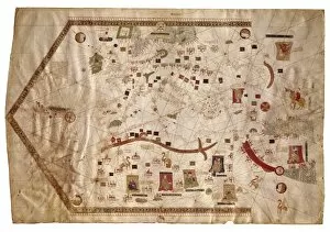
Background imageCartographic Collection: Portolan chart of the Mediterranean sea (1439)

Portolan chart of the Mediterranean sea (1439) of Gabriel de Vallseca. It belonged to Amerigo Vespucci. SPAIN. Barcelona. Barcelona Maritime Museum

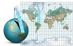
Background imageCartographic Collection: Mercator map projection, diagram

Mercator map projection, diagram
Mercator map projection. Diagram of an Earth globe (left) and a Mercator map projection (right) with the blue strip (from South America to Greenland)

Background imageCartographic Collection: Haci Ahmeds world map, 1560

Haci Ahmeds world map, 1560
Haci Ahmeds world map. This map, based on Oronce Fines cordiform (heart-shaped) map of 1534, was translated into Turkish in the Islamic year 967 (October 1559 to September 1560)

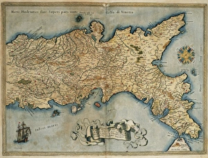
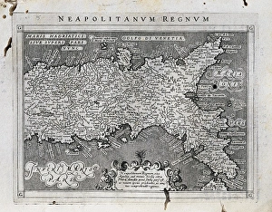
Background imageCartographic Collection: Map of the Kingdom of Naples. Theatrum Orbis Terrarum by Abr

Map of the Kingdom of Naples. Theatrum Orbis Terrarum by Abraham Ortelius (1527-1598). First Edition. Antwerp, 1574. Library of Catalonia. Barcelona. Spain

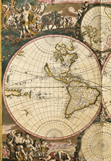
Background imageCartographic Collection: Nova Orbis Tabula in Lucem Edita by Frederik de Wit (1630-17

Nova Orbis Tabula in Lucem Edita by Frederik de Wit (1630-1706). 17th century. Detail of the Americas, Pacific Ocean and islands discovered. Amsterdam

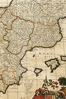
Background imageCartographic Collection: Spain. Detail. Atlas by Frederik de Wit (1630-1706). 17th ce

Spain. Detail. Atlas by Frederik de Wit (1630-1706). 17th ce
Map of the Principality of Catalonia, Kingdoms of Navarre, Aragon, Valencia, Murcia and the Balearic Islands. Atlas by Frederik de Wit (1630-1706). Amsterdam, 17th century

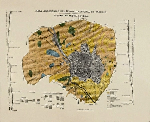
Background imageCartographic Collection: VILANOVA i PIERA, Joan (1821-1893). Agronomic map

VILANOVA i PIERA, Joan (1821-1893). Agronomic map of Madrid municipal area. SPAIN. MADRID (AUTONOMOUS COMMUNITY). Madrid. Instituto Geol󧩣 o y Minero de Espa

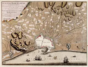
Background imageCartographic Collection: French map of the city of Barcelona (1706). SPAIN

French map of the city of Barcelona (1706). SPAIN. CATALONIA. Barcelona. Barcelona City History Museum

Background imageCartographic Collection: Map of the Kingdom of Naples. 1597-1568. Illustration

Map of the Kingdom of Naples. 1597-1568. Illustration from the work Geografia, cio鬠 Descrittione universale de la terra, edited in Venice by Giovanni Battista and Giorgio Galignani. SPAIN

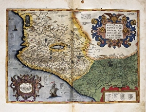
Background imageCartographic Collection: Theatrum Orbis Terrarum. New Spain (Mexico)

Theatrum Orbis Terrarum. New Spain (Mexico)
ORTELIUS, Abraham (1527-1598). Theatrum Orbis Terrarum. 1570. It is considered to be the first modern atlas. Map of New Spain (Mexico), 1579. Printed in Antwerp by Christophe Plantin (1588). Etching

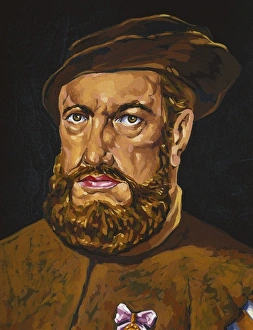
Background imageCartographic Collection: Portrait of Magalhaes. Spanish anonymous

Portrait of Magalhaes. Spanish anonymous
MAGELLAND, Ferdinand (1480-1521). Portuguese navigator and discoverer. Oil on canvas

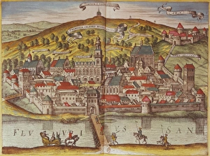
Background imageCartographic Collection: Civitatis Orbis Terrarum. Przemy?l

Civitatis Orbis Terrarum. Przemy?l
BRAUN, George (1541-1622). Civitatis Orbis Terrarum (Theatrum orbis terrarum). 1572-1617. Przensyl, Polish city near the border with Lithuania. Etching. FRANCE. Ό E-DE-FRANCE. Paris

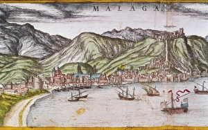
Background imageCartographic Collection: Civitatis Orbis Terrarum. Malaga

Civitatis Orbis Terrarum. Malaga
BRAUN, George (1541-1622). Civitatis Orbis Terrarum (Theatrum orbis terrarum). 1572-1617. Malaga (1599). Etching. SPAIN. CATALONIA. Barcelona. Historical Archive of Barcelona

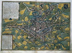
Background imageCartographic Collection: Civitatis Orbis Terrarum. Ghent

Civitatis Orbis Terrarum. Ghent
BRAUN, George (1541-1622). Civitatis Orbis Terrarum (Theatrum orbis terrarum). 1572-1617. Ghent (1572). Etching. SPAIN. CASTILE AND LEON. Salamanca. Salamanca University Library

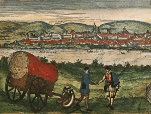
Background imageCartographic Collection: Civitatis Orbis Terrarum. Ecija

Civitatis Orbis Terrarum. Ecija
BRAUN, George (1541-1622). Civitatis Orbis Terrarum (Theatrum orbis terrarum). 1572-1617. Ecija (1567). Etching. SPAIN. CASTILE AND LEON. Salamanca. Salamanca University Library

Background imageCartographic Collection: Civitatis Orbis Terrarum. London

Civitatis Orbis Terrarum. London
BRAUN, George (1541-1622). Civitatis Orbis Terrarum (Theatrum orbis terrarum). 1572-1617. London. Detail. Etching. SPAIN. CASTILE AND LEON. Salamanca. Salamanca University Library

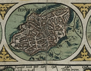
Background imageCartographic Collection: Atlas Novus. Asia, 17th c Jerusalem

Atlas Novus. Asia, 17th c Jerusalem
BLAEU, Jan (1596-1673). Atlas Novus or Atlas Maior. 1635 - 1665. Asia noviter delineata. Map of Asia printed in Amsterdam ca. 1635. Detail with view of the city of Jerusalem. Etching. SPAIN


All Professionally Made to Order for Quick Shipping

"Unveiling the World Through Cartographic Masterpieces" Step back in time and embark on a journey through history with these captivating cartographic treasures. From Al-Idrisi's world map of 1154 to Orteliuss' intricate creations from the 16th century, each map tells a unique story about the world as it was known at that time. Al-Idrisi's world map, crafted in 1154, offers a glimpse into medieval Islamic geography, showcasing an impressive understanding of global trade routes and geographical features. Meanwhile, the British Empire world map from the 19th century illustrates the vast extent of Britain's dominion across continents and oceans. The Catalan Atlas transports us to the 14th century with its exquisite craftsmanship and detailed depictions of various regions. It serves as a testament to Catalonia's rich maritime tradition and exploration during this period. Orteliuss' maps take center stage throughout this collection, providing invaluable insights into specific regions such as Ottoman Empire, Italy, Poland, Greece, Germany, Netherlands - all meticulously documented in his renowned Theatrum Orbis Terrarum. These masterpieces not only showcase Orteliuss' cartographic expertise but also shed light on political boundaries and cultural nuances prevalent during his era. Moving closer to home is the Map of City Dublin from 1797 which showcases Ireland's capital city at that time - offering glimpses into its urban layout and architectural landmarks that have shaped Dublin's identity over centuries. Lastly Zaragoza’s (19th c. ) Map takes us to Spain where we can explore Madrid through intricate details capturing its streetscape during that period - allowing us to immerse ourselves in Spanish history while navigating through its vibrant capital city. These remarkable cartographic works serve as windows into our past – they are not just maps; they are gateways connecting us with bygone eras.