Home > Arts > Artists > O > Abraham Ortelius
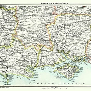
Civitatis Orbis Terrarum. London

![]()
Wall Art and Photo Gifts from Mary Evans Picture Library
Civitatis Orbis Terrarum. London
BRAUN, George (1541-1622). Civitatis Orbis Terrarum (Theatrum orbis terrarum). 1572-1617. London. Detail. Etching. SPAIN. CASTILE AND LEON. Salamanca. Salamanca University Library
Mary Evans Picture Library makes available wonderful images created for people to enjoy over the centuries
Media ID 14179692
© J. Bedmar/Iberfoto/Mary Evans
1527 1535 1541 1572 1590 1598 1617 1622 Abraham Attire Braun Cartographic Cartographies Cartography Castile Civitatis Dresses Engravings Etching Etchings Franz Hist Ricas Hist Ricos Histoa63 A Histoa63 As Histoa63 O Histoa63 Os Historia Historica Historico Hogenberg Leon Maps Orbis Ortelius Salamanca Suits Terrarum Theatrum Track University Europeans
FEATURES IN THESE COLLECTIONS
> Arts
> Artists
> O
> Abraham Ortelius
> Europe
> United Kingdom
> England
> London
> Related Images
> Europe
> United Kingdom
> England
> Maps
> Maps and Charts
> Abraham Ortelius
> Maps and Charts
> Spain
EDITORS COMMENTS
Civitatis Orbis Terrarum," or "Theatrum Orbis Terrarum," is a seminal work in the history of cartography, created by the collaborative efforts of George Braun and Abraham Ortelius. This particular detail is taken from the London edition of the map, published between 1572 and 1617. The map showcases the Iberian Peninsula, with a focus on the region of Castile and León, specifically the city of Salamanca. Salamanca, the ancient university city in western Spain, is depicted with intricate detail. The city's architecture is rendered in exquisite detail, with various buildings, including the University Library, depicted with great accuracy. The attire of the figures in the scene adds to the vividness of the image, providing a glimpse into the fashion of the time. This map is significant as it represents a major advancement in cartographic representation. The collaborative effort between Braun and Ortelius resulted in a more accurate and comprehensive depiction of the world than previously available. The map also showcases the influence of the Renaissance, with a focus on realism and detail. The map was produced during a time of great exploration and discovery, with Europeans expanding their reach across the globe. The map reflects this newfound knowledge, with the inclusion of previously unexplored territories and more accurate depictions of known lands. The map was produced using the etching technique, which allowed for greater detail and precision than earlier methods. The intricacy of the detail in this particular image is a testament to the skill of the engravers, Franz Hogenberg and his sons, who worked on the London edition of the map. Overall, this detail from the Civitatis Orbis Terrarum map is a fascinating glimpse into the world of the late 16th century, showcasing the advances in cartography, the influence of the Renaissance, and the spirit of exploration and discovery that characterized the era.
MADE IN THE USA
Safe Shipping with 30 Day Money Back Guarantee
FREE PERSONALISATION*
We are proud to offer a range of customisation features including Personalised Captions, Color Filters and Picture Zoom Tools
SECURE PAYMENTS
We happily accept a wide range of payment options so you can pay for the things you need in the way that is most convenient for you
* Options may vary by product and licensing agreement. Zoomed Pictures can be adjusted in the Cart.