Fraud Blocker Skip to main content

Cartographic Collection (page 3)

"Unveiling the World Through Cartographic Masterpieces" Step back in time and embark on a journey through history with these captivating cartographic treasures

Background imageCartographic Collection: Vera Cruz, 1844

Vera Cruz, 1844
2902757 Vera Cruz, 1844; (add.info.: Vera Cruz, 1844.); Buyenlarge Archive/UIG.

Background imageCartographic Collection: Nuevo Leon, 1844

Nuevo Leon, 1844
2902755 Nuevo Leon, 1844; (add.info.: Nuevo Leon, 1844.); Buyenlarge Archive/UIG.

Background imageCartographic Collection: St Petersburg, Russia, 1776

St Petersburg, Russia, 1776
2902729 St Petersburg, Russia, 1776; (add.info.: St. Petersburg, Russia, 1776.); Buyenlarge Archive/UIG.

Background imageCartographic Collection: La Crosse, Wis 1873

La Crosse, Wis 1873
2903030 La Crosse, Wis 1873; (add.info.: La Crosse, Wis. 1873.); Buyenlarge Archive/UIG.
Background imageCartographic Collection: Siberia, Russia, 1706

Siberia, Russia, 1706
2902723 Siberia, Russia, 1706; (add.info.: Siberia, Russia, 1706.); Buyenlarge Archive/UIG.

Background imageCartographic Collection: Asiatic Russia - 1868

Asiatic Russia - 1868
2902718 Asiatic Russia - 1868; (add.info.: Asiatic Russia - 1868); Buyenlarge Archive/UIG.

Background imageCartographic Collection: Turkey in Asia, 1849

Turkey in Asia, 1849
2902287 Turkey in Asia, 1849; (add.info.: Turkey in Asia, 1849.); Buyenlarge Archive/UIG.

Background imageCartographic Collection: Persia, Arabia, 1855

Persia, Arabia, 1855
2902282 Persia, Arabia, 1855; (add.info.: Persia, Arabia, 1855.); Buyenlarge Archive/UIG.

Background imageCartographic Collection: Persia, Afghanistan - Baluchistan, 1901

Persia, Afghanistan - Baluchistan, 1901
2902272 Persia, Afghanistan - Baluchistan, 1901; (add.info.: Persia, Afghanistan - Baluchistan, 1901.); Buyenlarge Archive/UIG.

Background imageCartographic Collection: Bokhara, Beluchistan - Afghanistan

Bokhara, Beluchistan - Afghanistan
2902271 Bokhara, Beluchistan - Afghanistan; (add.info.: Bokhara, Beluchistan - Afghanistan, 1800s.); Buyenlarge Archive/UIG.

Background imageCartographic Collection: Historical artifacts from Mexicos Indian past, 1885

Historical artifacts from Mexicos Indian past, 1885
2902262 Historical artifacts from Mexicos Indian past, 1885; (add.info.: Historic map of Mexico with Aztecs, Pyramids, votaries, idols, dolls, vessels. Printed in Spanish.); Buyenlarge Archive/UIG.

Background imageCartographic Collection: Agricultural Map of Mexico, 1885

Agricultural Map of Mexico, 1885
2902260 Agricultural Map of Mexico, 1885; (add.info.: Historic map of Mexico with Agriculture, husbandry, Horticulture, farming, trees, conservatories, paddies)

Background imageCartographic Collection: West Africa, 1679

West Africa, 1679
2902124 West Africa, 1679; (add.info.: West Africa, 1679.); Buyenlarge Archive/UIG.

Background imageCartographic Collection: Barbary, Black Africa - Guinee

Barbary, Black Africa - Guinee
2902122 Barbary, Black Africa - Guinee; (add.info.: Barbary, Black Africa - Guinee, 1792.); Buyenlarge Archive/UIG.

Background imageCartographic Collection: Africa, 1804

Africa, 1804
2902121 Africa, 1804; (add.info.: Africa, 1804.); Buyenlarge Archive/UIG.

Background imageCartographic Collection: Egypt, Arabia, Petra - Abyssinia, 1885

Egypt, Arabia, Petra - Abyssinia, 1885
2902112 Egypt, Arabia, Petra - Abyssinia, 1885; (add.info.: Inset of the Suez Canal. Egypt, Arabia, Petra - Abyssinia, 1885.); Buyenlarge Archive/UIG.

Background imageCartographic Collection: Africa, 1688

Africa, 1688
2902110 Africa, 1688; (add.info.: Africa, 1688.); Buyenlarge Archive/UIG.

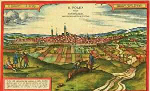
Background imageCartographic Collection: Sankt Polten, Austria

Sankt Polten, Austria
2901913 Sankt Polten, Austria; (add.info.: The city is situated on the Traisen River in northeastern Austria, between the Danube River and the foothills of the Alps)

Background imageCartographic Collection: Weimar, Germany

Weimar, Germany
2901912 Weimar, Germany; (add.info.: Located on Ilm river; was medieval center; ruled by counts of Weimar-Orlamde from 1247)

Background imageCartographic Collection: Loja, Granada, Spain, 17th century

Loja, Granada, Spain, 17th century
2901840 Loja, Granada, Spain, 17th century; (add.info.: City Captured from the Moors by Isabella during the Inquisition; It was called - flower amongst thorns.); Buyenlarge Archive/UIG.

Background imageCartographic Collection: Alhama de Granada, 17th century

Alhama de Granada, 17th century
2901793 Alhama de Granada, 17th century; (add.info.: City famous for its Baths, named after the Arabic.); Buyenlarge Archive/UIG.

Background imageCartographic Collection: Scotland

Scotland
2902837 Scotland; (add.info.: Scotland, 1849.); Buyenlarge Archive/UIG.

Background imageCartographic Collection: Europe, 1849

Europe, 1849
2902835 Europe, 1849; (add.info.: Europe, 1849.); Buyenlarge Archive/UIG.

Background imageCartographic Collection: Hiberia or Ireland, 1598

Hiberia or Ireland, 1598
2902827 Hiberia or Ireland, 1598; (add.info.: Hiberia or Ireland, 1598.); Buyenlarge Archive/UIG.

Background imageCartographic Collection: Home Rule Map of Ireland, 1893

Home Rule Map of Ireland, 1893
2902825 Home Rule Map of Ireland, 1893; (add.info.: Home Rule Map of Ireland, 1893.); Buyenlarge Archive/UIG.

Background imageCartographic Collection: Great Lakes Region During French Settlement Period, 1755

Great Lakes Region During French Settlement Period, 1755
2902819 Great Lakes Region During French Settlement Period, 1755; (add.info.: Great Lakes Region During French Settlement Period, 1755.); Buyenlarge Archive/UIG.

Background imageCartographic Collection: Railroad Map of the Eastern States, New England, 1856

Railroad Map of the Eastern States, New England, 1856
2902812 Railroad Map of the Eastern States, New England, 1856; (add.info.: Map of New England, part of eastern Canada, New York, Pennsylvania, New Jersey, Delaware, most of Maryland)

Background imageCartographic Collection: Canada - New France, 1685

Canada - New France, 1685
2902809 Canada - New France, 1685; (add.info.: Canada - New France, 1685.); Buyenlarge Archive/UIG.

Background imageCartographic Collection: British and French dominions in North America, 1755

British and French dominions in North America, 1755
2902800 British and French dominions in North America, 1755; (add.info.: A map of the British and French dominions in North America, with the roads, distances, limits)

Background imageCartographic Collection: North America, 1758

North America, 1758
2902792 North America, 1758; (add.info.: North America. From the French of Mr. dAnville, improved with the back settlements of Virginia and course of Ohio)

Background imageCartographic Collection: Sonora, Mexico, 1884

Sonora, Mexico, 1884
2902753 Sonora, Mexico, 1884; (add.info.: Sonora, Mexico, 1884.); Buyenlarge Archive/UIG.

Background imageCartographic Collection: Ethnographic Map of Asiatic Russia, 1870

Ethnographic Map of Asiatic Russia, 1870
2902750 Ethnographic Map of Asiatic Russia, 1870; (add.info.: Ethnographic Map of Asiatic Russia, 1870.); Buyenlarge Archive/UIG.

Background imageCartographic Collection: Russian Discoveries, 1775

Russian Discoveries, 1775
2902732 Russian Discoveries, 1775; (add.info.: Russian discoveries from the map published by the Imperial Academy of St. Petersburg.); Buyenlarge Archive/UIG.

Background imageCartographic Collection: Brownsville, Bridgeport

Brownsville, Bridgeport
2903131 Brownsville, Bridgeport; (add.info.: Brownsville, Bridgeport, Pennsylvania, 1883.); Buyenlarge Archive/UIG.

Background imageCartographic Collection: Theatre or War, Mexican Archipelago - the Caribbean, 1757

Theatre or War, Mexican Archipelago - the Caribbean, 1757
2902869 Theatre or War, Mexican Archipelago - the Caribbean, 1757; (add.info.: Theatre or War, Mexican Archipelago - the Caribbean, 1757.); Buyenlarge Archive/UIG.

Background imageCartographic Collection: Korea, 1750

Korea, 1750
2902863 Korea, 1750; (add.info.: Korea, 1750.); Buyenlarge Archive/UIG.

Background imageCartographic Collection: Asia - 1796

Asia - 1796
2902858 Asia - 1796; (add.info.: Asia - 1796); Buyenlarge Archive/UIG.

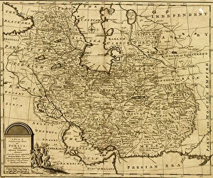
Background imageCartographic Collection: Persia, Iran, 1767

Persia, Iran, 1767
2902854 Persia, Iran, 1767; (add.info.: Persia, Iran, 1767.); Buyenlarge Archive/UIG.

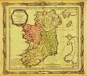
Background imageCartographic Collection: Ireland pictured in Ecclesiastical Divisions, 1766

Ireland pictured in Ecclesiastical Divisions, 1766
2902828 Ireland pictured in Ecclesiastical Divisions, 1766; (add.info.: Ireland pictured in Ecclesiastical Divisions, 1766.); Buyenlarge Archive/UIG.

Background imageCartographic Collection: Memoir Map of Ireland, 1797

Memoir Map of Ireland, 1797
2902826 Memoir Map of Ireland, 1797; (add.info.: Memoir Map of Ireland, 1797.); Buyenlarge Archive/UIG.

Background imageCartographic Collection: Portugese Navigational Map of the North Atlantic, 1630

Portugese Navigational Map of the North Atlantic, 1630
2902820 Portugese Navigational Map of the North Atlantic, 1630; (add.info.: Portugese Navigational Map of the North Atlantic, 1630.); Buyenlarge Archive/UIG.

Background imageCartographic Collection: Ports in the West Indies, 1630

Ports in the West Indies, 1630
2902885 Ports in the West Indies, 1630; (add.info.: Ports in the West Indies, 1630.); Buyenlarge Archive/UIG.

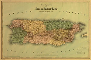
Background imageCartographic Collection: Puerto Rico, 1886

Puerto Rico, 1886
2902875 Puerto Rico, 1886; (add.info.: Colton, Company.); Buyenlarge Archive/UIG.

Background imageCartographic Collection: America in the 17th Century, 1652

America in the 17th Century, 1652
2902805 America in the 17th Century, 1652; (add.info.: America in the 17th Century, 1652.); Buyenlarge Archive/UIG.

Background imageCartographic Collection: Asia - 1570

Asia - 1570
2902850 Asia - 1570; (add.info.: Asia - 1570); Buyenlarge Archive/UIG.

Background imageCartographic Collection: Asia - 1600

Asia - 1600
2902848 Asia - 1600; (add.info.: Asia -1600); Buyenlarge Archive/UIG.

Background imageCartographic Collection: Siege of Santo Domingo

Siege of Santo Domingo
2902889 Siege of Santo Domingo; (add.info.: Siege of Santo Domingo, 1895.); Buyenlarge Archive/UIG.

Background imageCartographic Collection: Eighteenth Century Map of the United States, 1784

Eighteenth Century Map of the United States, 1784
2902818 Eighteenth Century Map of the United States, 1784; (add.info.: Eighteenth Century Map of the United States, 1784.); Buyenlarge Archive/UIG.


All Professionally Made to Order for Quick Shipping

"Unveiling the World Through Cartographic Masterpieces" Step back in time and embark on a journey through history with these captivating cartographic treasures. From Al-Idrisi's world map of 1154 to Orteliuss' intricate creations from the 16th century, each map tells a unique story about the world as it was known at that time. Al-Idrisi's world map, crafted in 1154, offers a glimpse into medieval Islamic geography, showcasing an impressive understanding of global trade routes and geographical features. Meanwhile, the British Empire world map from the 19th century illustrates the vast extent of Britain's dominion across continents and oceans. The Catalan Atlas transports us to the 14th century with its exquisite craftsmanship and detailed depictions of various regions. It serves as a testament to Catalonia's rich maritime tradition and exploration during this period. Orteliuss' maps take center stage throughout this collection, providing invaluable insights into specific regions such as Ottoman Empire, Italy, Poland, Greece, Germany, Netherlands - all meticulously documented in his renowned Theatrum Orbis Terrarum. These masterpieces not only showcase Orteliuss' cartographic expertise but also shed light on political boundaries and cultural nuances prevalent during his era. Moving closer to home is the Map of City Dublin from 1797 which showcases Ireland's capital city at that time - offering glimpses into its urban layout and architectural landmarks that have shaped Dublin's identity over centuries. Lastly Zaragoza’s (19th c. ) Map takes us to Spain where we can explore Madrid through intricate details capturing its streetscape during that period - allowing us to immerse ourselves in Spanish history while navigating through its vibrant capital city. These remarkable cartographic works serve as windows into our past – they are not just maps; they are gateways connecting us with bygone eras.