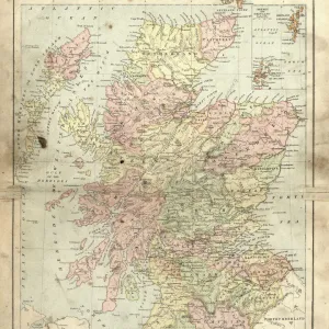
Framed Print > Europe > United Kingdom > Scotland > Maps
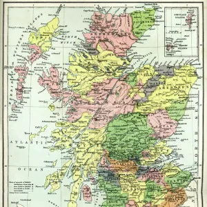
Framed Print : MAP: SCOTLAND. Line engraving, 19th century


![]()
Framed Photos From Granger
MAP: SCOTLAND. Line engraving, 19th century
Granger holds millions of images spanning more than 25,000 years of world history, from before the Stone Age to the dawn of the Space Age
Media ID 7552329
12"x10" Modern Frame
Introducing the captivating addition to your home decor, the Media Storehouse Framed Print featuring "MAP: SCOTLAND. Line engraving, 19th century" from The Granger Collection via Granger Art on Demand. This exquisite piece transports you back in time with its intricate line engraving, showcasing Scotland's historical cartography in stunning detail. The 19th-century origin of this map adds an air of antiquity to your space, making it a perfect conversation starter. Bring a touch of history and elegance to your walls with this captivating framed print.
10x8 Print in an MDF Wooden Frame with 180 gsm Satin Finish Paper. Glazed using shatter proof thin plexi glass. Frame thickness is 1 inch and depth 0.75 inch. Fluted cardboard backing held with clips. Supplied ready to hang with sawtooth hanger and rubber bumpers. Spot clean with a damp cloth. Packaged foam wrapped in a card.
Contemporary Framed and Mounted Prints - Professionally Made and Ready to Hang
Estimated Image Size (if not cropped) is 25.4cm x 25.4cm (10" x 10")
Estimated Product Size is 25.4cm x 30.5cm (10" x 12")
These are individually made so all sizes are approximate
Artwork printed orientated as per the preview above, with landscape (horizontal) or portrait (vertical) orientation to match the source image.
FEATURES IN THESE COLLECTIONS
> Arts
> Landscape paintings
> Waterfall and river artworks
> River artworks
> Europe
> France
> Canton
> Landes
> Europe
> United Kingdom
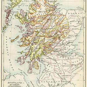
> Scotland
> Maps
> Europe
> United Kingdom
> Scotland
> Posters
> Europe
> United Kingdom
> Scotland
> Related Images
> Europe
> United Kingdom
> Scotland
> Rivers
> Maps and Charts
> Related Images
> Granger Art on Demand
> Maps
EDITORS COMMENTS
This print showcases a remarkable piece of history: a line engraving map of Scotland from the 19th century. The intricate details and craftsmanship evident in this artwork transport us back to an era when cartography was both an art form and a scientific endeavor. The map itself is a testament to the rich European heritage of Scotland, with its distinctive Scottish features highlighted throughout. From the rugged highlands to the winding rivers that traverse its picturesque landscapes, every corner of this enchanting country is meticulously captured in this engraving. Created during the 19th century, this map offers us a glimpse into how Scotland was perceived at that time. It serves as a valuable historical document, shedding light on geographical boundaries, landmarks, and even cultural nuances specific to that period. The fine lines etched onto paper evoke nostalgia for an age where technology had not yet dominated our lives. This exquisite work by The Granger Collection reminds us of the beauty found in traditional artistic techniques such as line engraving. Whether you are fascinated by Scottish history or simply appreciate vintage maps as works of art, this print will undoubtedly captivate your imagination. Display it proudly on your wall and let it transport you to another time - one where exploration and discovery were paramount.
MADE IN THE USA
Safe Shipping with 30 Day Money Back Guarantee
FREE PERSONALISATION*
We are proud to offer a range of customisation features including Personalised Captions, Color Filters and Picture Zoom Tools
SECURE PAYMENTS
We happily accept a wide range of payment options so you can pay for the things you need in the way that is most convenient for you
* Options may vary by product and licensing agreement. Zoomed Pictures can be adjusted in the Basket.