
Wall Art and Photo Gifts from Fine Art Storehouse
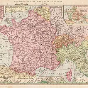
Map of France 1896
Andres Allgemeiner Handatlas - Bielefeld und Leipzig 1896
Unleash your creativity and transform your space into a visual masterpiece!
THEPALMER
Media ID 15133654
© This content is subject to copyright
Paris
FEATURES IN THESE COLLECTIONS
> Europe
> France
> Maps
> Europe
> France
> Paris
> Maps
> Europe
> Germany
> Bielefeld
> Europe
> Germany
> Leipzig
> Europe
> Germany
> Maps
> Fine Art Storehouse
> Map
> Historical Maps
> Fine Art Storehouse
> Map
> Maps and Charts
> Early Maps
> Maps and Charts
> France
> Maps and Charts
> Germany
MADE IN THE USA
Safe Shipping with 30 Day Money Back Guarantee
FREE PERSONALISATION*
We are proud to offer a range of customisation features including Personalised Captions, Color Filters and Picture Zoom Tools
SECURE PAYMENTS
We happily accept a wide range of payment options so you can pay for the things you need in the way that is most convenient for you
* Options may vary by product and licensing agreement. Zoomed Pictures can be adjusted in the Cart.
redeem
Beautiful Photo Prints and Gifts
image
Professionally Printed
inventory
Photo Prints are in stock
thumb_up
Professional quality finish
diamond
Made with high-grade materials
inventory_2
Carefully packed to aid safe arrival
Related Images

MAP OF FRANCE, c1900. With inset detail of Paris and surrounding area

Cartoon map of Florida

Old Antique map of Egypt, detail of River Nile, Alexandria, Cairo, 1890s, Victorian 19th Century history

Map Europe European 1930's 20th Century Country

Africa map of 1869

Antique map of France in Provinces, 1831

Antique Map of France - 19th Century

Map of Germany - Vector

Map of North and East sea 1896
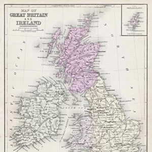
Map of Great Britain and Ireland 1877
Map of France 1886

Antique map of France
Related Collections

Early Maps
Browse 24,907 Prints

Map
Browse 9,856 Prints

Leipzig
Browse 2,063 Prints

Bielefeld
Browse 64 Prints

Maps
Browse 10,027 Prints

Maps
Browse 5,294 Prints

France
Browse 8,887 Prints
Germany
Browse 5,414 Prints
Maps
Browse 2,323 Prints

Historical Maps
Browse 3,307 Prints

