
Maps Collection
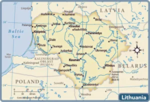
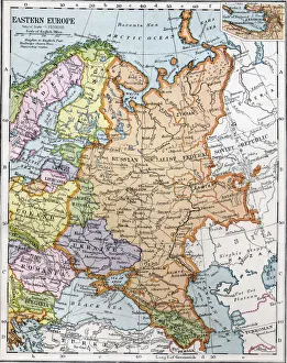
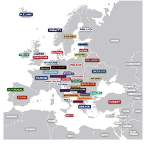
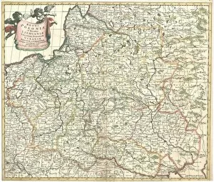
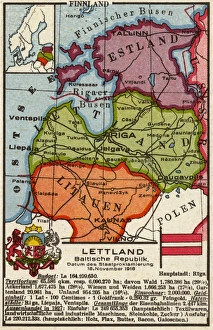
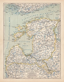
Lithuania is a country located in Northern Europe, bordered by Latvia to the north, Belarus to the east and south
Choose a picture from our Maps Collection for your Wall Art and Photo Gifts
57 items


All Professionally Made to Order for Quick Shipping
-
Maps Collection
Lithuania is a country located in Northern Europe, bordered by Latvia to the north, Belarus to the east and south, Poland to the south and Kaliningrad Oblast (a Russian exclave) to the southwest. Lithuania has a varied landscape with many rivers, lakes and forests. The capital city is Vilnius. Maps of Lithuania are available in both physical and digital formats. Physical maps show roads, cities, towns and other features such as rivers or mountains in great detail. Digital they are be used for navigation purposes or for planning trips around Lithuania as they provide accurate information on distances between locations. They also include points of interest such as hotels or restaurants which can be useful when travelling around this beautiful country.
+
Our beautiful pictures are available as Framed Prints, Photos, Wall Art and Photo Gifts
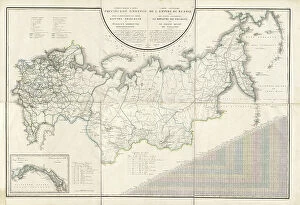
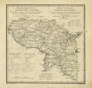
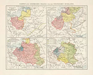
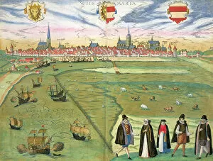
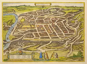
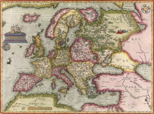
The Maps of Lithuania Europe collection from Media Storehouse is a stunning compilation of vintage and contemporary maps that showcase the beauty and history of Lithuania. Our collection features a wide range of maps, including topographical, political, historical, and cultural maps that provide an in-depth look at the country's geography, landmarks, cities, towns, and regions. Each map in our collection is carefully curated to offer a unique perspective on Lithuania's rich heritage and culture. From antique lithographs to modern digital prints, every piece captures the essence of this beautiful European nation. Whether you're looking for wall art or framed prints for your home or office space, the Maps of Lithuania Europe collection has something for everyone. With its diverse selection of high-quality prints and affordable prices, it's easy to find the perfect piece to suit your style and budget. If you're interested in Lithuanian history or simply want to add some unique artwork to your walls - our collection is definitely worth checking out.
+
What are Maps of Lithuania Europe art prints?
Maps of Lithuania Europe art prints are high-quality reproductions of vintage and contemporary maps that showcase the geography, topography, and landmarks of Lithuania. These art prints are perfect for those who love history, geography or Lithuanian culture. They can be used to decorate homes, offices or classrooms. The Maps of Lithuania Europe art prints come in a variety of sizes and styles to suit different tastes and preferences. Some feature detailed illustrations while others have a more minimalist design. The maps may also include additional information such as borders, cities, rivers and lakes. These lithographic prints are made using high-quality printing techniques that ensure they retain their vibrant colours and sharp details for years to come. They make great gifts for anyone interested in Lithuanian culture or European history. Maps of Lithuania Europe art prints offer an excellent way to appreciate the beauty and complexity of this fascinating country's landscape while adding a touch of sophistication to any space they adorn.
+
What Maps of Lithuania Europe art prints can I buy from Media Storehouse?
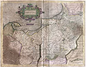
We offer a wide range of Maps of Lithuania Europe art prints for purchase. These maps showcase the beautiful country of Lithuania, highlighting its unique geography and landmarks. From vintage maps to modern designs, there is something for everyone's taste. One popular option is the antique map of Lithuania from 1855, which features intricate details and historical context. Another great choice is the colorful contemporary map that showcases major cities and attractions in Lithuania. Media Storehouse also offers customizable options such as adding personalized text or choosing different sizes to fit your space perfectly. Whether you're looking for a statement piece or a subtle addition to your decor, these Maps of Lithuania Europe art prints are sure to impress. With high-quality printing on premium paper stock, these pieces will last for years to come and make a great gift for any Lithuanian enthusiast or traveler.
+
How do I buy Maps of Lithuania Europe art prints?
To buy Maps of Lithuania Europe art prints from Media Storehouse, you can browse through our extensive collection of Lithuanian maps and select the one that best suits your needs. Once you have found the map you want to purchase, simply click on it and add it to your cart. You will then be prompted to enter your payment details and shipping address before completing the transaction. We offer a range of high-quality lithographic prints that are perfect for home or office decoration. Their maps are printed on premium quality paper using state-of-the-art printing technology, ensuring that they are both durable and visually stunning. Whether you're looking for a vintage map of Lithuania or a more contemporary design, we have something to suit every taste and budget. So why not explore our collection today and discover the perfect Maps of Lithuania Europe art print for your home or workplace?
+
How much do Maps of Lithuania Europe art prints cost?
We offer a wide range of Maps of Lithuania Europe art prints at varying prices. The cost of these prints depends on several factors such as the size, quality, and type of print selected by the customer. We have a variety of options available including canvas prints, framed prints, and poster prints which are all priced differently. Our you can choose from different sizes ranging from small to large depending on their preference and budget. Additionally, they can also select the material they want their print to be made from such as paper or canvas. We take pride in offering high-quality art prints that are affordable for everyone. Our pricing is competitive with other online retailers while still maintaining our commitment to providing excellent service and products. The cost of Maps of Lithuania Europe art prints varies based on individual preferences but we strive to provide options that fit every budget without compromising on quality.
+
How will my Maps of Lithuania Europe art prints be delivered to me?
We take pride in delivering high-quality art prints to our customers. When you purchase Maps of Lithuania Europe art prints from us, they will be carefully packaged and shipped directly to your chosen address. We use reliable shipping services to ensure that your order arrives safely and on time. Our standard delivery service includes tracking information so you can monitor the progress of your shipment. If you require faster delivery or have specific delivery instructions, please contact us and we will do our best to accommodate your needs. We understand how important it is for our customers to receive their orders in perfect condition. That's why we take great care when packaging each item for shipping. Our team uses sturdy materials such as cardboard tubes or flat mailers with protective backing boards to prevent damage during transit. When you order Maps of Lithuania Europe art prints from Media Storehouse, you can expect a hassle-free delivery experience with careful packaging and reliable shipping services.